How to get to Direct Development by bus?
Click on the bus route to see step by step directions with maps, line arrival times and updated time schedules.
From Leesburg VA-684, Fairfax County
58 minFrom Walmart, Fairfax County
63 minFrom Tysons Corner Center, Fairfax County
48 minFrom Defense Health Headquarters (DHHQ), Fairfax County
53 minFrom Inova Fairfax Hospital, Fairfax County
33 minFrom Spa World, Fairfax County
56 minFrom [I-495] Exit 54 - Braddock Road, Fairfax County
66 minFrom Centreville, VA, Fairfax County
52 minFrom Defense Health Agency Headquarters, Fairfax County
54 minFrom Mosaic District, Fairfax County
46 min
Bus stops near Direct Development in Fairfax
Bus lines to Direct Development in Fairfax
What are the closest stations to Direct Development?
The closest stations to Direct Development are:
- Chain Bridge Rd at Main St (Sb) is 54 yards away, 1 min walk.
- Chain Bridge Rd at Main St is 69 yards away, 2 min walk.
- University Dr at Main St is 90 yards away, 2 min walk.
- University Dr at Main St (Nb) is 110 yards away, 2 min walk.
- Fairfax Judicial Center is 364 yards away, 5 min walk.
Which bus lines stop near Direct Development?
These bus lines stop near Direct Development: 610, F23, F50, GOLD 1, GREEN 2.
What’s the nearest bus station to Direct Development in Fairfax?
The nearest bus station to Direct Development in Fairfax is Chain Bridge Rd at Main St (Sb). It’s a 1 min walk away.
What time is the first bus to Direct Development in Fairfax?
The F50 is the first bus that goes to Direct Development in Fairfax. It stops nearby at 5:21 AM.
What time is the last bus to Direct Development in Fairfax?
The GREEN 1 is the last bus that goes to Direct Development in Fairfax. It stops nearby at 10:41 PM.
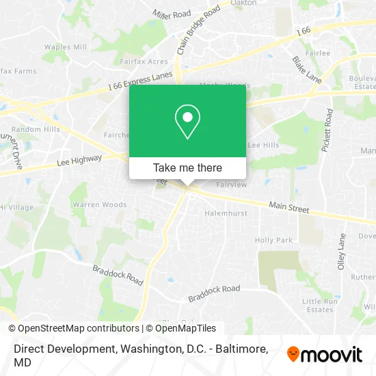
See Direct Development, Fairfax, on the map
Public Transit to Direct Development in Fairfax
Wondering how to get to Direct Development in Fairfax? Moovit helps you find the best way to get to Direct Development with step-by-step directions from the nearest public transit station.
Moovit provides free maps and live directions to help you navigate through your city. View schedules, routes, timetables, and find out how long does it take to get to Direct Development in real time.
Looking for the nearest stop or station to Direct Development? Check out this list of stops closest to your destination: Chain Bridge Rd at Main St (Sb); Chain Bridge Rd at Main St; University Dr at Main St; University Dr at Main St (Nb); Fairfax Judicial Center.
Bus: 610, F23, F50, GOLD 1, GREEN 2, GREEN 1, GOLD 2.
Want to see if there’s another route that gets you there at an earlier time? Moovit helps you find alternative routes or times. Get directions from and directions to Direct Development easily from the Moovit App or Website.
We make riding to Direct Development easy, which is why over 1.5 million users, including users in Fairfax, trust Moovit as the best app for public transit. You don’t need to download an individual bus app or train app, Moovit is your all-in-one transit app that helps you find the best bus time or train time available.
For information on prices of bus and metro, costs and ride fares to Direct Development, please check the Moovit app.
Use the app to navigate to popular places including to the airport, hospital, stadium, grocery store, mall, coffee shop, school, college, and university.
Direct Development Address: 10427 North St Fairfax, VA 22030 street in Fairfax
- Earp's Ordinary,
- Fairfax County Probation Center,
- Be Delighted Events,
- Lucy Loves,
- My Move Day,
- Andrew's Garage Door & Gate Repair,
- Julies Junk Removal,
- Scott Forrest, MD,
- Eps Network Solutions,
- Fairfax Kleaners,
- R&A Top Remodeling,
- Penny Pincher Coins (Penny Pincher Jewelry Liquidators),
- Virginia Business Law,
- Rothermel Law Firm,
- ND Greene PC,
- Asian Festival on Main,
- Fairfax County Appliance Repair,
- Senberry Bowls,
- Align Residential Services,
- Fairfax County Dui Lawyers
Places Near Direct Development (Fairfax)
- Pennsylvania Ave NW (3rd st and pennsylvania), Washington,
- Rock Creek Tennis Center, Washington,
- National Mall, Washington,
- Georgetown, Washington,
- Washington DC VA Medical Center, Washington,
- Marriott Marquis Washington, DC, Washington,
- Sibley Memorial Hospital, Washington,
- Museum Of The Bible, Washington,
- Capital One Arena, Washington,
- Westfield Montgomery Mall, Montgomery County,
- Amazon Hq2, Arlington County,
- Basilica of the National Shrine, Washington,
- National Museum of African American History and Culture, Washington,
- The Anthem, Washington,
- Washington National Cathedral, Washington,
- Warner Theatre, Washington,
- National Zoo, Washington,
- M&T Bank Stadium, Baltimore,
- Camden Yards, Baltimore,
- PG Mall, Prince George's County
How to get to popular places in Washington, D.C. - Baltimore, MD with public transit
Get around Fairfax by public transit!
Traveling around Fairfax has never been so easy. See step by step directions as you travel to any attraction, street or major public transit station. View bus and train schedules, arrival times, service alerts and detailed routes on a map, so you know exactly how to get to anywhere in Fairfax.
When traveling to any destination around Fairfax use Moovit's Live Directions with Get Off Notifications to know exactly where and how far to walk, how long to wait for your line, and how many stops are left. Moovit will alert you when it's time to get off — no need to constantly re-check whether yours is the next stop.
Wondering how to use public transit in Fairfax or how to pay for public transit in Fairfax? Moovit public transit app can help you navigate your way with public transit easily, and at minimum cost. It includes public transit fees, ticket prices, and costs. Looking for a map of Fairfax public transit lines? Moovit public transit app shows all public transit maps in Fairfax with all Bus, Train, Metro, Light Rail and Ferry routes and stops on an interactive map.
Washington, D.C. - Baltimore, MD has 5 transit type(s), including: Bus, Train, Metro, Light Rail and Ferry, operated by several transit agencies, including WMATA, Montgomery County Ride On, Fairfax Connector, TheBus, PRTC, DASH - Alexandria, Arlington Transit (ART), RTA of Central Maryland, MDOT MTA, MDOT MTA Light RailLink, MDOT MTA Commuter Bus, MDOT MTA Local Bus, FXBGO!, Virginia Railway Express (VRE) and MARC