How to get to Disbimp by bus?
Click on the bus route to see step by step directions with maps, line arrival times and updated time schedules.
Bus stop near Disbimp in Imperatriz
- Honda Motos (C/B), 8 min walk,VIEW
Bus lines to Disbimp in Imperatriz
What are the closest stations to Disbimp?
The closest stations to Disbimp are:
- Honda Motos (C/B) is 607 meters away, 8 min walk.
Which bus lines stop near Disbimp?
These bus lines stop near Disbimp: 011, 031.
What’s the nearest bus station to Disbimp in Imperatriz?
The nearest bus station to Disbimp in Imperatriz is Honda Motos (C/B). It’s a 8 min walk away.
What time is the first bus to Disbimp in Imperatriz?
The 011 is the first bus that goes to Disbimp in Imperatriz. It stops nearby at 6:00 AM.
What time is the last bus to Disbimp in Imperatriz?
The 011 is the last bus that goes to Disbimp in Imperatriz. It stops nearby at 10:29 PM.
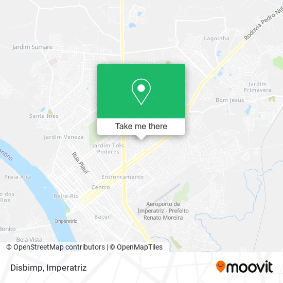
See Disbimp, Imperatriz, on the map
Public Transit to Disbimp in Imperatriz
Wondering how to get to Disbimp in Imperatriz? Moovit helps you find the best way to get to Disbimp with step-by-step directions from the nearest public transit station.
Moovit provides free maps and live directions to help you navigate through your city. View schedules, routes, timetables, and find out how long does it take to get to Disbimp in real time.
Looking for the nearest stop or station to Disbimp? Check out this list of stops closest to your destination: Honda Motos (C/B).
Bus: 011, 031, 012.
Want to see if there’s another route that gets you there at an earlier time? Moovit helps you find alternative routes or times. Get directions from and directions to Disbimp easily from the Moovit App or Website.
We make riding to Disbimp easy, which is why over 1.5 million users, including users in Imperatriz, trust Moovit as the best app for public transit. You don’t need to download an individual bus app or train app, Moovit is your all-in-one transit app that helps you find the best bus time or train time available.
For information on prices of bus, costs and ride fares to Disbimp, please check the Moovit app.
Use the app to navigate to popular places including to the airport, hospital, stadium, grocery store, mall, coffee shop, school, college, and university.
Disbimp Address: Rua Dom Marcelino, 602 Imperatriz Imperatriz-MA 65910-070 street in Imperatriz
- F Cardoso Salgado Representações,
- Escola Machado De Assis,
- Juçara Clube,
- Ditur Turismo,
- Santos Distribuidora,
- Supermercado Economico Deposito II,
- CE Raimundo Soares da Cunha,
- Paróquia Santa Cruz,
- Socobrindes Sacolas & Brindes,
- Company Company,
- Cruz Azul,
- Duetto Comunicação,
- Associacao Para Deficientes Visuais Dues Ue Fiel,
- Espaco Pedagogico e Psicopedagogico,
- Padaria (Mix Mateus - Bacuri),
- Conselho Escolar Menino Jesus,
- Soares Alencar Terapias,
- Centro De Ensino Delahe Fiquene,
- Estacionamento Central Park,
- R P B Moda Íntimas
Places Near Disbimp (Imperatriz)
- Oqd, Imperatriz,
- Jardim Sumare, Imperatriz,
- Bairro Maranhão Novo, Imperatriz,
- Rua João Lisboa, Imperatriz,
- Bairro Novo Horizonte, Imperatriz,
- Rua Urbano Santos, Imperatriz,
- Parque Santa Lúcia, Imperatriz,
- Loteamento Jardim das Oliveiras, Imperatriz,
- Cabaré da Nilde, Imperatriz,
- pe de macauba, Imperatriz,
- Sebastião Regis, Imperatriz,
- Imperatriz - MA, Imperatriz,
- Rua alagoas, Imperatriz,
- Bairro Jardim Tropical, Imperatriz,
- Rua Bom Futuro, Imperatriz,
- Vila Fiquene, Imperatriz,
- Bairro Vila Nova, Imperatriz,
- Cabare da Maria Preta, Imperatriz,
- Rodovia BR-010 100, Imperatriz,
- BR 010 KM 260, Imperatriz
How to get to popular places in Imperatriz with public transit
Get around Imperatriz by public transit!
Traveling around Imperatriz has never been so easy. See step by step directions as you travel to any attraction, street or major public transit station. View bus and train schedules, arrival times, service alerts and detailed routes on a map, so you know exactly how to get to anywhere in Imperatriz.
When traveling to any destination around Imperatriz use Moovit's Live Directions with Get Off Notifications to know exactly where and how far to walk, how long to wait for your line, and how many stops are left. Moovit will alert you when it's time to get off — no need to constantly re-check whether yours is the next stop.
Wondering how to use public transit in Imperatriz or how to pay for public transit in Imperatriz? Moovit public transit app can help you navigate your way with public transit easily, and at minimum cost. It includes public transit fees, ticket prices, and costs. Looking for a map of Imperatriz public transit lines? Moovit public transit app shows all public transit maps in Imperatriz with all bus routes and stops on an interactive map.
Imperatriz has 1 transit type(s), including: bus, operated by several transit agencies, including Ratrans (Imperatriz)