How to get to Discoteca Cava by bus?
Click on the bus route to see step by step directions with maps, line arrival times and updated time schedules.
From Matellini, Chorrillos
35 minFrom Juzgado de Paz Letrado de Barranco y Miraflores, Miraflores
44 minFrom Mercado Mayorista de Frutas, San Luis
33 minFrom Club Cultural Deportivo Lima, Chorrillos
43 minFrom Av. La mar, Miraflores
44 minFrom Av. Nicolas Ayllon, Ate
39 minFrom Centro Comercial La Rambla, San Borja
36 minFrom AV ANGAMOS ESTE CUADRA 15, Surquillo
32 minFrom La Victoria, La Victori
42 minFrom Gamarra - La Victoria, La Victori
43 min
How to get to Discoteca Cava by metro?
Click on the metro route to see step by step directions with maps, line arrival times and updated time schedules.
Bus stops near Discoteca Cava in Lima
Metro station near Discoteca Cava in Lima
- Villa Maria, 26 min walk,VIEW
Bus lines to Discoteca Cava in Lima
- 1059, San Gabriel (Villa María Del Triunfo) - Bayóvar (San Juan de Lurigancho),VIEW
- 1062, V.E.S. - S.J.L.,VIEW
- 1096, Oasis (V.E.S.) - Jicamarca (S.J.L.),VIEW
- 1113, El Triunfo (Villa María Del Triunfo) - Plaza Centro América (Miraflores),VIEW
- 1118, Av. El Triunfo (Villa María Del Triunfo) - Av. Ejercito (Miraflores),VIEW
- 1237, Santo Domingo (Carabayllo) - Velasco Alvarado (Villa El Salvador),VIEW
- 1263, Plaza Unión (Lima) - Nuevo Paraiso (V.M.T) ,VIEW
- IO30B, San Gabriel (V.M.T.) - Parque Kennedy (Miraflores),VIEW
- 1056, Villa El Salvador - San Juan de Lurigancho,VIEW
- 1060, Campoy (San Juan De Lurigancho) - Nueva Esperanza (Villa María Del Triunfo),VIEW
- 1093, S.J.M. - Surquillo - S.J.M.,VIEW
- 1097, Av. Santa Rosa (San Juan De Lurigancho) - Las Palmas (Pachacamac) ,VIEW
- 1099, 28 De Julio (Lima) - San Gabriel (Villa María Del Triunfo),VIEW
- 1100, Huaycan (Ate) - Las Palmas (Pachacamac),VIEW
- 1108, Montevideo (Lima) - Cementerio (Villa El Salvador),VIEW
- 1109, San Gabriel (Villa María Del Triunfo) - Espinar (Miraflores),VIEW
- 1110, Miraflores - VMT,VIEW
- 1123, José Gálvez (Villa María Del Triunfo) - Parque Kennedy (Miraflores),VIEW
- 1124, V.M.T. - Surquillo,VIEW
- 1125, Surquillo - V.M.T.,VIEW
What are the closest stations to Discoteca Cava?
The closest stations to Discoteca Cava are:
- Avenida Salvador Allende, 808 is 85 meters away, 2 min walk.
- Estacion San Juan is 386 meters away, 6 min walk.
- Avenida Salvador Allende, 656 is 411 meters away, 6 min walk.
- Villa Maria is 2012 meters away, 26 min walk.
Which bus lines stop near Discoteca Cava?
These bus lines stop near Discoteca Cava: 1059, 1062, 1118, 1237, 1263, 1400.
Which metro line stops near Discoteca Cava?
LINEA 1 (Bayóvar (San Juan De Lurigancho) - Separadora Industrial (Villa El Salvador))
What’s the nearest metro station to Discoteca Cava in Lima?
The nearest metro station to Discoteca Cava in Lima is Villa Maria. It’s a 26 min walk away.
What’s the nearest bus station to Discoteca Cava in Lima?
The nearest bus station to Discoteca Cava in Lima is Avenida Salvador Allende, 808. It’s a 2 min walk away.
What time is the first metro to Discoteca Cava in Lima?
The LINEA 1 is the first metro that goes to Discoteca Cava in Lima. It stops nearby at 5:06 AM.
What time is the last metro to Discoteca Cava in Lima?
The LINEA 1 is the last metro that goes to Discoteca Cava in Lima. It stops nearby at 10:40 PM.
What time is the first bus to Discoteca Cava in Lima?
The 1471 is the first bus that goes to Discoteca Cava in Lima. It stops nearby at 4:08 AM.
What time is the last bus to Discoteca Cava in Lima?
The 1280 is the last bus that goes to Discoteca Cava in Lima. It stops nearby at 1:33 AM.
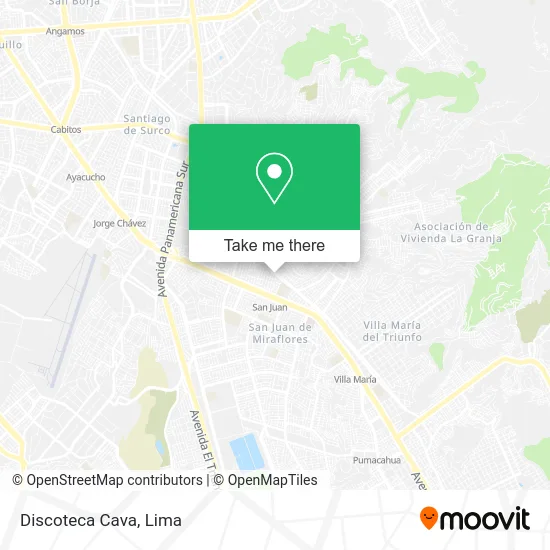
See Discoteca Cava, Lima, on the map
Public Transit to Discoteca Cava in Lima
Wondering how to get to Discoteca Cava in Lima? Moovit helps you find the best way to get to Discoteca Cava with step-by-step directions from the nearest public transit station.
Moovit provides free maps and live directions to help you navigate through your city. View schedules, routes, timetables, and find out how long does it take to get to Discoteca Cava in real time.
Looking for the nearest stop or station to Discoteca Cava? Check out this list of stops closest to your destination: Avenida Salvador Allende; Estacion San Juan; Avenida Salvador Allende; Villa Maria.
Bus: 1059, 1062, 1118, 1237, 1263, 1400, 1096, 1113, 1056, 1060, 1093, 1097, 1099, 1236.Metro: LINEA 1.
Want to see if there’s another route that gets you there at an earlier time? Moovit helps you find alternative routes or times. Get directions from and directions to Discoteca Cava easily from the Moovit App or Website.
We make riding to Discoteca Cava easy, which is why over 1.5 million users, including users in Lima, trust Moovit as the best app for public transit. You don’t need to download an individual bus app or train app, Moovit is your all-in-one transit app that helps you find the best bus time or train time available.
For information on prices of bus and metro, costs and ride fares to Discoteca Cava, please check the Moovit app.
Use the app to navigate to popular places including to the airport, hospital, stadium, grocery store, mall, coffee shop, school, college, and university.
Discoteca Cava Address: Avenida Agustín La Rosa Lozano y Tirado Pop. Arenal San Juan de Miraflores, San Juan de Miraflores, street in Lima
- El Camperito,
- Polleria El Camperito,
- Alejandro Tirado,
- Hostal Embassy,
- Supermercado Metro,
- Reducto N° 1,
- Mercado El Arenal,
- Av Cesar Canevaro Coop Santa Ursula Mz J Lote 9,
- I. E. P. Johannes Gutenberg,
- Parroquia San Francisco De Asís,
- Pop. Arenal San Juan de Miraflores,
- Iglesia San Francisco de la Cruz,
- Parque San Francisco,
- Av Defensores de Lima 731,
- Parque Cáceres,
- Institución Educativa N° 6037 Inca Pachacútec,
- San Francisco De Le Cruz,
- Buenaventura Rey 844 San Juan de Miraflores Zona K Alt cuadra 8 Av los Heroes Espalda de la est,
- Jr Buenaventura Rey 844 San Juan de Miraflores zona K Espalda de la cda 8 de la avenida Los Héro,
- Expreso Molina Unión S.A.C
Places Near Discoteca Cava (Lima)
- Parque de las Leyendas, San Miguel,
- Miraflores, Miraflores,
- Av. Abancay, Lima,
- Gamarra,
- Jockey Plaza, Santiago D,
- Pontificia Universidad Católica del Perú - PUCP, San Miguel,
- Parque Kennedy, Miraflores,
- av arequipa, Lima,
- Circuito Mágico Del Agua, Lima,
- Plaza San Miguel, San Miguel,
- Barranco, Barranco,
- Mall Del Sur,
- Av. La Marina, San Miguel,
- Hospital Edgardo Rebagliati Martins, Jesus Mari,
- Real Plaza Puruchuco, Ate,
- Av. Salaverry, Jesus Mari,
- Aeropuerto Internacional Jorge Chávez, Ventanilla,
- Larcomar, Miraflores,
- Paradero Av.Brasil,
- Centro Comercial Plaza Norte, Independen
How to get to popular places in Lima with public transit
Get around Lima by public transit!
Traveling around Lima has never been so easy. See step by step directions as you travel to any attraction, street or major public transit station. View bus and train schedules, arrival times, service alerts and detailed routes on a map, so you know exactly how to get to anywhere in Lima.
When traveling to any destination around Lima use Moovit's Live Directions with Get Off Notifications to know exactly where and how far to walk, how long to wait for your line, and how many stops are left. Moovit will alert you when it's time to get off — no need to constantly re-check whether yours is the next stop.
Wondering how to use public transit in Lima or how to pay for public transit in Lima? Moovit public transit app can help you navigate your way with public transit easily, and at minimum cost. It includes public transit fees, ticket prices, and costs. Looking for a map of Lima public transit lines? Moovit public transit app shows all public transit maps in Lima with all Bus, Metro and Ferry routes and stops on an interactive map.
Lima has 3 transit type(s), including: Bus, Metro and Ferry, operated by several transit agencies, including Metro de Lima Línea 2 , Metro de Lima, Corredor Rojo, Metropolitano, Metropolitano - Alimentadores, Corredor Morado, Corredor Azul, Rutas Tradicionales, Transportes y Servicios La Esperanza S.A., Las Flores S.A., Virgen de la Asunción S.A., Consorcio HAM, Transportes y Service Canadá S.A., ETUL4SA and ETUCHISA