How to get to Distrito Telefónica by bus?
Click on the bus route to see step by step directions with maps, line arrival times and updated time schedules.
From Iglesia Santa Gema (Santuario de Santa Gema), Madrid
53 minFrom Hospital HM Universitario Madrid, Madrid
58 minFrom Calle Nuñez de Balboa, Madrid
67 minFrom Museo Del Traje, Área Metropolitana De Madrid Y Corredor Del Henares
89 minFrom Calle Joaquin Costa, Madrid
59 minFrom Sanatorio Nuestra Señora Del Rosario, Área Metropolitana De Madrid Y Corredor Del Henares
67 minFrom Calle de Castelló 115, Madrid
55 minFrom Plaza Conde Valle Suchil, Madrid
58 minFrom Estación de Moncloa, Madrid
65 min
How to get to Distrito Telefónica by train?
Click on the train route to see step by step directions with maps, line arrival times and updated time schedules.
How to get to Distrito Telefónica by metro?
Click on the metro route to see step by step directions with maps, line arrival times and updated time schedules.
From Iglesia Santa Gema (Santuario de Santa Gema), Madrid
40 minFrom Hospital HM Universitario Madrid, Madrid
40 minFrom Calle Nuñez de Balboa, Madrid
44 minFrom Calle Joaquin Costa, Madrid
39 minFrom Sanatorio Nuestra Señora Del Rosario, Área Metropolitana De Madrid Y Corredor Del Henares
43 minFrom Calle de Castelló 115, Madrid
40 minFrom Plaza Conde Valle Suchil, Madrid
40 minFrom Estación de Moncloa, Madrid
53 min
Metro stations near Distrito Telefónica in Madrid
Bus stops near Distrito Telefónica in Madrid
Bus lines to Distrito Telefónica in Madrid
What are the closest stations to Distrito Telefónica?
The closest stations to Distrito Telefónica are:
- Ronda De La Comunicación is 14 meters away, 2 min walk.
- Ronda Comunicación - Distrito C is 462 meters away, 8 min walk.
- Av. Europa - Pza. Roma is 671 meters away, 10 min walk.
- Pórtico De La Gloria - Ronda Comunicación is 902 meters away, 13 min walk.
- Ronda Comunicación - Edificio Central is 1075 meters away, 16 min walk.
- Monte Del Gozo is 1372 meters away, 19 min walk.
- Las Tablas is 1705 meters away, 24 min walk.
Which bus lines stop near Distrito Telefónica?
These bus lines stop near Distrito Telefónica: 157, 170.
Which train lines stop near Distrito Telefónica?
These train lines stop near Distrito Telefónica: C4A, C4B.
Which metro line stops near Distrito Telefónica?
M-10 (Hospital Infanta Sofía)
What’s the nearest metro station to Distrito Telefónica in Madrid?
The nearest metro station to Distrito Telefónica in Madrid is Ronda De La Comunicación. It’s a 2 min walk away.
What’s the nearest bus station to Distrito Telefónica in Madrid?
The nearest bus station to Distrito Telefónica in Madrid is Ronda Comunicación - Distrito C. It’s a 8 min walk away.
What time is the first light rail to Distrito Telefónica in Madrid?
The ML-1 is the first light rail that goes to Distrito Telefónica in Madrid. It stops nearby at 6:05 AM.
What time is the last light rail to Distrito Telefónica in Madrid?
The ML-1 is the last light rail that goes to Distrito Telefónica in Madrid. It stops nearby at 1:48 AM.
What time is the first metro to Distrito Telefónica in Madrid?
The M-10 is the first metro that goes to Distrito Telefónica in Madrid. It stops nearby at 6:05 AM.
What time is the last metro to Distrito Telefónica in Madrid?
The M-10 is the last metro that goes to Distrito Telefónica in Madrid. It stops nearby at 1:48 AM.
What time is the first bus to Distrito Telefónica in Madrid?
The 154 is the first bus that goes to Distrito Telefónica in Madrid. It stops nearby at 6:28 AM.
What time is the last bus to Distrito Telefónica in Madrid?
The 157 is the last bus that goes to Distrito Telefónica in Madrid. It stops nearby at 12:02 AM.
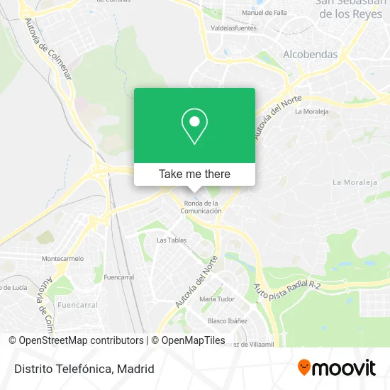
See Distrito Telefónica, Madrid, on the map
Public Transit to Distrito Telefónica in Madrid
Wondering how to get to Distrito Telefónica in Madrid? Moovit helps you find the best way to get to Distrito Telefónica with step-by-step directions from the nearest public transit station.
Moovit provides free maps and live directions to help you navigate through your city. View schedules, routes, timetables, and find out how long does it take to get to Distrito Telefónica in real time.
Looking for the nearest stop or station to Distrito Telefónica? Check out this list of stops closest to your destination: Ronda De La Comunicación; Ronda Comunicación - Distrito C; Av. Europa - Pza. Roma; Pórtico De La Gloria - Ronda Comunicación; Ronda Comunicación - Edificio Central; Monte Del Gozo; Las Tablas.
Bus: 157, 170, 157C, 154, 172, T61.Train: C4A, C4B.Metro: M-10, ML-1.
Want to see if there’s another route that gets you there at an earlier time? Moovit helps you find alternative routes or times. Get directions from and directions to Distrito Telefónica easily from the Moovit App or Website.
We make riding to Distrito Telefónica easy, which is why over 1.5 million users, including users in Madrid, trust Moovit as the best app for public transit. You don’t need to download an individual bus app or train app, Moovit is your all-in-one transit app that helps you find the best bus time or train time available.
For information on prices of metro, bus and train, costs and ride fares to Distrito Telefónica, please check the Moovit app.
Use the app to navigate to popular places including to the airport, hospital, stadium, grocery store, mall, coffee shop, school, college, and university.
Distrito Telefónica Address: Ronda de la Comunicación, s/n street in Madrid
- Ronda de la COMUNICACION, S/N,
- 42 Madrid,
- Administración de Lotería 513. Ronda de la Fortuna,
- Telefonica Corporate Innovation Center,
- Centro Comercial Moraleja Green,
- Metro Ronda de la Comunicación,
- Centro Formación Distrito Telefónica,
- Cabina Telefonica - Sede Telefonica,
- Inditex,
- Telefonica D.C. Plaza Norte,
- Auditorio Distrito Telefónica,
- Edificio Central Distrito Telefónica,
- Distrito Telefónica - Norte 1,
- Cafetería Telefónica Oeste,
- Plaza Obradoiro,
- Policlínico Hm Teléfonica,
- Distrito Telefónica - Sur 3,
- Las Tablas-Telefónica,
- Sodexo Telef. Las Tabl,
- La Borda del Mentidero
Places Near Distrito Telefónica (Madrid)
- Nassica, Área Metropolitana De Madrid Y Corredor Del Henares,
- Palacio De Vistalegre, Área Metropolitana De Madrid Y Corredor Del Henares,
- Mercadillo de Majadahonda, Majadahonda,
- Hospital Universitario La Paz, Madrid,
- Hospital Clínico Universitario San Carlos, Madrid,
- Wizink Center, Madrid,
- Estadio Wanda Metropolitano, Área Metropolitana De Madrid Y Corredor Del Henares,
- Sala La Riviera, Madrid,
- Plenilunio, Área Metropolitana De Madrid Y Corredor Del Henares,
- Estacion de Chamartin, Madrid,
- Centro Comercial La Gavia, Área Metropolitana De Madrid Y Corredor Del Henares,
- Calle de López de Hoyos 169, Madrid,
- Centro Comercial Islazul, Área Metropolitana De Madrid Y Corredor Del Henares,
- Mendez Alvaro, Madrid,
- Centro Comercial La Vaguada, Área Metropolitana De Madrid Y Corredor Del Henares,
- Hospital Universitario Ramón y Cajal, Madrid,
- Rastro De Madrid, Área Metropolitana De Madrid Y Corredor Del Henares,
- Plaza Mayor, Madrid,
- Centro Comercial Oasiz Madrid, Área Metropolitana De Madrid Y Corredor Del Henares,
- Tres Aguas, Alcorcón
How to get to popular places in Madrid with public transit
Get around Madrid by public transit!
Traveling around Madrid has never been so easy. See step by step directions as you travel to any attraction, street or major public transit station. View bus and train schedules, arrival times, service alerts and detailed routes on a map, so you know exactly how to get to anywhere in Madrid.
When traveling to any destination around Madrid use Moovit's Live Directions with Get Off Notifications to know exactly where and how far to walk, how long to wait for your line, and how many stops are left. Moovit will alert you when it's time to get off — no need to constantly re-check whether yours is the next stop.
Wondering how to use public transit in Madrid or how to pay for public transit in Madrid? Moovit public transit app can help you navigate your way with public transit easily, and at minimum cost. It includes public transit fees, ticket prices, and costs. Looking for a map of Madrid public transit lines? Moovit public transit app shows all public transit maps in Madrid with all Bus, Train, Metro and Light Rail routes and stops on an interactive map.
Madrid has 4 transit type(s), including: Bus, Train, Metro and Light Rail, operated by several transit agencies, including Metro de Madrid, Metro Ligero, Tranvía de Parla, Renfe Cercanías - Servicios de Autobús especiales, Renfe Cercanias, Renfe Cercanías, EMT, Interurbanos, Urbanos de Alcalá de Henares, Urbanos de Alcobendas, Urbanos de Alcorcón, Urbanos de Algete, Urbanos de Aranjuez, Urbanos de Arganda del Rey and Urbanos de Arroyomolinos