Directions to Dixie GO Station (Mississauga) with public transportation
The following transit lines have routes that pass near Dixie GO Station
 Bus: 1, 101, 31, 5.
- Train: MI, LW.
How to get to Dixie GO Station by bus?
Click on the bus route to see step by step directions with maps, line arrival times and updated time schedules.
How to get to Dixie GO Station by train?
Click on the train route to see step by step directions with maps, line arrival times and updated time schedules.
Bus stops near Dixie GO Station in Mississauga
- Dixie Go Station Platform 3, 2 min walk,
- Dixie Rd at Blundell Rd, 5 min walk,
- Dundas St at Neilco Crt, 8 min walk,
- Dundas St East Of Dixie Rd, 8 min walk,
- Queensway East Of Dixie Rd, 16 min walk,
Train stations near Dixie GO Station in Mississauga
- Dixie Go, 40 min walk,
- Long Branch Go, 52 min walk,
Streetcar stations near Dixie GO Station in Mississauga
- Long Branch Loop, 52 min walk,
- Lake Shore Blvd West at Thirty Seventh St, 58 min walk,
Bus lines to Dixie GO Station in Mississauga
- 31, 31 S Ogden To Long Branch Go,
- 5, 5 S Dixie To Long Branch Go,
- 1, 1 W Dundas To Ridgeway,
- 101, 101a E Express Dundas Exp,
- 4, 4 W North Service Road To Cooksville Go,
What are the closest stations to Dixie GO Station?
The closest stations to Dixie GO Station are:
- Dixie Go Station Platform 3 is 124 meters away, 2 min walk.
- Dixie Rd at Blundell Rd is 358 meters away, 5 min walk.
- Dundas St at Neilco Crt is 573 meters away, 8 min walk.
- Dundas St East Of Dixie Rd is 581 meters away, 8 min walk.
- Queensway East Of Dixie Rd is 1217 meters away, 16 min walk.
- Dixie Go is 3087 meters away, 40 min walk.
- Long Branch Go is 3975 meters away, 52 min walk.
- Long Branch Loop is 3998 meters away, 52 min walk.
- Lake Shore Blvd West at Thirty Seventh St is 4478 meters away, 58 min walk.
Which bus lines stop near Dixie GO Station?
These bus lines stop near Dixie GO Station: 1, 101, 31, 5.
Which train line stops near Dixie GO Station?
MI (Milton)
What’s the nearest bus station to Dixie GO Station in Mississauga?
The nearest bus station to Dixie GO Station in Mississauga is Dixie Go Station Platform 3. It’s a 2 min walk away.
What time is the first Streetcar to Dixie GO Station in Mississauga?
The 301 is the first Streetcar that goes to Dixie GO Station in Mississauga. It stops nearby at 3:01 AM.
What time is the last Streetcar to Dixie GO Station in Mississauga?
The 301 is the last Streetcar that goes to Dixie GO Station in Mississauga. It stops nearby at 4:18 AM.
What time is the first train to Dixie GO Station in Mississauga?
The LW is the first train that goes to Dixie GO Station in Mississauga. It stops nearby at 5:37 AM.
What time is the last train to Dixie GO Station in Mississauga?
The LW is the last train that goes to Dixie GO Station in Mississauga. It stops nearby at 12:09 AM.
What time is the first bus to Dixie GO Station in Mississauga?
The 1 is the first bus that goes to Dixie GO Station in Mississauga. It stops nearby at 3:06 AM.
What time is the last bus to Dixie GO Station in Mississauga?
The 1 is the last bus that goes to Dixie GO Station in Mississauga. It stops nearby at 3:13 AM.
See Dixie GO Station, Mississauga, on the map
Public Transit to Dixie GO Station in Mississauga
Wondering how to get to Dixie GO Station in Mississauga? Moovit helps you find the best way to get to Dixie GO Station with step-by-step directions from the nearest public transit station.
Moovit provides free maps and live directions to help you navigate through your city. View schedules, routes, timetables, and find out how long does it take to get to Dixie GO Station in real time.
Looking for the nearest stop or station to Dixie GO Station? Check out this list of stops closest to your destination: Dixie Go Station Platform 3; Dixie Rd at Blundell Rd; Dundas St at Neilco Crt; Dundas St East Of Dixie Rd; Queensway East Of Dixie Rd; Dixie Go; Long Branch Go; Long Branch Loop; Lake Shore Blvd West at Thirty Seventh St.
Bus: 1, 101, 31, 5.Train: MI, LW.
Want to see if there’s another route that gets you there at an earlier time? Moovit helps you find alternative routes or times. Get directions from and directions to Dixie GO Station easily from the Moovit App or Website.
We make riding to Dixie GO Station easy, which is why over 1.5 million users, including users in Mississauga, trust Moovit as the best app for public transit. You don’t need to download an individual bus app or train app, Moovit is your all-in-one transit app that helps you find the best bus time or train time available.
For information on prices of bus, Streetcar, subway and train, costs and ride fares to Dixie GO Station, please check the Moovit app.
Use the app to navigate to popular places including to the airport, hospital, stadium, grocery store, mall, coffee shop, school, college, and university.
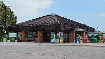
Dixie GO Station Address: 2445 Dixie Rd. street in Mississauga
- Sota Cafe & Catering,
- My-IVVI,
- Alpha Foods Market,
- Global Travel & Tours,
- KL Jane LTD,
- Costco Wholesale,
- Brows by Mimi,
- St Sva SRBN Orthdx CH & Sch Cngrttn,
- Labastie,
- Renoz,
- Ameen's Kitchen,
- Halibut House Fish & Chips,
- Costco,
- Bosley's,
- All Saints Serbian Orthodox Church,
- Frontier One (F1 Fingerprint) - Dundas / Dixie - RCMP-Accredited Agency,
- Bismillah Hajj & Umrah Services (Travel),
- F1 RCMP-Accredited Fingerprinting Agency,
- Fantasy Art Studio,
- Persian Rugs & Flooring
Places Near Dixie GO Station (Mississauga)
- Scarborough Town Centre, Toronto,
- St. Michael's Hospital, Toronto,
- Vaughan Mills Shopping Centre, Vaughan,
- Great Canadian Casino Resort, Toronto,
- Rogers Centre, Toronto,
- Distillery District Map, Toronto,
- Toronto Western Hospital, Toronto,
- Exhibition Place, Toronto,
- Chelsea Hotel, Toronto, Toronto,
- Toronto General Hospital, Toronto,
- Toronto Courthouse, Toronto,
- Toronto zoo, Toronto,
- Sunnybrook Hospital, Toronto,
- Meridian Hall, Toronto,
- Medieval Times, Toronto,
- Toronto Eaton Centre, Toronto,
- Budweiser Stage, Toronto,
- Enercare Centre, Toronto,
- St Lawrence Market, Toronto,
- St Michael s Hospital, Toronto
How to get to popular places in Toronto with public transit
Get around Mississauga by public transit!
Traveling around Mississauga has never been so easy. See step by step directions as you travel to any attraction, street or major public transit station. View bus and train schedules, arrival times, service alerts and detailed routes on a map, so you know exactly how to get to anywhere in Mississauga.
When traveling to any destination around Mississauga use Moovit's Live Directions with Get Off Notifications to know exactly where and how far to walk, how long to wait for your line, and how many stops are left. Moovit will alert you when it's time to get off — no need to constantly re-check whether yours is the next stop.
Wondering how to use public transit in Mississauga or how to pay for public transit in Mississauga? Moovit public transit app can help you navigate your way with public transit easily, and at minimum cost. It includes public transit fees, ticket prices, and costs. Looking for a map of Mississauga public transit lines? Moovit public transit app shows all public transit maps in Mississauga with all Bus, Train, Subway, Streetcar and Ferry routes and stops on an interactive map.
Toronto has 5 transit type(s), including: Bus, Train, Subway, Streetcar and Ferry, operated by several transit agencies, including TTC, Toronto Subway, Brampton Transit, MiWay, York Region Transit, GO Transit Bus, GO Transit, Durham Region Transit, UP Express, Grand River Transit, Guelph Transit, Hamilton Street Railway, Burlington Transit, Oakville Transit and Peterborough Transit