Directions to Dixie Restaurant (Petersburg) with public transportation
The following transit lines have routes that pass near Dixie Restaurant
 Bus: 3, 95, 22 - SOUTH PARK/ETTRICK, 4, 5.
- Train: CAROLINIAN, NORTHEAST REGIONAL, PALMETTO, FLORIDIAN, SILVER METEOR.
How to get to Dixie Restaurant by bus?
Click on the bus route to see step by step directions with maps, line arrival times and updated time schedules.
From Lorton, VA - Amtrak Auto Train Station (LOR), Fairfax County
525 minFrom Rose Gaming Resort, Prince William County
535 minFrom Busch Gardens Williamsburg (Employee Parking Lot), James City County
331 minFrom Lorton, VA, Fairfax County
519 minFrom Potomac Mills Mall, Prince William County
510 minFrom Woodbridge, VA, Prince William County
262 minFrom UVA Hospital Medical Center, Charlottesville
599 minFrom Amazon Fulfillment Center-Ric3, Richmond
182 min
How to get to Dixie Restaurant by train?
Click on the train route to see step by step directions with maps, line arrival times and updated time schedules.
Bus stops near Dixie Restaurant in Petersburg
- W Old St And N Market Street Carraige House Apartments, 5 min walk,VIEW
- E Washington Street And Madison Street, 5 min walk,VIEW
- Adams St And E Bank St, 9 min walk,VIEW
- Washington Street And Lafayette Street, 13 min walk,VIEW
- Petersburg Transportation Center, 15 min walk,VIEW
- Petersburg Transit Center, 16 min walk,VIEW
Train station near Dixie Restaurant in Petersburg
- Petersburg Amtrak Station, 49 min walk,VIEW
Bus lines to Dixie Restaurant in Petersburg
- 22 - SOUTH PARK/ETTRICK, Southpark Circle (Regal 16 Cinema),VIEW
- 4, Blandford,VIEW
- 5, County Drive,VIEW
- 6, South Crater Road,VIEW
- 21, Walnut Hill/Richard Bland,VIEW
- 24, Blandford Puddledock,VIEW
- 25, South Crater/County Drive,VIEW
- 3, Petersburg Station,VIEW
- 23, Petersburg Station,VIEW
- GREYHOUND US0670, Atlanta Bus Station,VIEW
- 95, 95x Richmond-Petersburg Express (Pbg),VIEW
- DINWIDDIE EXPRESS, Edgehill Shopping Center,VIEW
What are the closest stations to Dixie Restaurant?
The closest stations to Dixie Restaurant are:
- W Old St And N Market Street Carraige House Apartments is 312 yards away, 5 min walk.
- E Washington Street And Madison Street is 344 yards away, 5 min walk.
- Adams St And E Bank St is 702 yards away, 9 min walk.
- Washington Street And Lafayette Street is 1068 yards away, 13 min walk.
- Petersburg Transportation Center is 1193 yards away, 15 min walk.
- Petersburg Transit Center is 1263 yards away, 16 min walk.
- Petersburg Amtrak Station is 4169 yards away, 49 min walk.
Which bus lines stop near Dixie Restaurant?
These bus lines stop near Dixie Restaurant: 3, 95.
Which train lines stop near Dixie Restaurant?
These train lines stop near Dixie Restaurant: CAROLINIAN, NORTHEAST REGIONAL, PALMETTO.
What’s the nearest bus station to Dixie Restaurant in Petersburg?
The nearest bus stations to Dixie Restaurant in Petersburg are W Old St And N Market Street Carraige House Apartments and E Washington Street And Madison Street. The closest one is a 5 min walk away.
What time is the first train to Dixie Restaurant in Petersburg?
The NORTHEAST REGIONAL is the first train that goes to Dixie Restaurant in Petersburg. It stops nearby at 10:25 AM.
What time is the last train to Dixie Restaurant in Petersburg?
The SILVER METEOR is the last train that goes to Dixie Restaurant in Petersburg. It stops nearby at 2:53 AM.
What time is the first bus to Dixie Restaurant in Petersburg?
The 21 is the first bus that goes to Dixie Restaurant in Petersburg. It stops nearby at 6:15 AM.
What time is the last bus to Dixie Restaurant in Petersburg?
The GREYHOUND US0670 is the last bus that goes to Dixie Restaurant in Petersburg. It stops nearby at 1:30 PM.
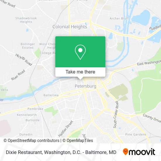
See Dixie Restaurant, Petersburg, on the map
Public Transit to Dixie Restaurant in Petersburg
Wondering how to get to Dixie Restaurant in Petersburg? Moovit helps you find the best way to get to Dixie Restaurant with step-by-step directions from the nearest public transit station.
Moovit provides free maps and live directions to help you navigate through your city. View schedules, routes, timetables, and find out how long does it take to get to Dixie Restaurant in real time.
Looking for the nearest stop or station to Dixie Restaurant? Check out this list of stops closest to your destination: W Old St And N Market Street Carraige House Apartments; E Washington Street And Madison Street; Adams St And E Bank St; Washington Street And Lafayette Street; Petersburg Transportation Center; Petersburg Transit Center; Petersburg Amtrak Station.
Bus: 3, 95, 22 - SOUTH PARK/ETTRICK, 4, 5, 6, 21, 24, 23, GREYHOUND US0670.Train: CAROLINIAN, NORTHEAST REGIONAL, PALMETTO, FLORIDIAN, SILVER METEOR.
Want to see if there’s another route that gets you there at an earlier time? Moovit helps you find alternative routes or times. Get directions from and directions to Dixie Restaurant easily from the Moovit App or Website.
We make riding to Dixie Restaurant easy, which is why over 1.5 million users, including users in Petersburg, trust Moovit as the best app for public transit. You don’t need to download an individual bus app or train app, Moovit is your all-in-one transit app that helps you find the best bus time or train time available.
For information on prices of bus, train and metro, costs and ride fares to Dixie Restaurant, please check the Moovit app.
Use the app to navigate to popular places including to the airport, hospital, stadium, grocery store, mall, coffee shop, school, college, and university.
Dixie Restaurant Address: 250 N Sycamore St Petersburg, VA 23803 street in Petersburg
- Corling's Corner Historical Marker,
- Chalice Community Christian Church,
- Lady JJ's Boutique,
- Perks Coffee Shop,
- Enchanting Evenings,
- Sycamore Antiques & Arct Art,
- Crystal Pools of Petersburg,
- Abigail's Antiques and Other Diversions,
- Arleene Herriman,
- Sweet Dixie,
- Rivers Edge,
- Apothic Company,
- Yogaonep Etersburg,
- Old Towne's Alibi,
- The Bucket Trade,
- Oyster Society,
- DJ's Java Joint,
- Respond1st LLC,
- Exchange Building,
- City of Petersburg Museums
Places Near Dixie Restaurant (Petersburg)
- Marriott Marquis Washington, DC, Washington,
- Pennsylvania Ave NW (3rd st and pennsylvania), Washington,
- Sibley Memorial Hospital, Washington,
- Museum Of The Bible, Washington,
- Georgetown, Washington,
- The Anthem, Washington,
- Amazon Hq2, Arlington County,
- Washington DC VA Medical Center, Washington,
- Basilica of the National Shrine, Washington,
- National Zoo, Washington,
- Camden Yards, Baltimore,
- Westfield Montgomery Mall, Montgomery County,
- National Mall, Washington,
- PG Mall, Prince George's County,
- National Museum of African American History and Culture, Washington,
- Rock Creek Tennis Center, Washington,
- Washington National Cathedral, Washington,
- M&T Bank Stadium, Baltimore,
- Capital One Arena, Washington,
- Warner Theatre, Washington
How to get to popular places in Washington, D.C. - Baltimore, MD with public transit
Get around Petersburg by public transit!
Traveling around Petersburg has never been so easy. See step by step directions as you travel to any attraction, street or major public transit station. View bus and train schedules, arrival times, service alerts and detailed routes on a map, so you know exactly how to get to anywhere in Petersburg.
When traveling to any destination around Petersburg use Moovit's Live Directions with Get Off Notifications to know exactly where and how far to walk, how long to wait for your line, and how many stops are left. Moovit will alert you when it's time to get off — no need to constantly re-check whether yours is the next stop.
Wondering how to use public transit in Petersburg or how to pay for public transit in Petersburg? Moovit public transit app can help you navigate your way with public transit easily, and at minimum cost. It includes public transit fees, ticket prices, and costs. Looking for a map of Petersburg public transit lines? Moovit public transit app shows all public transit maps in Petersburg with all Bus, Train, Metro, Light Rail and Ferry routes and stops on an interactive map.
Washington, D.C. - Baltimore, MD has 5 transit type(s), including: Bus, Train, Metro, Light Rail and Ferry, operated by several transit agencies, including WMATA, Montgomery County Ride On, Fairfax Connector, TheBus, PRTC, DASH - Alexandria, Arlington Transit (ART), RTA of Central Maryland, MDOT MTA, MDOT MTA Light RailLink, MDOT MTA Commuter Bus, MDOT MTA Local Bus, FXBGO!, Virginia Railway Express (VRE) and MARC