Directions to Dj Chef (Hampton Bays) with public transportation
The following transit lines have routes that pass near Dj Chef
 Bus: 92, HAMPTON JITNEY WESTHAMPTON.
- Train: MONTAUK BRANCH.
How to get to Dj Chef by bus?
Click on the bus route to see step by step directions with maps, line arrival times and updated time schedules.
From Hauppauge ny, Hauppauge
141 minFrom Wolffer Estate Vineyards, Sagaponack
120 minFrom Tanger Outlets, Riverhead, Calverton
60 minFrom Jake's 58 Casino, Islandia
152 minFrom Splish Splash Waterpark, Calverton
64 minFrom Orient Point, Orient
159 minFrom Hartford Healthcare Amphitheater, Bridgeport
398 min
How to get to Dj Chef by train?
Click on the train route to see step by step directions with maps, line arrival times and updated time schedules.
Train station near Dj Chef in Hampton Bays
- Hampton Bays, 12 min walk,VIEW
Bus stops near Dj Chef in Hampton Bays
What are the closest stations to Dj Chef?
The closest stations to Dj Chef are:
- Hampton Bays is 1010 yards away, 12 min walk.
- Hampton Bays Westbound is 1563 yards away, 19 min walk.
- Monatuk Hwy/Cemetery Rd is 1699 yards away, 20 min walk.
Which bus lines stop near Dj Chef?
These bus lines stop near Dj Chef: 92, HAMPTON JITNEY WESTHAMPTON.
Which train line stops near Dj Chef?
MONTAUK BRANCH (Penn Station)
What’s the nearest train station to Dj Chef in Hampton Bays?
The nearest train station to Dj Chef in Hampton Bays is Hampton Bays. It’s a 12 min walk away.
What time is the first train to Dj Chef in Hampton Bays?
The MONTAUK BRANCH is the first train that goes to Dj Chef in Hampton Bays. It stops nearby at 3:04 AM.
What time is the last train to Dj Chef in Hampton Bays?
The MONTAUK BRANCH is the last train that goes to Dj Chef in Hampton Bays. It stops nearby at 4:12 AM.
What time is the first bus to Dj Chef in Hampton Bays?
The 92 is the first bus that goes to Dj Chef in Hampton Bays. It stops nearby at 5:29 AM.
What time is the last bus to Dj Chef in Hampton Bays?
The 92 is the last bus that goes to Dj Chef in Hampton Bays. It stops nearby at 9:28 PM.
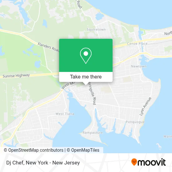
See Dj Chef, Hampton Bays, on the map
Public Transit to Dj Chef in Hampton Bays
Wondering how to get to Dj Chef in Hampton Bays? Moovit helps you find the best way to get to Dj Chef with step-by-step directions from the nearest public transit station.
Moovit provides free maps and live directions to help you navigate through your city. View schedules, routes, timetables, and find out how long does it take to get to Dj Chef in real time.
Looking for the nearest stop or station to Dj Chef? Check out this list of stops closest to your destination: Hampton Bays; Hampton Bays Westbound; Monatuk Hwy/Cemetery Rd.
Bus: 92, HAMPTON JITNEY WESTHAMPTON.Train: MONTAUK BRANCH.
Want to see if there’s another route that gets you there at an earlier time? Moovit helps you find alternative routes or times. Get directions from and directions to Dj Chef easily from the Moovit App or Website.
We make riding to Dj Chef easy, which is why over 1.5 million users, including users in Hampton Bays, trust Moovit as the best app for public transit. You don’t need to download an individual bus app or train app, Moovit is your all-in-one transit app that helps you find the best bus time or train time available.
For information on prices of bus and train, costs and ride fares to Dj Chef, please check the Moovit app.
Use the app to navigate to popular places including to the airport, hospital, stadium, grocery store, mall, coffee shop, school, college, and university.
Dj Chef Address: Elm St street in Hampton Bays
- Janice Resort,
- Reyes Estate Care,
- Extra Space Storage,
- Life Storage - Hampton Bays,
- Hamptons Vacation Inn,
- Sunrise Energy Concepts, Inc.,
- Rapid Recovery,
- Cruz Brothers Construction,
- Mbi Home Improvement Corp,
- Friendly's Restaurant,
- Salvatores Of the Hamptons,
- Barona Bay,
- Deros Food & Family,
- Bowen's by the Bays, Inc.,
- Friendly's Ice Cream Shop,
- San Patric Church In Manhathan,
- Finish Line (Located Inside Macy'S),
- Momo Fashion,
- Hampton Bays Station,
- Western Union
Places Near Dj Chef (Hampton Bays)
- Queens Center Mall, Queens,
- 3 Stone St, Manhattan,
- 26 Federal Plaza, Manhattan,
- Hudson Yards, Manhattan,
- SoHo, Manhattan,
- Chinatown, Manhattan,
- Times Square, Manhattan,
- Katz's Deli, Manhattan,
- 911 Memorial, Manhattan,
- Rockefeller Center, Manhattan,
- San Gennaro Feast, Manhattan,
- Mountainside Hospital, Glen Ridge,
- 111 Centre New York City Supreme Court, Manhattan,
- 376 Hudson Street, Manhattan,
- Pier 83, Manhattan,
- Wall Street, Manhattan,
- 1 Police Plaza, Manhattan,
- 66 John Street, Manhattan,
- Bellevue Hospital, Manhattan,
- qqqq, Manhattan
How to get to popular places in New York - New Jersey with public transit
Get around Hampton Bays by public transit!
Traveling around Hampton Bays has never been so easy. See step by step directions as you travel to any attraction, street or major public transit station. View bus and train schedules, arrival times, service alerts and detailed routes on a map, so you know exactly how to get to anywhere in Hampton Bays.
When traveling to any destination around Hampton Bays use Moovit's Live Directions with Get Off Notifications to know exactly where and how far to walk, how long to wait for your line, and how many stops are left. Moovit will alert you when it's time to get off — no need to constantly re-check whether yours is the next stop.
Wondering how to use public transit in Hampton Bays or how to pay for public transit in Hampton Bays? Moovit public transit app can help you navigate your way with public transit easily, and at minimum cost. It includes public transit fees, ticket prices, and costs. Looking for a map of Hampton Bays public transit lines? Moovit public transit app shows all public transit maps in Hampton Bays with all Bus, Train, Subway, Light Rail, Ferry and Cable Car routes and stops on an interactive map.
New York - New Jersey has 6 transit type(s), including: Bus, Train, Subway, Light Rail, Ferry and Cable Car, operated by several transit agencies, including MTA Subway, Metro-North Railroad, LIRR, PATH, MTA New York City Transit - Express routes, MTA Bus, NJ Transit, NYC Ferry, NICE bus, Bee-Line Bus, NJ Transit Rail, Norwalk Transit District, Hartford Line, River Valley Transit and HART