How to get to Doble R by bus?
Click on the bus route to see step by step directions with maps, line arrival times and updated time schedules.
From Plaza Alameda "28 de Julio", Jesus Mari
50 minFrom Calle Germán Amézaga 375, Lima
47 minFrom Estadio Alberto Gallardo, San Martin
34 minFrom Empresa de Transportes Flores Hnos., La Victori
36 minFrom El Agustino, El Agustin
65 minFrom Barrio Chino De Lima, Lima
50 minFrom Hospital Nacional Alberto Sabogal, Lima
45 minFrom Avenida Colonial, Lima
50 minFrom Av venezuela, Lima
49 minFrom Avenida Universitaria, Lima
40 min
Bus lines to Doble R in Independen
What are the closest stations to Doble R?
The closest stations to Doble R are:
- Posta is 287 meters away, 4 min walk.
- Avenida Antisuyo, 527 is 821 meters away, 11 min walk.
Which bus line stops near Doble R?
CR42 (Ovalo La Perla (La Perla) - Payet (Independencia))
What’s the nearest bus station to Doble R in Independen?
The nearest bus station to Doble R in Independen is Posta. It’s a 4 min walk away.
What time is the first bus to Doble R in Independen?
The CR42 is the first bus that goes to Doble R in Independen. It stops nearby at 4:32 AM.
What time is the last bus to Doble R in Independen?
The CR42 is the last bus that goes to Doble R in Independen. It stops nearby at 12:32 AM.
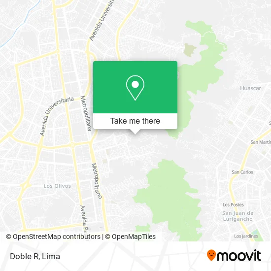
See Doble R, Independen, on the map
Public Transit to Doble R in Independen
Wondering how to get to Doble R in Independen? Moovit helps you find the best way to get to Doble R with step-by-step directions from the nearest public transit station.
Moovit provides free maps and live directions to help you navigate through your city. View schedules, routes, timetables, and find out how long does it take to get to Doble R in real time.
Looking for the nearest stop or station to Doble R? Check out this list of stops closest to your destination: Posta; Avenida Antisuyo.
Bus: CR42, 2407, IM08.
Want to see if there’s another route that gets you there at an earlier time? Moovit helps you find alternative routes or times. Get directions from and directions to Doble R easily from the Moovit App or Website.
We make riding to Doble R easy, which is why over 1.5 million users, including users in Independen, trust Moovit as the best app for public transit. You don’t need to download an individual bus app or train app, Moovit is your all-in-one transit app that helps you find the best bus time or train time available.
For information on prices of bus, costs and ride fares to Doble R, please check the Moovit app.
Use the app to navigate to popular places including to the airport, hospital, stadium, grocery store, mall, coffee shop, school, college, and university.
Doble R Address: Calle Lima 1 de Mayo, 15331 Independencia street in Independen
- Bs.As,
- TE Diria Buena Suerte Peo Me Perdistes,
- Los Bravos de la Salsa Peruana,
- Punto Dulce SAC,
- Pin Pon,
- Fiestas Happy Happy,
- 305 Club Lima,
- Enamorate-Detalles y Regalos,
- Boxers Latino,
- Ecoffice,
- Ecolima,
- Niples Volper Seal,
- Luz de Luna,
- Ferco Style,
- Angie Baby,
- Ya No Me Gusta,
- Sar Luis Shop,
- Menu Delivery Mariela,
- Qory Uniformes,
- Bien Dicho Ctm
Places Near Doble R (Independen)
- Circuito Mágico Del Agua, Lima,
- Pontificia Universidad Católica del Perú - PUCP, San Miguel,
- Av. La Marina, San Miguel,
- Hospital Edgardo Rebagliati Martins, Jesus Mari,
- Paradero Av.Brasil,
- Plaza San Miguel, San Miguel,
- Larcomar, Miraflores,
- Parque Kennedy, Miraflores,
- Jockey Plaza, Santiago D,
- Av. Abancay, Lima,
- Aeropuerto Internacional Jorge Chávez, Ventanilla,
- av arequipa, Lima,
- Miraflores, Miraflores,
- Real Plaza Puruchuco, Ate,
- Av. Salaverry, Jesus Mari,
- Mall Del Sur,
- Parque de las Leyendas, San Miguel,
- Barranco, Barranco,
- Centro Comercial Plaza Norte, Independen,
- Gamarra
How to get to popular places in Lima with public transit
Get around Independen by public transit!
Traveling around Independen has never been so easy. See step by step directions as you travel to any attraction, street or major public transit station. View bus and train schedules, arrival times, service alerts and detailed routes on a map, so you know exactly how to get to anywhere in Independen.
When traveling to any destination around Independen use Moovit's Live Directions with Get Off Notifications to know exactly where and how far to walk, how long to wait for your line, and how many stops are left. Moovit will alert you when it's time to get off — no need to constantly re-check whether yours is the next stop.
Wondering how to use public transit in Independen or how to pay for public transit in Independen? Moovit public transit app can help you navigate your way with public transit easily, and at minimum cost. It includes public transit fees, ticket prices, and costs. Looking for a map of Independen public transit lines? Moovit public transit app shows all public transit maps in Independen with all Bus, Metro and Ferry routes and stops on an interactive map.
Lima has 3 transit type(s), including: Bus, Metro and Ferry, operated by several transit agencies, including Metro de Lima Línea 2 , Metro de Lima, Corredor Rojo, Metropolitano, Metropolitano - Alimentadores, Corredor Morado, Corredor Azul, Rutas Tradicionales, Transportes y Servicios La Esperanza S.A., Las Flores S.A., Virgen de la Asunción S.A., Consorcio HAM, Transportes y Service Canadá S.A., ETUL4SA and ETUCHISA