Directions to Doce Mix (São José Dos Pinhais) with public transportation
The following transit lines have routes that pass near Doce Mix
How to get to Doce Mix by bus?
Click on the bus route to see step by step directions with maps, line arrival times and updated time schedules.
From Xaxim, Xaxim
45 minFrom Ceasa, Tatuquara
71 minFrom Ponto Intercampi UFPR-Politécnico, Jardim Das Américas
49 minFrom Centro Politécnico da UFPR, Jardim Das Américas
57 minFrom Arujá, São José Dos Pinhais
61 minFrom Rua Engenheiro Costa Barros, Cajuru
68 minFrom Vila Oficinas, Cajuru
73 minFrom CEASA - Centrais de Abastecimento do Paraná, Tatuquara
69 minFrom Rua Cid Marcondes de Albuquerque, Pinheirinho
54 minFrom Capão Raso, Capão Raso
57 min
Bus stops near Doce Mix in São José Dos Pinhais
Bus lines to Doce Mix in São José Dos Pinhais
- Y96 FAZENDA / SÃO JOSÉ, FAZENDA / SÃO JOSÉ,VIEW
- 200 PIT PRAÇA DA JUVENTUDE / CENTRO (VIA IZABEL REDENTORA), PIT PRAÇA DA JUVENTUDE / CENTRO (via IZABEL REDENTORA),VIEW
- 302 ELDORADO, ELDORADO,VIEW
- 303 JARDIM ITÁLIA, JARDIM ITÁLIA,VIEW
- 304 ZANIOLO, ZANIOLO,VIEW
- 305 SÃO DOMINGOS / ARISTOCRATA, SÃO DOMINGOS / ARISTOCRATA,VIEW
- 399 COLÔNIA RIO GRANDE / ELDORADO, COLÔNIA RIO GRANDE / ELDORADO,VIEW
- 401 CONTENDA, CONTENDA,VIEW
- 402 CAMPO LARGO, CAMPO LARGO,VIEW
- 406 COTIA (VIA CAMPO LARGO), COTIA (via CAMPO LARGO),VIEW
- 407 REFRIKO, REFRIKO,VIEW
- 409 FAXINA / QUEBRADA FUNDA, FAXINA / QUEBRADA FUNDA,VIEW
- 411 CONTENDA (VIA CAMPO LARGO), CONTENDA (via CAMPO LARGO),VIEW
- 412 CAMPESTRE DA FAXINA, CAMPESTRE DA FAXINA,VIEW
- 510 RIO PEQUENO, RIO PEQUENO,VIEW
- 543 BAIRRO A BAIRRO - 3, BAIRRO A BAIRRO - 3,VIEW
- E21 CENTRO SÃO JOSÉ / BOQUEIRÃO, Terminal São José → Terminal Boqueirão,VIEW
- 0263-500 SÃO JOSÉ DOS PINHAIS / LAGOINHA, São José dos Pinhais → Lagoinha,VIEW
- 101 T. AFONSO PENA / T. CENTRAL, Sentido Anti-horário (via SENAC),VIEW
- 507 T. CENTRAL / JUREMA, Jurema (via Acyolly) → Terminal Central São José,VIEW
What are the closest stations to Doce Mix?
The closest stations to Doce Mix are:
- R. Mendes Leitão, 2541 is 130 meters away, 2 min walk.
- R. Dona Izabel A Redentora, 1531 is 156 meters away, 3 min walk.
- R. Visconde do Rio Branco, 1669 is 222 meters away, 3 min walk.
- R. Veríssimo Marques, 1135 is 278 meters away, 4 min walk.
- R. Joaquim Nabuco, 2331 is 311 meters away, 5 min walk.
- R. Voluntários da Pátria, 212 is 322 meters away, 5 min walk.
Which bus lines stop near Doce Mix?
These bus lines stop near Doce Mix: 200 PIT PRAÇA DA JUVENTUDE / CENTRO (VIA IZABEL REDENTORA), 206 BARREIRINHA / SÃO JOSÉ, 403 CAMPINA, E21 CENTRO SÃO JOSÉ / BOQUEIRÃO, E99 SÃO JOSÉ / GUADALUPE (VIA T. CENTRAL).
What’s the nearest bus station to Doce Mix in São José Dos Pinhais?
The nearest bus station to Doce Mix in São José Dos Pinhais is R. Mendes Leitão, 2541. It’s a 2 min walk away.
What time is the first bus to Doce Mix in São José Dos Pinhais?
The 530 BAIRRO A BAIRRO - 2 is the first bus that goes to Doce Mix in São José Dos Pinhais. It stops nearby at 4:01 AM.
What time is the last bus to Doce Mix in São José Dos Pinhais?
The 530 BAIRRO A BAIRRO - 2 is the last bus that goes to Doce Mix in São José Dos Pinhais. It stops nearby at 1:17 AM.
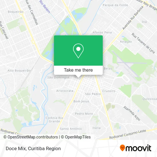
See Doce Mix, São José Dos Pinhais, on the map
Public Transit to Doce Mix in São José Dos Pinhais
Wondering how to get to Doce Mix in São José Dos Pinhais? Moovit helps you find the best way to get to Doce Mix with step-by-step directions from the nearest public transit station.
Moovit provides free maps and live directions to help you navigate through your city. View schedules, routes, timetables, and find out how long does it take to get to Doce Mix in real time.
Looking for the nearest stop or station to Doce Mix? Check out this list of stops closest to your destination: R. Mendes Leitão; R. Dona Izabel A Redentora; R. Visconde do Rio Branco; R. Veríssimo Marques; R. Joaquim Nabuco; R. Voluntários da Pátria.
Bus: 200 PIT PRAÇA DA JUVENTUDE / CENTRO (VIA IZABEL REDENTORA), 206 BARREIRINHA / SÃO JOSÉ, 403 CAMPINA, E21 CENTRO SÃO JOSÉ / BOQUEIRÃO, E99 SÃO JOSÉ / GUADALUPE (VIA T. CENTRAL), Y96 FAZENDA / SÃO JOSÉ, 302 ELDORADO, 303 JARDIM ITÁLIA, 304 ZANIOLO, 0263-500 SÃO JOSÉ DOS PINHAIS / LAGOINHA, 101 T. AFONSO PENA / T. CENTRAL, 507 T. CENTRAL / JUREMA, 300 BAIRRO A BAIRRO - 4, 505 INTERBAIRROS 1, 530 BAIRRO A BAIRRO - 2, 301 COLÔNIA RIO GRANDE, 311 SÃO MARCOS / AQUARIUS, 312 JARDIM CARMEM, 398 JARDIM CARMEM - SÃO MARCOS (AQUARIUS), 526 T. CENTRAL / MONTE LÍBANO, 515 ✈ AEROPORTO - 1 / SHOPPING SÃO JOSÉ.
Want to see if there’s another route that gets you there at an earlier time? Moovit helps you find alternative routes or times. Get directions from and directions to Doce Mix easily from the Moovit App or Website.
We make riding to Doce Mix easy, which is why over 1.5 million users, including users in São José Dos Pinhais, trust Moovit as the best app for public transit. You don’t need to download an individual bus app or train app, Moovit is your all-in-one transit app that helps you find the best bus time or train time available.
For information on prices of bus, costs and ride fares to Doce Mix, please check the Moovit app.
Use the app to navigate to popular places including to the airport, hospital, stadium, grocery store, mall, coffee shop, school, college, and university.
Doce Mix Address: Rua XV de Novembro street in São José Dos Pinhais
- Rua XV de Novembro 1556,
- B Box Fashion,
- Constance Maria Cortes Santos,
- Casas Bahia,
- Partido Progressista Brasileiro Diretorio Municipal Sao Jose,
- Sagitario Jeans-Comercio de Confeccoes,
- Rua Doutor Manoel Ribeiro de Campos 955,
- Studio Glamour - Centro de Beleza e Estética,
- Relojoaria Nova Era,
- Farmácia Redemed,
- Caixa Econômica Federal,
- Chaveiro Eldorado,
- Rua Santa Rita,
- M K Mecanica e Borracharia,
- Igreja Matriz São José dos Pinhais,
- Ra Catering,
- Game in Box Loja de Games Conserto e Desbloqueio de Video Games Sao José Pinhais,
- Serviço de Apoio Às Altas Habilidades / Superdotação,
- Garagem Silveira,
- Hotel ibis Curitiba Aeroporto
Places Near Doce Mix (São José Dos Pinhais)
- Arena Da Baixada - Curitiba,
- Rua Martim Afonso 558, Mercês,
- Shopping Estação, Rebouças,
- Hospital Angelina Caron, Campina Grande Do Sul,
- Jockey Plaza Shopping Center, Tarumã,
- Park Shopping Barigüi, Mossunguê,
- Hospital Erasto Gaertner, Jardim Das Américas,
- Rua General Mário Tourinho, Campina Do Siqueira,
- Hospital Da Cruz Vermelha, Batel,
- Parque Barigui, Mercês,
- Pontifícia Universidade Católica do Paraná (PUCPR), Prado Velho,
- Shopping Palladium, Portão,
- Jardim Botânico de Curitiba PR, Centro,
- Hospital Universitário Evangélico de Curitiba, Bigorrilho,
- Hospital do Rocio, Campo,
- Campo Largo, Campo,
- Hospital Madalena Sofia, Bairro Alto,
- Hospital de Clínicas (HC - UFPR), Centro,
- Hhhhh, Fazendinha,
- Hospital Nossa Senhora Das Graças, Mercês
How to get to popular places in Curitiba Region with public transit
Get around São José Dos Pinhais by public transit!
Traveling around São José Dos Pinhais has never been so easy. See step by step directions as you travel to any attraction, street or major public transit station. View bus and train schedules, arrival times, service alerts and detailed routes on a map, so you know exactly how to get to anywhere in São José Dos Pinhais.
When traveling to any destination around São José Dos Pinhais use Moovit's Live Directions with Get Off Notifications to know exactly where and how far to walk, how long to wait for your line, and how many stops are left. Moovit will alert you when it's time to get off — no need to constantly re-check whether yours is the next stop.
Wondering how to use public transit in São José Dos Pinhais or how to pay for public transit in São José Dos Pinhais? Moovit public transit app can help you navigate your way with public transit easily, and at minimum cost. It includes public transit fees, ticket prices, and costs. Looking for a map of São José Dos Pinhais public transit lines? Moovit public transit app shows all public transit maps in São José Dos Pinhais with all Bus and Cable Car routes and stops on an interactive map.
Curitiba Region has 2 transit type(s), including: Bus and Cable Car, operated by several transit agencies, including Sistema Integrado de Mobilidade (URBS), Sistema Integrado de Mobilidade (AMEP), URBS (Cartões bancários e Dinheiro), URBS (Cartões bancários / Cartão URBS), AMEP (Cartões bancários / Cartão MetroCard), AMEP (Cartões bancários / Cartão MetroCard / Dinheiro), Viação Colombo (Dinheiro), TRIAR (Cartão TRIAR / Dinheiro), Empresa Curitiba Cerro Azul (Dinheiro), Expresso Nossa Senhora da Penha (Dinheiro), Empresa Campo Alto Tijucas (Dinheiro), Auto Viação São José (Cartão VEM / Dinheiro), BRT S/A (Cartão VEM / Dinheiro), TransPiedade (Cartão Cidadão / Dinheiro) and Oceânica Sul (Cartão Transporte / Dinheiro)