How to get to Doce da Vida by bus?
Click on the bus route to see step by step directions with maps, line arrival times and updated time schedules.
From Vila de Prado, Vila De Prado
59 minFrom Central de Camionagem de Barcelos, Barcelos
29 minFrom Várzea, Barcelos
32 minFrom IPCA - Escola Superior de Gestão, Barcelos, Vila Boa e Vila Frescainha (São Martinho e São Pedro)
26 minFrom Barcelos, Barcelos
40 minFrom Centro de Formação Profissional Mazagão, Celeirós, Aveleda e Vimieiro
84 minFrom Palmeira, Braga
65 minFrom Mazagão, Celeirós, Aveleda e Vimieiro
86 minFrom Alfacoop Braga, Braga
95 minFrom portagens A3 Saída Para BRAGA, Celeirós, Aveleda e Vimieiro
102 min
Bus stops near Doce da Vida in Barcelos
Train station near Doce da Vida in Barcelos
- Silva, 60 min walk,VIEW
Bus lines to Doce da Vida in Barcelos
What are the closest stations to Doce da Vida?
The closest stations to Doce da Vida are:
- Roriz Cemitério is 14 meters away, 1 min walk.
- Roriz (Cruzamento Alvito S. Pedro) is 504 meters away, 7 min walk.
- Silva is 4746 meters away, 60 min walk.
Which bus line stops near Doce da Vida?
M31 (S. Julião de Freixo)
What’s the nearest bus station to Doce da Vida in Barcelos?
The nearest bus station to Doce da Vida in Barcelos is Roriz Cemitério. It’s a 1 min walk away.
What time is the first train to Doce da Vida in Barcelos?
The R is the first train that goes to Doce da Vida in Barcelos. It stops nearby at 5:39 AM.
What time is the last train to Doce da Vida in Barcelos?
The R is the last train that goes to Doce da Vida in Barcelos. It stops nearby at 11:07 PM.
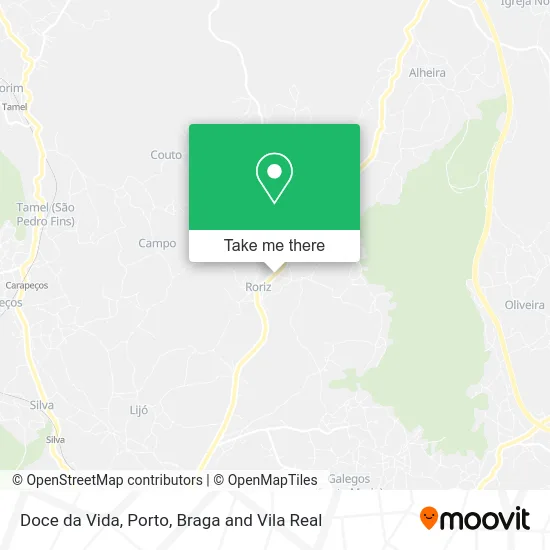
See Doce da Vida, Barcelos, on the map
Public Transit to Doce da Vida in Barcelos
Wondering how to get to Doce da Vida in Barcelos? Moovit helps you find the best way to get to Doce da Vida with step-by-step directions from the nearest public transit station.
Moovit provides free maps and live directions to help you navigate through your city. View schedules, routes, timetables, and find out how long does it take to get to Doce da Vida in real time.
Looking for the nearest stop or station to Doce da Vida? Check out this list of stops closest to your destination: Roriz Cemitério; Roriz (Cruzamento Alvito S. Pedro); Silva.
Bus: M31, M29, 217.Train: R.
Want to see if there’s another route that gets you there at an earlier time? Moovit helps you find alternative routes or times. Get directions from and directions to Doce da Vida easily from the Moovit App or Website.
We make riding to Doce da Vida easy, which is why over 1.5 million users, including users in Barcelos, trust Moovit as the best app for public transit. You don’t need to download an individual bus app or train app, Moovit is your all-in-one transit app that helps you find the best bus time or train time available.
For information on prices of bus and train, costs and ride fares to Doce da Vida, please check the Moovit app.
Use the app to navigate to popular places including to the airport, hospital, stadium, grocery store, mall, coffee shop, school, college, and university.
Doce da Vida Address: Rua S. Miguel de Roriz Roriz, 4750-651 Barcelos street in Barcelos
- Cemitério de Roriz Em Barcelos,
- Lima & Barros Confecções,
- Fábrica da Igreja Paroquial de São Jorge de Airó,
- Lima & Gomes,
- Zona Industrial de Roriz,
- Parque Industrial de Roriz,
- Cruzeiro Paroquial de Roriz,
- Biocelos Unipessoal Lda,
- Fátima & Leonardo Lima - Confecções,
- Miguel Fernandes Maciel,
- Nico Moda Jovem,
- Roriz,
- Escola Básica de Rio Covo,
- Transroriz - Transportes,
- Maxileafstore,
- Escola Básica de Bárrio,
- Arantes & Silva - Malhas e Confecções,
- Faria & Dias,
- Granja & Miranda - Confecções,
- Platano Café
Places Near Doce da Vida (Barcelos)
- Senhor de Matosinhos, Matosinhos e Leça da Palmeira,
- Maia, Maia,
- Acesso ao Shopping Parque Nascente, Campanhã,
- Hospital Santos Silva, Vila Nova De Gaia,
- Palácio de Cristal, Lordelo do Ouro e Massarelos,
- Leça da Palmeira, Matosinhos e Leça da Palmeira,
- Avintes, Vila Nova De Gaia,
- Zoo Santo Inácio, Vila Nova De Gaia,
- Canidelo, Vila Nova De Gaia,
- El Corte Inglés de Gaia, Mafamude e Vilar do Paraíso,
- Parque Aquatico Amarante - Aqua Aventura, Amarante,
- Rua Calouste Gulbenkian, Lordelo do Ouro e Massarelos,
- VILA do CONDE PORTO FASHION OUTLET, Modivas,
- Hospital da Prelada, Ramalde,
- Hospital de Santo António, Cedofeita, Santo Ildefonso, Sé, Miragaia, São Nicolau e Vitória,
- Arrábida Shopping, Santa Marinha e São Pedro da Afurada,
- Valongo, Valongo,
- Espinho, Espinho,
- MAR Shopping, Matosinhos e Leça da Palmeira,
- Estádio do Dragão, Campanhã
How to get to popular places in Porto, Braga and Vila Real with public transit
Get around Barcelos by public transit!
Traveling around Barcelos has never been so easy. See step by step directions as you travel to any attraction, street or major public transit station. View bus and train schedules, arrival times, service alerts and detailed routes on a map, so you know exactly how to get to anywhere in Barcelos.
When traveling to any destination around Barcelos use Moovit's Live Directions with Get Off Notifications to know exactly where and how far to walk, how long to wait for your line, and how many stops are left. Moovit will alert you when it's time to get off — no need to constantly re-check whether yours is the next stop.
Wondering how to use public transit in Barcelos or how to pay for public transit in Barcelos? Moovit public transit app can help you navigate your way with public transit easily, and at minimum cost. It includes public transit fees, ticket prices, and costs. Looking for a map of Barcelos public transit lines? Moovit public transit app shows all public transit maps in Barcelos with all Bus, Train, Metro, Ferry, Funicular and Gondola routes and stops on an interactive map.
Porto, Braga and Vila Real has 6 transit type(s), including: Bus, Train, Metro, Ferry, Funicular and Gondola, operated by several transit agencies, including Metro do Porto, Metro do Porto - Metrobus, CP - Comboios de Portugal, STCP, UNIR Mobilidade da Area Metropolitana do Porto, Getbus - Aerobus, Mobiave, Valpibus, TUB - Transportes Urbanos de Braga, TuViana, Guimabus, Ave Mobilidade, Cávado Mobilidade, Transdev and Câmara Municipal de Santo Tirso