How to get to Docplexus by bus?
Click on the bus route to see step by step directions with maps, line arrival times and updated time schedules.
From Hotel Sukanta, Pune & Velhe
63 minFrom अलका टौकीस (Alka Theater), Pune & Velhe
56 minFrom Bharati Vidyapeeth Deemed University Pune 30, Pune & Velhe
58 minFrom Alka chowk, Pune & Velhe
56 minFrom Karve Nagar, Pune & Velhe
66 minFrom J P Naik Center for Education and Development, Pune & Velhe
42 minFrom TCS Sahyadri Park, Paud
53 minFrom Life 365, Pune & Velhe
51 minFrom Bhimashankar, Pune & Velhe
58 minFrom Zudio, Pune & Velhe
46 min
Bus stops near Docplexus in Paud
Bus lines to Docplexus in Paud
- 114, Ma.Na.Pa Bhavan,VIEW
- 124, Aundh Gaon,VIEW
- 208, Bhekrainagar Depot,VIEW
- 344, Baner Depot,VIEW
- 344A, Susgaon Sunny World Resort,VIEW
- 208B, Mahatma Gandhi Bus Stand Pulgate,VIEW
- 114M, Ma.Na.Pa Bhavan (Ladies Sp),VIEW
- 345A, Hinjawadi Maan Phase 3,VIEW
- 344B, Bhosari Gaon,VIEW
- 258, Ma.Na.Pa Bhavan,VIEW
- 43, Nigdi Bhakti Shakti Terminal - Katraj,VIEW
- 44, Akurdi Railway Station - Katraj,VIEW
- 45, Radha Chowk (Mhalunge Phata) - Katraj,VIEW
- 77, Hinjawadi Maan Phase 3 - Ganpati Matha,VIEW
- 79, Hinjawadi Maan Phase 3 - Deccan Gymkhana,VIEW
- 228, Katraj - Vadgaon Mawal,VIEW
- 43A, Hinjawadi Maan Phase 3 - Katraj,VIEW
- 228B, Balewadi Depot - Katraj,VIEW
- 100C, Radha Chowk (Mhalunge Phata) - Hinjawadi Maan Phase 3,VIEW
- 50N, Nigdi Bhakti Shakti Terminal - Sinhgad Paytha,VIEW
What are the closest stations to Docplexus?
The closest stations to Docplexus are:
- D Mart Baner is 71 meters away, 2 min walk.
- Baner Depot is 285 meters away, 4 min walk.
- Vibgyor School Baner is 559 meters away, 8 min walk.
- Radha Chowk (Mhalunge Phata) is 674 meters away, 9 min walk.
- Radha Hotel is 858 meters away, 12 min walk.
Which bus lines stop near Docplexus?
These bus lines stop near Docplexus: 114, 360, 43A, 45.
What’s the nearest bus station to Docplexus in Paud?
The nearest bus station to Docplexus in Paud is D Mart Baner. It’s a 2 min walk away.
What time is the first bus to Docplexus in Paud?
The 355A is the first bus that goes to Docplexus in Paud. It stops nearby at 5:00 AM.
What time is the last bus to Docplexus in Paud?
The 44 is the last bus that goes to Docplexus in Paud. It stops nearby at 12:50 AM.
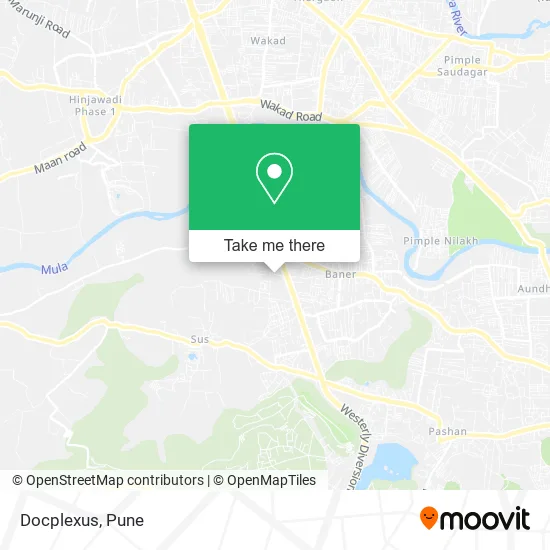
See Docplexus, Paud, on the map
Public Transit to Docplexus in Paud
Wondering how to get to Docplexus in Paud? Moovit helps you find the best way to get to Docplexus with step-by-step directions from the nearest public transit station.
Moovit provides free maps and live directions to help you navigate through your city. View schedules, routes, timetables, and find out how long does it take to get to Docplexus in real time.
Looking for the nearest stop or station to Docplexus? Check out this list of stops closest to your destination: D Mart Baner; Baner Depot; Vibgyor School Baner; Radha Chowk (Mhalunge Phata); Radha Hotel.
Bus: 114, 360, 43A, 45, 124, 208, 344, 344A, 345A, 344B, 258, 43, 44, 77, 79, 228A, 355A, 355B, 381B, 87E.
Want to see if there’s another route that gets you there at an earlier time? Moovit helps you find alternative routes or times. Get directions from and directions to Docplexus easily from the Moovit App or Website.
We make riding to Docplexus easy, which is why over 1.5 million users, including users in Paud, trust Moovit as the best app for public transit. You don’t need to download an individual bus app or train app, Moovit is your all-in-one transit app that helps you find the best bus time or train time available.
For information on prices of bus, costs and ride fares to Docplexus, please check the Moovit app.
Use the app to navigate to popular places including to the airport, hospital, stadium, grocery store, mall, coffee shop, school, college, and university.
Docplexus Address: Baner Sus Road पुणे 411045 MH street in Paud
- Accentia,
- Foton,
- V D A,
- Amiseq,
- Takraf,
- Finzly,
- Fusionstak,
- Tirupati Auto,
- Kolkata Roll Point,
- Yashoda Cafe,
- Ask E-Square Business Solutions Private Limited,
- Ask-Ehs Engineering & Consultants,
- Fox,
- Optically,
- Wefivesoft,
- A S K,
- Absence,
- I V L,
- Co Live Faster,
- Hub Engage
Places Near Docplexus (Paud)
- Fc Road, Pune & Velhe,
- Dagdusheth Halwai Ganpati Mandir, Pune & Velhe,
- ISKCON Nvcc Temple, Pune & Velhe,
- Chaturshringi Temple, Pune & Velhe,
- ISKCON Pune, Pune & Velhe,
- BAPS Shri Swaminarayan Mandir, Pune & Velhe,
- Cognizant Deccan Campus (CDC), Paud,
- Senapati Bapat Road, Pune & Velhe,
- Dagadusheth Halwai Ganapati Temple, Pune & Velhe,
- Pvr Icon - Pavilion Mall, Pune & Velhe,
- Pune Okayama Friendship Garden, Pune & Velhe,
- Tulshibaug, Pune & Velhe,
- Sarasbaug, Pune & Velhe,
- M G Road, Pune & Velhe,
- Vishwakarma Institute Of Technology (Vit), Pune & Velhe,
- Symbiosis Lavale Bus Stop, Pune & Velhe,
- Ion Digital Zone, Pune & Velhe,
- Westend Mall, Pune & Velhe,
- Swaminarayan Mandir, Pune & Velhe,
- Laxmi Road, Pune & Velhe
How to get to popular places in Pune with public transit
Get around Paud by public transit!
Traveling around Paud has never been so easy. See step by step directions as you travel to any attraction, street or major public transit station. View bus and train schedules, arrival times, service alerts and detailed routes on a map, so you know exactly how to get to anywhere in Paud.
When traveling to any destination around Paud use Moovit's Live Directions with Get Off Notifications to know exactly where and how far to walk, how long to wait for your line, and how many stops are left. Moovit will alert you when it's time to get off — no need to constantly re-check whether yours is the next stop.
Wondering how to use public transit in Paud or how to pay for public transit in Paud? Moovit public transit app can help you navigate your way with public transit easily, and at minimum cost. It includes public transit fees, ticket prices, and costs. Looking for a map of Paud public transit lines? Moovit public transit app shows all public transit maps in Paud with all Bus, Train and Metro routes and stops on an interactive map.
Pune has 3 transit type(s), including: Bus, Train and Metro, operated by several transit agencies, including Pune Metro (Maha Metro), PMPML, PMPML Night Bus Service (Ratrani) and Central Railways (Indian Railways)