How to get to Dog Bone Run by bus?
Click on the bus route to see step by step directions with maps, line arrival times and updated time schedules.
From New Rochelle, NY, New Rochelle
59 minFrom 23rd Street & 6th Ave., Manhattan
57 minFrom Randall's Island, Manhattan
74 minFrom MTA X80 - Manhattan to Randall's Island, Manhattan
53 minFrom Riverside Church, Manhattan
77 minFrom 391,E 149th St E 149th St, Bronx
52 minFrom Costco, Manhattan
71 minFrom Rikers Island, Bronx
132 minFrom 168 St, Manhattan
63 minFrom Englewood, NJ, Englewood
82 min
How to get to Dog Bone Run by train?
Click on the train route to see step by step directions with maps, line arrival times and updated time schedules.
How to get to Dog Bone Run by subway?
Click on the subway route to see step by step directions with maps, line arrival times and updated time schedules.
Bus stops near Dog Bone Run in Bronx
Subway stations near Dog Bone Run in Bronx
Train station near Dog Bone Run in Bronx
- Williams Bridge, 16 min walk,VIEW
Bus lines to Dog Bone Run in Bronx
- 4, Bedford Park,VIEW
- 20, Cross County Center @ Macys E Lane,VIEW
- 21, Limited Stops - Bedford Park,VIEW
- BX10, Norwood 205 St Sta,VIEW
- BXM4, Midtown 26 St Via 5 Av,VIEW
- BX16, Norwood 205 St Sta Via Mundy La,VIEW
- BX34, Woodlawn Katonah Av,VIEW
- BX1, 165 St,VIEW
- BX2, Mott Haven 138 St Via Concourse,VIEW
- BX28, Co-Op City Earhart Lane Via Gunhill,VIEW
- BX38, Co-Op City Bay Plaza Via Gunhill,VIEW
What are the closest stations to Dog Bone Run?
The closest stations to Dog Bone Run are:
- Jerome Ave @ W Gun Hill Rd is 230 yards away, 3 min walk.
- Bedford Park Blvd is 236 yards away, 3 min walk.
- East Gun Hill Rd/De Kalb Av is 304 yards away, 4 min walk.
- Bainbridge Av/E 212 St is 570 yards away, 7 min walk.
- Woodlawn is 573 yards away, 7 min walk.
- West Mosholu Pkwy South/Paul Av is 788 yards away, 10 min walk.
- Paul Av/West Mosholu Pkwy South is 817 yards away, 10 min walk.
- Williams Bridge is 1285 yards away, 16 min walk.
Which bus lines stop near Dog Bone Run?
These bus lines stop near Dog Bone Run: BX1, BX10, BX2, BX38, BX41-SBS, BXM3, BXM4.
Which train line stops near Dog Bone Run?
2 (515#| North White Plains)
Which subway line stops near Dog Bone Run?
4 (Uptown & The Bronx)
What’s the nearest subway station to Dog Bone Run in Bronx?
The nearest subway station to Dog Bone Run in Bronx is Bedford Park Blvd. It’s a 3 min walk away.
What’s the nearest train station to Dog Bone Run in Bronx?
The nearest train station to Dog Bone Run in Bronx is Williams Bridge. It’s a 16 min walk away.
What’s the nearest bus station to Dog Bone Run in Bronx?
The nearest bus station to Dog Bone Run in Bronx is Jerome Ave @ W Gun Hill Rd. It’s a 3 min walk away.
What time is the first subway to Dog Bone Run in Bronx?
The 4 is the first subway that goes to Dog Bone Run in Bronx. It stops nearby at 3:04 AM.
What time is the last subway to Dog Bone Run in Bronx?
The D is the last subway that goes to Dog Bone Run in Bronx. It stops nearby at 4:30 AM.
What time is the first train to Dog Bone Run in Bronx?
The 2 is the first train that goes to Dog Bone Run in Bronx. It stops nearby at 5:13 AM.
What time is the last train to Dog Bone Run in Bronx?
The 2 is the last train that goes to Dog Bone Run in Bronx. It stops nearby at 2:19 AM.
What time is the first bus to Dog Bone Run in Bronx?
The BX10 is the first bus that goes to Dog Bone Run in Bronx. It stops nearby at 3:03 AM.
What time is the last bus to Dog Bone Run in Bronx?
The BX10 is the last bus that goes to Dog Bone Run in Bronx. It stops nearby at 2:49 AM.
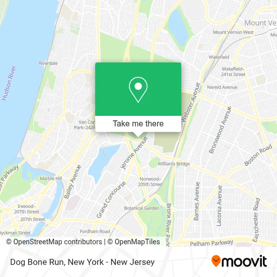
See Dog Bone Run, Bronx, on the map
Public Transit to Dog Bone Run in Bronx
Wondering how to get to Dog Bone Run in Bronx? Moovit helps you find the best way to get to Dog Bone Run with step-by-step directions from the nearest public transit station.
Moovit provides free maps and live directions to help you navigate through your city. View schedules, routes, timetables, and find out how long does it take to get to Dog Bone Run in real time.
Looking for the nearest stop or station to Dog Bone Run? Check out this list of stops closest to your destination: Jerome Ave @ W Gun Hill Rd; Bedford Park Blvd; East Gun Hill Rd/De Kalb Av; Bainbridge Av/E 212 St; Woodlawn; West Mosholu Pkwy South/Paul Av; Paul Av/West Mosholu Pkwy South; Williams Bridge.
Bus: BX1, BX10, BX2, BX38, BX41-SBS, BXM3, BXM4, 4, 20, 21.Train: 2.Subway: 4, B, D.
Want to see if there’s another route that gets you there at an earlier time? Moovit helps you find alternative routes or times. Get directions from and directions to Dog Bone Run easily from the Moovit App or Website.
We make riding to Dog Bone Run easy, which is why over 1.5 million users, including users in Bronx, trust Moovit as the best app for public transit. You don’t need to download an individual bus app or train app, Moovit is your all-in-one transit app that helps you find the best bus time or train time available.
For information on prices of bus, subway and train, costs and ride fares to Dog Bone Run, please check the Moovit app.
Use the app to navigate to popular places including to the airport, hospital, stadium, grocery store, mall, coffee shop, school, college, and university.
Dog Bone Run Address: 36 W Gun Hill Rd street in Bronx
- New York Best Cpr,
- Gmb Windows,
- Sleppy Hollow,
- New Restaurant,
- El Valle Restaurant,
- van cortlandt park Playground @E. Gunhill Road,
- Jerome Avenue & West Gun Hill Road,
- Jerome Ave and Gun Hill,
- Jerome Ave intersection E Gun Hill Rd,
- E Gun Hill Rd (jerome and gun hill),
- Dream Bronx NY,
- Rainbow,
- Usa Vein Clinics,
- Usa Hemorrhoid Centers - Norwood,
- Libertyx Bitcoin Atm,
- Atm Walgreens,
- Citymd Norwood Urgent Care,
- Michelle Alejo Family Daycare,
- Usa Fibroid Centers - Jerome Ave,
- Ultra Urban Inc.
Places Near Dog Bone Run (Bronx)
- 1 Police Plaza, Manhattan,
- SoHo, Manhattan,
- Bellevue Hospital, Manhattan,
- Chinatown, Manhattan,
- qqqq, Manhattan,
- Mountainside Hospital, Glen Ridge,
- San Gennaro Feast, Manhattan,
- Katz's Deli, Manhattan,
- Pier 83, Manhattan,
- 66 John Street, Manhattan,
- Hudson Yards, Manhattan,
- 3 Stone St, Manhattan,
- 376 Hudson Street, Manhattan,
- Times Square, Manhattan,
- 26 Federal Plaza, Manhattan,
- 111 Centre New York City Supreme Court, Manhattan,
- 911 Memorial, Manhattan,
- Wall Street, Manhattan,
- Queens Center Mall, Queens,
- Rockefeller Center, Manhattan
How to get to popular places in New York - New Jersey with public transit
Get around Bronx by public transit!
Traveling around Bronx has never been so easy. See step by step directions as you travel to any attraction, street or major public transit station. View bus and train schedules, arrival times, service alerts and detailed routes on a map, so you know exactly how to get to anywhere in Bronx.
When traveling to any destination around Bronx use Moovit's Live Directions with Get Off Notifications to know exactly where and how far to walk, how long to wait for your line, and how many stops are left. Moovit will alert you when it's time to get off — no need to constantly re-check whether yours is the next stop.
Wondering how to use public transit in Bronx or how to pay for public transit in Bronx? Moovit public transit app can help you navigate your way with public transit easily, and at minimum cost. It includes public transit fees, ticket prices, and costs. Looking for a map of Bronx public transit lines? Moovit public transit app shows all public transit maps in Bronx with all Bus, Train, Subway, Light Rail, Ferry and Cable Car routes and stops on an interactive map.
New York - New Jersey has 6 transit type(s), including: Bus, Train, Subway, Light Rail, Ferry and Cable Car, operated by several transit agencies, including MTA Subway, Metro-North Railroad, LIRR, PATH, MTA New York City Transit - Express routes, MTA Bus, NJ Transit, NYC Ferry, NICE bus, Bee-Line Bus, NJ Transit Rail, Norwalk Transit District, Hartford Line, River Valley Transit and HART