How to get to Dogs 2 Go by bus?
Click on the bus route to see step by step directions with maps, line arrival times and updated time schedules.
From Walmart, Fort Lauderdale
47 minFrom Kamal Singh, Plantation
81 minFrom Embassy Suites-Fort Lauderdale (Embassy Suites by Hilton Fort Lauderdale 17th Street), Fort Lauderdale
52 minFrom A1A, Fort Lauderdale
43 minFrom Banco Davivienda sa Miami Internatl Branch, Fort Lauderdale
45 minFrom Sawgrass Recreation Park, Fort Lauderdale
72 minFrom Butterfly World, Pompano Beach
98 minFrom Margate, FL, Coral Springs-Margate
73 minFrom Tri-Rail-Pompano Beach Station, Pompano Beach
81 minFrom Cash Escorts, Fort Lauderdale
29 min
How to get to Dogs 2 Go by train?
Click on the train route to see step by step directions with maps, line arrival times and updated time schedules.
Bus stops near Dogs 2 Go in Fort Lauderdale
Train station near Dogs 2 Go in Fort Lauderdale
- Cypress Creek Station, 61 min walk,VIEW
Bus lines to Dogs 2 Go in Fort Lauderdale
What are the closest stations to Dogs 2 Go?
The closest stations to Dogs 2 Go are:
- Dixie Highway/Northeast 42nd Street is 566 yards away, 7 min walk.
- Andrews Avenue/Northeast 41st Street is 898 yards away, 11 min walk.
- Cypress Creek Station is 5191 yards away, 61 min walk.
Which bus lines stop near Dogs 2 Go?
These bus lines stop near Dogs 2 Go: 50, 55, 60.
Which train line stops near Dogs 2 Go?
TRIRAIL (Southbound To Miami Airport)
What’s the nearest bus station to Dogs 2 Go in Fort Lauderdale?
The nearest bus station to Dogs 2 Go in Fort Lauderdale is Dixie Highway/Northeast 42nd Street. It’s a 7 min walk away.
What time is the first train to Dogs 2 Go in Fort Lauderdale?
The TRIRAIL is the first train that goes to Dogs 2 Go in Fort Lauderdale. It stops nearby at 4:38 AM.
What time is the last train to Dogs 2 Go in Fort Lauderdale?
The TRIRAIL is the last train that goes to Dogs 2 Go in Fort Lauderdale. It stops nearby at 10:43 PM.
What time is the first bus to Dogs 2 Go in Fort Lauderdale?
The 60 is the first bus that goes to Dogs 2 Go in Fort Lauderdale. It stops nearby at 5:35 AM.
What time is the last bus to Dogs 2 Go in Fort Lauderdale?
The 50 is the last bus that goes to Dogs 2 Go in Fort Lauderdale. It stops nearby at 11:30 PM.
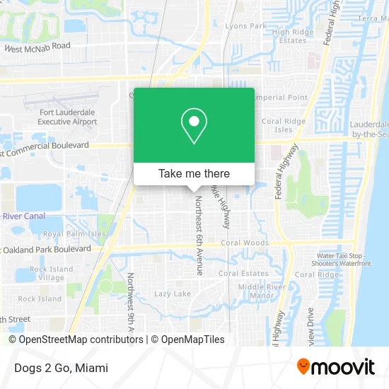
See Dogs 2 Go, Fort Lauderdale, on the map
Public Transit to Dogs 2 Go in Fort Lauderdale
Wondering how to get to Dogs 2 Go in Fort Lauderdale? Moovit helps you find the best way to get to Dogs 2 Go with step-by-step directions from the nearest public transit station.
Moovit provides free maps and live directions to help you navigate through your city. View schedules, routes, timetables, and find out how long does it take to get to Dogs 2 Go in real time.
Looking for the nearest stop or station to Dogs 2 Go? Check out this list of stops closest to your destination: Dixie Highway/Northeast 42nd Street; Andrews Avenue/Northeast 41st Street; Cypress Creek Station.
Bus: 50, 55, 60.Train: TRIRAIL.
Want to see if there’s another route that gets you there at an earlier time? Moovit helps you find alternative routes or times. Get directions from and directions to Dogs 2 Go easily from the Moovit App or Website.
We make riding to Dogs 2 Go easy, which is why over 1.5 million users, including users in Fort Lauderdale, trust Moovit as the best app for public transit. You don’t need to download an individual bus app or train app, Moovit is your all-in-one transit app that helps you find the best bus time or train time available.
For information on prices of bus and train, costs and ride fares to Dogs 2 Go, please check the Moovit app.
Use the app to navigate to popular places including to the airport, hospital, stadium, grocery store, mall, coffee shop, school, college, and university.
Dogs 2 Go Address: 4072 NE 5th Ter Oakland Park, FL 33334 street in Fort Lauderdale
- Dimelo Papi Pinchos,
- Coffee Pub,
- PM Bites,
- Flamingo di Chef,
- Arey of Flavors,
- Pide Que Hay,
- Island Palate 2go,
- Happy Hour Chefs,
- SPRD the Vibe,
- New Havana's Cafe & Catering,
- The Way To Your Heart,
- Mi Soon Come Restaurant,
- Big Daddy G's,
- Surry Co Smoke House,
- Athena Must Have Greek,
- Element Food Company,
- Campstyle Kitchen,
- Vegan2go Meals,
- Common Sense Cooking,
- Tasteful Kreationz
Places Near Dogs 2 Go (Fort Lauderdale)
- Richard E. Gerstein Justice Building, Miami,
- Aventura Mall, Miami,
- Miami VA Hospital, Miami,
- Miami Design District, Miami,
- Marlins Park, Miami,
- Miami Freedom Park, Miami,
- Sawgrass mall ( FL ), Miami Beach,
- Wynwood, Miami,
- Port of Miami Cruise Terminal, Miami,
- Brickell City Centre, Miami,
- Little Havana, Miami,
- Miami-Dade County Courthouse, Miami,
- Dolphin Mall Bus, Miami,
- Sawgrass Mall, Miami,
- Keiser University Flagship Campus, West Palm Beach,
- Hard Rock Stadium, Miami Gardens,
- Dolphin Mall, Miami,
- Bayside Marketplace, Miami,
- Zoo Miami, Miami,
- Aventura Mall, Miami Beach
How to get to popular places in Miami with public transit
Get around Fort Lauderdale by public transit!
Traveling around Fort Lauderdale has never been so easy. See step by step directions as you travel to any attraction, street or major public transit station. View bus and train schedules, arrival times, service alerts and detailed routes on a map, so you know exactly how to get to anywhere in Fort Lauderdale.
When traveling to any destination around Fort Lauderdale use Moovit's Live Directions with Get Off Notifications to know exactly where and how far to walk, how long to wait for your line, and how many stops are left. Moovit will alert you when it's time to get off — no need to constantly re-check whether yours is the next stop.
Wondering how to use public transit in Fort Lauderdale or how to pay for public transit in Fort Lauderdale? Moovit public transit app can help you navigate your way with public transit easily, and at minimum cost. It includes public transit fees, ticket prices, and costs. Looking for a map of Fort Lauderdale public transit lines? Moovit public transit app shows all public transit maps in Fort Lauderdale with all Bus, Train, Light Rail and Ferry routes and stops on an interactive map.
Miami has 4 transit type(s), including: Bus, Train, Light Rail and Ferry, operated by several transit agencies, including Broward County Transit, Miami-Dade Transit, Metrorail, Palm Tran, Tri-Rail, Brightline, MARTY, City of Homestead Trolley, Key West Transit, Treasure Coast Connector, GoLine IRT, Amtrak, Greyhound-us, FlixBus-us and Aventura Express Shuttle Bus