How to get to Dollar Insurance by bus?
Click on the bus route to see step by step directions with maps, line arrival times and updated time schedules.
From Dinner Key Picnic Islands Park, Miami
55 minFrom Best Buy, Miami Beach
47 minFrom Happy Endings Massage Parlor, North Westside
50 minFrom Target, Miami Beach
47 minFrom Midtown Miami, Miami
43 minFrom 5th Street & Lenox Avenue, Miami Beach
47 minFrom Lincoln Road Mall, Miami Beach
55 minFrom Alton Rd & 5th Street, Miami Beach
46 minFrom NW 27th Ave / NW 79th St, Miami
33 minFrom Homewood Suites by Hilton Miami Downtown/Brickell, Miami
50 min
How to get to Dollar Insurance by train?
Click on the train route to see step by step directions with maps, line arrival times and updated time schedules.
Bus stops near Dollar Insurance in Miami
Train stations near Dollar Insurance in Miami
Bus lines to Dollar Insurance in Miami
What are the closest stations to Dollar Insurance?
The closest stations to Dollar Insurance are:
- Nw 27 Av & Nw 17 St is 127 yards away, 2 min walk.
- Nw 20 St & Nw 27 Av is 668 yards away, 9 min walk.
- Nw 27 Av & Nw 20 St is 691 yards away, 9 min walk.
- Hialeah Market Station is 1196 yards away, 15 min walk.
- Civic Center Station is 1223 yards away, 15 min walk.
Which bus lines stop near Dollar Insurance?
These bus lines stop near Dollar Insurance: 20, 27.
Which train line stops near Dollar Insurance?
ORANGE (Dadeland South Stat.rail Northbound→MIA Northbound)
What’s the nearest train station to Dollar Insurance in Miami?
The nearest train stations to Dollar Insurance in Miami are Hialeah Market Station and Civic Center Station. The closest one is a 15 min walk away.
What’s the nearest bus station to Dollar Insurance in Miami?
The nearest bus station to Dollar Insurance in Miami is Nw 27 Av & Nw 17 St. It’s a 2 min walk away.
What time is the first train to Dollar Insurance in Miami?
The TRIRAIL is the first train that goes to Dollar Insurance in Miami. It stops nearby at 3:50 AM.
What time is the last train to Dollar Insurance in Miami?
The GREEN is the last train that goes to Dollar Insurance in Miami. It stops nearby at 12:37 AM.
What time is the first bus to Dollar Insurance in Miami?
The 27 is the first bus that goes to Dollar Insurance in Miami. It stops nearby at 3:11 AM.
What time is the last bus to Dollar Insurance in Miami?
The 27 is the last bus that goes to Dollar Insurance in Miami. It stops nearby at 3:31 AM.
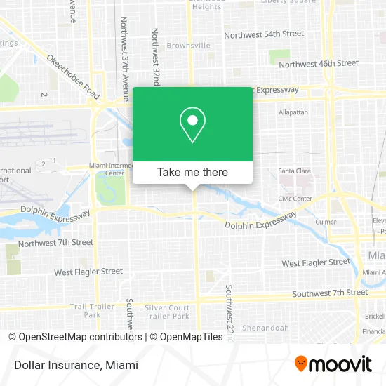
See Dollar Insurance, Miami, on the map
Public Transit to Dollar Insurance in Miami
Wondering how to get to Dollar Insurance in Miami? Moovit helps you find the best way to get to Dollar Insurance with step-by-step directions from the nearest public transit station.
Moovit provides free maps and live directions to help you navigate through your city. View schedules, routes, timetables, and find out how long does it take to get to Dollar Insurance in real time.
Looking for the nearest stop or station to Dollar Insurance? Check out this list of stops closest to your destination: Nw 27 Av & Nw 17 St; Nw 20 St & Nw 27 Av; Nw 27 Av & Nw 20 St; Hialeah Market Station; Civic Center Station.
Bus: 20, 27, 32, MIAALP.Train: ORANGE, TRIRAIL, GREEN.
Want to see if there’s another route that gets you there at an earlier time? Moovit helps you find alternative routes or times. Get directions from and directions to Dollar Insurance easily from the Moovit App or Website.
We make riding to Dollar Insurance easy, which is why over 1.5 million users, including users in Miami, trust Moovit as the best app for public transit. You don’t need to download an individual bus app or train app, Moovit is your all-in-one transit app that helps you find the best bus time or train time available.
For information on prices of bus and train, costs and ride fares to Dollar Insurance, please check the Moovit app.
Use the app to navigate to popular places including to the airport, hospital, stadium, grocery store, mall, coffee shop, school, college, and university.
Dollar Insurance Address: 1614 NW 27th Ave Miami, FL 33125 street in Miami
- Western Union,
- nw 27 ave exit @ 836,
- Selecto Market Cafeteria Pan Caliente Lottery,
- 27th Ave Locksmith Company,
- Dolex Dollar Express, Inc.,
- Lachicott Beautiful Salon,
- Jensen's Liquors No. 2,
- Medium Chief,
- Jel Painting,
- Vee's Beauty Room,
- NW 27th Ave / NW 16th Street Rd,
- NW 27th Ave / NW 17th St,
- Department of Children and Families,
- Nannybag Luggage Storage,
- Mi Ranchito Bar - Karaoke - Food,
- Kbeauty Nail & Spa,
- Vicky's Beauty Salon,
- Barbershop,
- Mi Ranchito Comida Centroamericana,
- Portobello Square Shopping Center
Places Near Dollar Insurance (Miami)
- Marlins Park, Miami,
- Dolphin Mall Bus, Miami,
- Aventura Mall, Miami Beach,
- Zoo Miami, Miami,
- Miami VA Hospital, Miami,
- Wynwood, Miami,
- Miami-Dade County Courthouse, Miami,
- Hard Rock Stadium, Miami Gardens,
- Bayside Marketplace, Miami,
- Sawgrass Mall, Miami,
- Richard E. Gerstein Justice Building, Miami,
- Little Havana, Miami,
- Aventura Mall, Miami,
- Brickell City Centre, Miami,
- Port of Miami Cruise Terminal, Miami,
- Miami Design District, Miami,
- Miami Freedom Park, Miami,
- Sawgrass mall ( FL ), Miami Beach,
- Keiser University Flagship Campus, West Palm Beach,
- Dolphin Mall, Miami
How to get to popular places in Miami with public transit
Get around Miami by public transit!
Traveling around Miami has never been so easy. See step by step directions as you travel to any attraction, street or major public transit station. View bus and train schedules, arrival times, service alerts and detailed routes on a map, so you know exactly how to get to anywhere in Miami.
When traveling to any destination around Miami use Moovit's Live Directions with Get Off Notifications to know exactly where and how far to walk, how long to wait for your line, and how many stops are left. Moovit will alert you when it's time to get off — no need to constantly re-check whether yours is the next stop.
Wondering how to use public transit in Miami or how to pay for public transit in Miami? Moovit public transit app can help you navigate your way with public transit easily, and at minimum cost. It includes public transit fees, ticket prices, and costs. Looking for a map of Miami public transit lines? Moovit public transit app shows all public transit maps in Miami with all Bus, Train, Light Rail and Ferry routes and stops on an interactive map.
Miami has 4 transit type(s), including: Bus, Train, Light Rail and Ferry, operated by several transit agencies, including Broward County Transit, Miami-Dade Transit, Metrorail, Palm Tran, Tri-Rail, Brightline, MARTY, City of Homestead Trolley, Key West Transit, Treasure Coast Connector, GoLine IRT, Amtrak, Greyhound-us, FlixBus-us and Aventura Express Shuttle Bus