How to get to Dose Pilates Reformer by bus?
Click on the bus route to see step by step directions with maps, line arrival times and updated time schedules.
From Pintores Mexicanos Colonia, Aguascalientes
52 minFrom Fraccionamiento La Rioja, Aguascalientes
71 minFrom Fracc. Fidel Velázquez, Aguascalientes
59 minFrom Boulevard Licenciado Adolfo Ruiz Cortines 921, Aguascalientes
50 minFrom Jalpa, Aguascalientes
52 minFrom DIF Municipal, Aguascalientes
50 minFrom Lohu Construcciones, Aguascalientes
72 minFrom Aguascalientes Boca de Túnel, Aguascalientes
39 minFrom Lanceta HG, Aguascalientes
48 minFrom Los Caños, Aguascalientes
36 min
Bus stops near Dose Pilates Reformer in Aguascalientes
Bus lines to Dose Pilates Reformer in Aguascalientes
What are the closest stations to Dose Pilates Reformer?
The closest stations to Dose Pilates Reformer are:
- Aguascalientes 110 is 325 meters away, 5 min walk.
- Vulcanizadora Lomas Del Sur is 367 meters away, 5 min walk.
Which bus line stops near Dose Pilates Reformer?
RUTA 37 (Hacienda San Marcos)
What’s the nearest bus station to Dose Pilates Reformer in Aguascalientes?
The nearest bus stations to Dose Pilates Reformer in Aguascalientes are Aguascalientes 110 and Vulcanizadora Lomas Del Sur. The closest one is a 5 min walk away.
What time is the first bus to Dose Pilates Reformer in Aguascalientes?
The RUTA 37 is the first bus that goes to Dose Pilates Reformer in Aguascalientes. It stops nearby at 5:53 AM.
What time is the last bus to Dose Pilates Reformer in Aguascalientes?
The RUTA 47 is the last bus that goes to Dose Pilates Reformer in Aguascalientes. It stops nearby at 10:22 PM.
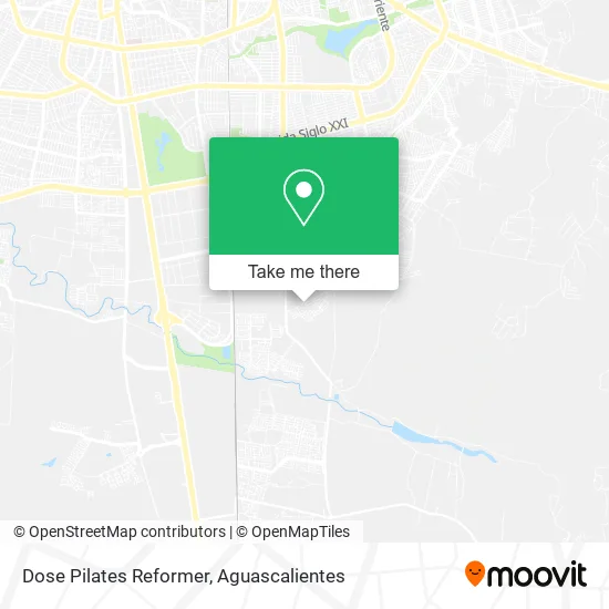
See Dose Pilates Reformer, Aguascalientes, on the map
Public Transit to Dose Pilates Reformer in Aguascalientes
Wondering how to get to Dose Pilates Reformer in Aguascalientes? Moovit helps you find the best way to get to Dose Pilates Reformer with step-by-step directions from the nearest public transit station.
Moovit provides free maps and live directions to help you navigate through your city. View schedules, routes, timetables, and find out how long does it take to get to Dose Pilates Reformer in real time.
Looking for the nearest stop or station to Dose Pilates Reformer? Check out this list of stops closest to your destination: Aguascalientes 110; Vulcanizadora Lomas Del Sur.
Bus: RUTA 37, RUTA 47.
Want to see if there’s another route that gets you there at an earlier time? Moovit helps you find alternative routes or times. Get directions from and directions to Dose Pilates Reformer easily from the Moovit App or Website.
We make riding to Dose Pilates Reformer easy, which is why over 1.5 million users, including users in Aguascalientes, trust Moovit as the best app for public transit. You don’t need to download an individual bus app or train app, Moovit is your all-in-one transit app that helps you find the best bus time or train time available.
For information on prices of bus, costs and ride fares to Dose Pilates Reformer, please check the Moovit app.
Use the app to navigate to popular places including to the airport, hospital, stadium, grocery store, mall, coffee shop, school, college, and university.
Dose Pilates Reformer Address: Calle Lomas del Centro 102, Fraccionamiento Lomas del Sur, 20298 Aguascalientes, Aguascalientes street in Aguascalientes
- Central de Abastos,
- Casa Om Sai,
- Pension Municipal,
- Fracc. Lomas del Sur,
- Fraccionamiento Lomas del Sur,
- Abts Los Pitufos,
- Lomas del Sur,
- WESTERN UNION,
- Laureles del Sur,
- Fracc. Laureles del Sur,
- Noche Buena,
- Via Gavia Plaza Comercial,
- Jass & Jess Nails,
- Parque de Villa Sur,
- Rosticería 5 Mas 5,
- Casa Club Villa Fontana,
- Fracc. San Sebastián,
- Residencial Villa Sur,
- Fraccionamiento San Sebastián,
- Plaza Villa Sur
Places Near Dose Pilates Reformer (Aguascalientes)
- Blvd. Luis Donaldo Colosio, Aguascalientes,
- Central De Autobuses, Aguascalientes,
- Imss Clinica 1, Aguascalientes,
- Villas de Nuestra Señora de la Asunción, Aguascalientes,
- Agropecuario, Aguascalientes,
- Nuevo Hospital Hidalgo, Aguascalientes,
- Jesús María, Aguascalientes,
- Aeropuerto de Aguascalientes S.A. de C.V., Aguascalientes,
- Isla San Marcos, Aguascalientes,
- Parque Las Tres Centurias, Aguascalientes,
- Centro, Aguascalientes,
- La Isla San Marcos, Aguascalientes,
- Universidad Autónoma de Aguascalientes, Aguascalientes,
- Terminal De Combis, Aguascalientes,
- Villasuncion, Aguascalientes,
- Centro Comercial Altaria, Aguascalientes,
- clinica 3 uaa, Aguascalientes,
- Hospital Imss No. 3, Aguascalientes,
- Ciudad industrial, Aguascalientes,
- ESPACIOS, Aguascalientes
How to get to popular places in Aguascalientes with public transit
Get around Aguascalientes by public transit!
Traveling around Aguascalientes has never been so easy. See step by step directions as you travel to any attraction, street or major public transit station. View bus and train schedules, arrival times, service alerts and detailed routes on a map, so you know exactly how to get to anywhere in Aguascalientes.
When traveling to any destination around Aguascalientes use Moovit's Live Directions with Get Off Notifications to know exactly where and how far to walk, how long to wait for your line, and how many stops are left. Moovit will alert you when it's time to get off — no need to constantly re-check whether yours is the next stop.
Wondering how to use public transit in Aguascalientes or how to pay for public transit in Aguascalientes? Moovit public transit app can help you navigate your way with public transit easily, and at minimum cost. It includes public transit fees, ticket prices, and costs. Looking for a map of Aguascalientes public transit lines? Moovit public transit app shows all public transit maps in Aguascalientes with all bus routes and stops on an interactive map.
Aguascalientes has 1 transit type(s), including: bus, operated by several transit agencies, including Coordinación General de Movilidad