Directions to Dougherty's English Class (Baltimore) with public transportation
The following transit lines have routes that pass near Dougherty's English Class
 Bus: CITYLINK PURPLE, 34.
- Train: MARC.
How to get to Dougherty's English Class by bus?
Click on the bus route to see step by step directions with maps, line arrival times and updated time schedules.
From I-83 Exit 5 (Maryland Ave/Charles St), Baltimore
46 minFrom Johns Hopkins Bayview Medical Center, Baltimore
62 minFrom Guinness Open Gate Brewery & Barrel House, Baltimore County
74 minFrom Harford Road, Baltimore
49 minFrom Bwi2 Employee Shuttles, Baltimore
50 minFrom Hanover, Baltimore
47 minFrom Morgan State University, Baltimore
66 minFrom Mitchell Court House, Baltimore
30 minFrom Hampden, Baltimore
57 minFrom MVA Glen Burnie, Anne Arundel County
61 min
Bus stop near Dougherty's English Class in Baltimore
- Yale Ave & Mount Saint Joseph High School Mid Sb, 7 min walk,VIEW
Train station near Dougherty's English Class in Baltimore
- West Baltimore Marc Nb, 21 min walk,VIEW
Bus lines to Dougherty's English Class in Baltimore
What are the closest stations to Dougherty's English Class?
The closest stations to Dougherty's English Class are:
- Yale Ave & Mount Saint Joseph High School Mid Sb is 467 yards away, 7 min walk.
- West Baltimore Marc Nb is 1749 yards away, 21 min walk.
Which bus line stops near Dougherty's English Class?
CITYLINK PURPLE (Paradise)
What’s the nearest train station to Dougherty's English Class in Baltimore?
The nearest train station to Dougherty's English Class in Baltimore is West Baltimore Marc Nb. It’s a 21 min walk away.
What’s the nearest bus station to Dougherty's English Class in Baltimore?
The nearest bus station to Dougherty's English Class in Baltimore is Yale Ave & Mount Saint Joseph High School Mid Sb. It’s a 7 min walk away.
What time is the first train to Dougherty's English Class in Baltimore?
The MARC is the first train that goes to Dougherty's English Class in Baltimore. It stops nearby at 4:39 AM.
What time is the last train to Dougherty's English Class in Baltimore?
The MARC is the last train that goes to Dougherty's English Class in Baltimore. It stops nearby at 10:53 PM.
What time is the first bus to Dougherty's English Class in Baltimore?
The CITYLINK PURPLE is the first bus that goes to Dougherty's English Class in Baltimore. It stops nearby at 4:13 AM.
What time is the last bus to Dougherty's English Class in Baltimore?
The CITYLINK PURPLE is the last bus that goes to Dougherty's English Class in Baltimore. It stops nearby at 2:40 AM.
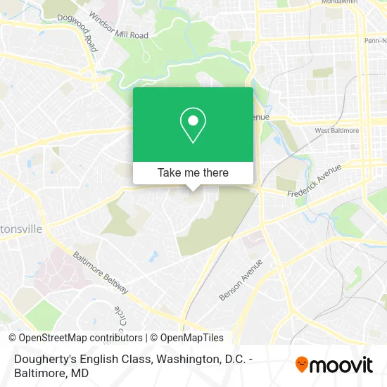
See Dougherty's English Class, Baltimore, on the map
Public Transit to Dougherty's English Class in Baltimore
Wondering how to get to Dougherty's English Class in Baltimore? Moovit helps you find the best way to get to Dougherty's English Class with step-by-step directions from the nearest public transit station.
Moovit provides free maps and live directions to help you navigate through your city. View schedules, routes, timetables, and find out how long does it take to get to Dougherty's English Class in real time.
Looking for the nearest stop or station to Dougherty's English Class? Check out this list of stops closest to your destination: Yale Ave & Mount Saint Joseph High School Mid Sb; West Baltimore Marc Nb.
Bus: CITYLINK PURPLE, 34.Train: MARC.
Want to see if there’s another route that gets you there at an earlier time? Moovit helps you find alternative routes or times. Get directions from and directions to Dougherty's English Class easily from the Moovit App or Website.
We make riding to Dougherty's English Class easy, which is why over 1.5 million users, including users in Baltimore, trust Moovit as the best app for public transit. You don’t need to download an individual bus app or train app, Moovit is your all-in-one transit app that helps you find the best bus time or train time available.
For information on prices of bus, costs and ride fares to Dougherty's English Class, please check the Moovit app.
Use the app to navigate to popular places including to the airport, hospital, stadium, grocery store, mall, coffee shop, school, college, and university.
Location: Baltimore, Washington, D.C. - Baltimore, MD
- Ryken Hall,
- Mount Saint Joseph High School,
- Frederick Ave Bike Lanes,
- Shipley David Rev & Delores,
- MSJ Smith Athletic Center,
- Valencia Fragrance Co Baltimore,
- Athol Ave and Freder,
- Athol and Frederick,
- Monette's Royal Cleaning,
- Fixmeup Electronic Repairs,
- Robbie's Happy Place,
- Devon Mobile Mechanic,
- MD-144 (SH-144),
- MD-144,
- Greens at Irvington Mews,
- Afin Natural Hair Body & Soul,
- Maryland Protection Specialist Agency,
- Neesee's Blessing Hands,
- 209 S Athol Ave ,
- Gs Marketing
Places Near Dougherty's English Class (Baltimore)
- Marriott Marquis Washington, DC, Washington,
- Museum Of The Bible, Washington,
- PG Mall, Prince George's County,
- Warner Theatre, Washington,
- Westfield Montgomery Mall, Montgomery County,
- Washington DC VA Medical Center, Washington,
- Rock Creek Tennis Center, Washington,
- National Museum of African American History and Culture, Washington,
- Washington National Cathedral, Washington,
- Georgetown, Washington,
- National Zoo, Washington,
- Basilica of the National Shrine, Washington,
- National Theatre, Washington,
- M&T Bank Stadium, Baltimore,
- The Anthem, Washington,
- Amazon Hq2, Arlington County,
- Capital One Arena, Washington,
- Pennsylvania Ave NW (3rd st and pennsylvania), Washington,
- Sibley Memorial Hospital, Washington,
- Camden Yards, Baltimore
How to get to popular places in Washington, D.C. - Baltimore, MD with public transit
Get around Baltimore by public transit!
Traveling around Baltimore has never been so easy. See step by step directions as you travel to any attraction, street or major public transit station. View bus and train schedules, arrival times, service alerts and detailed routes on a map, so you know exactly how to get to anywhere in Baltimore.
When traveling to any destination around Baltimore use Moovit's Live Directions with Get Off Notifications to know exactly where and how far to walk, how long to wait for your line, and how many stops are left. Moovit will alert you when it's time to get off — no need to constantly re-check whether yours is the next stop.
Wondering how to use public transit in Baltimore or how to pay for public transit in Baltimore? Moovit public transit app can help you navigate your way with public transit easily, and at minimum cost. It includes public transit fees, ticket prices, and costs. Looking for a map of Baltimore public transit lines? Moovit public transit app shows all public transit maps in Baltimore with all Bus, Train, Metro, Light Rail and Ferry routes and stops on an interactive map.
Washington, D.C. - Baltimore, MD has 5 transit type(s), including: Bus, Train, Metro, Light Rail and Ferry, operated by several transit agencies, including WMATA, Montgomery County Ride On, Fairfax Connector, TheBus, PRTC, DASH - Alexandria, Arlington Transit (ART), RTA of Central Maryland, MDOT MTA, MDOT MTA Light RailLink, MDOT MTA Commuter Bus, MDOT MTA Local Bus, FXBGO!, Virginia Railway Express (VRE) and MARC