How to get to Drip&Surf by bus?
Click on the bus route to see step by step directions with maps, line arrival times and updated time schedules.
From Baden-Baden, Karlsruhe/Baden-Baden Airport, Rheinmünster
70 minFrom Krankenhaus Freudenstadt, Vereinbarte Verwaltungsgemeinschaft Freudenstadt
243 minFrom Mercedes-Benz Werk Rastatt, Vereinbarte Verwaltungsgemeinschaft Rastatt
112 minFrom Hopfenschlingel, Vereinbarte Verwaltungsgemeinschaft Rastatt
78 minFrom Grinde-Hütte, Seebach
120 minFrom Parkplatz Bauhaus, Verwaltungsgemeinschaft Offenburg
124 min
How to get to Drip&Surf by train?
Click on the train route to see step by step directions with maps, line arrival times and updated time schedules.
From Krankenhaus Freudenstadt, Vereinbarte Verwaltungsgemeinschaft Freudenstadt
137 minFrom Höhenhotel Pfeifle, Baiersbronn
105 minFrom Hopfenschlingel, Vereinbarte Verwaltungsgemeinschaft Rastatt
58 minFrom Waldbronn Eistreff, Waldbronn
105 minFrom Epplesee, Rheinstetten
60 minFrom Parkplatz Bauhaus, Verwaltungsgemeinschaft Offenburg
80 min
Bus stops near Drip&Surf in Weitenung
Train stations near Drip&Surf in Weitenung
- Sinzheim (B. Bühl), 7 min walk,VIEW
Bus lines to Drip&Surf in Weitenung
What are the closest stations to Drip&Surf?
The closest stations to Drip&Surf are:
- Weitenung Friedhof is 122 meters away, 2 min walk.
- Weitenung Tankstelle Huck is 453 meters away, 7 min walk.
- Weitenung Ottenhofen is 464 meters away, 7 min walk.
- Sinzheim (B. Bühl) is 473 meters away, 7 min walk.
Which train line stops near Drip&Surf?
S7 (Achern)
Which bus lines stop near Drip&Surf?
These bus lines stop near Drip&Surf: 211, 216, 272, X44.
What’s the nearest train station to Drip&Surf in Weitenung?
The nearest train station to Drip&Surf in Weitenung is Sinzheim (B. Bühl). It’s a 7 min walk away.
What’s the nearest bus station to Drip&Surf in Weitenung?
The nearest bus station to Drip&Surf in Weitenung is Weitenung Friedhof. It’s a 2 min walk away.
What time is the first train to Drip&Surf in Weitenung?
The S7 is the first train that goes to Drip&Surf in Weitenung. It stops nearby at 5:09 AM.
What time is the last train to Drip&Surf in Weitenung?
The RB44 is the last train that goes to Drip&Surf in Weitenung. It stops nearby at 1:29 AM.
What time is the first bus to Drip&Surf in Weitenung?
The 211 is the first bus that goes to Drip&Surf in Weitenung. It stops nearby at 5:12 AM.
What time is the last bus to Drip&Surf in Weitenung?
The 272 is the last bus that goes to Drip&Surf in Weitenung. It stops nearby at 12:30 AM.
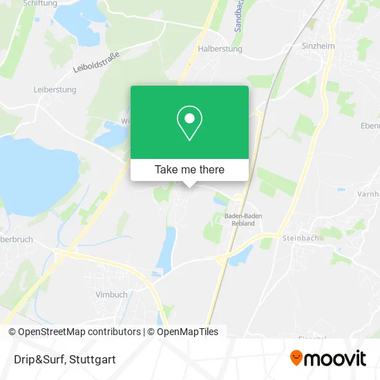
See Drip&Surf, Weitenung, on the map
Public Transit to Drip&Surf in Weitenung
Wondering how to get to Drip&Surf in Weitenung? Moovit helps you find the best way to get to Drip&Surf with step-by-step directions from the nearest public transit station.
Moovit provides free maps and live directions to help you navigate through your city. View schedules, routes, timetables, and find out how long does it take to get to Drip&Surf in real time.
Looking for the nearest stop or station to Drip&Surf? Check out this list of stops closest to your destination: Weitenung Friedhof; Weitenung Tankstelle Huck; Weitenung Ottenhofen; Sinzheim (B. Bühl).
Train: S7, S71, RB44, S71.Bus: 211, 216, 272, X44, 262, 262, 267.
Want to see if there’s another route that gets you there at an earlier time? Moovit helps you find alternative routes or times. Get directions from and directions to Drip&Surf easily from the Moovit App or Website.
We make riding to Drip&Surf easy, which is why over 1.5 million users, including users in Weitenung, trust Moovit as the best app for public transit. You don’t need to download an individual bus app or train app, Moovit is your all-in-one transit app that helps you find the best bus time or train time available.
For information on prices of bus, train and light rail, costs and ride fares to Drip&Surf, please check the Moovit app.
Use the app to navigate to popular places including to the airport, hospital, stadium, grocery store, mall, coffee shop, school, college, and university.
Drip&Surf Address: Elzhofener Straße 18 Ottenhofen, 77815 Bühl street in Weitenung
- Gymnastikgruppe II Weitenung,
- Hahn G. Steuerberater,
- Köninger Reisen,
- Maler Nikolai Jung,
- Gipser Jung,
- Tischtennisabteilung Weitenung,
- Bambuk,
- Melanie Licht Olaf Nieke Gdbr Crossmarketing,
- Blanda's,
- Fliesenleger Weiß,
- Elzhofen,
- Edgar Gutknecht Malergeschäft,
- Monika und Rudolf Huh,
- Asv Weitenung,
- Abi Noblis,
- Lothar Kohr,
- Friedhof Weitenung,
- Alsec,
- Böhmer Alexander,
- Gert Sonnenberg
Places Near Drip&Surf (Weitenung)
- Gleis 101/102 (tief), Stuttgart-Mitte,
- Im Wizemann (Halle), Bad Cannstatt,
- Pariser Platz Stuttgart, Stuttgart-Mitte,
- Mercedes-Benz Museum, Bad Cannstatt,
- Mercedes-Benz Museum (Mercedes Museum Stuttgart), Bad Cannstatt,
- Porsche Museum, Zuffenhausen,
- Hanns-Martin-Schleyer-Halle (Stuttgart Hans-Martin-Schleyerhalle), Bad Cannstatt,
- Marmorsaal Im Weissenburgpark, Stuttgart-Süd,
- Waldfriedhof, Degerloch,
- Mettingen Eros-Center Puff Laufhaus, Esslingen Am Neckar,
- Hanns-Martin-Schleyer-Halle, Bad Cannstatt,
- Gasometer Pforzheim, Pforzheim,
- FlixBus Haltestelle, Stuttgart,
- SI-Centrum, Möhringen,
- Klinikum Stuttgart - Katharinenhospital, Stuttgart-Mitte,
- Wilhelma (U-Bahn Wilhelma), Bad Cannstatt,
- Porsche-Arena, Bad Cannstatt,
- Hauptbahnhof Stuttgart, Stuttgart-Mitte,
- Schleyerhalle, Bad Cannstatt,
- Geilhaus Haus 33a, Reutlingen-Betzingen
How to get to popular places in Stuttgart with public transit
Get around Weitenung by public transit!
Traveling around Weitenung has never been so easy. See step by step directions as you travel to any attraction, street or major public transit station. View bus and train schedules, arrival times, service alerts and detailed routes on a map, so you know exactly how to get to anywhere in Weitenung.
When traveling to any destination around Weitenung use Moovit's Live Directions with Get Off Notifications to know exactly where and how far to walk, how long to wait for your line, and how many stops are left. Moovit will alert you when it's time to get off — no need to constantly re-check whether yours is the next stop.
Wondering how to use public transit in Weitenung or how to pay for public transit in Weitenung? Moovit public transit app can help you navigate your way with public transit easily, and at minimum cost. It includes public transit fees, ticket prices, and costs. Looking for a map of Weitenung public transit lines? Moovit public transit app shows all public transit maps in Weitenung with all Bus, Train, Subway, Light Rail, Ferry, S-Bahn and Funicular routes and stops on an interactive map.
Stuttgart has 7 transit type(s), including: Bus, Train, Subway, Light Rail, Ferry, S-Bahn and Funicular, operated by several transit agencies, including SSB - Stadtbahn, SSB, SSB - Seilbahn / Zacke, S-Bahn Stuttgart, Rhein-Neckar-Verkehr GmbH (rnv), Karlsruher Verkehrsverbund, DB AG, DB Regiobus BW, Arverio Baden-Württemberg GmbH, DB RegioNetz Verkehrs GmbH Westfrankenbahn, DB Regio AG Baden-Württemberg, Südwestdeutsche Verkehrs-AG, DB Regio AG Mitte Region Hessen, DB and Bodensee-Oberschwaben-Bahn