Directions to Ds6 Multimarcas (Atuba) with public transportation
The following transit lines have routes that pass near Ds6 Multimarcas
How to get to Ds6 Multimarcas by bus?
Click on the bus route to see step by step directions with maps, line arrival times and updated time schedules.
From Praça Afonso Botelho, Água Verde
39 minFrom Rua Bolsão dos Papagaios, Pinhais
43 minFrom Alameda Augusto Stellfeld, Centro
37 minFrom Avenida Vicente Machado, Batel
45 minFrom Rua Nunes Machado, Rebouças
40 minFrom Praça Afonso Botelho - Praça do Atlético, Água Verde
39 minFrom Bosque Zaninelli, Pilarzinho
54 minFrom Almirante Tamandaré, Almirante Tamandaré
57 minFrom Vila Oficinas, Cajuru
39 minFrom Rua Jacarezinho, Mercês
42 min
Bus stops near Ds6 Multimarcas in Atuba
Bus lines to Ds6 Multimarcas in Atuba
- B03 GUARAITUBA / ALTO DA XV (VIA MARACANÃ), Av. Affonso Pena → Terminal Guaraituba,VIEW
- B06 GUARAITUBA / RUI BARBOSA (VIA MARACANÃ / SEMIDIRETO), Praça Rui Barbosa → Terminal Guaraituba,VIEW
- B20 GUARAITUBA / CABRAL (VIA MARACANÃ), Terminal Guaraituba → Terminal Cabral,VIEW
- B69 MAD. CURITIBA / SÃO DIMAS, Terminal Guadalupe → São Dimas,VIEW
- Y99 TUNAS DO PARANÁ / GUADALUPE, Terminal Guadalupe → Tunas do Paraná,VIEW
- 222 VILA ESPERANÇA, Vila Esperança → Terminal Boa Vista,VIEW
- 229 MAD. PENHA / FERNANDO DE NORONHA, Terminal Boa Vista ↺ Penha (Circular),VIEW
- N01 HOSPITAL CARON / ESTAÇÃO ATUBA (VIA JARDIM PAULISTA - QUATRO BARRAS), Estação Atuba → T. Paulista / T. Quatro Barras,VIEW
- S02 ROÇA GRANDE / ESTAÇÃO ATUBA, Terminal Roça Grande → Estação Atuba,VIEW
- B05 GUARAITUBA / CABRAL, Terminal Cabral → Terminal Guaraituba,VIEW
- B07 GUARAITUBA / CABRAL (VIA MARACANÃ), Terminal Guaraituba → Terminal Cabral,VIEW
- O31 QUATRO BARRAS / ESTAÇÃO ATUBA (VIA GRACIOSA), Estação Atuba → Terminal Quatro Barras,VIEW
- B42 MARACANÃ / ESTAÇÃO ATUBA, Terminal Maracanã → Estação Atuba,VIEW
- O62 QUATRO BARRAS / GUADALUPE (VIA ESTAÇÃO ATUBA), Terminal Guadalupe → Terminal Quatro Barras,VIEW
- C66 VILA ZUMBI / ESTAÇÃO ATUBA, Estação Atuba → Vila Zumbi,VIEW
- C72 VILA PALMITAL / GUADALUPE (VIA ESTAÇÃO ATUBA), Vila Palmital (31 de Março) → Terminal Guadalupe,VIEW
- B89 GUARAITUBA / RUI BARBOSA (VIA MARACANÃ / CABRAL), Terminal Guaraituba → Praça Rui Barbosa,VIEW
- C98 VILA PALMITAL / ESTAÇÃO ATUBA, Vila Palmital→ Estação Atuba,VIEW
- 237 PARQUE ATUBA, Terminal Santa Cândida ↺ Parque Atuba (Circular),VIEW
- 345 BAIRRO ALTO / ATUBA, Terminal Bairro Alto → Estação Atuba,VIEW
What are the closest stations to Ds6 Multimarcas?
The closest stations to Ds6 Multimarcas are:
- Marginal Norte da Estrada da Ribeira, 522 is 28 meters away, 1 min walk.
- Atuba is 138 meters away, 2 min walk.
- R. Roaldo Brun, 540 is 449 meters away, 6 min walk.
- Marginal Br 116 Sul - Sam's Club is 670 meters away, 9 min walk.
Which bus lines stop near Ds6 Multimarcas?
These bus lines stop near Ds6 Multimarcas: 345 BAIRRO ALTO / ATUBA, 350 ATUBA / PINHEIRINHO, B05 GUARAITUBA / CABRAL, B06 GUARAITUBA / RUI BARBOSA (VIA MARACANÃ / SEMIDIRETO), B20 GUARAITUBA / CABRAL (VIA MARACANÃ).
What’s the nearest bus station to Ds6 Multimarcas in Atuba?
The nearest bus station to Ds6 Multimarcas in Atuba is Marginal Norte da Estrada da Ribeira, 522. It’s a 1 min walk away.
What time is the first bus to Ds6 Multimarcas in Atuba?
The 229 MAD. PENHA / FERNANDO DE NORONHA is the first bus that goes to Ds6 Multimarcas in Atuba. It stops nearby at 3:46 AM.
What time is the last bus to Ds6 Multimarcas in Atuba?
The 229 MAD. PENHA / FERNANDO DE NORONHA is the last bus that goes to Ds6 Multimarcas in Atuba. It stops nearby at 2:59 AM.
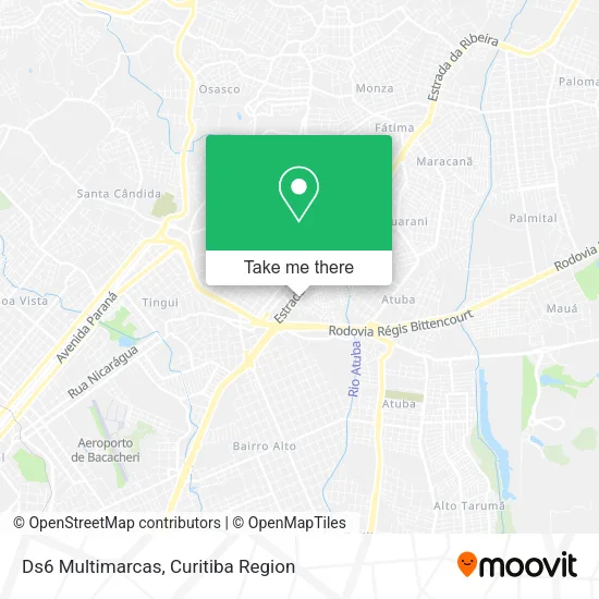
See Ds6 Multimarcas, Atuba, on the map
Public Transit to Ds6 Multimarcas in Atuba
Wondering how to get to Ds6 Multimarcas in Atuba? Moovit helps you find the best way to get to Ds6 Multimarcas with step-by-step directions from the nearest public transit station.
Moovit provides free maps and live directions to help you navigate through your city. View schedules, routes, timetables, and find out how long does it take to get to Ds6 Multimarcas in real time.
Looking for the nearest stop or station to Ds6 Multimarcas? Check out this list of stops closest to your destination: Marginal Norte da Estrada da Ribeira; Atuba; R. Roaldo Brun; Marginal Br 116 Sul - Sam's Club.
Bus: 345 BAIRRO ALTO / ATUBA, 350 ATUBA / PINHEIRINHO, B05 GUARAITUBA / CABRAL, B06 GUARAITUBA / RUI BARBOSA (VIA MARACANÃ / SEMIDIRETO), B20 GUARAITUBA / CABRAL (VIA MARACANÃ), B03 GUARAITUBA / ALTO DA XV (VIA MARACANÃ), B69 MAD. CURITIBA / SÃO DIMAS, Y99 TUNAS DO PARANÁ / GUADALUPE, N01 HOSPITAL CARON / ESTAÇÃO ATUBA (VIA JARDIM PAULISTA - QUATRO BARRAS), S02 ROÇA GRANDE / ESTAÇÃO ATUBA, B07 GUARAITUBA / CABRAL (VIA MARACANÃ), O31 QUATRO BARRAS / ESTAÇÃO ATUBA (VIA GRACIOSA), 238 ATUBA / SANTA CÂNDIDA, B43 RIO VERDE, N61 CAMPINA GRANDE DO SUL / GUADALUPE, N62 JARDIM PAULISTA / GUADALUPE, O69 MAD. QUATRO BARRAS / SANTA CÂNDIDA, N72 EUGÊNIA MARIA / GUADALUPE, O74 QUATRO BARRAS / GUADALUPE.
Want to see if there’s another route that gets you there at an earlier time? Moovit helps you find alternative routes or times. Get directions from and directions to Ds6 Multimarcas easily from the Moovit App or Website.
We make riding to Ds6 Multimarcas easy, which is why over 1.5 million users, including users in Atuba, trust Moovit as the best app for public transit. You don’t need to download an individual bus app or train app, Moovit is your all-in-one transit app that helps you find the best bus time or train time available.
For information on prices of bus, costs and ride fares to Ds6 Multimarcas, please check the Moovit app.
Use the app to navigate to popular places including to the airport, hospital, stadium, grocery store, mall, coffee shop, school, college, and university.
Ds6 Multimarcas Address: Estrada da Ribeira, 550 Atuba Curitiba-PR 82860-000 street in Atuba
- Meu Estilo Magazine,
- Dilemma Motos Pecas Acessórios e Eletro Eletronica,
- Rota Livre Locadora,
- Embreagile,
- Salão e Estética Encorpore,
- BR-476 - Atuba - Curitiba - PR,
- Blocok Paraná,
- Frischmann Aisengart,
- Rua Pintor Ricardo Krieger 165,
- H & L Embreagens Comercio a Varejo de Pecas e Acessórios,
- Keren Hapuque Marcondes Sociedade Individual de Advocacia,
- Samar Glass Ltda,
- Social Pool,
- Allied Tecnologia,
- Hiper Condor Colombo,
- Restaurante e Lanchonete Rota 476,
- B Café & Especialidades,
- Cunha Equipamentos Galvânicos,
- Auto Escola Mendes,
- Bel Mari Panificadora
Places Near Ds6 Multimarcas (Atuba)
- Hospital Nossa Senhora Das Graças, Mercês,
- Campo Largo, Campo,
- Parque Barigui, Mercês,
- Jockey Plaza Shopping Center, Tarumã,
- Jardim Botânico de Curitiba PR, Centro,
- Hospital Erasto Gaertner, Jardim Das Américas,
- Rua Martim Afonso 558, Mercês,
- Hospital de Clínicas (HC - UFPR), Centro,
- Hospital Universitário Evangélico de Curitiba, Bigorrilho,
- Arena Da Baixada - Curitiba,
- Hospital Da Cruz Vermelha, Batel,
- Park Shopping Barigüi, Mossunguê,
- Hospital Angelina Caron, Campina Grande Do Sul,
- Pontifícia Universidade Católica do Paraná (PUCPR), Prado Velho,
- Hospital Madalena Sofia, Bairro Alto,
- Shopping Estação, Rebouças,
- Rua General Mário Tourinho, Campina Do Siqueira,
- Hhhhh, Fazendinha,
- Hospital do Rocio, Campo,
- Shopping Palladium, Portão
How to get to popular places in Curitiba Region with public transit
Get around Atuba by public transit!
Traveling around Atuba has never been so easy. See step by step directions as you travel to any attraction, street or major public transit station. View bus and train schedules, arrival times, service alerts and detailed routes on a map, so you know exactly how to get to anywhere in Atuba.
When traveling to any destination around Atuba use Moovit's Live Directions with Get Off Notifications to know exactly where and how far to walk, how long to wait for your line, and how many stops are left. Moovit will alert you when it's time to get off — no need to constantly re-check whether yours is the next stop.
Wondering how to use public transit in Atuba or how to pay for public transit in Atuba? Moovit public transit app can help you navigate your way with public transit easily, and at minimum cost. It includes public transit fees, ticket prices, and costs. Looking for a map of Atuba public transit lines? Moovit public transit app shows all public transit maps in Atuba with all Bus and Cable Car routes and stops on an interactive map.
Curitiba Region has 2 transit type(s), including: Bus and Cable Car, operated by several transit agencies, including Sistema Integrado de Mobilidade (URBS), Sistema Integrado de Mobilidade (AMEP), URBS (Cartões bancários e Dinheiro), URBS (Cartões bancários / Cartão URBS), AMEP (Cartões bancários / Cartão MetroCard), AMEP (Cartões bancários / Cartão MetroCard / Dinheiro), Viação Colombo (Dinheiro), TRIAR (Cartão TRIAR / Dinheiro), Empresa Curitiba Cerro Azul (Dinheiro), Expresso Nossa Senhora da Penha (Dinheiro), Empresa Campo Alto Tijucas (Dinheiro), Auto Viação São José (Cartão VEM / Dinheiro), BRT S/A (Cartão VEM / Dinheiro), TransPiedade (Cartão Cidadão / Dinheiro) and Oceânica Sul (Cartão Transporte / Dinheiro)
Public transit lines with stations closest to Ds6 Multimarcas in Atuba
Bus lines with stations closest to Ds6 Multimarcas in Atuba
Marginal Norte da Estrada da Ribeira, 522
 B03 GUARAITUBA / ALTO DA XV (VIA MARACANÃ)GUARAITUBA / ALTO DA XV (via MARACANÃ)
- B06 GUARAITUBA / RUI BARBOSA (VIA MARACANÃ / SEMIDIRETO)GUARAITUBA / RUI BARBOSA (via MARACANÃ / SEMIDIRETO)
- B20 GUARAITUBA / CABRAL (VIA MARACANÃ)GUARAITUBA / CABRAL (via MARACANÃ)
- B69 MAD. CURITIBA / SÃO DIMASMAD. CURITIBA / SÃO DIMAS
- Y99 TUNAS DO PARANÁ / GUADALUPETUNAS DO PARANÁ / GUADALUPE
Atuba
- N01 HOSPITAL CARON / ESTAÇÃO ATUBA (VIA JARDIM PAULISTA - QUATRO BARRAS)HOSPITAL CARON / ESTAÇÃO ATUBA (via JARDIM PAULISTA - QUATRO BARRAS)
- S02 ROÇA GRANDE / ESTAÇÃO ATUBAROÇA GRANDE / ESTAÇÃO ATUBA
- B05 GUARAITUBA / CABRALGUARAITUBA / CABRAL
- B07 GUARAITUBA / CABRAL (VIA MARACANÃ)GUARAITUBA / CABRAL (via MARACANÃ)
- O31 QUATRO BARRAS / ESTAÇÃO ATUBA (VIA GRACIOSA)QUATRO BARRAS / ESTAÇÃO ATUBA (via GRACIOSA)
Marginal Br 116 Sul - Sam's Club
- N61 CAMPINA GRANDE DO SUL / GUADALUPECAMPINA GRANDE DO SUL / GUADALUPE
- N62 JARDIM PAULISTA / GUADALUPEJARDIM PAULISTA / GUADALUPE
- O69 MAD. QUATRO BARRAS / SANTA CÂNDIDAMAD. QUATRO BARRAS / SANTA CÂNDIDA
- N72 EUGÊNIA MARIA / GUADALUPEEUGÊNIA MARIA / GUADALUPE
- O74 QUATRO BARRAS / GUADALUPEQUATRO BARRAS / GUADALUPE