How to get to Dunedin Supportive Living Program by bus?
Click on the bus route to see step by step directions with maps, line arrival times and updated time schedules.
From Cub Foods, St. Paul
37 minFrom Raymond Ave Station, St. Paul
59 minFrom University of Minnesota Veterinary Medical Center, Falcon Heights
66 minFrom 3M Center - Building 224, Maplewood
43 minFrom Avalon School (Avalon Charter School), St. Paul
62 minFrom Lake Phalen Beach, St. Paul
43 minFrom Minnesota State Fairgrounds, Falcon Heights
51 minFrom Target St Paul Midway, St. Paul
51 minFrom Minneapolis Veterans Home, Minneapolis
71 min
Bus stops near Dunedin Supportive Living Program in St. Paul
Light Rail stations near Dunedin Supportive Living Program in St. Paul
- Union Depot Station, 33 min walk,VIEW
Train station near Dunedin Supportive Living Program in St. Paul
- St. Paul-Minneapolis, 35 min walk,VIEW
Bus lines to Dunedin Supportive Living Program in St. Paul
What are the closest stations to Dunedin Supportive Living Program?
The closest stations to Dunedin Supportive Living Program are:
- Robert St S & Colorado St is 292 yards away, 4 min walk.
- Wabasha St & Congress St is 401 yards away, 5 min walk.
- Union Depot Station is 2803 yards away, 33 min walk.
- St. Paul-Minneapolis is 2912 yards away, 35 min walk.
Which bus lines stop near Dunedin Supportive Living Program?
These bus lines stop near Dunedin Supportive Living Program: 68, 71.
What’s the nearest bus station to Dunedin Supportive Living Program in St. Paul?
The nearest bus station to Dunedin Supportive Living Program in St. Paul is Robert St S & Colorado St. It’s a 4 min walk away.
What time is the first light rail to Dunedin Supportive Living Program in St. Paul?
The METRO GREEN LINE is the first light rail that goes to Dunedin Supportive Living Program in St. Paul. It stops nearby at 4:26 AM.
What time is the last light rail to Dunedin Supportive Living Program in St. Paul?
The METRO GREEN LINE is the last light rail that goes to Dunedin Supportive Living Program in St. Paul. It stops nearby at 12:10 AM.
What time is the first train to Dunedin Supportive Living Program in St. Paul?
The BOREALIS is the first train that goes to Dunedin Supportive Living Program in St. Paul. It stops nearby at 11:39 AM.
What time is the last train to Dunedin Supportive Living Program in St. Paul?
The EMPIRE BUILDER is the last train that goes to Dunedin Supportive Living Program in St. Paul. It stops nearby at 8:50 AM.
What time is the first bus to Dunedin Supportive Living Program in St. Paul?
The 68 is the first bus that goes to Dunedin Supportive Living Program in St. Paul. It stops nearby at 4:49 AM.
What time is the last bus to Dunedin Supportive Living Program in St. Paul?
The 68 is the last bus that goes to Dunedin Supportive Living Program in St. Paul. It stops nearby at 1:20 AM.
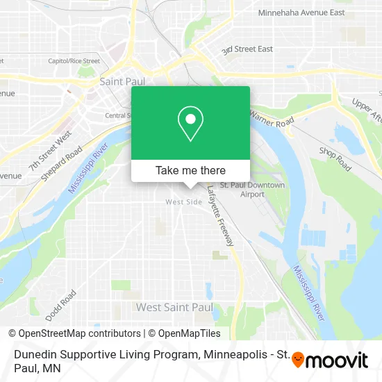
See Dunedin Supportive Living Program, St. Paul, on the map
Public Transit to Dunedin Supportive Living Program in St. Paul
Wondering how to get to Dunedin Supportive Living Program in St. Paul? Moovit helps you find the best way to get to Dunedin Supportive Living Program with step-by-step directions from the nearest public transit station.
Moovit provides free maps and live directions to help you navigate through your city. View schedules, routes, timetables, and find out how long does it take to get to Dunedin Supportive Living Program in real time.
Looking for the nearest stop or station to Dunedin Supportive Living Program? Check out this list of stops closest to your destination: Robert St S & Colorado St; Wabasha St & Congress St; Union Depot Station; St. Paul-Minneapolis.
Bus: 68, 71, 62, 75.Train: BOREALIS, EMPIRE BUILDER.
Want to see if there’s another route that gets you there at an earlier time? Moovit helps you find alternative routes or times. Get directions from and directions to Dunedin Supportive Living Program easily from the Moovit App or Website.
We make riding to Dunedin Supportive Living Program easy, which is why over 1.7 million users, including users in St. Paul, trust Moovit as the best app for public transit. You don’t need to download an individual bus app or train app, Moovit is your all-in-one transit app that helps you find the best bus time or train time available.
For information on prices of bus and light rail, costs and ride fares to Dunedin Supportive Living Program, please check the Moovit app.
Use the app to navigate to popular places including to the airport, hospital, stadium, grocery store, mall, coffee shop, school, college, and university.
Dunedin Supportive Living Program Address: 469 Ada St St Paul, MN 55107 street in St. Paul
- Dunedin Terrace Apartments,
- Neighborhood House,
- Paul And Sheila Wellstone Center For Community Building,
- Helon House,
- Riverview Spanish / English Dual Immersion,
- Reyna Exteriors,
- State Government District 06a,
- Dr. Deanna M Gengler,
- Specials & Events,
- Lozano Marcos Kirchert & Associates,
- El Burrito Mercado,
- Le Fresuchii Neveria,
- La Monarca Supermercad,
- Saint Paul Standalone Locks,
- Auto Locksmith Service,
- Taqueria El Charrito,
- St. Elizabeth Orthodox Church,
- Aurora Management,
- MNL Painting Services,
- Luis Handyman Service
Places Near Dunedin Supportive Living Program (St. Paul)
- St. Paul College, St. Paul,
- Treasure Island Resort & Casino, St. Paul,
- Minnehaha Falls, Minneapolis,
- Minnesota State Capitol, St. Paul,
- Mpls. Convention Center, Minneapolis,
- Minneapolis Institute of Art, Minneapolis,
- Harriet Island Regional Park, St. Paul,
- Target Center, Minneapolis,
- Surly Brewing Co., Minneapolis,
- Target Field, Minneapolis,
- Northrop Auditorium, Minneapolis,
- Orpheum Theatre (Minneapolis, Minnesota), Minneapolis,
- Grand Casino Hinckley,MN, Minneapolis,
- Xcel Energy Center, St. Paul,
- Bishop Henry Whipple Federal Building,
- Minneapolis Sculpture Garden, Minneapolis,
- 3m Arena at Mariucci, Minneapolis,
- Mystic lake casino bus, Minneapolis,
- Huntington Bank Stadium, Minneapolis,
- Abbott Northwestern Piper Building, Minneapolis
How to get to popular places in Minneapolis - St. Paul, MN with public transit
Get around St. Paul by public transit!
Traveling around St. Paul has never been so easy. See step by step directions as you travel to any attraction, street or major public transit station. View bus and train schedules, arrival times, service alerts and detailed routes on a map, so you know exactly how to get to anywhere in St. Paul.
When traveling to any destination around St. Paul use Moovit's Live Directions with Get Off Notifications to know exactly where and how far to walk, how long to wait for your line, and how many stops are left. Moovit will alert you when it's time to get off — no need to constantly re-check whether yours is the next stop.
Wondering how to use public transit in St. Paul or how to pay for public transit in St. Paul? Moovit public transit app can help you navigate your way with public transit easily, and at minimum cost. It includes public transit fees, ticket prices, and costs. Looking for a map of St. Paul public transit lines? Moovit public transit app shows all public transit maps in St. Paul with all Bus, Train and Light Rail routes and stops on an interactive map.
Minneapolis - St. Paul, MN has 3 transit type(s), including: Bus, Train and Light Rail, operated by several transit agencies, including Metro Transit , Metro Transit, MVTA, Plymouth Metrolink, SouthWest Transit, Maple Grove, University of Minnesota, Airport (MAC), Amtrak, Mankato Transit System, SMART, FlixBus-us and Greyhound-us