Directions to Dungeons & Dragons (Wichita) with public transportation
The following transit lines have routes that pass near Dungeons & Dragons
How to get to Dungeons & Dragons by bus?
Click on the bus route to see step by step directions with maps, line arrival times and updated time schedules.
From The Kansas Association of Taxidermists, Wichita
57 minFrom Amani Traders, Wichita
38 minFrom Enders Open Magnet Elementary School, Wichita
48 minFrom Hertz, Wichita
34 minFrom Lola Candle Co., Wichita
32 minFrom Phil's Farm & Butchery, Wichita
33 minFrom Acceptance Now, Wichita
56 minFrom Gracemed DODGE Family Clinic, Wichita
65 minFrom Freedom Property Investors, Wichita
24 min
Bus stops near Dungeons & Dragons in Wichita
Bus lines to Dungeons & Dragons in Wichita
What are the closest stations to Dungeons & Dragons?
The closest stations to Dungeons & Dragons are:
- Hubbard Hall Outbound is 234 yards away, 3 min walk.
- Hillside And Shadybrook is 608 yards away, 8 min walk.
Which bus lines stop near Dungeons & Dragons?
These bus lines stop near Dungeons & Dragons: 202: OLIVE, ROUTE21: DOUGLAS.
What’s the nearest bus station to Dungeons & Dragons in Wichita?
The nearest bus station to Dungeons & Dragons in Wichita is Hubbard Hall Outbound. It’s a 3 min walk away.
What time is the first bus to Dungeons & Dragons in Wichita?
The ROUTE21: DOUGLAS is the first bus that goes to Dungeons & Dragons in Wichita. It stops nearby at 4:55 AM.
What time is the last bus to Dungeons & Dragons in Wichita?
The ROUTE21: DOUGLAS is the last bus that goes to Dungeons & Dragons in Wichita. It stops nearby at 10:15 PM.
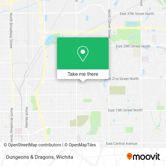
See Dungeons & Dragons, Wichita, on the map
Public Transit to Dungeons & Dragons in Wichita
Wondering how to get to Dungeons & Dragons in Wichita? Moovit helps you find the best way to get to Dungeons & Dragons with step-by-step directions from the nearest public transit station.
Moovit provides free maps and live directions to help you navigate through your city. View schedules, routes, timetables, and find out how long does it take to get to Dungeons & Dragons in real time.
Looking for the nearest stop or station to Dungeons & Dragons? Check out this list of stops closest to your destination: Hubbard Hall Outbound; Hillside And Shadybrook.
Bus: 202: OLIVE, ROUTE21: DOUGLAS, 202A: WSU, NORTH HIGH SCHOO, ROUTE28: KU MED-.
Want to see if there’s another route that gets you there at an earlier time? Moovit helps you find alternative routes or times. Get directions from and directions to Dungeons & Dragons easily from the Moovit App or Website.
We make riding to Dungeons & Dragons easy, which is why over 1.5 million users, including users in Wichita, trust Moovit as the best app for public transit. You don’t need to download an individual bus app or train app, Moovit is your all-in-one transit app that helps you find the best bus time or train time available.
For information on prices of bus, costs and ride fares to Dungeons & Dragons, please check the Moovit app.
Use the app to navigate to popular places including to the airport, hospital, stadium, grocery store, mall, coffee shop, school, college, and university.
Dungeons & Dragons Address: N Perimeter Rd Wichita, KS 67260 street in Wichita
- Grace Memorial Chapel,
- 2e,
- Wichita State University,
- STARBUCKS,
- Heskett Center,
- Wsu Duerksen Fine Arts Center Wichita,
- Miller Concert Hall,
- Wichita State University, Main Campus - Lot 1,
- Amazon Locker-Maisie,
- 2w,
- Amazon Hub Locker,
- Wichita State University, Duerksen Fine Arts Center - Lot 1,
- 16s,
- WSU Media Resources Center,
- Play To Learn Day Care,
- 1845 Fairmount St Parking,
- 19w,
- Wichita State Delta Gamma,
- Wichita Police-Patrol North Bureau (Patrol North Police Station),
- 9w
Places Near Dungeons & Dragons (Wichita)
- Afghan Halal Market, Wichita,
- Four Corners Cafe @ Wesley Medical Center, Wichita,
- Westside Athletic Field (Friends University Baseball Field), Wichita,
- 21st & Maize, Wichita,
- Total Card Solutions, Wichita,
- Ratcliff Auto and Truck Repair, Wichita,
- Lopez Services, Wichita,
- Spirit Aerosystems Inc, Building 1-198D,
- Spirit Aerosystems,
- Hubb's glory hole, Wichita,
- East 21st Street North and Webb Road, Wichita,
- Sena African Hair Braiding LLC, Wichita,
- Ascencion Via Christi Hospital St Francis, Wichita,
- Spirit AeroSystems, Bldg 2-280J (Section 9),
- Bmer Tech Automotive, Wichita,
- McConnell Air Force Base, Mcconnell Afb,
- North High School, Wichita,
- Wichita Dwight D. Eisenhower National Airport (ICT) (Wichita Eisenhower National Airport), Wichita,
- Towne East Mall, Wichita,
- Paige Place Apartments, Wichita
How to get to popular places in Wichita with public transit
Get around Wichita by public transit!
Traveling around Wichita has never been so easy. See step by step directions as you travel to any attraction, street or major public transit station. View bus and train schedules, arrival times, service alerts and detailed routes on a map, so you know exactly how to get to anywhere in Wichita.
When traveling to any destination around Wichita use Moovit's Live Directions with Get Off Notifications to know exactly where and how far to walk, how long to wait for your line, and how many stops are left. Moovit will alert you when it's time to get off — no need to constantly re-check whether yours is the next stop.
Wondering how to use public transit in Wichita or how to pay for public transit in Wichita? Moovit public transit app can help you navigate your way with public transit easily, and at minimum cost. It includes public transit fees, ticket prices, and costs. Looking for a map of Wichita public transit lines? Moovit public transit app shows all public transit maps in Wichita with all bus routes and stops on an interactive map.
Wichita has 1 transit type(s), including: bus, operated by several transit agencies, including Wichita Transit, Greyhound-us and FlixBus-us