Directions to DUO (Tel Aviv-Yafo) with public transportation
The following transit lines have routes that pass near DUO
 Bus: 10, 115, 161, 2, 238.
- Israel Railways: Be'er Sheva Center - Herzliya, Herzliya - Be'er Sheva Center, Herzliya - Jerusalem/Yitzhak Navon.
How to get to DUO by bus?
Click on the bus route to see step by step directions with maps, line arrival times and updated time schedules.
From Camp Maklef (Personnel), Ramat Gan
30 minFrom Kiryat Ono, Kiryat Ono
40 minFrom Concord Halls, Bnei Brak
34 minFrom Seven Stars Mall, Herzliya
40 minFrom Moshe Levy, Rishon LeZion
53 minFrom HaMoshava Stadium, Petah Tikva
43 minFrom Lishanski, Rishon LeZion
40 minFrom King George, Tel Aviv-Yafo
38 minFrom Rishon LeZion Market on Tuesday, Rishon LeZion
62 min
How to get to DUO by Israel Railways?
Click on the Israel Railways route to see step by step directions with maps, line arrival times and updated time schedules.
Bus stops near DUO in Tel Aviv-Yafo
Light Rail stations near DUO in Tel Aviv-Yafo
- King Saul Light Rail Station, 8 min walk,VIEW
Bus lines to DUO in Tel Aviv-Yafo
- 4, Tel Aviv-Yafo,VIEW
- 10, Bat Yam,VIEW
- 62, Ramat Gan,VIEW
- 115, Kiryat Ono,VIEW
- 161, Bnei Brak,VIEW
- 222, Modi'in-Maccabim-Re'ut,VIEW
- 296, Beit Dagan,VIEW
- 333, Ashdod,VIEW
- 445, Ben Gurion Airport,VIEW
- 463, Givat Shmuel,VIEW
- 466, Petah Tikva,VIEW
- 489, Holon,VIEW
- 555, Yehud,VIEW
- 566, Rosh HaAyin,VIEW
- 599, Petah Tikva,VIEW
- 705, Givatayim,VIEW
- 717, Ramat Gan,VIEW
- 48, Tel Aviv-Yafo,VIEW
- 247, Tel Aviv-Yafo,VIEW
- 249, Kfar Saba,VIEW
What are the closest stations to DUO?
The closest stations to DUO are:
- Frishman Beach is 94 meters away, 2 min walk.
- Bograshov Beach/Tayelet is 319 meters away, 5 min walk.
- HaYarkon/Trumpeldor is 492 meters away, 7 min walk.
- Trumpeldor/Ben Yehuda is 539 meters away, 7 min walk.
- King Saul Light Rail Station is 590 meters away, 8 min walk.
- Dizengoff Square/Dizengoff is 648 meters away, 9 min walk.
Which bus lines stop near DUO?
These bus lines stop near DUO: 10, 115, 161, 2, 238, 4, 66, 90.
Which Israel Railways lines stop near DUO?
These Israel Railways lines stop near DUO: Be'er Sheva Center - Herzliya, Herzliya - Be'er Sheva Center, Herzliya - Jerusalem/Yitzhak Navon.
What’s the nearest light rail station to DUO in Tel Aviv-Yafo?
The nearest light rail station to DUO in Tel Aviv-Yafo is King Saul Light Rail Station. It’s a 8 min walk away.
What’s the nearest bus station to DUO in Tel Aviv-Yafo?
The nearest bus station to DUO in Tel Aviv-Yafo is Frishman Beach. It’s a 2 min walk away.
What time is the first light rail to DUO in Tel Aviv-Yafo?
The R3 is the first light rail that goes to DUO in Tel Aviv-Yafo. It stops nearby at 5:30 AM.
What time is the last light rail to DUO in Tel Aviv-Yafo?
The R2 is the last light rail that goes to DUO in Tel Aviv-Yafo. It stops nearby at 12:54 AM.
What time is the first bus to DUO in Tel Aviv-Yafo?
The 445 is the first bus that goes to DUO in Tel Aviv-Yafo. It stops nearby at 3:14 AM.
What time is the last bus to DUO in Tel Aviv-Yafo?
The 445 is the last bus that goes to DUO in Tel Aviv-Yafo. It stops nearby at 3:17 AM.
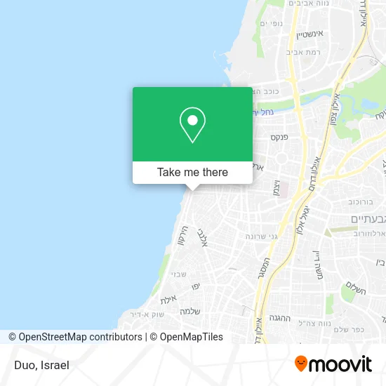
See DUO, Tel Aviv-Yafo, on the map
Public Transit to DUO in Tel Aviv-Yafo
Wondering how to get to DUO in Tel Aviv-Yafo? Moovit helps you find the best way to get to DUO with step-by-step directions from the nearest public transit station.
Moovit provides free maps and live directions to help you navigate through your city. View schedules, routes, timetables, and find out how long does it take to get to DUO in real time.
Looking for the nearest stop or station to DUO? Check out this list of stops closest to your destination: Frishman Beach; Bograshov Beach/Tayelet; HaYarkon/Trumpeldor; Trumpeldor/Ben Yehuda; King Saul Light Rail Station; Dizengoff Square/Dizengoff.
Bus: 10, 115, 161, 2, 238, 4, 66, 90, 62, 48, 247, 249, 717, 63, 128, White Savvus, 18, 61, 230, 231, Green Savbus, Blue Savbus, 5, 8.Israel Railways: Be'er Sheva Center - Herzliya, Herzliya - Be'er Sheva Center, Herzliya - Jerusalem/Yitzhak Navon.
Want to see if there’s another route that gets you there at an earlier time? Moovit helps you find alternative routes or times. Get directions from and directions to DUO easily from the Moovit App or Website.
We make riding to DUO easy, which is why over 1.5 million users, including users in Tel Aviv-Yafo, trust Moovit as the best app for public transit. You don’t need to download an individual bus app or train app, Moovit is your all-in-one transit app that helps you find the best bus time or train time available.
For information on prices of bus and Israel Railways, costs and ride fares to DUO, please check the Moovit app.
Use the app to navigate to popular places including to the airport, hospital, stadium, grocery store, mall, coffee shop, school, college, and university.
DUO Address: הירקון הצפון הישן-האזור הדרומי, 63432 תל אביב - יפו street in Tel Aviv-Yafo
- Dan Tel Aviv Hotel,
- Spa Boutique Tel Aviv,
- Dan Hotel,
- Sun Rise Rooms for Rent,
- Yasou Restaurant Tel Aviv,
- Dan Hotel Tel Aviv,
- Dan Hotel,
- Dan Tel Aviv,
- Corridor,
- Forel,
- Bogarshov LaMer - Restaurant,
- Dream Beach Tel Aviv Boutique Hotel,
- Elwood Bar,
- Shlomo Lahat Promenade,
- Super Yishman,
- Shelter - Tel Aviv-Yafo, Herbert Samuel A,
- Handicraft Raymond,
- Coco Thai,
- Ben Yehuda/Bograshov,
- Avis
Places Near DUO (Tel Aviv-Yafo)
- Bislach 17, Ramat Negev Regional Council,
- Assuta Hospital - Ramat HaHayal, Tel Aviv-Yafo,
- Tel Hashomer Base, Ramat Gan,
- Dizengoff Center, Tel Aviv-Yafo,
- Tel HaShomer North Gate, Ramat Gan,
- Expo Tel Aviv, Tel Aviv-Yafo,
- HaKotel, Jerusalem,
- Menora Mivtachim Arena, Tel Aviv-Yafo,
- Carmel Market, Tel Aviv-Yafo,
- Ramat Gan Stadium, Ramat Gan,
- Gideon Camp - Military Base 7, Emek Lod Regional Council,
- Glilot Complex, Hof HaSharon Regional Council,
- Southern Medical Center, Ramat Negev Regional Council,
- Beilinson Hospital, Petah Tikva,
- Bloomfield Stadium, Tel Aviv-Yafo,
- Ichilov Hospital, Tel Aviv-Yafo,
- Yarkon Park, Tel Aviv-Yafo,
- Azrieli, Tel Aviv-Yafo,
- Moovit Office, Nes Ziona,
- Kashcafe, Kiryat Ata
How to get to popular places in Israel with public transit
Get around Tel Aviv-Yafo by public transit!
Traveling around Tel Aviv-Yafo has never been so easy. See step by step directions as you travel to any attraction, street or major public transit station. View bus and train schedules, arrival times, service alerts and detailed routes on a map, so you know exactly how to get to anywhere in Tel Aviv-Yafo.
When traveling to any destination around Tel Aviv-Yafo use Moovit's Live Directions with Get Off Notifications to know exactly where and how far to walk, how long to wait for your line, and how many stops are left. Moovit will alert you when it's time to get off — no need to constantly re-check whether yours is the next stop.
Wondering how to use public transit in Tel Aviv-Yafo or how to pay for public transit in Tel Aviv-Yafo? Moovit public transit app can help you navigate your way with public transit easily, and at minimum cost. It includes public transit fees, ticket prices, and costs. Looking for a map of Tel Aviv-Yafo public transit lines? Moovit public transit app shows all public transit maps in Tel Aviv-Yafo with all Bus, Israel Railways, Light Rail, Carmelit / Rachbalit and Shuttle routes and stops on an interactive map.
Israel has 5 transit type(s), including: Bus, Israel Railways, Light Rail, Carmelit / Rachbalit and Shuttle, operated by several transit agencies, including Dan, Tel Aviv Light Rail - Tevel - Red Line, Israel Railways, Egged, Metropoline, Kavim, Electra Afikim, Nateev Express, Extra, Extra Jerusalem, Jerusalem Light Rail - Kfir, Egged Jerusalem Envelope Route, Dan Badarom, Dan Beer-Sheva and Electra Afikim Transport