How to get to Dupon Circle Locksmith 24 7 by bus?
Click on the bus route to see step by step directions with maps, line arrival times and updated time schedules.
From Senate Hearing Room G50, Dirksen Building, Washington
78 minFrom Quarterdeck Restaurant, Arlington County
63 minFrom Russell Senate Office Building, Washington
79 minFrom Islamic Center of Washington, Washington
42 minFrom State Department, Washington
62 minFrom 1629 K St NW, Washington
57 minFrom Botanical Gardens, Washington
69 minFrom Citizenm Washington DC Capitol, Washington
70 minFrom Hubert H. Humphrey Building, Washington
69 minFrom 450 K, Washington
66 min
How to get to Dupon Circle Locksmith 24 7 by metro?
Click on the metro route to see step by step directions with maps, line arrival times and updated time schedules.
From Senate Hearing Room G50, Dirksen Building, Washington
39 minFrom Quarterdeck Restaurant, Arlington County
53 minFrom Russell Senate Office Building, Washington
41 minFrom Islamic Center of Washington, Washington
41 minFrom State Department, Washington
49 minFrom 1629 K St NW, Washington
30 minFrom Botanical Gardens, Washington
42 minFrom Citizenm Washington DC Capitol, Washington
37 minFrom Hubert H. Humphrey Building, Washington
41 minFrom 450 K, Washington
37 min
Bus stops near Dupon Circle Locksmith 24 7 in Washington
Metro station near Dupon Circle Locksmith 24 7 in Washington
- Tenleytown Metro Station, 59 min walk,VIEW
Bus lines to Dupon Circle Locksmith 24 7 in Washington
What are the closest stations to Dupon Circle Locksmith 24 7?
The closest stations to Dupon Circle Locksmith 24 7 are:
- Western Av Nw+River Rd NW is 227 yards away, 3 min walk.
- Nw Western Av & Nw River Rd is 246 yards away, 4 min walk.
- Wisconsin Av Nw+Fessenden St NW is 751 yards away, 9 min walk.
- Tenleytown Metro Station is 4989 yards away, 59 min walk.
Which bus lines stop near Dupon Circle Locksmith 24 7?
These bus lines stop near Dupon Circle Locksmith 24 7: D80, D96.
Which metro line stops near Dupon Circle Locksmith 24 7?
RED (Shady Grove)
What’s the nearest bus station to Dupon Circle Locksmith 24 7 in Washington?
The nearest bus station to Dupon Circle Locksmith 24 7 in Washington is Western Av Nw+River Rd NW. It’s a 3 min walk away.
What time is the first metro to Dupon Circle Locksmith 24 7 in Washington?
The RED is the first metro that goes to Dupon Circle Locksmith 24 7 in Washington. It stops nearby at 5:21 AM.
What time is the last metro to Dupon Circle Locksmith 24 7 in Washington?
The RED is the last metro that goes to Dupon Circle Locksmith 24 7 in Washington. It stops nearby at 12:19 AM.
What time is the first bus to Dupon Circle Locksmith 24 7 in Washington?
The D80 is the first bus that goes to Dupon Circle Locksmith 24 7 in Washington. It stops nearby at 3:01 AM.
What time is the last bus to Dupon Circle Locksmith 24 7 in Washington?
The D80 is the last bus that goes to Dupon Circle Locksmith 24 7 in Washington. It stops nearby at 3:27 AM.
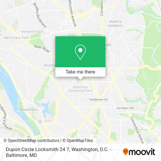
See Dupon Circle Locksmith 24 7, Washington, on the map
Public Transit to Dupon Circle Locksmith 24 7 in Washington
Wondering how to get to Dupon Circle Locksmith 24 7 in Washington? Moovit helps you find the best way to get to Dupon Circle Locksmith 24 7 with step-by-step directions from the nearest public transit station.
Moovit provides free maps and live directions to help you navigate through your city. View schedules, routes, timetables, and find out how long does it take to get to Dupon Circle Locksmith 24 7 in real time.
Looking for the nearest stop or station to Dupon Circle Locksmith 24 7? Check out this list of stops closest to your destination: Western Av Nw+River Rd NW; Nw Western Av & Nw River Rd; Wisconsin Av Nw+Fessenden St NW; Tenleytown Metro Station.
Bus: D80, D96, 29, D82.Metro: RED.
Want to see if there’s another route that gets you there at an earlier time? Moovit helps you find alternative routes or times. Get directions from and directions to Dupon Circle Locksmith 24 7 easily from the Moovit App or Website.
We make riding to Dupon Circle Locksmith 24 7 easy, which is why over 1.5 million users, including users in Washington, trust Moovit as the best app for public transit. You don’t need to download an individual bus app or train app, Moovit is your all-in-one transit app that helps you find the best bus time or train time available.
For information on prices of metro and bus, costs and ride fares to Dupon Circle Locksmith 24 7, please check the Moovit app.
Use the app to navigate to popular places including to the airport, hospital, stadium, grocery store, mall, coffee shop, school, college, and university.
Dupon Circle Locksmith 24 7 Address: 4512 River Rd NW Washington, DC 20016 street in Washington
- Glove Guy,
- River Road Presbyterian Church,
- Arvin Vohra Education,
- Ecco,
- Sarah Crawford Najafi - Long & Foster Real Estate,
- Phillippa Tarrant,
- GEICO,
- Joseph Gawler’S Sons, Llc,
- BCG DC,
- Chevy Chase Metro Center,
- Chevy Chase Metro Plaza,
- Dr Irving M Ryckoff MD,
- Friendship Heights Outpatient Center (Children's National Friendship Heights),
- Colonial Parking Station 397,
- Jim Knows DC,
- Maids in Black,
- Michaels,
- Bloomingdale's,
- PG Tile,
- PNC Bank
Places Near Dupon Circle Locksmith 24 7 (Washington)
- Westfield Montgomery Mall, Montgomery County,
- Capital One Arena, Washington,
- Amazon Hq2, Arlington County,
- Sibley Memorial Hospital, Washington,
- M&T Bank Stadium, Baltimore,
- Warner Theatre, Washington,
- Rock Creek Tennis Center, Washington,
- Pennsylvania Ave NW (3rd st and pennsylvania), Washington,
- PG Mall, Prince George's County,
- National Theatre, Washington,
- Basilica of the National Shrine, Washington,
- National Zoo, Washington,
- Camden Yards, Baltimore,
- Museum Of The Bible, Washington,
- The Anthem, Washington,
- Marriott Marquis Washington, DC, Washington,
- Washington National Cathedral, Washington,
- Georgetown, Washington,
- Washington DC VA Medical Center, Washington,
- National Museum of African American History and Culture, Washington
How to get to popular places in Washington, D.C. - Baltimore, MD with public transit
Get around Washington by public transit!
Traveling around Washington has never been so easy. See step by step directions as you travel to any attraction, street or major public transit station. View bus and train schedules, arrival times, service alerts and detailed routes on a map, so you know exactly how to get to anywhere in Washington.
When traveling to any destination around Washington use Moovit's Live Directions with Get Off Notifications to know exactly where and how far to walk, how long to wait for your line, and how many stops are left. Moovit will alert you when it's time to get off — no need to constantly re-check whether yours is the next stop.
Wondering how to use public transit in Washington or how to pay for public transit in Washington? Moovit public transit app can help you navigate your way with public transit easily, and at minimum cost. It includes public transit fees, ticket prices, and costs. Looking for a map of Washington public transit lines? Moovit public transit app shows all public transit maps in Washington with all Bus, Train, Metro, Light Rail and Ferry routes and stops on an interactive map.
Washington, D.C. - Baltimore, MD has 5 transit type(s), including: Bus, Train, Metro, Light Rail and Ferry, operated by several transit agencies, including WMATA, Montgomery County Ride On, Fairfax Connector, TheBus, PRTC, DASH - Alexandria, Arlington Transit (ART), RTA of Central Maryland, MDOT MTA, MDOT MTA Light RailLink, MDOT MTA Commuter Bus, MDOT MTA Local Bus, FXBGO!, Virginia Railway Express (VRE) and MARC