How to get to Dynames Tech by bus?
Click on the bus route to see step by step directions with maps, line arrival times and updated time schedules.
From 36 Rue d'Assas, Paris
47 minFrom Place de la République, Paris
64 minFrom Rue de la Roquette, Paris
48 minFrom Mairie du 18e arrondissement, Paris
50 minFrom Rue d'Ulm, Paris
54 minFrom Place de la Bastille, Paris
48 minFrom Musée Rodin, Paris
42 minFrom Avenue Charles de Gaulle, Neuilly-Sur-Seine
48 minFrom Montmartre, Paris
50 minFrom Théâtre Hébertot, Paris
41 min
How to get to Dynames Tech by train?
Click on the train route to see step by step directions with maps, line arrival times and updated time schedules.
How to get to Dynames Tech by metro?
Click on the metro route to see step by step directions with maps, line arrival times and updated time schedules.
From 36 Rue d'Assas, Paris
35 minFrom Place de la République, Paris
42 minFrom Rue de la Roquette, Paris
46 minFrom Mairie du 18e arrondissement, Paris
46 minFrom Rue d'Ulm, Paris
46 minFrom Place de la Bastille, Paris
45 minFrom Musée Rodin, Paris
39 minFrom Avenue Charles de Gaulle, Neuilly-Sur-Seine
48 minFrom Montmartre, Paris
46 minFrom Théâtre Hébertot, Paris
51 min
Bus stops near Dynames Tech in Boulogne-Billancourt
Metro stations near Dynames Tech in Boulogne-Billancourt
Bus lines to Dynames Tech in Boulogne-Billancourt
What are the closest stations to Dynames Tech?
The closest stations to Dynames Tech are:
- Ancienne Mairie is 121 meters away, 2 min walk.
- André Morizet is 283 meters away, 4 min walk.
- Gallieni - Billancourt is 297 meters away, 4 min walk.
- Marcel Sembat is 353 meters away, 5 min walk.
- Rue de Billancourt is 357 meters away, 5 min walk.
- Boulogne Jean Jaurès is 894 meters away, 12 min walk.
Which bus line stops near Dynames Tech?
72 (Parc de Saint-Cloud)
Which train lines stop near Dynames Tech?
These train lines stop near Dynames Tech: L, U.
Which metro line stops near Dynames Tech?
10 (Gare D'Austerlitz)
What’s the nearest metro station to Dynames Tech in Boulogne-Billancourt?
The nearest metro station to Dynames Tech in Boulogne-Billancourt is Marcel Sembat. It’s a 5 min walk away.
What’s the nearest bus station to Dynames Tech in Boulogne-Billancourt?
The nearest bus station to Dynames Tech in Boulogne-Billancourt is Ancienne Mairie. It’s a 2 min walk away.
What time is the first light rail to Dynames Tech in Boulogne-Billancourt?
The T2 is the first light rail that goes to Dynames Tech in Boulogne-Billancourt. It stops nearby at 6:13 AM.
What time is the last light rail to Dynames Tech in Boulogne-Billancourt?
The T2 is the last light rail that goes to Dynames Tech in Boulogne-Billancourt. It stops nearby at 12:56 AM.
What time is the first metro to Dynames Tech in Boulogne-Billancourt?
The 9 is the first metro that goes to Dynames Tech in Boulogne-Billancourt. It stops nearby at 5:31 AM.
What time is the last metro to Dynames Tech in Boulogne-Billancourt?
The 9 is the last metro that goes to Dynames Tech in Boulogne-Billancourt. It stops nearby at 1:13 AM.
What time is the first bus to Dynames Tech in Boulogne-Billancourt?
The 175 is the first bus that goes to Dynames Tech in Boulogne-Billancourt. It stops nearby at 6:50 AM.
What time is the last bus to Dynames Tech in Boulogne-Billancourt?
The 72 is the last bus that goes to Dynames Tech in Boulogne-Billancourt. It stops nearby at 1:28 AM.
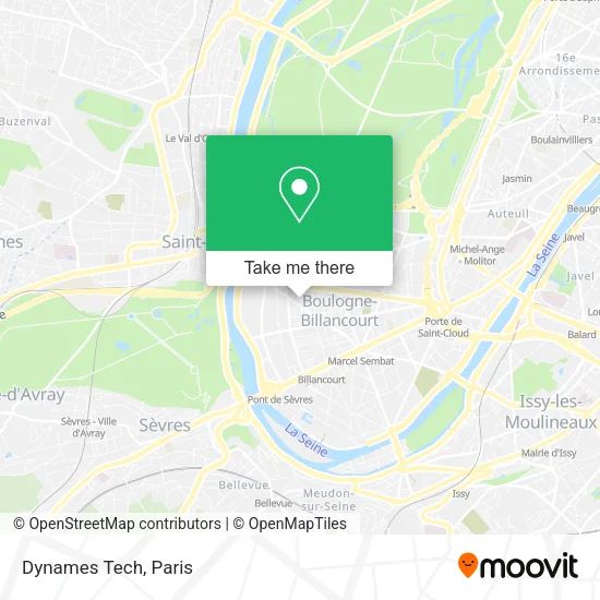
See Dynames Tech, Boulogne-Billancourt, on the map
Public Transit to Dynames Tech in Boulogne-Billancourt
Wondering how to get to Dynames Tech in Boulogne-Billancourt? Moovit helps you find the best way to get to Dynames Tech with step-by-step directions from the nearest public transit station.
Moovit provides free maps and live directions to help you navigate through your city. View schedules, routes, timetables, and find out how long does it take to get to Dynames Tech in real time.
Looking for the nearest stop or station to Dynames Tech? Check out this list of stops closest to your destination: Ancienne Mairie; André Morizet; Gallieni - Billancourt; Marcel Sembat; Rue de Billancourt; Boulogne Jean Jaurès.
Bus: 72, 126, 175, 260, SUBB N.Train: L, U.Metro: 10, 9.
Want to see if there’s another route that gets you there at an earlier time? Moovit helps you find alternative routes or times. Get directions from and directions to Dynames Tech easily from the Moovit App or Website.
We make riding to Dynames Tech easy, which is why over 1.5 million users, including users in Boulogne-Billancourt, trust Moovit as the best app for public transit. You don’t need to download an individual bus app or train app, Moovit is your all-in-one transit app that helps you find the best bus time or train time available.
For information on prices of metro, bus and train, costs and ride fares to Dynames Tech, please check the Moovit app.
Use the app to navigate to popular places including to the airport, hospital, stadium, grocery store, mall, coffee shop, school, college, and university.
Dynames Tech Address: 36 Rue de l'Ancienne Mairie 92100 Boulogne-Billancourt street in Boulogne-Billancourt
- Activ Zone Group,
- Corpimmo,
- Poleo,
- Madame Marie Elisabeth Véra,
- Futuramedia,
- Marie-Noëlle Prohom,
- Dougados Julie,
- Macha Nossintchouk,
- Vigne Matthieu,
- Mano,
- Groupe Edlc - les Enfants de la Comédie,
- Dr. Amar Orly,
- Association Philotechnique Boulogne Billancourt,
- Dr. Martin Dominique,
- Boulogne Informatic Club,
- Dr. de Langhe Christian,
- Dr. Buk-Serero Anne,
- Dr. Alexandre Pascale,
- Osmozium,
- Cap Data Consulting
Places Near Dynames Tech (Boulogne-Billancourt)
- Hôpital de la Pitié-Salpêtrière, Paris,
- Hopital Foch, Suresnes,
- Hôpital Saint-Joseph, Paris,
- 29 Rue Manin, Paris,
- Créteil Soleil, Creteil,
- Fondation Louis Vuitton, Paris,
- Théâtre Mogador, Paris,
- Gare Routière Flixbus, Paris,
- Atelier Des Lumieres, Paris,
- Marché Saint-Pierre, Paris,
- Centre Hospitalier des 15/20, Paris,
- Hôpital Necker, Paris,
- Institut Curie, Paris,
- Hôpital Pitié Salpêtrière, Paris,
- Hôpital Beaujon, Clichy,
- Hopital Lariboisière, Paris,
- Galeries Lafayette Haussmann, Paris,
- Galeries Lafayette, Paris,
- Hôpital Cochin, Paris,
- Hôpital Henri Mondor, Creteil
How to get to popular places in Paris with public transit
Get around Boulogne-Billancourt by public transit!
Traveling around Boulogne-Billancourt has never been so easy. See step by step directions as you travel to any attraction, street or major public transit station. View bus and train schedules, arrival times, service alerts and detailed routes on a map, so you know exactly how to get to anywhere in Boulogne-Billancourt.
When traveling to any destination around Boulogne-Billancourt use Moovit's Live Directions with Get Off Notifications to know exactly where and how far to walk, how long to wait for your line, and how many stops are left. Moovit will alert you when it's time to get off — no need to constantly re-check whether yours is the next stop.
Wondering how to use public transit in Boulogne-Billancourt or how to pay for public transit in Boulogne-Billancourt? Moovit public transit app can help you navigate your way with public transit easily, and at minimum cost. It includes public transit fees, ticket prices, and costs. Looking for a map of Boulogne-Billancourt public transit lines? Moovit public transit app shows all public transit maps in Boulogne-Billancourt with all Bus, Train, Metro, Light Rail, RER, Funicular and Gondola routes and stops on an interactive map.
Paris has 7 transit type(s), including: Bus, Train, Metro, Light Rail, RER, Funicular and Gondola, operated by several transit agencies, including RATP, RER, RER Bus de remplacement, Train, Train Bus de remplacement, Tramway Bus de remplacement, TER, ADP, Magical Shuttle, Argenteuil - Boucles de Seine, Autocars Dominique, Bièvre, Brie et 2 Morin, Le Bus - C.C. du Clermontois and Cœur d’Essonne