Directions to Dynamic Collision (Queens) with public transportation
The following transit lines have routes that pass near Dynamic Collision
 Bus: Q101, Q102, Q32, Q63, Q66.
- Train: BABYLON BRANCH, FAR ROCKAWAY BRANCH, LONG BEACH BRANCH, MONTAUK BRANCH, PORT WASHINGTON BRANCH.
- Subway: M, N, R, E, F.
How to get to Dynamic Collision by bus?
Click on the bus route to see step by step directions with maps, line arrival times and updated time schedules.
How to get to Dynamic Collision by train?
Click on the train route to see step by step directions with maps, line arrival times and updated time schedules.
How to get to Dynamic Collision by subway?
Click on the subway route to see step by step directions with maps, line arrival times and updated time schedules.
Bus stops near Dynamic Collision in Queens
Subway stations near Dynamic Collision in Queens
Bus lines to Dynamic Collision in Queens
What are the closest stations to Dynamic Collision?
The closest stations to Dynamic Collision are:
- 31 St/37 Av is 265 yards away, 4 min walk.
- 36 St is 304 yards away, 4 min walk.
- Northern Blvd/37 St is 338 yards away, 4 min walk.
- 36 Av is 432 yards away, 6 min walk.
- 35 Av/35 St is 544 yards away, 7 min walk.
- Queens Plaza is 1126 yards away, 14 min walk.
Which bus lines stop near Dynamic Collision?
These bus lines stop near Dynamic Collision: Q101, Q102, Q32, Q63.
Which train lines stop near Dynamic Collision?
These train lines stop near Dynamic Collision: BABYLON BRANCH, FAR ROCKAWAY BRANCH, LONG BEACH BRANCH, MONTAUK BRANCH, PORT WASHINGTON BRANCH, RONKONKOMA BRANCH.
Which subway lines stop near Dynamic Collision?
These subway lines stop near Dynamic Collision: M, N, R.
What’s the nearest subway station to Dynamic Collision in Queens?
The nearest subway station to Dynamic Collision in Queens is 36 St. It’s a 4 min walk away.
What’s the nearest bus station to Dynamic Collision in Queens?
The nearest bus stations to Dynamic Collision in Queens are 31 St/37 Av and Northern Blvd/37 St. The closest one is a 4 min walk away.
What time is the first subway to Dynamic Collision in Queens?
The E is the first subway that goes to Dynamic Collision in Queens. It stops nearby at 3:00 AM.
What time is the last subway to Dynamic Collision in Queens?
The F is the last subway that goes to Dynamic Collision in Queens. It stops nearby at 3:47 AM.
What time is the first bus to Dynamic Collision in Queens?
The Q101 is the first bus that goes to Dynamic Collision in Queens. It stops nearby at 3:11 AM.
What time is the last bus to Dynamic Collision in Queens?
The Q66 is the last bus that goes to Dynamic Collision in Queens. It stops nearby at 3:17 AM.
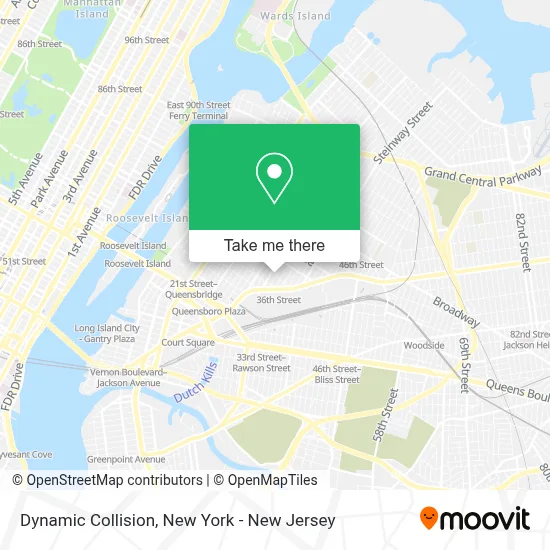
See Dynamic Collision, Queens, on the map
Public Transit to Dynamic Collision in Queens
Wondering how to get to Dynamic Collision in Queens? Moovit helps you find the best way to get to Dynamic Collision with step-by-step directions from the nearest public transit station.
Moovit provides free maps and live directions to help you navigate through your city. View schedules, routes, timetables, and find out how long does it take to get to Dynamic Collision in real time.
Looking for the nearest stop or station to Dynamic Collision? Check out this list of stops closest to your destination: 31 St/37 Av; 36 St; Northern Blvd/37 St; 36 Av; 35 Av/35 St; Queens Plaza.
Bus: Q101, Q102, Q32, Q63, Q66.Train: BABYLON BRANCH, FAR ROCKAWAY BRANCH, LONG BEACH BRANCH, MONTAUK BRANCH, PORT WASHINGTON BRANCH, RONKONKOMA BRANCH.Subway: M, N, R, E, F, W, FX.
Want to see if there’s another route that gets you there at an earlier time? Moovit helps you find alternative routes or times. Get directions from and directions to Dynamic Collision easily from the Moovit App or Website.
We make riding to Dynamic Collision easy, which is why over 1.5 million users, including users in Queens, trust Moovit as the best app for public transit. You don’t need to download an individual bus app or train app, Moovit is your all-in-one transit app that helps you find the best bus time or train time available.
For information on prices of subway, bus, train and ferry, costs and ride fares to Dynamic Collision, please check the Moovit app.
Use the app to navigate to popular places including to the airport, hospital, stadium, grocery store, mall, coffee shop, school, college, and university.
Dynamic Collision Address: 33-11 37th Ave street in Queens
- Subrang Tv,
- Glam Studio Nyc,
- Watch Guard,
- Auto Tech Service Inc.,
- Smashedphotobooth.Com,
- Premium Foods USA,
- Astoria Seafood,
- RWS Studios,
- Flagstar Private Bank,
- Kanga's Playcenter and Cafe, Long Island City,
- Drivus,
- Ecuadorian American Cultural Center,
- Radical Storage - Luggage Storage 36 Street Station,
- Kanga's Indoor Playground,
- Kanga's Indoor Playcenter,
- The High Risk Solution,
- Electronic Lifestyles Llc,
- Get Simple Process,
- Grahame Fowler Shop,
- Artisan NY Productions
Places Near Dynamic Collision (Queens)
- Mountainside Hospital, Glen Ridge,
- Chinatown, Manhattan,
- 911 Memorial, Manhattan,
- Bellevue Hospital, Manhattan,
- SoHo, Manhattan,
- 111 Centre New York City Supreme Court, Manhattan,
- Rockefeller Center, Manhattan,
- 26 Federal Plaza, Manhattan,
- Pier 83, Manhattan,
- Queens Center Mall, Queens,
- Times Square, Manhattan,
- 66 John Street, Manhattan,
- 1 Police Plaza, Manhattan,
- qqqq, Manhattan,
- Wall Street, Manhattan,
- 3 Stone St, Manhattan,
- Katz's Deli, Manhattan,
- San Gennaro Feast, Manhattan,
- Hudson Yards, Manhattan,
- 376 Hudson Street, Manhattan
How to get to popular places in New York - New Jersey with public transit
Get around Queens by public transit!
Traveling around Queens has never been so easy. See step by step directions as you travel to any attraction, street or major public transit station. View bus and train schedules, arrival times, service alerts and detailed routes on a map, so you know exactly how to get to anywhere in Queens.
When traveling to any destination around Queens use Moovit's Live Directions with Get Off Notifications to know exactly where and how far to walk, how long to wait for your line, and how many stops are left. Moovit will alert you when it's time to get off — no need to constantly re-check whether yours is the next stop.
Wondering how to use public transit in Queens or how to pay for public transit in Queens? Moovit public transit app can help you navigate your way with public transit easily, and at minimum cost. It includes public transit fees, ticket prices, and costs. Looking for a map of Queens public transit lines? Moovit public transit app shows all public transit maps in Queens with all Bus, Train, Subway, Light Rail, Ferry and Cable Car routes and stops on an interactive map.
New York - New Jersey has 6 transit type(s), including: Bus, Train, Subway, Light Rail, Ferry and Cable Car, operated by several transit agencies, including MTA Subway, Metro-North Railroad, LIRR, PATH, MTA New York City Transit - Express routes, MTA Bus, NJ Transit, NYC Ferry, NICE bus, Bee-Line Bus, NJ Transit Rail, Norwalk Transit District, Hartford Line, River Valley Transit and HART