Directions to E (Ningbo) with public transportation
The following transit lines have routes that pass near E
 Bus: Route 272 Night Line, Route 712, Route 728 Outer Ring, Route 750, Route 782.
- Metro: Line 1, Line 1.
How to get to E by bus?
Click on the bus route to see step by step directions with maps, line arrival times and updated time schedules.
How to get to E by metro?
Click on the metro route to see step by step directions with maps, line arrival times and updated time schedules.
Bus stops near E in Ningbo
Metro station near E in Ningbo
- Changjiang Road, 15 min walk,VIEW
Bus lines to E in Ningbo
- Route 272 Night Line, Daxie Passenger Center,VIEW
- 728 Inner Loop, Daqian Bus Terminal,VIEW
- Route 728 Outer Ring, Daqian Bus Terminal,VIEW
- Route 712, Beilun Passenger Transport,VIEW
- Route 721, Beilun Passenger Transport,VIEW
- Route 782, East Bonded Area,VIEW
- Route 720, Bai Feng Pier,VIEW
- Route 271 Night Line, Ningbo Railway,VIEW
- Route 791, Ningbo East Bus,VIEW
- Route 710 North Line, Phoenix Mountain Theme Park,VIEW
What are the closest stations to E?
The closest stations to E are:
- Zhonghe Road-Huangshan Road Intersection is 441 meters away, 7 min walk.
- Beilun Sports & Arts Center is 527 meters away, 8 min walk.
- Sports and Arts Center is 587 meters away, 8 min walk.
- Administrative Service Center is 847 meters away, 12 min walk.
- Minshan School is 1063 meters away, 14 min walk.
- Changjiang Road is 1075 meters away, 15 min walk.
- Taihe School is 1196 meters away, 16 min walk.
Which bus lines stop near E?
These bus lines stop near E: Route 272 Night Line, Route 712, Route 728 Outer Ring, Route 750, Route 782.
Which metro line stops near E?
Line 1 (Xiapu)
What’s the nearest metro station to E in Ningbo?
The nearest metro station to E in Ningbo is Changjiang Road. It’s a 15 min walk away.
What’s the nearest bus station to E in Ningbo?
The nearest bus station to E in Ningbo is Zhonghe Road-Huangshan Road Intersection. It’s a 7 min walk away.
What time is the first metro to E in Ningbo?
The Line 1 is the first metro that goes to E in Ningbo. It stops nearby at 6:00 AM.
What time is the last metro to E in Ningbo?
The Line 1 is the last metro that goes to E in Ningbo. It stops nearby at 11:10 PM.
What time is the first bus to E in Ningbo?
The Route 782 is the first bus that goes to E in Ningbo. It stops nearby at 5:47 AM.
What time is the last bus to E in Ningbo?
The Route 710 North Line is the last bus that goes to E in Ningbo. It stops nearby at 9:28 PM.
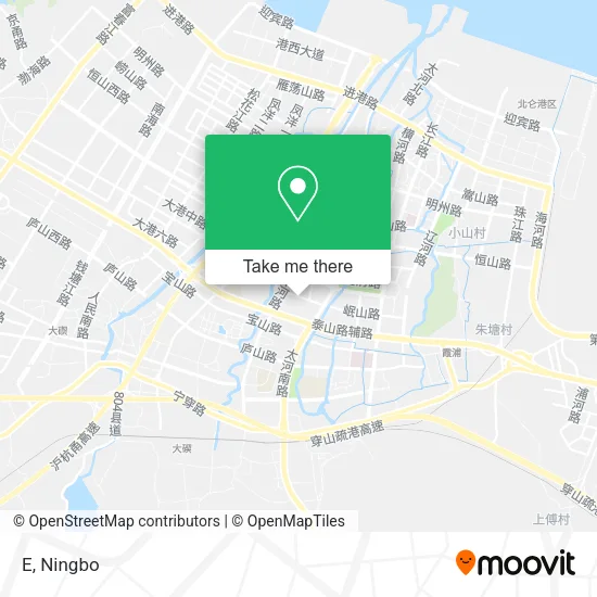
See E, Ningbo, on the map
Public Transit to E in Ningbo
Wondering how to get to E in Ningbo? Moovit helps you find the best way to get to E with step-by-step directions from the nearest public transit station.
Moovit provides free maps and live directions to help you navigate through your city. View schedules, routes, timetables, and find out how long does it take to get to E in real time.
Looking for the nearest stop or station to E? Check out this list of stops closest to your destination: Zhonghe Road-Huangshan Road Intersection; Beilun Sports & Arts Center; Sports and Arts Center; Administrative Service Center; Minshan School; Changjiang Road; Taihe School.
Bus: Route 272 Night Line, Route 712, Route 728 Outer Ring, Route 750, Route 782, Route 272 Night Line, 728 Inner Loop, Route 728 Outer Ring, Route 712, Route 721, Route 782.Metro: Line 1, Line 1.
Want to see if there’s another route that gets you there at an earlier time? Moovit helps you find alternative routes or times. Get directions from and directions to E easily from the Moovit App or Website.
We make riding to E easy, which is why over 1.5 million users, including users in Ningbo, trust Moovit as the best app for public transit. You don’t need to download an individual bus app or train app, Moovit is your all-in-one transit app that helps you find the best bus time or train time available.
For information on prices of bus and metro, costs and ride fares to E, please check the Moovit app.
Use the app to navigate to popular places including to the airport, hospital, stadium, grocery store, mall, coffee shop, school, college, and university.
E Address: 宁波市北仑区中河路399号北仑银泰城F2 street in Ningbo
- HANGTEN (Beilun Yintai City),
- CAN.TORP,
- In's,
- our.Q,
- DR·KonG,
- EEICIIETTOD,
- Noolly,
- SATCHI (Beilun Yintai City Branch),
- Camel (Yintai Department Store Branch),
- Baicaoji Beauty Space (Beilun Yintai City Branch),
- A&N (Yintai City Branch),
- Tyrannis,
- Little Taste (Beilun Yintai City Store),
- Beilun Yintai City (East Gate 1),
- POLO MEISDO,
- North Gate,
- DQ (Yintai Department Store),
- Beilun Yintai City - Charging Rest Station,
- Shanshan Home Textiles (Beilun Yintai City Store),
- Hi GO Children's Handcraft and Intellectual Playground (Yintai City)
Places Near E (Ningbo)
- Ningbo Jintian Copper (Group) Co., Ltd., Jiangbei District,
- France · Woodpecker,
- Ningbo Second Hospital-Emergency, Haishu District,
- Gas Station, Yinzhou District,
- Ningbo Lishe International Airport, Yinzhou District,
- Li Huili Eastern Hospital, Yinzhou District,
- Ningbo First Hospital - Inpatient Department, Haishu District,
- Zhongle Dance Hall, Jiangbei District,
- Ningbo Medical Center Li Huili Eastern Hospital, Yinzhou District,
- Wanxiang City, Jiangbei District,
- Ningbo Cultural Creative Port, Jiangbei District,
- Sam's Club (Qinghe Road), Jiangbei District,
- Nantang Old Street, Haishu District,
- Ayuwang Temple, Yinzhou District,
- Ningbo Medical Center Li Huili Hospital East Hospital - Outpatient, Yinzhou District,
- Ningbo No. 6 Hospital, Jiangdong District,
- Ningbo Traditional Chinese Medicine Hospital, Haishu District,
- City Hero (New City Wuyue Plaza), Zhenhai District,
- Wanxiang City (Under Construction), Jiangbei District,
- Ningbo Foreigner Beach, Jiangbei District
How to get to popular places in Ningbo with public transit
Get around Ningbo by public transit!
Traveling around Ningbo has never been so easy. See step by step directions as you travel to any attraction, street or major public transit station. View bus and train schedules, arrival times, service alerts and detailed routes on a map, so you know exactly how to get to anywhere in Ningbo.
When traveling to any destination around Ningbo use Moovit's Live Directions with Get Off Notifications to know exactly where and how far to walk, how long to wait for your line, and how many stops are left. Moovit will alert you when it's time to get off — no need to constantly re-check whether yours is the next stop.
Wondering how to use public transit in Ningbo or how to pay for public transit in Ningbo? Moovit public transit app can help you navigate your way with public transit easily, and at minimum cost. It includes public transit fees, ticket prices, and costs. Looking for a map of Ningbo public transit lines? Moovit public transit app shows all public transit maps in Ningbo with all Bus and Metro routes and stops on an interactive map.
Ningbo has 2 transit type(s), including: Bus and Metro, operated by several transit agencies, including Ningbo Metro, Ningbo Bus and Yuyao Bus