How to get to EVBox by bus?
Click on the bus route to see step by step directions with maps, line arrival times and updated time schedules.
From Chambourcy, Chambourcy
103 minFrom Orgeval, Orgeval
78 minFrom Consulat D'Algérie, Pontoise
56 minFrom Fête des Loges, Saint-Germain-En-Laye
62 minFrom Carrefour Montesson, Montesson
125 minFrom Franconville, Franconville
60 minFrom L'Isle-Adam, L'Isle-Adam
97 minFrom IKEA, Franconville
53 minFrom Herblay, Herblay
81 minFrom Hôpital de Poissy, Poissy
111 min
How to get to EVBox by train?
Click on the train route to see step by step directions with maps, line arrival times and updated time schedules.
Bus stops near EVBox in Cergy
RER station near EVBox in Cergy
- Cergy Le Haut, 8 min walk,VIEW
Bus lines to EVBox in Cergy
- 1201, Gare de Cergy Saint-Christophe,VIEW
- 1224, Gare de Cergy Préfecture - Quai B,VIEW
- 1235, Zac de Puiseux,VIEW
- 1239, La Taillette,VIEW
- 1117, Place du 19 Mars 1962,VIEW
- 1143, Gare Routière,VIEW
- 5409, Gare de Mantes-La-Jolie - Quai 13,VIEW
- 6559, Nicot / École Notre-Dame,VIEW
- 6591, Martelet,VIEW
- 7808, Gare Routière de Mantes-La-Ville - Quai 25,VIEW
- 9504, Porte de Rouen,VIEW
- 1206, Gare de Cergy Saint-Christophe,VIEW
- N150, Gare De Cergy-Le-Haut - Gare Saint-Lazare,VIEW
- N152, Gare Saint-Lazare - Gare De Cergy-Le-Haut,VIEW
- 1240, Gare de Cergy Saint-Christophe,VIEW
- A, Gare de Sartrouville,VIEW
- L, Cergy Le Haut RER,VIEW
What are the closest stations to EVBox?
The closest stations to EVBox are:
- La Constellation is 57 meters away, 1 min walk.
- Gare de Cergy Saint-Christophe is 301 meters away, 5 min walk.
- Cergy Le Haut is 553 meters away, 8 min walk.
Which train line stops near EVBox?
L (Cergy-le-Haut/ Versailles-Rive-Droite/ Saint-Nom-la-Bretèche - Forêt de Marly)
Which RER line stops near EVBox?
A (Marne la Vallée Chessy / Boissy Saint-Léger)
Which bus lines stop near EVBox?
These bus lines stop near EVBox: 1201, 1206, 1224, 7808.
What’s the nearest bus station to EVBox in Cergy?
The nearest bus station to EVBox in Cergy is La Constellation. It’s a 1 min walk away.
What’s the nearest RER station to EVBox in Cergy?
The nearest RER station to EVBox in Cergy is Cergy Le Haut. It’s a 8 min walk away.
What time is the first train to EVBox in Cergy?
The L is the first train that goes to EVBox in Cergy. It stops nearby at 7:07 AM.
What time is the last train to EVBox in Cergy?
The L is the last train that goes to EVBox in Cergy. It stops nearby at 9:01 PM.
What time is the first bus to EVBox in Cergy?
The N150 is the first bus that goes to EVBox in Cergy. It stops nearby at 3:12 AM.
What time is the last bus to EVBox in Cergy?
The N152 is the last bus that goes to EVBox in Cergy. It stops nearby at 4:23 AM.
What time is the first RER to EVBox in Cergy?
The A is the first RER that goes to EVBox in Cergy. It stops nearby at 4:41 AM.
What time is the last RER to EVBox in Cergy?
The A is the last RER that goes to EVBox in Cergy. It stops nearby at 10:16 PM.
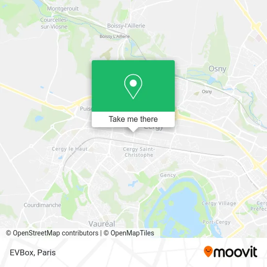
See EVBox, Cergy, on the map
Public Transit to EVBox in Cergy
Wondering how to get to EVBox in Cergy? Moovit helps you find the best way to get to EVBox with step-by-step directions from the nearest public transit station.
Moovit provides free maps and live directions to help you navigate through your city. View schedules, routes, timetables, and find out how long does it take to get to EVBox in real time.
Looking for the nearest stop or station to EVBox? Check out this list of stops closest to your destination: La Constellation; Gare de Cergy Saint-Christophe; Cergy Le Haut.
Train: L.RER: A, L.Bus: 1201, 1206, 1224, 7808, 1235, 1239, 1117, 1143, 5409, 6559, 6591, N150, N152.
Want to see if there’s another route that gets you there at an earlier time? Moovit helps you find alternative routes or times. Get directions from and directions to EVBox easily from the Moovit App or Website.
We make riding to EVBox easy, which is why over 1.5 million users, including users in Cergy, trust Moovit as the best app for public transit. You don’t need to download an individual bus app or train app, Moovit is your all-in-one transit app that helps you find the best bus time or train time available.
For information on prices of bus, train and RER, costs and ride fares to EVBox, please check the Moovit app.
Use the app to navigate to popular places including to the airport, hospital, stadium, grocery store, mall, coffee shop, school, college, and university.
EVBox Address: 25 Avenue de la Constellation 95800 Cergy street in Cergy
- Netcome Voyages,
- Africain Restaurant,
- A Vue d'Oeil,
- Aip Formation,
- Kaly Bien-Être,
- Atelier 21,
- Cohen Nikita,
- Agi Info,
- Brulé Marie-Christine,
- Comconnexions,
- Controle G,
- Logetel Logiciel en Telesurveillance,
- Drive 4 You,
- My Card My Figur,
- Hédia Stéphane Plaza Immobilier,
- Etit,
- My Gaming Room,
- De Locher,
- Hotel ibis,
- Association Boa
Places Near EVBox (Cergy)
- Fondation Louis Vuitton, Paris,
- Atelier Des Lumieres, Paris,
- Hôpital Beaujon, Clichy,
- Marché Saint-Pierre, Paris,
- Créteil Soleil, Creteil,
- Gare Routière Flixbus, Paris,
- Hopital Foch, Suresnes,
- Centre Hospitalier des 15/20, Paris,
- Hôpital de la Pitié-Salpêtrière, Paris,
- Hôpital Saint-Joseph, Paris,
- 29 Rue Manin, Paris,
- Galeries Lafayette Haussmann, Paris,
- Galeries Lafayette, Paris,
- Beaugrenelle, Paris,
- Théâtre Mogador, Paris,
- Hopital Lariboisière, Paris,
- Hôpital Henri Mondor, Creteil,
- Hôpital Pitié Salpêtrière, Paris,
- Hôpital Necker, Paris,
- Hôpital Cochin, Paris
How to get to popular places in Paris with public transit
Get around Cergy by public transit!
Traveling around Cergy has never been so easy. See step by step directions as you travel to any attraction, street or major public transit station. View bus and train schedules, arrival times, service alerts and detailed routes on a map, so you know exactly how to get to anywhere in Cergy.
When traveling to any destination around Cergy use Moovit's Live Directions with Get Off Notifications to know exactly where and how far to walk, how long to wait for your line, and how many stops are left. Moovit will alert you when it's time to get off — no need to constantly re-check whether yours is the next stop.
Wondering how to use public transit in Cergy or how to pay for public transit in Cergy? Moovit public transit app can help you navigate your way with public transit easily, and at minimum cost. It includes public transit fees, ticket prices, and costs. Looking for a map of Cergy public transit lines? Moovit public transit app shows all public transit maps in Cergy with all Bus, Train, Metro, Light Rail, RER, Funicular and Gondola routes and stops on an interactive map.
Paris has 7 transit type(s), including: Bus, Train, Metro, Light Rail, RER, Funicular and Gondola, operated by several transit agencies, including RATP, RER, RER Bus de remplacement, Train, Train Bus de remplacement, Tramway Bus de remplacement, TER, ADP, Magical Shuttle, Argenteuil - Boucles de Seine, Autocars Dominique, Bièvre, Brie et 2 Morin, Le Bus - C.C. du Clermontois and Cœur d’Essonne