Eastgate Terminal - Tuesday schedule
| Line | Direction | Time |
|---|---|---|
| 01 | Eastgate Square | 5:02 AM |
| 55 | 55 - Winona Crossing | 5:02 AM |
| 01 | Hamilton Go Centre | 5:06 AM |
| 55 | 55a - Jones at Highway 8 Via Barton And Glover | 5:15 AM |
| 44 | Confederation Walmart | 5:18 AM |
| 01 | Eastgate Square | 5:22 AM |
| 01 | Hamilton Go Centre | 5:26 AM |
| 55 | 55 - Eastgate Square Via Highway 8 | 5:28 AM |
| 10 | University Plaza | 5:30 AM |
| 55 | 55 - Winona Crossing | 5:30 AM |
| 44 | Ancaster Business Park | 5:33 AM |
| 01 | Eastgate Square | 5:37 AM |
| 01 | Hamilton Go Centre | 5:41 AM |
| 55 | 55a - Jones at Highway 8 Via Barton And Glover | 5:45 AM |
| 10 | University Plaza | 5:48 AM |
| 01 | Eastgate Square | 5:51 AM |
| 44 | Confederation Walmart | 5:54 AM |
| 01 | 1a - West Hamilton Loop Via Mcmaster University | 5:56 AM |
| 55 | 55 - Winona Crossing | 6:00 AM |
| 10 | University Plaza | 6:03 AM |
| 44 | Ancaster Business Park | 6:03 AM |
| 01 | Hamilton Go Centre | 6:05 AM |
| 01 | Eastgate Square | 6:05 AM |
| 44 | Confederation Walmart | 6:09 AM |
| 01 | 1a - West Hamilton Loop Via Mcmaster University | 6:13 AM |
Directions to Eastgate Terminal (Hamilton) with public transportation
The following transit lines have routes that pass near Eastgate Terminal
 Bus: 01, 10, TC-300, TC-700, X-IND.
- Train: LW.
How to get to Eastgate Terminal by bus?
Click on the bus route to see step by step directions with maps, line arrival times and updated time schedules.
How to get to Eastgate Terminal by train?
Click on the train route to see step by step directions with maps, line arrival times and updated time schedules.
Bus stops near Eastgate Terminal in Hamilton
- Queenston Opposite Eastgate Square, 3 min walk,
- Queenston at Kenora, 3 min walk,
- Queenston Opposite Irene, 4 min walk,
- Centennial at Queenston, 4 min walk,
Train station near Eastgate Terminal in Hamilton
- Confederation Go, 16 min walk,
Bus lines to Eastgate Terminal in Hamilton
- 01, 1a - West Hamilton Loop Via Mcmaster University,
- TC-300, TIGER-CATS EXPRESS - 300 GT,
- TC-700, TIGER-CATS EXPRESS - 700 GT,
- X-IND, Stoney Creek Industrial,
- 55, 55 - Winona Crossing,
- 44, Ancaster Business Park,
- 56, Lakeland Loop Via Walmart And Confederation Park,
What are the closest stations to Eastgate Terminal?
The closest stations to Eastgate Terminal are:
- Queenston Opposite Eastgate Square stop is 180 meters away, 3 min walk.
- Queenston at Kenora stop is 210 meters away, 3 min walk.
- Queenston Opposite Irene stop is 257 meters away, 4 min walk.
- Centennial at Queenston stop is 291 meters away, 4 min walk.
- Confederation Go station is 1047 meters away, 16 min walk.
Which bus lines stop near Eastgate Terminal?
These bus lines stop near Eastgate Terminal: 01, 10.
Which train line stops near Eastgate Terminal?
LW (Northbound)
What’s the nearest train station to Eastgate Terminal in Hamilton?
The nearest train station to Eastgate Terminal in Hamilton is Confederation Go. It’s a 16 min walk away.
What’s the nearest bus station to Eastgate Terminal in Hamilton?
The nearest bus stations to Eastgate Terminal in Hamilton are Queenston Opposite Eastgate Square and Queenston at Kenora. The closest one is a 3 min walk away.
What time is the first train to Eastgate Terminal in Hamilton?
The LW is the first train that goes to Eastgate Terminal in Hamilton. It stops nearby at 5:50 AM.
What time is the last train to Eastgate Terminal in Hamilton?
The LW is the last train that goes to Eastgate Terminal in Hamilton. It stops nearby at 11:31 PM.
What time is the first bus to Eastgate Terminal in Hamilton?
The 01 is the first bus that goes to Eastgate Terminal in Hamilton. It stops nearby at 4:23 AM.
What time is the last bus to Eastgate Terminal in Hamilton?
The 44 is the last bus that goes to Eastgate Terminal in Hamilton. It stops nearby at 2:03 AM.
Eastgate Terminal
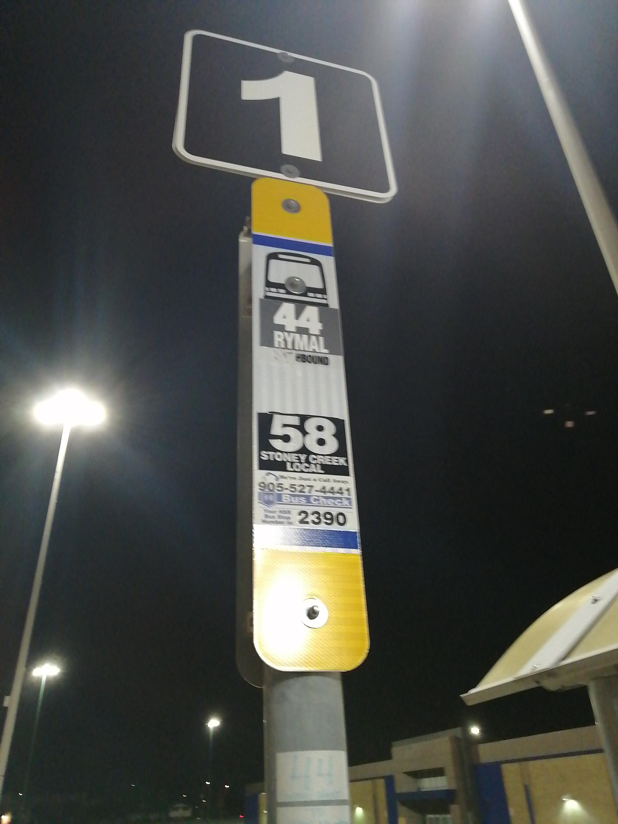 Taken by Anonymous
See Eastgate Terminal, Hamilton, on the map
Public transit to Eastgate Terminal in Hamilton
Looking for directions to Eastgate Terminal in Hamilton, Canada?
Download the Moovit App to find the current schedule and step-by-step directions for Bus or Train routes that pass through Eastgate Terminal.
Looking for the nearest stops closest to Eastgate Terminal ? Check out this list of closest stops to your destination: Queenston Opposite Eastgate Square; Queenston at Kenora; Queenston Opposite Irene; Centennial at Queenston; Confederation Go.
Bus: 01, 10, TC-300, TC-700, X-IND, 55, 44, 56.Train: LW.
We make riding on public transit to Eastgate Terminal easy, which is why over 1.7 billion users, including users in Hamilton trust Moovit as the best app for public transit.
Use the app to navigate to popular places including to the airport, hospital, stadium, grocery store, mall, coffee shop, school, college, and university.
The first line to this stop is 01, at 5:02 AM, and the last line is 44 at 4:50 AM.
This stop serves Hamilton Street Railway’s lines
Popular routes from Eastgate Terminal, Hamilton
- Queenston Opposite Eastgate Square,
- Queenston at Kenora,
- Queenston Opposite Irene,
- Centennial at Queenston
Bus stops near Eastgate Terminal
- Confederation Go
Train station near Eastgate Terminal
- Brock St. @ Dundas St.,
- Guelph at Fairview,
- Bristol Rd at Whitehorn Ave,
- Fairview St + Appleby Line,
- Dundas St at Cliff Rd,
- Goreway Dr at Derry Rd,
- Airport Rd At Thamesgate Dr,
- Islington Av / Woodbridge Av,
- Hyde Park Gate + Dundas St West,
- Erin Mills Pky at Folkway Dr,
- Major Mackenzie Dr / Warden Av,
- Highway 7 / Main St Unionville,
- Bathurst Street Ferry Terminal,
- Erin Centre Blvd West Of Erin Mills Pky,
- Hurontario St at Dundas St,
- Hwy 7 E/Of Vaughan Valley Blvd,
- Kipling Terminal Platform 3,
- Hurontario St at King St,
- Bergamot Ave At Islington Ave,
- Bayview Av / Stouffville Rd
Popular public transit stations in Hamilton
Get around Hamilton by public transit!
Traveling around Hamilton has never been so easy. See step by step directions as you travel to any attraction, street or major public transit station. View bus and train schedules, arrival times, service alerts and detailed routes on a map, so you know exactly how to get to anywhere in Hamilton.
When traveling to any destination around Hamilton use Moovit's Live Directions with Get Off Notifications to know exactly where and how far to walk, how long to wait for your line, and how many stops are left. Moovit will alert you when it's time to get off — no need to constantly re-check whether yours is the next stop.
Wondering how to use public transit in Hamilton or how to pay for public transit in Hamilton? Moovit public transit app can help you navigate your way with public transit easily, and at minimum cost. It includes public transit fees, ticket prices, and costs. Looking for a map of Hamilton public transit lines? Moovit public transit app shows all public transit maps in Hamilton with all Bus, Train, Subway, Streetcar and Ferry routes and stops on an interactive map.
Toronto has 5 transit type(s), including: Bus, Train, Subway, Streetcar and Ferry, operated by several transit agencies, including TTC, Toronto Subway, Brampton Transit, MiWay, York Region Transit, GO Transit Bus, GO Transit, Durham Region Transit, UP Express, Grand River Transit, Guelph Transit, Hamilton Street Railway, Burlington Transit, Oakville Transit and pererborough