How to get to Echod Graphics by bus?
Click on the bus route to see step by step directions with maps, line arrival times and updated time schedules.
From AAAAs, Manhattan
79 minFrom Ozone Park, Queens
78 minFrom Metropolitan Hospital, Manhattan
105 minFrom 7th Avenue, Manhattan
85 minFrom New Jersey/New York border - Lincoln Tunnel crossing, Manhattan
97 minFrom Flixbus Nyc 300 W 31st St., Manhattan
69 minFrom Ambassador Theatre, Manhattan
87 minFrom Forest Hills, Queens
85 minFrom Newport Mall Bus, Jersey City
152 min
How to get to Echod Graphics by train?
Click on the train route to see step by step directions with maps, line arrival times and updated time schedules.
How to get to Echod Graphics by subway?
Click on the subway route to see step by step directions with maps, line arrival times and updated time schedules.
From AAAAs, Manhattan
45 minFrom Ozone Park, Queens
44 minFrom Metropolitan Hospital, Manhattan
61 minFrom 7th Avenue, Manhattan
46 minFrom New Jersey/New York border - Lincoln Tunnel crossing, Manhattan
70 minFrom Flixbus Nyc 300 W 31st St., Manhattan
45 minFrom Ambassador Theatre, Manhattan
48 minFrom Forest Hills, Queens
52 min
Bus stops near Echod Graphics in New York - New Jersey
Subway station near Echod Graphics in New York - New Jersey
- Classon Av, 3 min walk,VIEW
Ferry station near Echod Graphics in New York - New Jersey
- Brooklyn Navy Yard, 11 min walk,VIEW
Bus lines to Echod Graphics in New York - New Jersey
What are the closest stations to Echod Graphics?
The closest stations to Echod Graphics are:
- Myrtle Av/Grand Av is 100 yards away, 2 min walk.
- Flushing Av/Franklin Av is 166 yards away, 3 min walk.
- Classon Av is 235 yards away, 3 min walk.
- Park Av/Ryerson St is 337 yards away, 4 min walk.
- Classon Av/Myrtle Av is 342 yards away, 5 min walk.
- Brooklyn Navy Yard is 906 yards away, 11 min walk.
Which bus lines stop near Echod Graphics?
These bus lines stop near Echod Graphics: B39, B44, B48, B54, B57, B62.
Which train line stops near Echod Graphics?
CITY TERMINAL ZONE (Atlantic Terminal)
Which subway lines stop near Echod Graphics?
These subway lines stop near Echod Graphics: G, M.
What’s the nearest subway station to Echod Graphics in New York - New Jersey?
The nearest subway station to Echod Graphics in New York - New Jersey is Classon Av. It’s a 3 min walk away.
What’s the nearest bus station to Echod Graphics in New York - New Jersey?
The nearest bus station to Echod Graphics in New York - New Jersey is Myrtle Av/Grand Av. It’s a 2 min walk away.
What’s the nearest ferry station to Echod Graphics in New York - New Jersey?
The nearest ferry station to Echod Graphics in New York - New Jersey is Brooklyn Navy Yard. It’s a 11 min walk away.
What time is the first subway to Echod Graphics in New York - New Jersey?
The G is the first subway that goes to Echod Graphics in New York - New Jersey. It stops nearby at 3:01 AM.
What time is the last subway to Echod Graphics in New York - New Jersey?
The G is the last subway that goes to Echod Graphics in New York - New Jersey. It stops nearby at 3:08 AM.
What time is the first bus to Echod Graphics in New York - New Jersey?
The B62 is the first bus that goes to Echod Graphics in New York - New Jersey. It stops nearby at 3:00 AM.
What time is the last bus to Echod Graphics in New York - New Jersey?
The B62 is the last bus that goes to Echod Graphics in New York - New Jersey. It stops nearby at 3:06 AM.
What time is the first ferry to Echod Graphics in New York - New Jersey?
The AS is the first ferry that goes to Echod Graphics in New York - New Jersey. It stops nearby at 6:34 AM.
What time is the last ferry to Echod Graphics in New York - New Jersey?
The AS is the last ferry that goes to Echod Graphics in New York - New Jersey. It stops nearby at 9:06 PM.
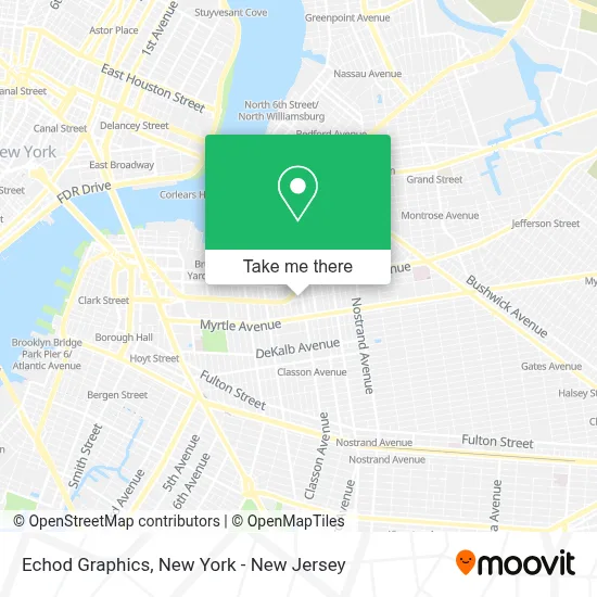
See Echod Graphics, New York - New Jersey, on the map
Public Transit to Echod Graphics in New York - New Jersey
Wondering how to get to Echod Graphics in New York - New Jersey? Moovit helps you find the best way to get to Echod Graphics with step-by-step directions from the nearest public transit station.
Moovit provides free maps and live directions to help you navigate through your city. View schedules, routes, timetables, and find out how long does it take to get to Echod Graphics in real time.
Looking for the nearest stop or station to Echod Graphics? Check out this list of stops closest to your destination: Myrtle Av/Grand Av; Flushing Av/Franklin Av; Classon Av; Park Av/Ryerson St; Classon Av/Myrtle Av; Brooklyn Navy Yard.
Bus: B39, B44, B48, B54, B57, B62.Train: CITY TERMINAL ZONE.Subway: G, M.Ferry: AS.
Want to see if there’s another route that gets you there at an earlier time? Moovit helps you find alternative routes or times. Get directions from and directions to Echod Graphics easily from the Moovit App or Website.
We make riding to Echod Graphics easy, which is why over 1.5 million users, including users in New York - New Jersey, trust Moovit as the best app for public transit. You don’t need to download an individual bus app or train app, Moovit is your all-in-one transit app that helps you find the best bus time or train time available.
For information on prices of bus, subway and train, costs and ride fares to Echod Graphics, please check the Moovit app.
Use the app to navigate to popular places including to the airport, hospital, stadium, grocery store, mall, coffee shop, school, college, and university.
Echod Graphics Address: 433 Park Ave street in New York - New Jersey
- Two Point Eight Imaging,
- M and C Kitchens,
- Brooklyn Photo Studios,
- High Quality Cuts,
- Park Ave (emerson park),
- Brooklyn Pushcart Garage & Supply,
- Bk Fit,
- Airport Shuttle Boston,
- J Tepler and Co,
- Qfs,
- High Fashion Smokes and Prints,
- D&W Design & Manufacturing,
- Steuben Playground,
- Hirschfeld & Co Cpa,
- Liberty Warehouse,
- 81 Steuben Car & Tuck,
- Diamond Support Inc,
- Aaa Gas,
- Man With A Van,
- Sunoco
Places Near Echod Graphics (New York - New Jersey)
- 66 John Street, Manhattan,
- San Gennaro Feast, Manhattan,
- 111 Centre New York City Supreme Court, Manhattan,
- Katz's Deli, Manhattan,
- Queens Center Mall, Queens,
- 376 Hudson Street, Manhattan,
- Hudson Yards, Manhattan,
- Pier 83, Manhattan,
- 26 Federal Plaza, Manhattan,
- Rockefeller Center, Manhattan,
- Chinatown, Manhattan,
- 3 Stone St, Manhattan,
- qqqq, Manhattan,
- 1 Police Plaza, Manhattan,
- SoHo, Manhattan,
- Times Square, Manhattan,
- Wall Street, Manhattan,
- 911 Memorial, Manhattan,
- Mountainside Hospital, Glen Ridge,
- Bellevue Hospital, Manhattan
How to get to popular places in New York - New Jersey with public transit
Get around New York - New Jersey by public transit!
Traveling around New York - New Jersey has never been so easy. See step by step directions as you travel to any attraction, street or major public transit station. View bus and train schedules, arrival times, service alerts and detailed routes on a map, so you know exactly how to get to anywhere in New York - New Jersey.
When traveling to any destination around New York - New Jersey use Moovit's Live Directions with Get Off Notifications to know exactly where and how far to walk, how long to wait for your line, and how many stops are left. Moovit will alert you when it's time to get off — no need to constantly re-check whether yours is the next stop.
Wondering how to use public transit in New York - New Jersey or how to pay for public transit in New York - New Jersey? Moovit public transit app can help you navigate your way with public transit easily, and at minimum cost. It includes public transit fees, ticket prices, and costs. Looking for a map of New York - New Jersey public transit lines? Moovit public transit app shows all public transit maps in New York - New Jersey with all Bus, Train, Subway, Light Rail, Ferry and Cable Car routes and stops on an interactive map.
New York - New Jersey has 6 transit type(s), including: Bus, Train, Subway, Light Rail, Ferry and Cable Car, operated by several transit agencies, including MTA Subway, Metro-North Railroad, LIRR, PATH, MTA New York City Transit - Express routes, MTA Bus, NJ Transit, NYC Ferry, NICE bus, Bee-Line Bus, NJ Transit Rail, Norwalk Transit District, Hartford Line, River Valley Transit and HART