How to get to Ecoluminas II by bus?
Click on the bus route to see step by step directions with maps, line arrival times and updated time schedules.
From El Picacho, Aguascalientes
42 minFrom Santa Imelda, Aguascalientes
50 minFrom Fracc. La Ribera, Aguascalientes
58 minFrom Ejido la Guayana, Aguascalientes
107 minFrom 14ª Zona Militar, Aguascalientes
50 minFrom Av.Federico Méndez, Aguascalientes
43 minFrom Edificio Lafayette, Aguascalientes
48 minFrom Fabrica Valle Redondo, Aguascalientes
33 minFrom Flextronics, Aguascalientes
47 minFrom San José de Gracia, Aguascalientes
53 min
Bus stops near Ecoluminas II in Aguascalientes
Bus lines to Ecoluminas II in Aguascalientes
What are the closest stations to Ecoluminas II?
The closest stations to Ecoluminas II are:
- Feliciano Martínez Cruz, 601 is 361 meters away, 5 min walk.
- Circunvalación, 107 is 558 meters away, 8 min walk.
Which bus lines stop near Ecoluminas II?
These bus lines stop near Ecoluminas II: RUTA 28, RUTA 50, RUTA 50B.
What’s the nearest bus station to Ecoluminas II in Aguascalientes?
The nearest bus station to Ecoluminas II in Aguascalientes is Feliciano Martínez Cruz, 601. It’s a 5 min walk away.
What time is the first bus to Ecoluminas II in Aguascalientes?
The RUTA 50 is the first bus that goes to Ecoluminas II in Aguascalientes. It stops nearby at 5:45 AM.
What time is the last bus to Ecoluminas II in Aguascalientes?
The RUTA 50 is the last bus that goes to Ecoluminas II in Aguascalientes. It stops nearby at 10:54 PM.
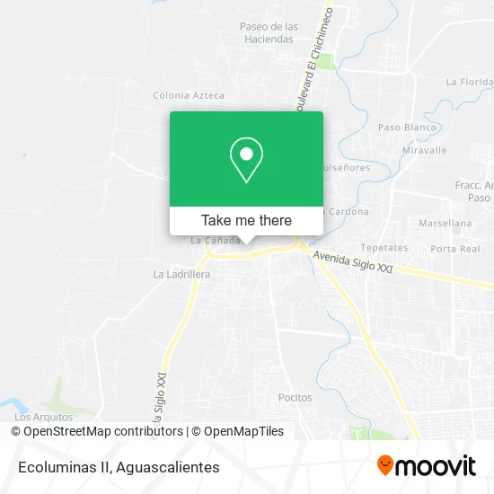
See Ecoluminas II, Aguascalientes, on the map
Public Transit to Ecoluminas II in Aguascalientes
Wondering how to get to Ecoluminas II in Aguascalientes? Moovit helps you find the best way to get to Ecoluminas II with step-by-step directions from the nearest public transit station.
Moovit provides free maps and live directions to help you navigate through your city. View schedules, routes, timetables, and find out how long does it take to get to Ecoluminas II in real time.
Looking for the nearest stop or station to Ecoluminas II? Check out this list of stops closest to your destination: Feliciano Martínez Cruz; Circunvalación.
Bus: RUTA 28, RUTA 50, RUTA 50B.
Want to see if there’s another route that gets you there at an earlier time? Moovit helps you find alternative routes or times. Get directions from and directions to Ecoluminas II easily from the Moovit App or Website.
We make riding to Ecoluminas II easy, which is why over 1.5 million users, including users in Aguascalientes, trust Moovit as the best app for public transit. You don’t need to download an individual bus app or train app, Moovit is your all-in-one transit app that helps you find the best bus time or train time available.
For information on prices of bus, costs and ride fares to Ecoluminas II, please check the Moovit app.
Use the app to navigate to popular places including to the airport, hospital, stadium, grocery store, mall, coffee shop, school, college, and university.
Ecoluminas II Address: Calle Chicahuales 311, Fraccionamiento Solidaridad, 20926 Jesús María, Aguascalientes street in Aguascalientes
- En La Feria de Jesus Maria Chicahuales,
- El Líder,
- Tienda de Abarrotes-Leona Vicario,
- Carniceria San Felipe de Jesus,
- Venta de Dulces y Materias Primas para Reposteria,
- DULCERIA LOS CHAPULINES,
- Tacos El Proa,
- Reyes del Taco Jesús María,
- Narros Burger Norte,
- Gas Imperial de Aguascalientes,
- Secundaria Tecnica, 10,
- Ruscello Agu,
- Escuela Secundaria Tecnica 10,
- Papeleria Arboledas,
- Tapiceria Lujacy,
- Abarrotes Pepe,
- Botanas Hector,
- Vinculos de Amor y Esperanza Centro de Rehabilitacion,
- Autopartes Maresa,
- Jesus Maria Agu
Places Near Ecoluminas II (Aguascalientes)
- Central De Autobuses, Aguascalientes,
- Imss Clinica 1, Aguascalientes,
- La Isla San Marcos, Aguascalientes,
- Jesús María, Aguascalientes,
- Blvd. Luis Donaldo Colosio, Aguascalientes,
- Ciudad industrial, Aguascalientes,
- Terminal De Combis, Aguascalientes,
- ESPACIOS, Aguascalientes,
- Aeropuerto de Aguascalientes S.A. de C.V., Aguascalientes,
- Universidad Autónoma de Aguascalientes, Aguascalientes,
- Centro, Aguascalientes,
- Centro Comercial Altaria, Aguascalientes,
- Villas de Nuestra Señora de la Asunción, Aguascalientes,
- Parque Las Tres Centurias, Aguascalientes,
- Nuevo Hospital Hidalgo, Aguascalientes,
- Agropecuario, Aguascalientes,
- Villasuncion, Aguascalientes,
- Isla San Marcos, Aguascalientes,
- Hospital Imss No. 3, Aguascalientes,
- clinica 3 uaa, Aguascalientes
How to get to popular places in Aguascalientes with public transit
Get around Aguascalientes by public transit!
Traveling around Aguascalientes has never been so easy. See step by step directions as you travel to any attraction, street or major public transit station. View bus and train schedules, arrival times, service alerts and detailed routes on a map, so you know exactly how to get to anywhere in Aguascalientes.
When traveling to any destination around Aguascalientes use Moovit's Live Directions with Get Off Notifications to know exactly where and how far to walk, how long to wait for your line, and how many stops are left. Moovit will alert you when it's time to get off — no need to constantly re-check whether yours is the next stop.
Wondering how to use public transit in Aguascalientes or how to pay for public transit in Aguascalientes? Moovit public transit app can help you navigate your way with public transit easily, and at minimum cost. It includes public transit fees, ticket prices, and costs. Looking for a map of Aguascalientes public transit lines? Moovit public transit app shows all public transit maps in Aguascalientes with all bus routes and stops on an interactive map.
Aguascalientes has 1 transit type(s), including: bus, operated by several transit agencies, including Coordinación General de Movilidad