Directions to Eduma (Bacacheri) with public transportation
The following transit lines have routes that pass near Eduma
How to get to Eduma by bus?
Click on the bus route to see step by step directions with maps, line arrival times and updated time schedules.
From Madalosso, Santa Felicidade
58 minFrom Rebouças, Rebouças
40 minFrom Santa Quiteria, Santa Quitéria
54 minFrom Bigorrilho, Bigorrilho
51 minFrom Rua Paulo Gorski, Mossunguê
64 minFrom Universidade Positivo, Centro
37 minFrom Estação Tubo Kennedy, Rebouças
42 minFrom Restaurante Madalosso, Santa Felicidade
57 minFrom Rua Omilio Monteiro Soares 2677, Fanny
41 minFrom Alameda Princesa Izabel, Bigorrilho
48 min
Bus stops near Eduma in Bacacheri
Bus lines to Eduma in Bacacheri
- 211 COLINA VERDE, Terminal Cabral → Colina Verde,VIEW
- B03 GUARAITUBA / ALTO DA XV (VIA MARACANÃ), Terminal Guaraituba ↺ Jardim Social / Alto da Rua XV (Circular),VIEW
- 361 AUGUSTO STRESSER, Estação Solar → Praça Santos Andrade,VIEW
- 374 HUGO LANGE, Praça Santos Andrade → Terminal Bairro Alto,VIEW
- 365 JARDIM SOCIAL / BATEL, Batel → Estação Fagundes Varela,VIEW
- 371 HIGIENÓPOLIS, Praça Santos Andrade → Terminal Bairro Alto,VIEW
What are the closest stations to Eduma?
The closest stations to Eduma are:
- R. Paulo Ildefonso Assumpção, 557 is 139 meters away, 3 min walk.
- R. Fagundes Varela, 1522 is 232 meters away, 4 min walk.
- R. Fagundes Varela, 1719 is 410 meters away, 6 min walk.
- R. Fagundes Varela, 1790 is 434 meters away, 6 min walk.
Which bus lines stop near Eduma?
These bus lines stop near Eduma: 211 COLINA VERDE, 371 HIGIENÓPOLIS, 374 HUGO LANGE.
What’s the nearest bus station to Eduma in Bacacheri?
The nearest bus station to Eduma in Bacacheri is R. Paulo Ildefonso Assumpção, 557. It’s a 3 min walk away.
What time is the first bus to Eduma in Bacacheri?
The 211 COLINA VERDE is the first bus that goes to Eduma in Bacacheri. It stops nearby at 5:42 AM.
What time is the last bus to Eduma in Bacacheri?
The 365 JARDIM SOCIAL / BATEL is the last bus that goes to Eduma in Bacacheri. It stops nearby at 12:28 AM.
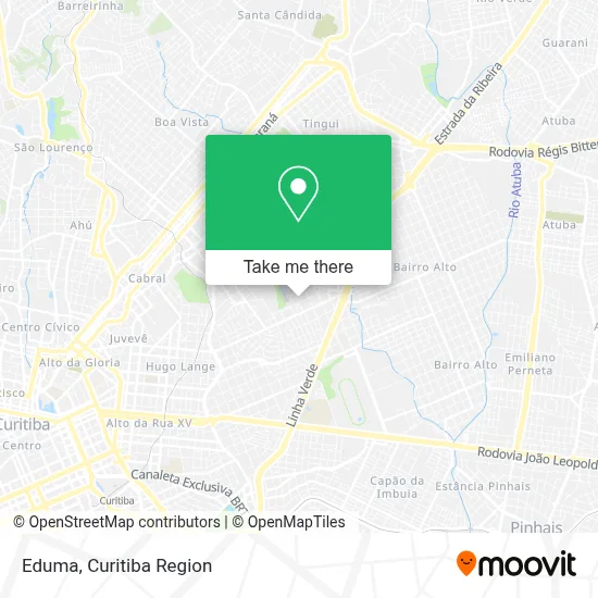
See Eduma, Bacacheri, on the map
Public Transit to Eduma in Bacacheri
Wondering how to get to Eduma in Bacacheri? Moovit helps you find the best way to get to Eduma with step-by-step directions from the nearest public transit station.
Moovit provides free maps and live directions to help you navigate through your city. View schedules, routes, timetables, and find out how long does it take to get to Eduma in real time.
Looking for the nearest stop or station to Eduma? Check out this list of stops closest to your destination: R. Paulo Ildefonso Assumpção; R. Fagundes Varela; R. Fagundes Varela; R. Fagundes Varela.
Bus: 211 COLINA VERDE, 371 HIGIENÓPOLIS, 374 HUGO LANGE, B03 GUARAITUBA / ALTO DA XV (VIA MARACANÃ), 361 AUGUSTO STRESSER, 365 JARDIM SOCIAL / BATEL.
Want to see if there’s another route that gets you there at an earlier time? Moovit helps you find alternative routes or times. Get directions from and directions to Eduma easily from the Moovit App or Website.
We make riding to Eduma easy, which is why over 1.5 million users, including users in Bacacheri, trust Moovit as the best app for public transit. You don’t need to download an individual bus app or train app, Moovit is your all-in-one transit app that helps you find the best bus time or train time available.
For information on prices of bus, costs and ride fares to Eduma, please check the Moovit app.
Use the app to navigate to popular places including to the airport, hospital, stadium, grocery store, mall, coffee shop, school, college, and university.
Eduma Address: Rua Cláudio Chatagnier, 916 Bacacheri Curitiba-PR 82520-590 street in Bacacheri
- Rua Anita Ribas 630,
- Rua Mercedes Seiler Rocha 111,
- Vitae-Clínica Veterinária,
- Escola Menino Jesus,
- La Ville Projetos e Construcoes,
- Rua Paulo Ildefonso Assumpção 707,
- Rua Fagundes Varela,
- Exito Clínica Médica e Psicológica,
- IHOC Instituto de Hemologia E Oncolocia Curitiba,
- Rua Fagundes Varela 1785,
- Boni Tattoo,
- Salão Das Meninas,
- Rua Renato Thadeo 460,
- Edificio Residencial Graciosa,
- Panificadora Bober,
- Emoldure - Molduras, Quadros e Espelhos,
- Omairi Comercio De Tapetes,
- Frutaria Natura Vita,
- Dreamland,
- Condominio Edificio Paula Suelen
Places Near Eduma (Bacacheri)
- Park Shopping Barigüi, Mossunguê,
- Jardim Botânico de Curitiba PR, Centro,
- Shopping Estação, Rebouças,
- Hospital de Clínicas (HC - UFPR), Centro,
- Pontifícia Universidade Católica do Paraná (PUCPR), Prado Velho,
- Hospital Da Cruz Vermelha, Batel,
- Hospital Madalena Sofia, Bairro Alto,
- Shopping Palladium, Portão,
- Hospital Erasto Gaertner, Jardim Das Américas,
- Jockey Plaza Shopping Center, Tarumã,
- Hhhhh, Fazendinha,
- Hospital do Rocio, Campo,
- Campo Largo, Campo,
- Rua General Mário Tourinho, Campina Do Siqueira,
- Hospital Universitário Evangélico de Curitiba, Bigorrilho,
- Hospital Angelina Caron, Campina Grande Do Sul,
- Parque Barigui, Mercês,
- Rua Martim Afonso 558, Mercês,
- Hospital Nossa Senhora Das Graças, Mercês,
- Arena Da Baixada - Curitiba
How to get to popular places in Curitiba Region with public transit
Get around Bacacheri by public transit!
Traveling around Bacacheri has never been so easy. See step by step directions as you travel to any attraction, street or major public transit station. View bus and train schedules, arrival times, service alerts and detailed routes on a map, so you know exactly how to get to anywhere in Bacacheri.
When traveling to any destination around Bacacheri use Moovit's Live Directions with Get Off Notifications to know exactly where and how far to walk, how long to wait for your line, and how many stops are left. Moovit will alert you when it's time to get off — no need to constantly re-check whether yours is the next stop.
Wondering how to use public transit in Bacacheri or how to pay for public transit in Bacacheri? Moovit public transit app can help you navigate your way with public transit easily, and at minimum cost. It includes public transit fees, ticket prices, and costs. Looking for a map of Bacacheri public transit lines? Moovit public transit app shows all public transit maps in Bacacheri with all Bus and Cable Car routes and stops on an interactive map.
Curitiba Region has 2 transit type(s), including: Bus and Cable Car, operated by several transit agencies, including Sistema Integrado de Mobilidade (URBS), Sistema Integrado de Mobilidade (AMEP), URBS (Cartões bancários e Dinheiro), URBS (Cartões bancários / Cartão URBS), AMEP (Cartões bancários / Cartão MetroCard), AMEP (Cartões bancários / Cartão MetroCard / Dinheiro), Viação Colombo (Dinheiro), TRIAR (Cartão TRIAR / Dinheiro), Empresa Curitiba Cerro Azul (Dinheiro), Expresso Nossa Senhora da Penha (Dinheiro), Empresa Campo Alto Tijucas (Dinheiro), Auto Viação São José (Cartão VEM / Dinheiro), BRT S/A (Cartão VEM / Dinheiro), TransPiedade (Cartão Cidadão / Dinheiro) and Oceânica Sul (Cartão Transporte / Dinheiro)