How to get to Ekkehard Realschule by bus?
Click on the bus route to see step by step directions with maps, line arrival times and updated time schedules.
How to get to Ekkehard Realschule by train?
Click on the train route to see step by step directions with maps, line arrival times and updated time schedules.
Bus stops near Ekkehard Realschule in Verwaltungsgemeinschaft Singen (Hohentwiel)
Train stations near Ekkehard Realschule in Verwaltungsgemeinschaft Singen (Hohentwiel)
Bus lines to Ekkehard Realschule in Verwaltungsgemeinschaft Singen (Hohentwiel)
- 1, Singen (Htw) ZOB Bstg I - Singen Max-Porzig-Straße,VIEW
- 10, Singen Friedhof - Singen (Htw) ZOB Bstg K,VIEW
- 205, Singen (Htw) ZOB Bstg A - Radolfzell ZOB,VIEW
- 300, Singen (Htw) ZOB Bstg G - Tengen Rathaus,Tengen,VIEW
- 302, Singen (Htw) ZOB Bstg G - Engen,VIEW
- 306, Schlatt u.Kr. Im Brand - Engen,VIEW
- 403, Gottmadingen Bahnhof - Gailingen Jugendwerk,VIEW
- 404, Riedheim Bergstraße - Gottmadingen Bahnhof,VIEW
- 8, Singen (Htw) Zob,VIEW
- 9, Schlatt U.Kr. Im Brand,VIEW
- 2, Singen (Htw) Zob,VIEW
- 400, Singen (Htw) Zob,VIEW
- 401, Wiechs,VIEW
- 3, Singen (Htw) ZOB Bstg E - Singen Feldbergstraße,VIEW
- 33, Singen (Htw) ZOB Bstg A - Stein am Rhein, Bahnhof,VIEW
- 4, Singen Freiburger Straße - Singen (Htw) ZOB Bstg J,VIEW
- 402, Singen (Htw) ZOB Bstg H - Worblingen Kreuzstraße,VIEW
- 5, Singen Berliner Platz - Singen (Htw) ZOB Bstg K,VIEW
- 6, Singen (Htw) ZOB Bstg E - Singen Berliner Platz,VIEW
- 7, Singen (Htw) ZOB Bstg D - Bohlingen Ledergasse,VIEW
What are the closest stations to Ekkehard Realschule?
The closest stations to Ekkehard Realschule are:
- Singen Höristraße is 382 meters away, 6 min walk.
- Singen Rathaus-Stadthalle-Schloss is 384 meters away, 6 min walk.
- Singen Ekkehardschule is 453 meters away, 6 min walk.
- Singen Heinrich-Weber-Platz is 611 meters away, 9 min walk.
- Singen (Htw) Zob is 765 meters away, 10 min walk.
- Singen-Landesgartenschau Bf is 4088 meters away, 52 min walk.
- Singen (Hohentwiel) is 4351 meters away, 56 min walk.
- Singen (Htw) Bahnhof is 4351 meters away, 56 min walk.
Which train lines stop near Ekkehard Realschule?
These train lines stop near Ekkehard Realschule: RE 3, RE 87, RE2, S6.
Which bus lines stop near Ekkehard Realschule?
These bus lines stop near Ekkehard Realschule: 400, 401.
What’s the nearest bus station to Ekkehard Realschule in Verwaltungsgemeinschaft Singen (Hohentwiel)?
The nearest bus stations to Ekkehard Realschule in Verwaltungsgemeinschaft Singen (Hohentwiel) are Singen Höristraße, Singen Rathaus-Stadthalle-Schloss and Singen Ekkehardschule. The closest one is a 6 min walk away.
What time is the first light rail to Ekkehard Realschule in Verwaltungsgemeinschaft Singen (Hohentwiel)?
The S6 is the first light rail that goes to Ekkehard Realschule in Verwaltungsgemeinschaft Singen (Hohentwiel). It stops nearby at 5:10 AM.
What time is the last light rail to Ekkehard Realschule in Verwaltungsgemeinschaft Singen (Hohentwiel)?
The S6 is the last light rail that goes to Ekkehard Realschule in Verwaltungsgemeinschaft Singen (Hohentwiel). It stops nearby at 12:52 AM.
What time is the first train to Ekkehard Realschule in Verwaltungsgemeinschaft Singen (Hohentwiel)?
The RB31 is the first train that goes to Ekkehard Realschule in Verwaltungsgemeinschaft Singen (Hohentwiel). It stops nearby at 4:11 AM.
What time is the last train to Ekkehard Realschule in Verwaltungsgemeinschaft Singen (Hohentwiel)?
The RB31 is the last train that goes to Ekkehard Realschule in Verwaltungsgemeinschaft Singen (Hohentwiel). It stops nearby at 1:31 AM.
What time is the first bus to Ekkehard Realschule in Verwaltungsgemeinschaft Singen (Hohentwiel)?
The 2 is the first bus that goes to Ekkehard Realschule in Verwaltungsgemeinschaft Singen (Hohentwiel). It stops nearby at 4:32 AM.
What time is the last bus to Ekkehard Realschule in Verwaltungsgemeinschaft Singen (Hohentwiel)?
The 400 is the last bus that goes to Ekkehard Realschule in Verwaltungsgemeinschaft Singen (Hohentwiel). It stops nearby at 1:36 AM.
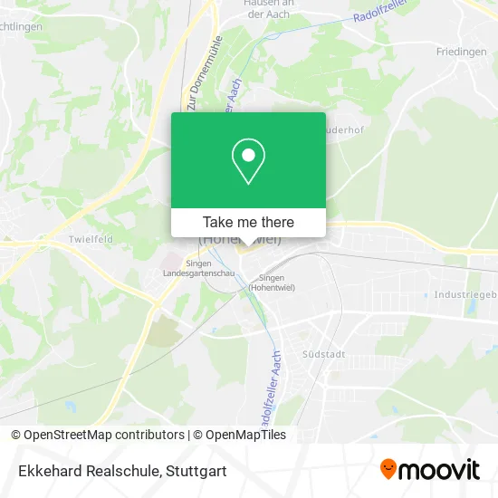
See Ekkehard Realschule, Verwaltungsgemeinschaft Singen (Hohentwiel), on the map
Public Transit to Ekkehard Realschule in Verwaltungsgemeinschaft Singen (Hohentwiel)
Wondering how to get to Ekkehard Realschule in Verwaltungsgemeinschaft Singen (Hohentwiel)? Moovit helps you find the best way to get to Ekkehard Realschule with step-by-step directions from the nearest public transit station.
Moovit provides free maps and live directions to help you navigate through your city. View schedules, routes, timetables, and find out how long does it take to get to Ekkehard Realschule in real time.
Looking for the nearest stop or station to Ekkehard Realschule? Check out this list of stops closest to your destination: Singen Höristraße; Singen Rathaus-Stadthalle-Schloss; Singen Ekkehardschule; Singen Heinrich-Weber-Platz; Singen (Htw) Zob; Singen-Landesgartenschau Bf; Singen (Hohentwiel); Singen (Htw) Bahnhof.
Train: RE 3, RE 87, RE2, S6, SVG, RE4, RE3, RE3, RE4, RE4, RE4, IC, RE 2, RE 4.Bus: 400, 401, 1, 10, 205, 300, 302, 306, 403, 404.
Want to see if there’s another route that gets you there at an earlier time? Moovit helps you find alternative routes or times. Get directions from and directions to Ekkehard Realschule easily from the Moovit App or Website.
We make riding to Ekkehard Realschule easy, which is why over 1.5 million users, including users in Verwaltungsgemeinschaft Singen (Hohentwiel), trust Moovit as the best app for public transit. You don’t need to download an individual bus app or train app, Moovit is your all-in-one transit app that helps you find the best bus time or train time available.
For information on prices of train, bus and light rail, costs and ride fares to Ekkehard Realschule, please check the Moovit app.
Use the app to navigate to popular places including to the airport, hospital, stadium, grocery store, mall, coffee shop, school, college, and university.
Ekkehard Realschule Address: Ekkehardstraße 1 78224 Singen (Hohentwiel) street in Verwaltungsgemeinschaft Singen (Hohentwiel)
- Abendrealschule Singen,
- Spd Kreis Konstanz,
- Arge Dritte Welt,
- Weltladen Weltläden,
- Stolpersteine für Singen,
- Südwestbank,
- Lichtfugenstele,
- Achatz-Müller,
- Bioenergie Region Bodensee,
- Anwaltskanzlei Dr. Bönning,
- Solarcomplex,
- Hanse-Merkur,
- Architektur + Energie,
- Nahwärme Renquishausen,
- Kunstmuseum Singen,
- Reformhaus Burchardt,
- Antalya,
- Siegfried Keller,
- Pavilion China,
- Bosporus
Places Near Ekkehard Realschule (Verwaltungsgemeinschaft Singen (Hohentwiel))
- Mercedes-Benz Museum, Bad Cannstatt,
- SI-Centrum, Möhringen,
- Hauptbahnhof Stuttgart, Stuttgart-Mitte,
- Schleyerhalle, Bad Cannstatt,
- Gasometer Pforzheim, Pforzheim,
- Hanns-Martin-Schleyer-Halle, Bad Cannstatt,
- Pariser Platz Stuttgart, Stuttgart-Mitte,
- Gleis 101/102 (tief), Stuttgart-Mitte,
- Im Wizemann (Halle), Bad Cannstatt,
- Porsche Museum, Zuffenhausen,
- Geilhaus Haus 33a, Reutlingen-Betzingen,
- Porsche-Arena, Bad Cannstatt,
- Mercedes-Benz Museum (Mercedes Museum Stuttgart), Bad Cannstatt,
- Hanns-Martin-Schleyer-Halle (Stuttgart Hans-Martin-Schleyerhalle), Bad Cannstatt,
- Marmorsaal Im Weissenburgpark, Stuttgart-Süd,
- Klinikum Stuttgart - Katharinenhospital, Stuttgart-Mitte,
- FlixBus Haltestelle, Stuttgart,
- Waldfriedhof, Degerloch,
- Mettingen Eros-Center Puff Laufhaus, Esslingen Am Neckar,
- Wilhelma (U-Bahn Wilhelma), Bad Cannstatt
How to get to popular places in Stuttgart with public transit
Get around Verwaltungsgemeinschaft Singen (Hohentwiel) by public transit!
Traveling around Verwaltungsgemeinschaft Singen (Hohentwiel) has never been so easy. See step by step directions as you travel to any attraction, street or major public transit station. View bus and train schedules, arrival times, service alerts and detailed routes on a map, so you know exactly how to get to anywhere in Verwaltungsgemeinschaft Singen (Hohentwiel).
When traveling to any destination around Verwaltungsgemeinschaft Singen (Hohentwiel) use Moovit's Live Directions with Get Off Notifications to know exactly where and how far to walk, how long to wait for your line, and how many stops are left. Moovit will alert you when it's time to get off — no need to constantly re-check whether yours is the next stop.
Wondering how to use public transit in Verwaltungsgemeinschaft Singen (Hohentwiel) or how to pay for public transit in Verwaltungsgemeinschaft Singen (Hohentwiel)? Moovit public transit app can help you navigate your way with public transit easily, and at minimum cost. It includes public transit fees, ticket prices, and costs. Looking for a map of Verwaltungsgemeinschaft Singen (Hohentwiel) public transit lines? Moovit public transit app shows all public transit maps in Verwaltungsgemeinschaft Singen (Hohentwiel) with all Bus, Train, Subway, Light Rail, Ferry, S-Bahn and Funicular routes and stops on an interactive map.
Stuttgart has 7 transit type(s), including: Bus, Train, Subway, Light Rail, Ferry, S-Bahn and Funicular, operated by several transit agencies, including SSB - Stadtbahn, SSB, SSB - Seilbahn / Zacke, S-Bahn Stuttgart, Rhein-Neckar-Verkehr GmbH (rnv), Karlsruher Verkehrsverbund, DB AG, DB Regiobus BW, Arverio Baden-Württemberg GmbH, DB RegioNetz Verkehrs GmbH Westfrankenbahn, DB Regio AG Baden-Württemberg, Südwestdeutsche Verkehrs-AG, DB Regio AG Mitte Region Hessen, DB and Bodensee-Oberschwaben-Bahn