How to get to El Agostaderito by bus?
Click on the bus route to see step by step directions with maps, line arrival times and updated time schedules.
From Sam's Club, Aguascalientes
47 minFrom Fracc. Campestre La Herradura, Aguascalientes
71 minFrom Fraccionamiento Viña Antigua, Aguascalientes
43 minFrom Soriana, Aguascalientes
26 minFrom Fracc. Fuentes del Lago, Aguascalientes
51 minFrom Fraccionamiento Los Ángeles, Aguascalientes
44 minFrom Parque Industrial Valle de Aguascalientes (PIVA), Aguascalientes
47 minFrom Colosio y Prol. Zaragoza, Aguascalientes
62 minFrom Minth de México, Aguascalientes
65 minFrom El Dorado, Aguascalientes
45 min
Bus stops near El Agostaderito in Aguascalientes
Bus lines to El Agostaderito in Aguascalientes
What are the closest stations to El Agostaderito?
The closest stations to El Agostaderito are:
- San Francisco De Los Viveros, Lb is 109 meters away, 2 min walk.
- Avenida Siglo Xxi, 314 is 233 meters away, 4 min walk.
- San Francisco De Los Viveros, 1102 is 328 meters away, 5 min walk.
- El Novillo is 333 meters away, 5 min walk.
Which bus lines stop near El Agostaderito?
These bus lines stop near El Agostaderito: RUTA 25, RUTA 35, RUTA 39, RUTA 41, RUTA 50.
What’s the nearest bus station to El Agostaderito in Aguascalientes?
The nearest bus station to El Agostaderito in Aguascalientes is San Francisco De Los Viveros, Lb. It’s a 2 min walk away.
What time is the first bus to El Agostaderito in Aguascalientes?
The RUTA 41 is the first bus that goes to El Agostaderito in Aguascalientes. It stops nearby at 5:46 AM.
What time is the last bus to El Agostaderito in Aguascalientes?
The RUTA 45 is the last bus that goes to El Agostaderito in Aguascalientes. It stops nearby at 10:35 PM.
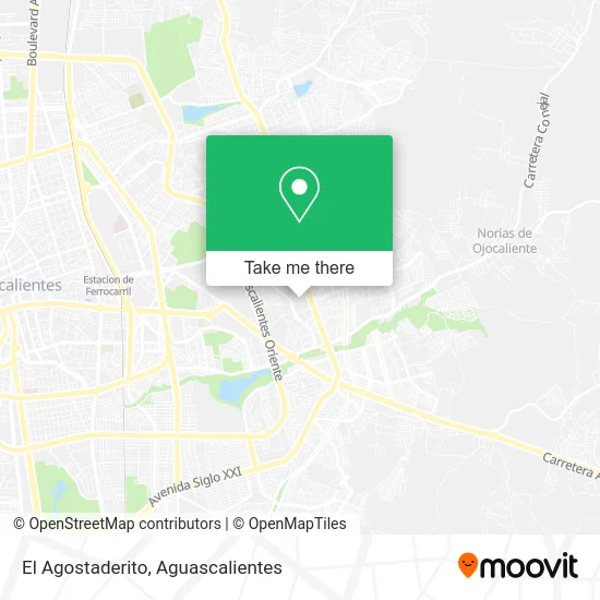
See El Agostaderito, Aguascalientes, on the map
Public Transit to El Agostaderito in Aguascalientes
Wondering how to get to El Agostaderito in Aguascalientes? Moovit helps you find the best way to get to El Agostaderito with step-by-step directions from the nearest public transit station.
Moovit provides free maps and live directions to help you navigate through your city. View schedules, routes, timetables, and find out how long does it take to get to El Agostaderito in real time.
Looking for the nearest stop or station to El Agostaderito? Check out this list of stops closest to your destination: San Francisco De Los Viveros; Avenida Siglo Xxi; San Francisco De Los Viveros; El Novillo.
Bus: RUTA 25, RUTA 35, RUTA 39, RUTA 41, RUTA 50, RUTA 24, RUTA 42, RUTA 45, RUTA 19.
Want to see if there’s another route that gets you there at an earlier time? Moovit helps you find alternative routes or times. Get directions from and directions to El Agostaderito easily from the Moovit App or Website.
We make riding to El Agostaderito easy, which is why over 1.5 million users, including users in Aguascalientes, trust Moovit as the best app for public transit. You don’t need to download an individual bus app or train app, Moovit is your all-in-one transit app that helps you find the best bus time or train time available.
For information on prices of bus, costs and ride fares to El Agostaderito, please check the Moovit app.
Use the app to navigate to popular places including to the airport, hospital, stadium, grocery store, mall, coffee shop, school, college, and university.
El Agostaderito Address: El Agostaderito, Aguascalientes, Ags., México street in Aguascalientes
- Avenida Ojocaliente & Los Conos,
- Autobuses de la Piedad,
- Cañada Honda 201,
- Secundaria Tecnica, 33,
- Fraccionamiento Ojocaliente 3,
- Aka Las Tortas,
- salón del maestro jubilado,
- Los Conos Agu,
- Heladeria Helito,
- Policía Federal Destacamento Aguascalientes,
- C4 Estatal,
- IESPA Academia De Policia,
- Bazar Americano,
- IMSS Hospital General de Zona No 2,
- Instituto Estatal De Seguridad Publica De Aguascalientes,
- Tianguis Ojocaliente I,
- Centro de Estudios de Bachillerato Aguascalientes,
- Página Oficial Ceb Aguascalientes 6 / 1,
- El Taray,
- Carretera Aguascalientes Loreto Km 1.9
Places Near El Agostaderito (Aguascalientes)
- Isla San Marcos, Aguascalientes,
- Blvd. Luis Donaldo Colosio, Aguascalientes,
- Central De Autobuses, Aguascalientes,
- Imss Clinica 1, Aguascalientes,
- Nuevo Hospital Hidalgo, Aguascalientes,
- Ciudad industrial, Aguascalientes,
- Aeropuerto de Aguascalientes S.A. de C.V., Aguascalientes,
- Universidad Autónoma de Aguascalientes, Aguascalientes,
- Centro, Aguascalientes,
- ESPACIOS, Aguascalientes,
- Agropecuario, Aguascalientes,
- Villasuncion, Aguascalientes,
- Centro Comercial Altaria, Aguascalientes,
- Jesús María, Aguascalientes,
- Parque Las Tres Centurias, Aguascalientes,
- La Isla San Marcos, Aguascalientes,
- Terminal De Combis, Aguascalientes,
- Hospital Imss No. 3, Aguascalientes,
- clinica 3 uaa, Aguascalientes,
- Villas de Nuestra Señora de la Asunción, Aguascalientes
How to get to popular places in Aguascalientes with public transit
Get around Aguascalientes by public transit!
Traveling around Aguascalientes has never been so easy. See step by step directions as you travel to any attraction, street or major public transit station. View bus and train schedules, arrival times, service alerts and detailed routes on a map, so you know exactly how to get to anywhere in Aguascalientes.
When traveling to any destination around Aguascalientes use Moovit's Live Directions with Get Off Notifications to know exactly where and how far to walk, how long to wait for your line, and how many stops are left. Moovit will alert you when it's time to get off — no need to constantly re-check whether yours is the next stop.
Wondering how to use public transit in Aguascalientes or how to pay for public transit in Aguascalientes? Moovit public transit app can help you navigate your way with public transit easily, and at minimum cost. It includes public transit fees, ticket prices, and costs. Looking for a map of Aguascalientes public transit lines? Moovit public transit app shows all public transit maps in Aguascalientes with all bus routes and stops on an interactive map.
Aguascalientes has 1 transit type(s), including: bus, operated by several transit agencies, including Coordinación General de Movilidad