How to get to El Baraton by bus?
Click on the bus route to see step by step directions with maps, line arrival times and updated time schedules.
From Target (Target Store Dadeland), Miami
79 minFrom Camillus House, Miami
56 minFrom Slam Academy, Miami
29 minFrom 120 Beach max omni Bus terminal, Miami
51 minFrom Port Of Miami - Carnival Cruise, Miami
76 minFrom Puerto de Miami, Miami
67 minFrom West Little River, Miami
69 minFrom Port of Miami, Miami
78 minFrom 73 W. Flagler Street, Miami
56 minFrom BrandsMart USA, Kendall-Palmetto Bay
75 min
Bus stops near El Baraton in Miami
Light Rail stations near El Baraton in Miami
- Mia@Lower Level Ramp, 55 min walk,VIEW
Bus lines to El Baraton in Miami
What are the closest stations to El Baraton?
The closest stations to El Baraton are:
- Nw 47th Ave @ W Flagler St is 143 yards away, 2 min walk.
- W Flagler St & Nw 47 Av is 150 yards away, 2 min walk.
- Mia@Lower Level Ramp is 4672 yards away, 55 min walk.
Which bus lines stop near El Baraton?
These bus lines stop near El Baraton: 11, 211.
What’s the nearest bus station to El Baraton in Miami?
The nearest bus stations to El Baraton in Miami are Nw 47th Ave @ W Flagler St and W Flagler St & Nw 47 Av. The closest one is a 2 min walk away.
What time is the first light rail to El Baraton in Miami?
The MIA is the first light rail that goes to El Baraton in Miami. It stops nearby at 3:03 AM.
What time is the last light rail to El Baraton in Miami?
The MIA is the last light rail that goes to El Baraton in Miami. It stops nearby at 2:59 AM.
What time is the first bus to El Baraton in Miami?
The 11 is the first bus that goes to El Baraton in Miami. It stops nearby at 3:19 AM.
What time is the last bus to El Baraton in Miami?
The 11 is the last bus that goes to El Baraton in Miami. It stops nearby at 2:28 AM.
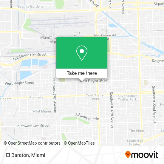
See El Baraton, Miami, on the map
Public Transit to El Baraton in Miami
Wondering how to get to El Baraton in Miami? Moovit helps you find the best way to get to El Baraton with step-by-step directions from the nearest public transit station.
Moovit provides free maps and live directions to help you navigate through your city. View schedules, routes, timetables, and find out how long does it take to get to El Baraton in real time.
Looking for the nearest stop or station to El Baraton? Check out this list of stops closest to your destination: Nw 47th Ave @ W Flagler St; W Flagler St & Nw 47 Av; Mia@Lower Level Ramp.
Bus: 11, 211, MIAFLAG.
Want to see if there’s another route that gets you there at an earlier time? Moovit helps you find alternative routes or times. Get directions from and directions to El Baraton easily from the Moovit App or Website.
We make riding to El Baraton easy, which is why over 1.5 million users, including users in Miami, trust Moovit as the best app for public transit. You don’t need to download an individual bus app or train app, Moovit is your all-in-one transit app that helps you find the best bus time or train time available.
For information on prices of bus, train and light rail, costs and ride fares to El Baraton, please check the Moovit app.
Use the app to navigate to popular places including to the airport, hospital, stadium, grocery store, mall, coffee shop, school, college, and university.
El Baraton Address: 4746 W Flagler St Miami, FL 33134 street in Miami
- Everette Adrian,
- El Palomar,
- Sciatica Stop Chiropractor,
- Cubazul Air Charter,
- Eg 2 Coin Laundry,
- New Queen Beauty Salon,
- 4777 W Flagler St Parking,
- Air Conditioning Service 24 7,
- Estrella Medical Centers (Flagler),
- West Flagler Street & West 47th Avenue,
- 4743 NW Flagler ter Parking,
- NW 47th Ave / NW Flagler Ter,
- Alpha Foundations,
- 4800 W Flagler St Garage,
- Pizza Onne II,
- Goldentrust Insurance,
- Coral Therapie,
- Accounting Express Enterprises,
- Flagler Smoke Shop,
- Sunshine Inn Hotel
Places Near El Baraton (Miami)
- Wynwood, Miami,
- Sawgrass mall ( FL ), Miami Beach,
- Miami-Dade County Courthouse, Miami,
- Sawgrass Mall, Miami,
- Keiser University Flagship Campus, West Palm Beach,
- Marlins Park, Miami,
- Bayside Marketplace, Miami,
- Aventura Mall, Miami Beach,
- Zoo Miami, Miami,
- Miami Design District, Miami,
- Hard Rock Stadium, Miami Gardens,
- Miami Freedom Park, Miami,
- Dolphin Mall Bus, Miami,
- Little Havana, Miami,
- Aventura Mall, Miami,
- Miami VA Hospital, Miami,
- Brickell City Centre, Miami,
- Dolphin Mall, Miami,
- Richard E. Gerstein Justice Building, Miami,
- Port of Miami Cruise Terminal, Miami
How to get to popular places in Miami with public transit
Get around Miami by public transit!
Traveling around Miami has never been so easy. See step by step directions as you travel to any attraction, street or major public transit station. View bus and train schedules, arrival times, service alerts and detailed routes on a map, so you know exactly how to get to anywhere in Miami.
When traveling to any destination around Miami use Moovit's Live Directions with Get Off Notifications to know exactly where and how far to walk, how long to wait for your line, and how many stops are left. Moovit will alert you when it's time to get off — no need to constantly re-check whether yours is the next stop.
Wondering how to use public transit in Miami or how to pay for public transit in Miami? Moovit public transit app can help you navigate your way with public transit easily, and at minimum cost. It includes public transit fees, ticket prices, and costs. Looking for a map of Miami public transit lines? Moovit public transit app shows all public transit maps in Miami with all Bus, Train, Light Rail and Ferry routes and stops on an interactive map.
Miami has 4 transit type(s), including: Bus, Train, Light Rail and Ferry, operated by several transit agencies, including Broward County Transit, Miami-Dade Transit, Metrorail, Palm Tran, Tri-Rail, Brightline, MARTY, City of Homestead Trolley, Key West Transit, Treasure Coast Connector, GoLine IRT, Amtrak, Greyhound-us, FlixBus-us and Aventura Express Shuttle Bus