How to get to El Cholo by Colectivo?
Click on the Colectivo route to see step by step directions with maps, line arrival times and updated time schedules.
From Hospital Evita, Lanús
64 minFrom Agaces 162, Distrito Federal
35 minFrom Cancha de Velez Sarsfield, Distrito Federal
31 minFrom Colonia Express (Turismo-Agencias-Colonia Express), Distrito Federal
49 minFrom Hospital Italiano, Distrito Federal
37 minFrom Estadio Monumental (River Plate), Distrito Federal
67 minFrom Servicio Penitenciario Bonaerense Unidad 30, General San Martín
69 minFrom Parque Lezama, Distrito Federal
54 minFrom Av. Belgrano y Av. Entre Ríos, Distrito Federal
42 minFrom Av. Triunvirato y Monroe, Distrito Federal
44 min
How to get to El Cholo by train?
Click on the train route to see step by step directions with maps, line arrival times and updated time schedules.
How to get to El Cholo by Subte?
Click on the Subte route to see step by step directions with maps, line arrival times and updated time schedules.
From Agaces 162, Distrito Federal
53 minFrom Cancha de Velez Sarsfield, Distrito Federal
38 minFrom Colonia Express (Turismo-Agencias-Colonia Express), Distrito Federal
51 minFrom Hospital Italiano, Distrito Federal
38 minFrom Estadio Monumental (River Plate), Distrito Federal
95 minFrom Parque Lezama, Distrito Federal
68 minFrom Av. Belgrano y Av. Entre Ríos, Distrito Federal
41 minFrom Av. Triunvirato y Monroe, Distrito Federal
65 min
Colectivo stops near El Cholo in Distrito Federal
- Estación Floresta (136), 1 min walk,VIEW
- Avenida Rivadavia Y Baradero (63), 2 min walk,VIEW
- Estación Floresta (1 - 88), 2 min walk,VIEW
- Avenida Rivadavia Y Lamarca (49 - 88), 2 min walk,VIEW
- Avenida Rivadavia Y Dolores (49 - 85), 2 min walk,VIEW
- Avenida Rivadavia Y Lamarca (85 - 92), 2 min walk,VIEW
- Estación Floresta (8 - 96), 3 min walk,VIEW
- Avenida Rivadavia Y Lamarca (113), 3 min walk,VIEW
- Estación Floresta (1 - 2 - 92), 3 min walk,VIEW
Train station near El Cholo in Distrito Federal
- Flores, 17 min walk,VIEW
Subte stations near El Cholo in Distrito Federal
Colectivo lines to El Cholo in Distrito Federal
- 136, B: Primera Junta,VIEW
- 63, A: Barrancas De Belgrano X Riglos,VIEW
- 1, B: Estación Morón,VIEW
- 88, A: Cañuelas x Rivadavia,VIEW
- 49, Km. 27 x Peribebuy,VIEW
- 85, C: Ciudadela Norte,VIEW
- 92, C: Gral. Paz y Perón,VIEW
- 8, Liniers - Hospital Argerich (X Av. Rivadavia),VIEW
- 96, B: Castillo x Atalaya,VIEW
- 113, A: San Justo x Gavilán,VIEW
- 2, A: Aduana,VIEW
What are the closest stations to El Cholo?
The closest stations to El Cholo are:
- Estación Floresta (136) is 46 meters away, 1 min walk.
- Avenida Rivadavia Y Baradero (63) is 79 meters away, 2 min walk.
- Estación Floresta (1 - 88) is 118 meters away, 2 min walk.
- Avenida Rivadavia Y Lamarca (49 - 88) is 124 meters away, 2 min walk.
- Avenida Rivadavia Y Dolores (49 - 85) is 137 meters away, 2 min walk.
- Avenida Rivadavia Y Lamarca (85 - 92) is 137 meters away, 2 min walk.
- Estación Floresta (8 - 96) is 160 meters away, 3 min walk.
- Avenida Rivadavia Y Lamarca (113) is 162 meters away, 3 min walk.
- Estación Floresta (1 - 2 - 92) is 207 meters away, 3 min walk.
- Flores is 1336 meters away, 17 min walk.
- San Jose De Flores is 1447 meters away, 19 min walk.
- Plaza De Los Virreyes is 2442 meters away, 31 min walk.
Which Colectivo lines stop near El Cholo?
These Colectivo lines stop near El Cholo: 113, 114, 2, 63, 8, 85, 92, 96.
Which train line stops near El Cholo?
SARMIENTO (Once→Moreno)
Which Subte line stops near El Cholo?
A (Plaza De Mayo→San Pedrito)
What’s the nearest Subte station to El Cholo in Distrito Federal?
The nearest Subte station to El Cholo in Distrito Federal is San Jose De Flores. It’s a 19 min walk away.
What’s the nearest train station to El Cholo in Distrito Federal?
The nearest train station to El Cholo in Distrito Federal is Flores. It’s a 17 min walk away.
What’s the nearest Colectivo station to El Cholo in Distrito Federal?
The nearest Colectivo station to El Cholo in Distrito Federal is Estación Floresta (136). It’s a 1 min walk away.
What time is the first Subte to El Cholo in Distrito Federal?
The A is the first Subte that goes to El Cholo in Distrito Federal. It stops nearby at 5:30 AM.
What time is the last Subte to El Cholo in Distrito Federal?
The E is the last Subte that goes to El Cholo in Distrito Federal. It stops nearby at 11:19 PM.
What time is the first train to El Cholo in Distrito Federal?
The SARMIENTO is the first train that goes to El Cholo in Distrito Federal. It stops nearby at 3:39 AM.
What time is the last train to El Cholo in Distrito Federal?
The SARMIENTO is the last train that goes to El Cholo in Distrito Federal. It stops nearby at 3:43 AM.
What time is the first Colectivo to El Cholo in Distrito Federal?
The 8 is the first Colectivo that goes to El Cholo in Distrito Federal. It stops nearby at 3:02 AM.
What time is the last Colectivo to El Cholo in Distrito Federal?
The 96 is the last Colectivo that goes to El Cholo in Distrito Federal. It stops nearby at 4:40 AM.
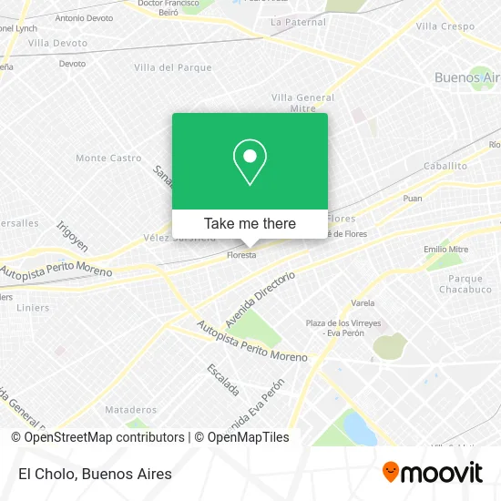
See El Cholo, Distrito Federal, on the map
Public Transit to El Cholo in Distrito Federal
Wondering how to get to El Cholo in Distrito Federal? Moovit helps you find the best way to get to El Cholo with step-by-step directions from the nearest public transit station.
Moovit provides free maps and live directions to help you navigate through your city. View schedules, routes, timetables, and find out how long does it take to get to El Cholo in real time.
Looking for the nearest stop or station to El Cholo? Check out this list of stops closest to your destination: Estación Floresta (136); Avenida Rivadavia Y Baradero (63); Estación Floresta (1 - 88); Avenida Rivadavia Y Lamarca (49 - 88); Avenida Rivadavia Y Dolores (49 - 85); Avenida Rivadavia Y Lamarca (85 - 92); Estación Floresta (8 - 96); Avenida Rivadavia Y Lamarca (113); Estación Floresta (1 - 2 - 92); Flores; San Jose De Flores; Plaza De Los Virreyes.
Colectivo: 113, 114, 2, 63, 8, 85, 92, 96, 136, 1, 88.Train: SARMIENTO.Subte: A, E.
Want to see if there’s another route that gets you there at an earlier time? Moovit helps you find alternative routes or times. Get directions from and directions to El Cholo easily from the Moovit App or Website.
We make riding to El Cholo easy, which is why over 1.5 million users, including users in Distrito Federal, trust Moovit as the best app for public transit. You don’t need to download an individual bus app or train app, Moovit is your all-in-one transit app that helps you find the best bus time or train time available.
For information on prices of Colectivo, train and Subte, costs and ride fares to El Cholo, please check the Moovit app.
Use the app to navigate to popular places including to the airport, hospital, stadium, grocery store, mall, coffee shop, school, college, and university.
El Cholo Address: Avenida Rivadavia street in Distrito Federal
- Rivadavia-Ensenada,
- Joaquín V. González / Avenida Rivadavia,
- AVENIDA RIVADAVIA 8242 PISO 10 C,
- RIVADAVIA 8242,
- El Tropezon-Resto Bar,
- Pmcventas,
- Bahía Blanca / Avenida Rivadavia,
- Candelaria / Avenida Rivadavia,
- Bahía Blanca,
- Avenida Rivadavia & Bahía Blanca,
- Yerbal 3700,
- Rivadavia - Candelaria,
- Amodil Revendedora,
- Baradero / Avenida Rivadavia,
- San Nicolás / Avenida Rivadavia,
- Baradero / San Nicolás,
- Yerbal-Joaquín V. González,
- Peluquerias-Siluya Peluquera a Domicilio,
- Farmacia Hudson,
- Hudson
Places Near El Cholo (Distrito Federal)
- La Plata, La Plata,
- Jardín Japonés, Distrito Federal,
- CABA, Distrito Federal,
- Barrio Chino, Distrito Federal,
- Flores, Distrito Federal,
- Hospital Santa Lucia, Distrito Federal,
- Abasto Shopping, Distrito Federal,
- Aeroparque Jorge Newbery,
- Facultad de Odontología (UBA), Distrito Federal,
- La Plata, La Plata,
- Parque de la Ciudad, Distrito Federal,
- Movistar Arena, Distrito Federal,
- Aeropuerto Ezeiza, Distrito Federal,
- Tecnópolis, Vicente López,
- Unicenter Shopping, San Isidro,
- Once, Distrito Federal,
- Estadio Monumental (River Plate), Distrito Federal,
- Avellaneda, Avellaneda,
- Buenos Aires, Distrito Federal,
- Dot Baires Shopping, Vicente López
How to get to popular places in Buenos Aires with public transit
Get around Distrito Federal by public transit!
Traveling around Distrito Federal has never been so easy. See step by step directions as you travel to any attraction, street or major public transit station. View bus and train schedules, arrival times, service alerts and detailed routes on a map, so you know exactly how to get to anywhere in Distrito Federal.
When traveling to any destination around Distrito Federal use Moovit's Live Directions with Get Off Notifications to know exactly where and how far to walk, how long to wait for your line, and how many stops are left. Moovit will alert you when it's time to get off — no need to constantly re-check whether yours is the next stop.
Wondering how to use public transit in Distrito Federal or how to pay for public transit in Distrito Federal? Moovit public transit app can help you navigate your way with public transit easily, and at minimum cost. It includes public transit fees, ticket prices, and costs. Looking for a map of Distrito Federal public transit lines? Moovit public transit app shows all public transit maps in Distrito Federal with all Colectivo, Train, Subte, Light Rail and Ferry routes and stops on an interactive map.
Buenos Aires has 5 transit type(s), including: Colectivo, Train, Subte, Light Rail and Ferry, operated by several transit agencies, including Municipalidad Carmen de Areco, Trenes Argentinos, Ferrovías, Metrovías, Subte de Buenos Aires, Doscientos Ocho Transporte Automotor S.A., Empresa del Oeste, Empresa de Transportes Tratado del PIlar S.R.L., Transportes Veintidos de Septiembre, Sargento Cabral, Transportes Sesenta y Ocho, Transportes Quirno Costa, Transportes Santa Fe, Transportes Automotores Riachuelo and Transportes Atlantida