How to get to El Churrero de El Molar by bus?
Click on the bus route to see step by step directions with maps, line arrival times and updated time schedules.
From Micropolix
38 minFrom Hospital Infanta Sofía.
39 minFrom San Sebastián De Los Reyes the Style Outlets
36 minFrom Autovía A-1 (Madrid-Burgos) km 24
29 minFrom Antena 3 Televisión
43 minFrom Tanatorio La Paz
99 minFrom Centro Comercial Alegra
38 minFrom Centro Penitenciario Madrid V - Soto Del Real
137 minFrom The Style Outlets
37 minFrom Outlet Factory
38 min
Bus stops near El Churrero de El Molar
Bus lines to El Churrero de El Molar
- VAC-242, 1 Madrid (Avda. De América) (Por Pueblos),VIEW
- 191, Madrid (Plaza de Castilla) - Buitrago,VIEW
- 193, Madrid (Plaza de Castilla) - Pedrezuela - El Vellón,VIEW
- 194, Madrid (Plaza de Castilla) - Rascafria,VIEW
- 195, Madrid (Plaza de Castilla) - Braojos,VIEW
- 196, Madrid (Plaza de Castilla) - La Acebeda,VIEW
- N104, Madrid (Plaza de Castilla) - El Molar,VIEW
- VAC-242, Madrid - Aranda de Duero - El Burgo de Osma,VIEW
- 193A, Venturada - Ctra. Irún,VIEW
- 197D, C.º Soledad - Av. Madrid,VIEW
What are the closest stations to El Churrero de El Molar?
The closest stations to El Churrero de El Molar are:
- Ctra. A-1a - El Molar is 276 meters away, 4 min walk.
- Pza. Mayor - Ayuntamiento is 457 meters away, 6 min walk.
- Pza. Mayor - Fuente is 473 meters away, 7 min walk.
Which bus lines stop near El Churrero de El Molar?
These bus lines stop near El Churrero de El Molar: 191, 193, 196.
What’s the nearest bus station to El Churrero de El Molar?
The nearest bus station to El Churrero de El Molar is Ctra. A-1a - El Molar. It’s a 4 min walk away.
What time is the first bus to El Churrero de El Molar?
The N104 is the first bus that goes to El Churrero de El Molar. It stops nearby at 3:05 AM.
What time is the last bus to El Churrero de El Molar?
The N104 is the last bus that goes to El Churrero de El Molar. It stops nearby at 3:10 AM.
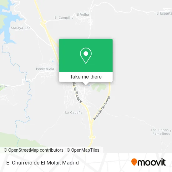
See El Churrero de El Molar on the map
Public Transportation to El Churrero de El Molar
Wondering how to get to El Churrero de El Molar? Moovit helps you find the best way to get to El Churrero de El Molar with step-by-step directions from the nearest public transit station.
Moovit provides free maps and live directions to help you navigate through your city. View schedules, routes, timetables, and find out how long does it take to get to El Churrero de El Molar in real time.
Looking for the nearest stop or station to El Churrero de El Molar? Check out this list of stops closest to your destination: Ctra. A-1a - El Molar; Pza. Mayor - Ayuntamiento; Pza. Mayor - Fuente.
Bus: 191, 193, 196, VAC-242, 194, 195, 193A, 197D.
Want to see if there’s another route that gets you there at an earlier time? Moovit helps you find alternative routes or times. Get directions from and directions to El Churrero de El Molar easily from the Moovit App or Website.
We make riding to El Churrero de El Molar easy, which is why over 1.5 million users, including users in El Molar, trust Moovit as the best app for public transit. You don’t need to download an individual bus app or train app, Moovit is your all-in-one transit app that helps you find the best bus time or train time available.
For information on prices of bus, costs and ride fares to El Churrero de El Molar, please check the Moovit app.
Use the app to navigate to popular places including to the airport, hospital, stadium, grocery store, mall, coffee shop, school, college, and university.
El Churrero de El Molar Address: Calle San Isidro, 28710 El Molar street in El Molar
- Polideportivo Municipal El Molar,
- Polideportivo El Molar,
- Lidersport,
- Avenida de la Constitución s/n,
- Escuela de Educación Infantil Santa Cecilia,
- Complejo Deportivo Mol,
- Colegio Nacional Comarcal Nuestra Señora del Remolino,
- C.D. Molar Sport,
- Rufino Morales,
- Summa112 - Cue El Molar.,
- Sanmano 2007,
- Centro de Educación de Personas Adultas,
- Tahona Luis González,
- Bus Leader,
- Molar Gym,
- Calle Fuente del Toro, 6,
- Huerta y Jardín,
- Arkeidia,
- Cristalbox El Molar,
- la boca del lobo
Places Near El Churrero de El Molar
- Mercadillo de Majadahonda, Majadahonda,
- Nassica, Área Metropolitana De Madrid Y Corredor Del Henares,
- Centro Comercial Islazul, Área Metropolitana De Madrid Y Corredor Del Henares,
- Hospital Clínico Universitario San Carlos, Madrid,
- Hospital Universitario Ramón y Cajal, Madrid,
- Plenilunio, Área Metropolitana De Madrid Y Corredor Del Henares,
- Wizink Center, Madrid,
- Mendez Alvaro, Madrid,
- Centro Comercial Oasiz Madrid, Área Metropolitana De Madrid Y Corredor Del Henares,
- Calle de López de Hoyos 169, Madrid,
- Palacio De Vistalegre, Área Metropolitana De Madrid Y Corredor Del Henares,
- Centro Comercial La Vaguada, Área Metropolitana De Madrid Y Corredor Del Henares,
- Estacion de Chamartin, Madrid,
- Sala La Riviera, Madrid,
- Tres Aguas, Alcorcón,
- Rastro De Madrid, Área Metropolitana De Madrid Y Corredor Del Henares,
- Centro Comercial La Gavia, Área Metropolitana De Madrid Y Corredor Del Henares,
- Estadio Wanda Metropolitano, Área Metropolitana De Madrid Y Corredor Del Henares,
- Hospital Universitario La Paz, Madrid,
- Plaza Mayor, Madrid
How to get to popular places in Madrid with public transit
Get around El Molar by public transit!
Traveling around El Molar has never been so easy. See step by step directions as you travel to any attraction, street or major public transit station. View bus and train schedules, arrival times, service alerts and detailed routes on a map, so you know exactly how to get to anywhere in El Molar.
When traveling to any destination around El Molar use Moovit's Live Directions with Get Off Notifications to know exactly where and how far to walk, how long to wait for your line, and how many stops are left. Moovit will alert you when it's time to get off — no need to constantly re-check whether yours is the next stop.
Wondering how to use public transit in El Molar or how to pay for public transit in El Molar? Moovit public transit app can help you navigate your way with public transit easily, and at minimum cost. It includes public transit fees, ticket prices, and costs. Looking for a map of El Molar public transit lines? Moovit public transit app shows all public transit maps in El Molar with all Bus, Train, Metro and Light Rail routes and stops on an interactive map.
Madrid has 4 transit type(s), including: Bus, Train, Metro and Light Rail, operated by several transit agencies, including Metro de Madrid, Metro Ligero, Tranvía de Parla, Renfe Cercanías - Servicios de Autobús especiales, Renfe Cercanias, Renfe Cercanías, EMT, Interurbanos, Urbanos de Alcalá de Henares, Urbanos de Alcobendas, Urbanos de Alcorcón, Urbanos de Algete, Urbanos de Aranjuez, Urbanos de Arganda del Rey and Urbanos de Arroyomolinos