How to get to El Duende by bus?
Click on the bus route to see step by step directions with maps, line arrival times and updated time schedules.
From Calle Maldonado, Madrid
76 minFrom Hospital HM Universitario Madrid, Madrid
64 minFrom Plaza Conde Valle Suchil, Madrid
64 minFrom Goya, Área Metropolitana De Madrid Y Corredor Del Henares
78 minFrom Palacio Vistalegre, Madrid
78 minFrom Calle Sancho Dávila, Madrid
69 minFrom Avenida Felipe II S/N, Madrid
64 minFrom Sector 3 - Getafe, Getafe
96 minFrom The Style Outlets Getafe, Getafe
55 minFrom Calle De Ferraz, Madrid
70 min
How to get to El Duende by train?
Click on the train route to see step by step directions with maps, line arrival times and updated time schedules.
From Calle Maldonado, Madrid
67 minFrom Hospital HM Universitario Madrid, Madrid
61 minFrom Plaza Conde Valle Suchil, Madrid
61 minFrom Goya, Área Metropolitana De Madrid Y Corredor Del Henares
57 minFrom Palacio Vistalegre, Madrid
67 minFrom Avenida Felipe II S/N, Madrid
60 minFrom Sector 3 - Getafe, Getafe
48 minFrom Calle De Ferraz, Madrid
60 min
How to get to El Duende by metro?
Click on the metro route to see step by step directions with maps, line arrival times and updated time schedules.
From Calle Maldonado, Madrid
61 minFrom Hospital HM Universitario Madrid, Madrid
67 minFrom Plaza Conde Valle Suchil, Madrid
66 minFrom Goya, Área Metropolitana De Madrid Y Corredor Del Henares
70 minFrom Palacio Vistalegre, Madrid
61 minFrom Calle Sancho Dávila, Madrid
65 minFrom Avenida Felipe II S/N, Madrid
58 minFrom Sector 3 - Getafe, Getafe
55 minFrom Calle De Ferraz, Madrid
61 min
Bus stops near El Duende in Madrid
Metro station near El Duende in Madrid
- Villaverde Bajo - Cruce, 32 min walk,VIEW
Train stations near El Duende in Madrid
Bus lines to El Duende in Madrid
What are the closest stations to El Duende?
The closest stations to El Duende are:
- Berrocal - Limonita is 104 meters away, 2 min walk.
- Av. Los Rosales - Zafiro is 614 meters away, 9 min walk.
- Villaverde Bajo - Cruce is 2381 meters away, 32 min walk.
- San Cristóbal De Los Ángeles is 4104 meters away, 53 min walk.
- Villaverde Bajo is 4634 meters away, 60 min walk.
Which bus lines stop near El Duende?
These bus lines stop near El Duende: 123, 85.
Which train line stops near El Duende?
C4 (Parla)
Which metro line stops near El Duende?
M-3 (El Casar)
What’s the nearest bus station to El Duende in Madrid?
The nearest bus station to El Duende in Madrid is Berrocal - Limonita. It’s a 2 min walk away.
What time is the first metro to El Duende in Madrid?
The M-3 is the first metro that goes to El Duende in Madrid. It stops nearby at 6:05 AM.
What time is the last metro to El Duende in Madrid?
The M-3 is the last metro that goes to El Duende in Madrid. It stops nearby at 1:59 AM.
What time is the first train to El Duende in Madrid?
The C4 is the first train that goes to El Duende in Madrid. It stops nearby at 5:23 AM.
What time is the last train to El Duende in Madrid?
The C4 is the last train that goes to El Duende in Madrid. It stops nearby at 12:12 AM.
What time is the first bus to El Duende in Madrid?
The 411 is the first bus that goes to El Duende in Madrid. It stops nearby at 3:28 AM.
What time is the last bus to El Duende in Madrid?
The N12 is the last bus that goes to El Duende in Madrid. It stops nearby at 3:40 AM.
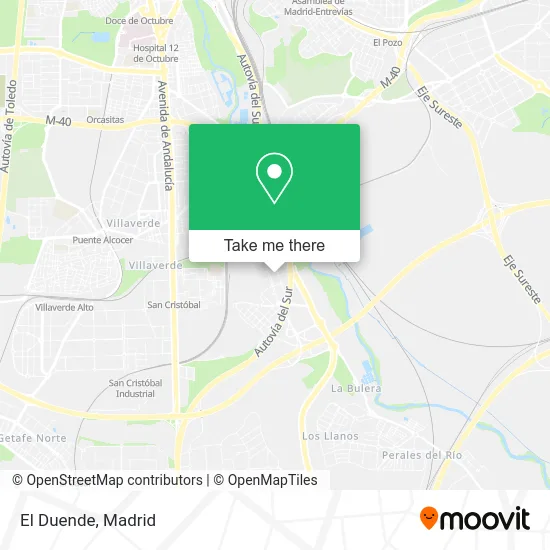
See El Duende, Madrid, on the map
Public Transit to El Duende in Madrid
Wondering how to get to El Duende in Madrid? Moovit helps you find the best way to get to El Duende with step-by-step directions from the nearest public transit station.
Moovit provides free maps and live directions to help you navigate through your city. View schedules, routes, timetables, and find out how long does it take to get to El Duende in real time.
Looking for the nearest stop or station to El Duende? Check out this list of stops closest to your destination: Berrocal - Limonita; Av. Los Rosales - Zafiro; Villaverde Bajo - Cruce; San Cristóbal De Los Ángeles; Villaverde Bajo.
Bus: 123, 85, N12, 411, 412, 415.Train: C4, C3, C4A, C4B.Metro: M-3.
Want to see if there’s another route that gets you there at an earlier time? Moovit helps you find alternative routes or times. Get directions from and directions to El Duende easily from the Moovit App or Website.
We make riding to El Duende easy, which is why over 1.5 million users, including users in Madrid, trust Moovit as the best app for public transit. You don’t need to download an individual bus app or train app, Moovit is your all-in-one transit app that helps you find the best bus time or train time available.
For information on prices of bus, metro and train, costs and ride fares to El Duende, please check the Moovit app.
Use the app to navigate to popular places including to the airport, hospital, stadium, grocery store, mall, coffee shop, school, college, and university.
El Duende Address: Calle de la Limonita, 2 28021 Butarque Madrid street in Madrid
- Calle Estefanita,
- I.E.S. Juan Ramón Jimenez,
- Natican Style,
- Oficina Mapfre de Madrid,
- Carniceria Miguel,
- Lola Cabanero,
- Ceip El Greco,
- Farmacia - Calle Berrocal 11,
- Calle de Berrocal 11,
- Ceip Ausias March,
- Doner Kebap Armenia,
- Óptica Los Rosales (Centro Óptico y Auditivo Los Rosales. Terapia Visual.),
- Vivian Pablos Galvez,
- Mariano Sanchez Gonzalo,
- Colegio Público El Greco,
- Calle Silvinita, 11,
- Calle de Berrocal 7 Local 10,
- Residencia Para Mayores Adavir Villaverde,
- La Via Reiki,
- Calle Estefanita 58 - 60
Places Near El Duende (Madrid)
- Tres Aguas, Alcorcón,
- Palacio De Vistalegre, Área Metropolitana De Madrid Y Corredor Del Henares,
- Estacion de Chamartin, Madrid,
- Hospital Universitario La Paz, Madrid,
- Plaza Mayor, Madrid,
- Centro Comercial La Vaguada, Área Metropolitana De Madrid Y Corredor Del Henares,
- Sala La Riviera, Madrid,
- Wizink Center, Madrid,
- Calle de López de Hoyos 169, Madrid,
- Plenilunio, Área Metropolitana De Madrid Y Corredor Del Henares,
- Hospital Universitario Ramón y Cajal, Madrid,
- Centro Comercial Islazul, Área Metropolitana De Madrid Y Corredor Del Henares,
- Centro Comercial Oasiz Madrid, Área Metropolitana De Madrid Y Corredor Del Henares,
- Mercadillo de Majadahonda, Majadahonda,
- Estadio Wanda Metropolitano, Área Metropolitana De Madrid Y Corredor Del Henares,
- Centro Comercial La Gavia, Área Metropolitana De Madrid Y Corredor Del Henares,
- Rastro De Madrid, Área Metropolitana De Madrid Y Corredor Del Henares,
- Nassica, Área Metropolitana De Madrid Y Corredor Del Henares,
- Mendez Alvaro, Madrid,
- Hospital Clínico Universitario San Carlos, Madrid
How to get to popular places in Madrid with public transit
Get around Madrid by public transit!
Traveling around Madrid has never been so easy. See step by step directions as you travel to any attraction, street or major public transit station. View bus and train schedules, arrival times, service alerts and detailed routes on a map, so you know exactly how to get to anywhere in Madrid.
When traveling to any destination around Madrid use Moovit's Live Directions with Get Off Notifications to know exactly where and how far to walk, how long to wait for your line, and how many stops are left. Moovit will alert you when it's time to get off — no need to constantly re-check whether yours is the next stop.
Wondering how to use public transit in Madrid or how to pay for public transit in Madrid? Moovit public transit app can help you navigate your way with public transit easily, and at minimum cost. It includes public transit fees, ticket prices, and costs. Looking for a map of Madrid public transit lines? Moovit public transit app shows all public transit maps in Madrid with all Bus, Train, Metro and Light Rail routes and stops on an interactive map.
Madrid has 4 transit type(s), including: Bus, Train, Metro and Light Rail, operated by several transit agencies, including Metro de Madrid, Metro Ligero, Tranvía de Parla, Renfe Cercanías - Servicios de Autobús especiales, Renfe Cercanias, Renfe Cercanías, EMT, Interurbanos, Urbanos de Alcalá de Henares, Urbanos de Alcobendas, Urbanos de Alcorcón, Urbanos de Algete, Urbanos de Aranjuez, Urbanos de Arganda del Rey and Urbanos de Arroyomolinos