How to get to El Mexicano by bus?
Click on the bus route to see step by step directions with maps, line arrival times and updated time schedules.
From Sala De Conciertos, Aguascalientes
42 minFrom Villa de Nuestra Señora de La Asunción, Aguascalientes
63 minFrom Teleperformance Aguascalientes Hacienda, Aguascalientes
46 minFrom Campestre, Aguascalientes
54 minFrom Fracc. Real del Sol, Aguascalientes
65 minFrom Cbtis No 195, Aguascalientes
48 minFrom Calle Alfredo Lewis, Aguascalientes
37 minFrom Avenida Independencia, Aguascalientes
54 minFrom Los Caños, Aguascalientes
39 minFrom Paraíso, Aguascalientes
64 min
Bus stops near El Mexicano in Aguascalientes
Bus lines to El Mexicano in Aguascalientes
What are the closest stations to El Mexicano?
The closest stations to El Mexicano are:
- Jesús Rivera Franco C-18e, Lb is 314 meters away, 5 min walk.
- Avenida Siglo Xxi, 13440 is 825 meters away, 11 min walk.
- Boulevard José María Chávez, 1902a is 876 meters away, 12 min walk.
Which bus lines stop near El Mexicano?
These bus lines stop near El Mexicano: RUTA 04, RUTA 50.
What’s the nearest bus station to El Mexicano in Aguascalientes?
The nearest bus station to El Mexicano in Aguascalientes is Jesús Rivera Franco C-18e, Lb. It’s a 5 min walk away.
What time is the first bus to El Mexicano in Aguascalientes?
The RUTA 14 is the first bus that goes to El Mexicano in Aguascalientes. It stops nearby at 6:02 AM.
What time is the last bus to El Mexicano in Aguascalientes?
The RUTA 50 is the last bus that goes to El Mexicano in Aguascalientes. It stops nearby at 10:21 PM.
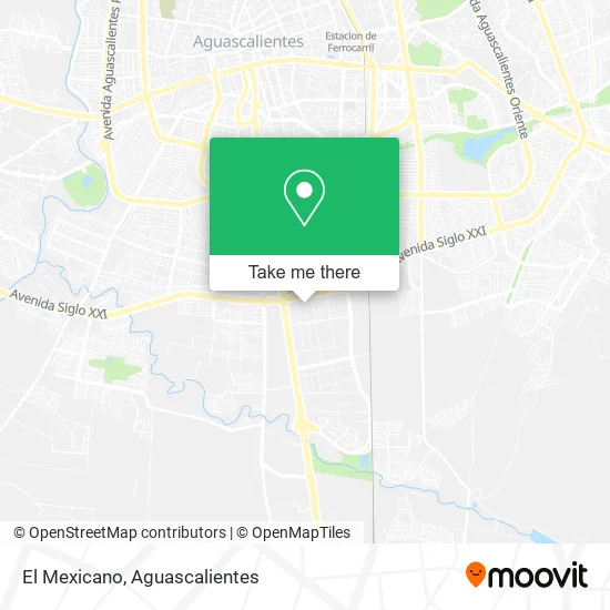
See El Mexicano, Aguascalientes, on the map
Public Transit to El Mexicano in Aguascalientes
Wondering how to get to El Mexicano in Aguascalientes? Moovit helps you find the best way to get to El Mexicano with step-by-step directions from the nearest public transit station.
Moovit provides free maps and live directions to help you navigate through your city. View schedules, routes, timetables, and find out how long does it take to get to El Mexicano in real time.
Looking for the nearest stop or station to El Mexicano? Check out this list of stops closest to your destination: Jesús Rivera Franco C-18e; Avenida Siglo Xxi; Boulevard José María Chávez.
Bus: RUTA 04, RUTA 50, RUTA 33, RUTA 14, RUTA 43.
Want to see if there’s another route that gets you there at an earlier time? Moovit helps you find alternative routes or times. Get directions from and directions to El Mexicano easily from the Moovit App or Website.
We make riding to El Mexicano easy, which is why over 1.5 million users, including users in Aguascalientes, trust Moovit as the best app for public transit. You don’t need to download an individual bus app or train app, Moovit is your all-in-one transit app that helps you find the best bus time or train time available.
For information on prices of bus, costs and ride fares to El Mexicano, please check the Moovit app.
Use the app to navigate to popular places including to the airport, hospital, stadium, grocery store, mall, coffee shop, school, college, and university.
El Mexicano Address: El Mexicano, Calle Filemón Alonso Muñoz 105, Fraccionamiento Ciudad Industrial, 20290 Aguascaliente street in Aguascalientes
- Gcpeasa,
- Brasil Espadas,
- Transportes Leon Mexico Suc. Aguascalientes,
- Distribuidora de Tubos y Conexiones de P.V.C.,
- Comebi Nal,
- Servicio Panamericano,
- Filemón Alonso Muñoz C-10N 20,
- Pavimentos y Maquinaria,
- Pasteurizadora Aguascalientes SA de CV,
- Productos Marines,
- La Reta,
- Leche 19 Diecinueve Hermanos,
- Residencial Las Plazas,
- Muscle Factory Gym,
- Palenque de la Feria de Irapuato,
- 3pl Services Ramos Arizpe,
- Sayab Alberca y Jardín,
- Fraicret,
- Salón Andrea,
- Capitán Barbanegra
Places Near El Mexicano (Aguascalientes)
- ESPACIOS, Aguascalientes,
- Terminal De Combis, Aguascalientes,
- clinica 3 uaa, Aguascalientes,
- La Isla San Marcos, Aguascalientes,
- Isla San Marcos, Aguascalientes,
- Nuevo Hospital Hidalgo, Aguascalientes,
- Jesús María, Aguascalientes,
- Agropecuario, Aguascalientes,
- Central De Autobuses, Aguascalientes,
- Aeropuerto de Aguascalientes S.A. de C.V., Aguascalientes,
- Parque Las Tres Centurias, Aguascalientes,
- Blvd. Luis Donaldo Colosio, Aguascalientes,
- Universidad Autónoma de Aguascalientes, Aguascalientes,
- Centro, Aguascalientes,
- Hospital Imss No. 3, Aguascalientes,
- Villasuncion, Aguascalientes,
- Villas de Nuestra Señora de la Asunción, Aguascalientes,
- Centro Comercial Altaria, Aguascalientes,
- Ciudad industrial, Aguascalientes,
- Imss Clinica 1, Aguascalientes
How to get to popular places in Aguascalientes with public transit
Get around Aguascalientes by public transit!
Traveling around Aguascalientes has never been so easy. See step by step directions as you travel to any attraction, street or major public transit station. View bus and train schedules, arrival times, service alerts and detailed routes on a map, so you know exactly how to get to anywhere in Aguascalientes.
When traveling to any destination around Aguascalientes use Moovit's Live Directions with Get Off Notifications to know exactly where and how far to walk, how long to wait for your line, and how many stops are left. Moovit will alert you when it's time to get off — no need to constantly re-check whether yours is the next stop.
Wondering how to use public transit in Aguascalientes or how to pay for public transit in Aguascalientes? Moovit public transit app can help you navigate your way with public transit easily, and at minimum cost. It includes public transit fees, ticket prices, and costs. Looking for a map of Aguascalientes public transit lines? Moovit public transit app shows all public transit maps in Aguascalientes with all bus routes and stops on an interactive map.
Aguascalientes has 1 transit type(s), including: bus, operated by several transit agencies, including Coordinación General de Movilidad