How to get to El Mono by bus?
Click on the bus route to see step by step directions with maps, line arrival times and updated time schedules.
From Pintores Mexicanos Colonia, Aguascalientes
45 minFrom Fraccionamiento Viña Antigua, Aguascalientes
62 minFrom Universidad Cuauhtemoc Plantel Aguascalientes, Aguascalientes
41 minFrom Centro Comercial Altaria, Aguascalientes
36 minFrom Coyote Ugly, Aguascalientes
50 minFrom Fracc. Valle De Las Trojes, Aguascalientes
48 minFrom Fraccionamiento Camino Real, Aguascalientes
50 minFrom Tec de Monterrey Campus Ags, Aguascalientes
44 minFrom Plaza Terracota, Aguascalientes
40 min
Bus stops near El Mono in Aguascalientes
Bus lines to El Mono in Aguascalientes
- RUTA 28, Jesús María,VIEW
- RUTA 37, Hacienda San Marcos,VIEW
- RUTA 42, Bellavista,VIEW
- RUTA 02, Centro (Jardín Carpio),VIEW
- RUTA 40, Terminal Oriente - Terminal Oriente (S),VIEW
- RUTA 40, Terminal Oriente - Terminal Oriente (N),VIEW
- RUTA 07, Villa Las Palmas,VIEW
- RUTA 20N, Terminal Oriente - Terminal Oriente (N),VIEW
What are the closest stations to El Mono?
The closest stations to El Mono are:
- Avenida Héroe De Nacozari, 204 is 275 meters away, 4 min walk.
- Avenida Aguascalientes Sur, 502 is 334 meters away, 5 min walk.
- Aguascalientes Sur, 405b is 348 meters away, 5 min walk.
- Convencion 1914 Sur, 1503 is 376 meters away, 6 min walk.
Which bus lines stop near El Mono?
These bus lines stop near El Mono: RUTA 07, RUTA 28, RUTA 37.
What’s the nearest bus station to El Mono in Aguascalientes?
The nearest bus station to El Mono in Aguascalientes is Avenida Héroe De Nacozari, 204. It’s a 4 min walk away.
What time is the first bus to El Mono in Aguascalientes?
The RUTA 40 is the first bus that goes to El Mono in Aguascalientes. It stops nearby at 5:57 AM.
What time is the last bus to El Mono in Aguascalientes?
The RUTA 07 is the last bus that goes to El Mono in Aguascalientes. It stops nearby at 10:56 PM.
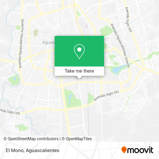
See El Mono, Aguascalientes, on the map
Public Transit to El Mono in Aguascalientes
Wondering how to get to El Mono in Aguascalientes? Moovit helps you find the best way to get to El Mono with step-by-step directions from the nearest public transit station.
Moovit provides free maps and live directions to help you navigate through your city. View schedules, routes, timetables, and find out how long does it take to get to El Mono in real time.
Looking for the nearest stop or station to El Mono? Check out this list of stops closest to your destination: Avenida Héroe De Nacozari; Avenida Aguascalientes Sur; Aguascalientes Sur; Convencion 1914 Sur.
Bus: RUTA 07, RUTA 28, RUTA 37, RUTA 42, RUTA 02, RUTA 40, RUTA 40, RUTA 20N.
Want to see if there’s another route that gets you there at an earlier time? Moovit helps you find alternative routes or times. Get directions from and directions to El Mono easily from the Moovit App or Website.
We make riding to El Mono easy, which is why over 1.5 million users, including users in Aguascalientes, trust Moovit as the best app for public transit. You don’t need to download an individual bus app or train app, Moovit is your all-in-one transit app that helps you find the best bus time or train time available.
For information on prices of bus, costs and ride fares to El Mono, please check the Moovit app.
Use the app to navigate to popular places including to the airport, hospital, stadium, grocery store, mall, coffee shop, school, college, and university.
El Mono Address: El Mono, Avenida Héroe de Nacozari Sur, Fraccionamiento México, 20270 Aguascalientes, Aguascaliente street in Aguascalientes
- Servicio Especializado V. W,
- Electroauto Service,
- Clinica Veterinaria Victoria,
- Copy Dos,
- Consultorio de Terapia Fisica,
- El Marinero,
- Rio Pescaderia,
- Toner Express,
- Abarrotes Pérez,
- Acuario Nacozari,
- Ofitodo,
- Mariscos El Sánchez,
- Florería Arlette,
- Taller eléctrico,
- Reparacion de Tapiceria J P,
- Workout,
- Bazar Don Luis,
- El Antojal,
- Dejavu Travels-Agencia de Viajes,
- Cemex Planta Concreto Aguascalientes Sur
Places Near El Mono (Aguascalientes)
- ESPACIOS, Aguascalientes,
- Central De Autobuses, Aguascalientes,
- Jesús María, Aguascalientes,
- clinica 3 uaa, Aguascalientes,
- Centro Comercial Altaria, Aguascalientes,
- Centro, Aguascalientes,
- Universidad Autónoma de Aguascalientes, Aguascalientes,
- Nuevo Hospital Hidalgo, Aguascalientes,
- Agropecuario, Aguascalientes,
- Terminal De Combis, Aguascalientes,
- Parque Las Tres Centurias, Aguascalientes,
- Hospital Imss No. 3, Aguascalientes,
- Ciudad industrial, Aguascalientes,
- La Isla San Marcos, Aguascalientes,
- Imss Clinica 1, Aguascalientes,
- Blvd. Luis Donaldo Colosio, Aguascalientes,
- Villasuncion, Aguascalientes,
- Aeropuerto de Aguascalientes S.A. de C.V., Aguascalientes,
- Isla San Marcos, Aguascalientes,
- Villas de Nuestra Señora de la Asunción, Aguascalientes
How to get to popular places in Aguascalientes with public transit
Get around Aguascalientes by public transit!
Traveling around Aguascalientes has never been so easy. See step by step directions as you travel to any attraction, street or major public transit station. View bus and train schedules, arrival times, service alerts and detailed routes on a map, so you know exactly how to get to anywhere in Aguascalientes.
When traveling to any destination around Aguascalientes use Moovit's Live Directions with Get Off Notifications to know exactly where and how far to walk, how long to wait for your line, and how many stops are left. Moovit will alert you when it's time to get off — no need to constantly re-check whether yours is the next stop.
Wondering how to use public transit in Aguascalientes or how to pay for public transit in Aguascalientes? Moovit public transit app can help you navigate your way with public transit easily, and at minimum cost. It includes public transit fees, ticket prices, and costs. Looking for a map of Aguascalientes public transit lines? Moovit public transit app shows all public transit maps in Aguascalientes with all bus routes and stops on an interactive map.
Aguascalientes has 1 transit type(s), including: bus, operated by several transit agencies, including Coordinación General de Movilidad