How to get to El Rey de Copas by bus?
Click on the bus route to see step by step directions with maps, line arrival times and updated time schedules.
From Hospital naval talcahuano, Talcahuano
51 minFrom Corral Municipal Talcahuano, Talcahuano
45 minFrom Ist, Talcahuano
41 minFrom Hualpén, Talcahuano
27 minFrom Municipalidad De Chiguayante, Concepcion
43 minFrom Huertos Familiares de San Pedro, Concepcion
37 minFrom Avenida Cristóbal Colón 3430, Talcahuano
41 minFrom Floresta 4, Concepcion
34 minFrom UDLA, Talcahuano
43 min
Bus stops near El Rey de Copas in Concepcion
- Freire Esq. Caupolicán, 3 min walk,VIEW
- O Higgins Con Lincoyan, 3 min walk,VIEW
- Rengo Esq Barros Arana, 4 min walk,VIEW
- O Higgins Con Angol, 4 min walk,VIEW
- Freire Esq Rengo, 5 min walk,VIEW
- Freire Esq Lincoyan, 6 min walk,VIEW
- O'Higgins Esq. Rengo, 7 min walk,VIEW
- San Martín Esq. Caupolicán, 9 min walk,VIEW
- San Martín Esq. Lincoyán, 9 min walk,VIEW
Bus lines to El Rey de Copas in Concepcion
- 30MB, 30m - Industrias,VIEW
- 30NC, 30c - Penco Lirquen,VIEW
- 40BP, 40p - 4 Esquinas,VIEW
- 41CR, 41r - Hualpencillo,VIEW
- 41QV, 41q - Concepción,VIEW
- 43JT, 43t - Hualpencillo,VIEW
- 71ZI, 71z - 4 Esquinas - Lenga,VIEW
- B02, B02 - Centro Concepción,VIEW
- 30QE, 30q - Higueras,VIEW
- 30RD, 30r - Higueras,VIEW
- 31DF, 31d - Lobos Viejos,VIEW
- 32EG, 32e - Lobos Viejos,VIEW
- 32JK, 32j - Lobos Viejos,VIEW
- 42FW, 42f - Concepción,VIEW
- 50SU, 50s - Concepción,VIEW
- 56VO, 56v - T. Collao - Hospital,VIEW
- 57YP, 57p - San Vicente,VIEW
- 62HM, 62m - San Vicente,VIEW
- 62ON, 62n - San Vicente,VIEW
- 62VS, 62s - San Vicente,VIEW
What are the closest stations to El Rey de Copas?
The closest stations to El Rey de Copas are:
- Freire Esq. Caupolicán is 180 meters away, 3 min walk.
- O Higgins Con Lincoyan is 214 meters away, 3 min walk.
- Rengo Esq Barros Arana is 268 meters away, 4 min walk.
- O Higgins Con Angol is 293 meters away, 4 min walk.
- Freire Esq Rengo is 343 meters away, 5 min walk.
- Freire Esq Lincoyan is 438 meters away, 6 min walk.
- O'Higgins Esq. Rengo is 467 meters away, 7 min walk.
- San Martín Esq. Caupolicán is 639 meters away, 9 min walk.
- San Martín Esq. Lincoyán is 658 meters away, 9 min walk.
Which bus lines stop near El Rey de Copas?
These bus lines stop near El Rey de Copas: 10AN, 14HT, 16HK, 21QB, 44AB, 44EU, 65FS.
What’s the nearest bus station to El Rey de Copas in Concepcion?
The nearest bus stations to El Rey de Copas in Concepcion are Freire Esq. Caupolicán and O Higgins Con Lincoyan. The closest one is a 3 min walk away.
What time is the first bus to El Rey de Copas in Concepcion?
The 22XE is the first bus that goes to El Rey de Copas in Concepcion. It stops nearby at 5:04 AM.
What time is the last bus to El Rey de Copas in Concepcion?
The 44EU is the last bus that goes to El Rey de Copas in Concepcion. It stops nearby at 2:01 AM.
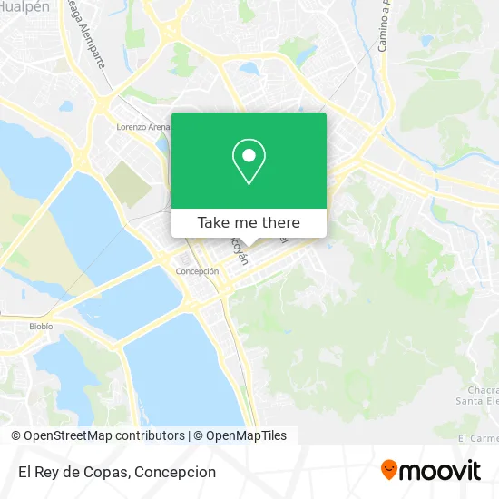
See El Rey de Copas, Concepcion, on the map
Public Transit to El Rey de Copas in Concepcion
Wondering how to get to El Rey de Copas in Concepcion? Moovit helps you find the best way to get to El Rey de Copas with step-by-step directions from the nearest public transit station.
Moovit provides free maps and live directions to help you navigate through your city. View schedules, routes, timetables, and find out how long does it take to get to El Rey de Copas in real time.
Looking for the nearest stop or station to El Rey de Copas? Check out this list of stops closest to your destination: Freire Esq. Caupolicán; O Higgins Con Lincoyan; Rengo Esq Barros Arana; O Higgins Con Angol; Freire Esq Rengo; Freire Esq Lincoyan; O'Higgins Esq. Rengo; San Martín Esq. Caupolicán; San Martín Esq. Lincoyán.
Bus: 10AN, 14HT, 16HK, 21QB, 44AB, 44EU, 65FS, 30MB, 30NC, 40BP, 41CR, 41QV, B02, 30QE, 30RD, 31DF, 32EG, 63FH, 63IG, 63LB, 20TM, 20VA, 22KD, 22RC, 52AD, 60ZM, 63KP, 42UH, 60XK, 60YL, 65DQ, 65ER.
Want to see if there’s another route that gets you there at an earlier time? Moovit helps you find alternative routes or times. Get directions from and directions to El Rey de Copas easily from the Moovit App or Website.
We make riding to El Rey de Copas easy, which is why over 1.5 million users, including users in Concepcion, trust Moovit as the best app for public transit. You don’t need to download an individual bus app or train app, Moovit is your all-in-one transit app that helps you find the best bus time or train time available.
For information on prices of bus, costs and ride fares to El Rey de Copas, please check the Moovit app.
Use the app to navigate to popular places including to the airport, hospital, stadium, grocery store, mall, coffee shop, school, college, and university.
El Rey de Copas Address: El Rey de Copas, Avenida Bernardo O'Higgins, 4030000 Concepción, Bíobío street in Concepcion
- Crudos Hansel y Gretel,
- Hanaya Sushi Mall del Centro,
- Congelados Parque Central,
- Inter-Radio Service,
- RAMADA Borrachos Pero Buenos Muchachos,
- Huambali,
- Cristian Lay Lomas City,
- Sunrise, desayunos a Domicilio,
- Notaría Juan Espinosa Bancalari,
- Sala Municipal de Exposiciones Federico Ramirez,
- Calle Bernardo O`Higgins 537,
- Alamary,
- Minga,
- Liceo Tecnico Profesional La Araucana,
- Empresa de Camiones-Grúas Multiservi,
- Depilación Masculina Concepción- Talcahuano,
- Ingeniero-Nolberto Muñoz,
- Laboratorios de Analisis Clinicos-Hemosan,
- 7 Año de la Escuela Lautaro,
- Boutique Daniella
Places Near El Rey de Copas (Concepcion)
- En la micro camino a chiguayante, Concepcion,
- Playa Lenga,
- Universidad Del Bío-Bío, Concepcion,
- Vega Monumental, Concepcion,
- En La Micro Camino A Tome, Concepcion,
- Lomas San Sebastian, Talcahuano,
- Universidad De Concepción, Concepcion,
- Mall Plaza Mirador Bío Bío, Concepcion,
- Hualpén, Concepcion,
- Terminal Aeropuerto Carriel Sur, Talcahuano,
- Penco, Penco,
- Caleta Tumbes, Talcahuano,
- Hospital Las Higueras, Talcahuano,
- Hospital Clínico Del Sur, Concepcion,
- Club Hípico De Concepción, Talcahuano,
- Zoológico de Concepción, Concepcion,
- Jumbo - Easy Hualpén, Concepcion,
- Mall Plaza del Trebol, Talcahuano,
- San Pedro De La Paz, Concepcion,
- Clinica bio bio, Concepcion
How to get to popular places in Concepcion with public transit
Get around Concepcion by public transit!
Traveling around Concepcion has never been so easy. See step by step directions as you travel to any attraction, street or major public transit station. View bus and train schedules, arrival times, service alerts and detailed routes on a map, so you know exactly how to get to anywhere in Concepcion.
When traveling to any destination around Concepcion use Moovit's Live Directions with Get Off Notifications to know exactly where and how far to walk, how long to wait for your line, and how many stops are left. Moovit will alert you when it's time to get off — no need to constantly re-check whether yours is the next stop.
Wondering how to use public transit in Concepcion or how to pay for public transit in Concepcion? Moovit public transit app can help you navigate your way with public transit easily, and at minimum cost. It includes public transit fees, ticket prices, and costs. Looking for a map of Concepcion public transit lines? Moovit public transit app shows all public transit maps in Concepcion with all bus routes and stops on an interactive map.
Concepcion has 1 transit type(s), including: bus, operated by several transit agencies, including División de Transporte Público Regional