How to get to El Salsa by bus?
Click on the bus route to see step by step directions with maps, line arrival times and updated time schedules.
From Carapongo, Lurigancho
74 minFrom Cevicheria El Rico Piura, Ate
72 minFrom Santa Eulalia, Santa Eula
26 minFrom Huachipa, Ate
58 minFrom Chaclacayo, Chaclacayo
44 minFrom Entrada A Huaycan, Ate
50 minFrom Universidad Peruana Unión - UPeU, Lurigancho
58 minFrom Cieneguilla, Cieneguill
164 minFrom Centro Comercial Real Plaza Santa Clara, Ate
69 minFrom Ñaña, Chaclacayo
51 min
Bus stop near El Salsa in Lurigancho
- 7 De Junio, 7 min walk,VIEW
Bus lines to El Salsa in Lurigancho
What are the closest stations to El Salsa?
The closest stations to El Salsa are:
- 7 De Junio is 510 meters away, 7 min walk.
Which bus lines stop near El Salsa?
These bus lines stop near El Salsa: 1069, 1085, 1218, 1319, 1480.
What’s the nearest bus station to El Salsa in Lurigancho?
The nearest bus station to El Salsa in Lurigancho is 7 De Junio. It’s a 7 min walk away.
What time is the first bus to El Salsa in Lurigancho?
The 1319 is the first bus that goes to El Salsa in Lurigancho. It stops nearby at 3:00 AM.
What time is the last bus to El Salsa in Lurigancho?
The 1319 is the last bus that goes to El Salsa in Lurigancho. It stops nearby at 4:33 AM.
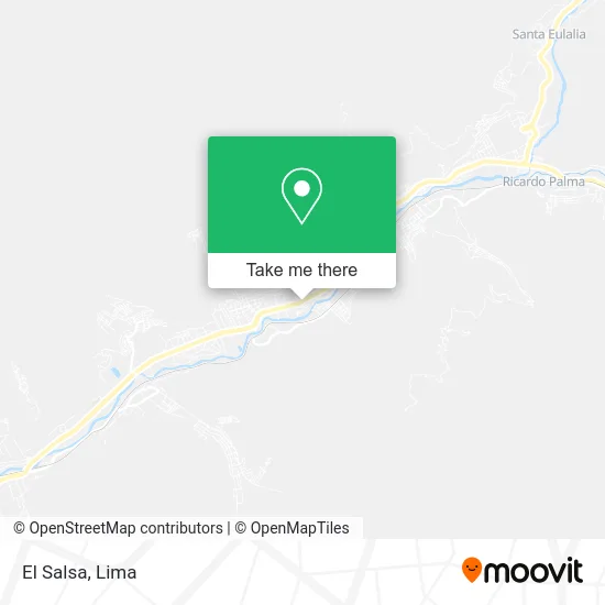
See El Salsa, Lurigancho, on the map
Public Transit to El Salsa in Lurigancho
Wondering how to get to El Salsa in Lurigancho? Moovit helps you find the best way to get to El Salsa with step-by-step directions from the nearest public transit station.
Moovit provides free maps and live directions to help you navigate through your city. View schedules, routes, timetables, and find out how long does it take to get to El Salsa in real time.
Looking for the nearest stop or station to El Salsa? Check out this list of stops closest to your destination: 7 De Junio.
Bus: 1069, 1085, 1218, 1319, 1480, 1354.
Want to see if there’s another route that gets you there at an earlier time? Moovit helps you find alternative routes or times. Get directions from and directions to El Salsa easily from the Moovit App or Website.
We make riding to El Salsa easy, which is why over 1.5 million users, including users in Lurigancho, trust Moovit as the best app for public transit. You don’t need to download an individual bus app or train app, Moovit is your all-in-one transit app that helps you find the best bus time or train time available.
For information on prices of bus, costs and ride fares to El Salsa, please check the Moovit app.
Use the app to navigate to popular places including to the airport, hospital, stadium, grocery store, mall, coffee shop, school, college, and university.
El Salsa Address: Avenida Lima Sur Chacrasana, 15468 Lurigancho street in Lurigancho
- Ferreteria La Rivera,
- D'Kanto Karaoke & Pub,
- Funeraria Valentina,
- Hector Chumpitaz,
- Corte Superior de Justicia de Lima Este - Sede Pariachi,
- Institución Educativa Inicial 101 Aldea Infantil,
- Policlinico Rosales,
- Agencia Chosica-Caja Arequipa,
- I.E. Nº 1198 La Ribera,
- Pasaje San Martín Pedregal Bajo Chosica,
- Capilla San Martín De Porres,
- Hostal Pedregal,
- Mercado Virgen De Cocharcas,
- Universidad Peruana de Ciencias Aplicadas UPC,
- Estadio Santa Rosa,
- Carhuamaca Leiva Lizbeth Karina,
- Psaje San Martin Lote 15 Pedregal Bajo Chosica Altura de Plaza Vea De Chosica,
- Estadio Quirio,
- Univ. Guzmán y Valle La Cantuta,
- Institución Educativa 1195 Cesar Vallejo
Places Near El Salsa (Lurigancho)
- Larcomar, Miraflores,
- Plaza San Miguel, San Miguel,
- Real Plaza Puruchuco, Ate,
- Hospital Edgardo Rebagliati Martins, Jesus Mari,
- Barranco, Barranco,
- Mall Del Sur,
- Jockey Plaza, Santiago D,
- Parque Kennedy, Miraflores,
- Gamarra,
- Av. Salaverry, Jesus Mari,
- Aeropuerto Internacional Jorge Chávez, Ventanilla,
- Paradero Av.Brasil,
- Av. La Marina, San Miguel,
- Parque de las Leyendas, San Miguel,
- Circuito Mágico Del Agua, Lima,
- Av. Abancay, Lima,
- Miraflores, Miraflores,
- Pontificia Universidad Católica del Perú - PUCP, San Miguel,
- av arequipa, Lima,
- Centro Comercial Plaza Norte, Independen
How to get to popular places in Lima with public transit
Get around Lurigancho by public transit!
Traveling around Lurigancho has never been so easy. See step by step directions as you travel to any attraction, street or major public transit station. View bus and train schedules, arrival times, service alerts and detailed routes on a map, so you know exactly how to get to anywhere in Lurigancho.
When traveling to any destination around Lurigancho use Moovit's Live Directions with Get Off Notifications to know exactly where and how far to walk, how long to wait for your line, and how many stops are left. Moovit will alert you when it's time to get off — no need to constantly re-check whether yours is the next stop.
Wondering how to use public transit in Lurigancho or how to pay for public transit in Lurigancho? Moovit public transit app can help you navigate your way with public transit easily, and at minimum cost. It includes public transit fees, ticket prices, and costs. Looking for a map of Lurigancho public transit lines? Moovit public transit app shows all public transit maps in Lurigancho with all Bus, Metro and Ferry routes and stops on an interactive map.
Lima has 3 transit type(s), including: Bus, Metro and Ferry, operated by several transit agencies, including Metro de Lima Línea 2 , Metro de Lima, Corredor Rojo, Metropolitano, Metropolitano - Alimentadores, Corredor Morado, Corredor Azul, Rutas Tradicionales, Transportes y Servicios La Esperanza S.A., Las Flores S.A., Virgen de la Asunción S.A., Consorcio HAM, Transportes y Service Canadá S.A., ETUL4SA and ETUCHISA