Eltingville/Transit Center stop - Thursday schedule
| Line | Direction | Time |
|---|---|---|
| SIM4 | Downtown Worth St Via Church St | 6:00 AM |
| SIM31 | Midtown Via 23 St Via Madison Av | 6:00 AM |
| SIM8 | Midtown Via 42 St Via Madison Av | 6:07 AM |
| SIM4 | Downtown Worth St Via Church St | 6:12 AM |
| SIM8 | Midtown Via 42 St Via Madison Av | 6:13 AM |
| SIM31 | Midtown Via 23 St Via Madison Av | 6:15 AM |
| SIM8 | Midtown Via 42 St Via Madison Av | 6:19 AM |
| SIM4 | Downtown Worth St Via Church St | 6:22 AM |
| SIM8 | Midtown Via 42 St Via Madison Av | 6:25 AM |
| SIM31 | Midtown Via 23 St Via Madison Av | 6:30 AM |
| SIM8 | Midtown Via 42 St Via Madison Av | 6:31 AM |
| SIM4 | Downtown Worth St Via Church St | 6:32 AM |
| SIM8 | Midtown Via 42 St Via Madison Av | 6:37 AM |
| SIM4 | Downtown Worth St Via Church St | 6:39 AM |
| SIM8 | Midtown Via 42 St Via Madison Av | 6:43 AM |
| SIM4 | Downtown Worth St Via Church St | 6:45 AM |
| SIM31 | Midtown Via 23 St Via Madison Av | 6:45 AM |
| SIM8 | Midtown Via 42 St Via Madison Av | 6:49 AM |
| SIM4 | Downtown Worth St Via Church St | 6:51 AM |
| SIM8 | Midtown Via 42 St Via Madison Av | 6:54 AM |
| SIM31 | Midtown Via 23 St Via Madison Av | 6:55 AM |
| SIM4 | Downtown Worth St Via Church St | 6:57 AM |
| SIM8 | Midtown Via 42 St Via Madison Av | 6:59 AM |
| SIM4 | Downtown Worth St Via Church St | 7:03 AM |
| SIM8 | Midtown Via 42 St Via Madison Av | 7:04 AM |
See Eltingville/Transit Center, Staten Island, on the map
Directions to Eltingville/Transit Center (Staten Island) with public transportation
The following transit lines have routes that pass near Eltingville/Transit Center
 Bus:
Bus: - Subway:
How to get to Eltingville/Transit Center by bus?
Click on the bus route to see step by step directions with maps, line arrival times and updated time schedules.
Bus stations near Eltingville/Transit Center in Staten Island
- Eltingville/Transit Center,1 min walk,
Subway stations near Eltingville/Transit Center in Staten Island
- Great Kills,6 min walk,
Bus lines to Eltingville/Transit Center in Staten Island
- SIM22,Eltingville Via Ar Kill Rd Via Richmond,
- S79-SBS,Select Bus Bay Ridge 86 St Station,
- SIM1,Soho Houston St Via Church St,
- SIM1C,Eltngvlle Trans Ctr Via Hylan Via Rich,
- SIM4,Downtown Worth St Via Church St,
- SIM5,Eltvlle Trans Ctr Via F Cap Bl Via Gfrds,
- SIM6,Eltvlle Trans Ctr Via F Cap Bl Via Gfrds,
- SIM7,Greenwich Village Via West St Via 6 Av,
- SIM8,Arden Hts Via Richmond Av Via Woodrow Rd,
- SIM10,Eltingville Trans Ctr Via Hylan Via Rich,
- SIM15,Eltingville Transit Center Via Richmond,
- SIM31,Eltingville Trans Ctr Via Forest Hill Rd,
- S55,Rossville Veterans Rd E Via Amboy Rd,
- S56,Huguenot Luten Av,
- S59,Port Richmond,
- S74,Bricktown Mall Via Ar Kill Rd,
- S84,Limited Bricktown Mall Via Ar Kill Rd,
- S89,Limited Bayonne 34 St-Hblr Sta Via Rich,
- SIM4C,Huguenot Via Richmond Av Via Arthur Kill,
What are the closest stations to Eltingville/Transit Center?
The closest stations to Eltingville/Transit Center are:
- Eltingville/Transit Center is 58 yards away, 1 min walk.
- Great Kills is 447 yards away, 6 min walk.
Which bus lines stop near Eltingville/Transit Center?
These bus lines stop near Eltingville/Transit Center: S79-SBS, SIM1C, SIM8.
What’s the nearest subway station to Eltingville/Transit Center in Staten Island?
The nearest subway station to Eltingville/Transit Center in Staten Island is Great Kills. It’s a 6 min walk away.
What’s the nearest bus stop to Eltingville/Transit Center in Staten Island?
The nearest bus stop to Eltingville/Transit Center in Staten Island is Eltingville/Transit Center. It’s a 1 min walk away.
What time is the first subway to Eltingville/Transit Center in Staten Island?
The SIR is the first subway that goes to Eltingville/Transit Center in Staten Island. It stops nearby at 3:01 AM.
What time is the last subway to Eltingville/Transit Center in Staten Island?
The SIR is the last subway that goes to Eltingville/Transit Center in Staten Island. It stops nearby at 3:07 AM.
What time is the first bus to Eltingville/Transit Center in Staten Island?
The SIM1C is the first bus that goes to Eltingville/Transit Center in Staten Island. It stops nearby at 3:00 AM.
What time is the last bus to Eltingville/Transit Center in Staten Island?
The SIM1C is the last bus that goes to Eltingville/Transit Center in Staten Island. It stops nearby at 3:45 AM.
How much is the bus fare to Eltingville/Transit Center?
The bus fare to Eltingville/Transit Center costs about $2.90.
How much is the subway fare to Eltingville/Transit Center?
The subway fare to Eltingville/Transit Center costs about $2.90.
How much is the train fare to Eltingville/Transit Center?
The train fare to Eltingville/Transit Center costs about $2.25 - $14.00.
See Eltingville/Transit Center, Staten Island, on the map
Public transit to Eltingville/Transit Center stop in Staten Island
Looking for directions to Eltingville/Transit Center in Staten Island, United States?
Download the Moovit App to find the current schedule and step-by-step directions for Bus, Subway or Train routes that pass through Eltingville/Transit Center.
Looking for the nearest stops closest to Eltingville/Transit Center ? Check out this list of closest stops to your destination: Eltingville/Transit Center; Great Kills.
Bus:Subway:
We make riding on public transit to Eltingville/Transit Center easy, which is why over 1.5 million users, including users in Staten Island trust Moovit as the best app for public transit.
Use the app to navigate to popular places including to the airport, hospital, stadium, grocery store, mall, coffee shop, school, college, and university.
The first line to this stop is SIM4, at 6:00 AM, and the last line is SIM8 at 5:59 AM.
90 Wainwright Ave, Staten Island, New York, NY, USA
This stop serves MTA New York City Transit - Express routes’s lines
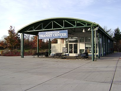
Bus stop near Eltingville/Transit Center
Eltingville/Transit CenterSubway station near Eltingville/Transit Center
Great KillsPopular public transit stations in Staten Island
5 Av/W 41 St,Ocean City Transportation Center,East Houston St/2 Av,Rt-4 Service Road at Main St,207 St,Paterson Plank Rd at Town Hall/Roosevelt,Berkeley Heights,Sheepshead Bay,Ozone Park-Lefferts Blvd,Bowery,Kings Hwy,Bethpage,W 42 St/8 Av,Flatlands Av/E 103 St,Delancey St-Essex St,Lafayette St/Astor Pl,Classon Av/Prospect Pl,86 St & Broadway,E 86 St/Lexington Av,W 96 St/BroadwayGet around Staten Island by public transit!
Traveling around Staten Island has never been so easy. See step by step directions as you travel to any attraction, street or major public transit station. View bus and train schedules, arrival times, service alerts and detailed routes on a map, so you know exactly how to get to anywhere in Staten Island.
When traveling to any destination around Staten Island use Moovit's Live Directions with Get Off Notifications to know exactly where and how far to walk, how long to wait for your line, and how many stops are left. Moovit will alert you when it's time to get off — no need to constantly re-check whether yours is the next stop.
Wondering how to use public transit in Staten Island or how to pay for public transit in Staten Island? Moovit public transit app can help you navigate your way with public transit easily, and at minimum cost. It includes public transit fees, ticket prices, and costs. Looking for a map of Staten Island public transit lines? Moovit public transit app shows all public transit maps in Staten Island with all bus, subway or train routes and stops on an interactive map.
Staten Island has 3 transit type(s), including: bus, subway or train, operated by several transit agencies, including MTA Subway, Metro-North Railroad, LIRR, PATH, Shore Line East, MTA Bus Company, MTA New York City Transit - Express routes, MTA Bus, NJ Transit, NYC Ferry, NICE bus, Bee-Line Bus, NJ Transit Rail, NJ Transit Rail and Norwalk Transit District