How to get to Em Squared Restaurant by bus?
Click on the bus route to see step by step directions with maps, line arrival times and updated time schedules.
From W Woolbright Rd / Jog Rd, Boynton Beach-Delray Beach
110 minFrom Ollie's Bargain Outlet, Boynton Beach-Delray Beach
34 minFrom DXN Florida, Boynton Beach-Delray Beach
101 minFrom Military Trail & Yamato Rd., Boca Raton
44 minFrom Tri-Rail-Deerfield Beach Station, Deerfield Beach
90 minFrom Lynn University, Boca Raton
47 minFrom Somerset Academy Canyons Charter School, Sunshine Parkway
97 minFrom Town Center at Boca Raton-East, Boca Raton
59 minFrom Class Room GN 101 Florida Atlantic University, Boca Raton
49 minFrom Boynton Beach Mall, Boynton Beach-Delray Beach
54 min
How to get to Em Squared Restaurant by train?
Click on the train route to see step by step directions with maps, line arrival times and updated time schedules.
Bus stops near Em Squared Restaurant in Boynton Beach-Delray Beach
Train station near Em Squared Restaurant in Boynton Beach-Delray Beach
- Delray Beach Station, 47 min walk,VIEW
Bus lines to Em Squared Restaurant in Boynton Beach-Delray Beach
What are the closest stations to Em Squared Restaurant?
The closest stations to Em Squared Restaurant are:
- FEDERAL HWY at LINTON BLVD is 316 yards away, 4 min walk.
- PLZ OF DELRAY at PUBLIX is 671 yards away, 8 min walk.
- Delray Beach Station is 3924 yards away, 47 min walk.
Which bus lines stop near Em Squared Restaurant?
These bus lines stop near Em Squared Restaurant: 1, 2, 80, 88.
Which train line stops near Em Squared Restaurant?
TRIRAIL (Northbound To Mangonia Park)
What’s the nearest bus station to Em Squared Restaurant in Boynton Beach-Delray Beach?
The nearest bus station to Em Squared Restaurant in Boynton Beach-Delray Beach is FEDERAL HWY at LINTON BLVD. It’s a 4 min walk away.
What time is the first train to Em Squared Restaurant in Boynton Beach-Delray Beach?
The TRIRAIL is the first train that goes to Em Squared Restaurant in Boynton Beach-Delray Beach. It stops nearby at 4:21 AM.
What time is the last train to Em Squared Restaurant in Boynton Beach-Delray Beach?
The FLORIDIAN is the last train that goes to Em Squared Restaurant in Boynton Beach-Delray Beach. It stops nearby at 4:42 PM.
What time is the first bus to Em Squared Restaurant in Boynton Beach-Delray Beach?
The 1 is the first bus that goes to Em Squared Restaurant in Boynton Beach-Delray Beach. It stops nearby at 6:19 AM.
What time is the last bus to Em Squared Restaurant in Boynton Beach-Delray Beach?
The 1 is the last bus that goes to Em Squared Restaurant in Boynton Beach-Delray Beach. It stops nearby at 10:01 PM.
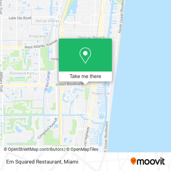
See Em Squared Restaurant, Boynton Beach-Delray Beach, on the map
Public Transit to Em Squared Restaurant in Boynton Beach-Delray Beach
Wondering how to get to Em Squared Restaurant in Boynton Beach-Delray Beach? Moovit helps you find the best way to get to Em Squared Restaurant with step-by-step directions from the nearest public transit station.
Moovit provides free maps and live directions to help you navigate through your city. View schedules, routes, timetables, and find out how long does it take to get to Em Squared Restaurant in real time.
Looking for the nearest stop or station to Em Squared Restaurant? Check out this list of stops closest to your destination: FEDERAL HWY at LINTON BLVD; PLZ OF DELRAY at PUBLIX; Delray Beach Station.
Bus: 1, 2, 80, 88.Train: TRIRAIL, FLORIDIAN, SILVER METEOR.
Want to see if there’s another route that gets you there at an earlier time? Moovit helps you find alternative routes or times. Get directions from and directions to Em Squared Restaurant easily from the Moovit App or Website.
We make riding to Em Squared Restaurant easy, which is why over 1.5 million users, including users in Boynton Beach-Delray Beach, trust Moovit as the best app for public transit. You don’t need to download an individual bus app or train app, Moovit is your all-in-one transit app that helps you find the best bus time or train time available.
For information on prices of bus and train, costs and ride fares to Em Squared Restaurant, please check the Moovit app.
Use the app to navigate to popular places including to the airport, hospital, stadium, grocery store, mall, coffee shop, school, college, and university.
Em Squared Restaurant Address: 360 Linton Blvd Delray Beach, FL 33444 street in Boynton Beach-Delray Beach
- Gozman Garage Door Repair Service,
- PNC Mortgage,
- Anderson Power Services,
- Eco Panel Systems,
- Chiropractic Treatments,
- TACO BELL,
- Mavis Discount Tire,
- Bob's Printing,
- Wallflower Merchandise, LLC,
- Southwest Automated Security,
- Pethotel,
- Delray Beach Jet Locksmith,
- Park View Properties,
- STARBUCKS,
- Elite Tint Protection Plus,
- The Ultimate Service,
- Dkar's Auto Repair,
- E Linton Blvd / Old Dixie Hwy,
- Swa Scales-Delray East,
- Metro Taxi
Places Near Em Squared Restaurant (Boynton Beach-Delray Beach)
- Wynwood, Miami,
- Sawgrass Mall, Miami,
- Port of Miami Cruise Terminal, Miami,
- Aventura Mall, Miami,
- Brickell City Centre, Miami,
- Miami VA Hospital, Miami,
- Dolphin Mall, Miami,
- Miami-Dade County Courthouse, Miami,
- Miami Freedom Park, Miami,
- Keiser University Flagship Campus, West Palm Beach,
- Miami Design District, Miami,
- Aventura Mall, Miami Beach,
- Marlins Park, Miami,
- Dolphin Mall Bus, Miami,
- Hard Rock Stadium, Miami Gardens,
- Bayside Marketplace, Miami,
- Richard E. Gerstein Justice Building, Miami,
- Little Havana, Miami,
- Sawgrass mall ( FL ), Miami Beach,
- Zoo Miami, Miami
How to get to popular places in Miami with public transit
Get around Boynton Beach-Delray Beach by public transit!
Traveling around Boynton Beach-Delray Beach has never been so easy. See step by step directions as you travel to any attraction, street or major public transit station. View bus and train schedules, arrival times, service alerts and detailed routes on a map, so you know exactly how to get to anywhere in Boynton Beach-Delray Beach.
When traveling to any destination around Boynton Beach-Delray Beach use Moovit's Live Directions with Get Off Notifications to know exactly where and how far to walk, how long to wait for your line, and how many stops are left. Moovit will alert you when it's time to get off — no need to constantly re-check whether yours is the next stop.
Wondering how to use public transit in Boynton Beach-Delray Beach or how to pay for public transit in Boynton Beach-Delray Beach? Moovit public transit app can help you navigate your way with public transit easily, and at minimum cost. It includes public transit fees, ticket prices, and costs. Looking for a map of Boynton Beach-Delray Beach public transit lines? Moovit public transit app shows all public transit maps in Boynton Beach-Delray Beach with all Bus, Train, Light Rail and Ferry routes and stops on an interactive map.
Miami has 4 transit type(s), including: Bus, Train, Light Rail and Ferry, operated by several transit agencies, including Broward County Transit, Miami-Dade Transit, Metrorail, Palm Tran, Tri-Rail, Brightline, MARTY, City of Homestead Trolley, Key West Transit, Treasure Coast Connector, GoLine IRT, Amtrak, Greyhound-us, FlixBus-us and Aventura Express Shuttle Bus