How to get to Embassy Of The State of Kuwait by bus?
Click on the bus route to see step by step directions with maps, line arrival times and updated time schedules.
From Charles E. Smith Center, Washington
47 minFrom Washington Costco DC, Washington
79 minFrom Ronald Reagan Washington National Airport (Dca), Arlington County
94 minFrom Festival Grounds at RFK Campus, Washington
79 minFrom Days Inn by Wyndham Arlington Pentagon, Arlington County
79 minFrom Hilton Garden Inn Reagan National Airport, Arlington County
81 minFrom Embassy Of Canada, Washington
48 minFrom Tomb of the Unknown Soldier, Arlington County
94 minFrom US Marine Corps War Memorial (Iwo Jima), Arlington County
68 minFrom Costco, Washington
80 min
How to get to Embassy Of The State of Kuwait by metro?
Click on the metro route to see step by step directions with maps, line arrival times and updated time schedules.
From Charles E. Smith Center, Washington
35 minFrom Ronald Reagan Washington National Airport (Dca), Arlington County
37 minFrom Festival Grounds at RFK Campus, Washington
49 minFrom Hilton Garden Inn Reagan National Airport, Arlington County
44 minFrom Embassy Of Canada, Washington
30 minFrom Tomb of the Unknown Soldier, Arlington County
37 minFrom US Marine Corps War Memorial (Iwo Jima), Arlington County
43 min
Bus stops near Embassy Of The State of Kuwait in Washington
Metro stations near Embassy Of The State of Kuwait in Washington
Bus lines to Embassy Of The State of Kuwait in Washington
What are the closest stations to Embassy Of The State of Kuwait?
The closest stations to Embassy Of The State of Kuwait are:
- Connecticut Av Nw+Van Ness St NW is 431 yards away, 6 min walk.
- Porter St Nw+34 St NW is 895 yards away, 11 min walk.
- Columbia Heights is 1716 yards away, 21 min walk.
- Tenleytown Metro Station is 1879 yards away, 23 min walk.
Which bus lines stop near Embassy Of The State of Kuwait?
These bus lines stop near Embassy Of The State of Kuwait: C61, D70.
Which metro line stops near Embassy Of The State of Kuwait?
RED (Shady Grove)
What’s the nearest metro station to Embassy Of The State of Kuwait in Washington?
The nearest metro station to Embassy Of The State of Kuwait in Washington is Columbia Heights. It’s a 21 min walk away.
What’s the nearest bus station to Embassy Of The State of Kuwait in Washington?
The nearest bus station to Embassy Of The State of Kuwait in Washington is Connecticut Av Nw+Van Ness St NW. It’s a 6 min walk away.
What time is the first metro to Embassy Of The State of Kuwait in Washington?
The GREEN is the first metro that goes to Embassy Of The State of Kuwait in Washington. It stops nearby at 5:16 AM.
What time is the last metro to Embassy Of The State of Kuwait in Washington?
The GREEN is the last metro that goes to Embassy Of The State of Kuwait in Washington. It stops nearby at 12:25 AM.
What time is the first bus to Embassy Of The State of Kuwait in Washington?
The C61 is the first bus that goes to Embassy Of The State of Kuwait in Washington. It stops nearby at 3:03 AM.
What time is the last bus to Embassy Of The State of Kuwait in Washington?
The C61 is the last bus that goes to Embassy Of The State of Kuwait in Washington. It stops nearby at 3:05 AM.
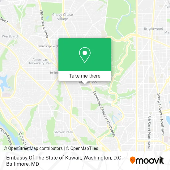
See Embassy Of The State of Kuwait, Washington, on the map
Public Transit to Embassy Of The State of Kuwait in Washington
Wondering how to get to Embassy Of The State of Kuwait in Washington? Moovit helps you find the best way to get to Embassy Of The State of Kuwait with step-by-step directions from the nearest public transit station.
Moovit provides free maps and live directions to help you navigate through your city. View schedules, routes, timetables, and find out how long does it take to get to Embassy Of The State of Kuwait in real time.
Looking for the nearest stop or station to Embassy Of The State of Kuwait? Check out this list of stops closest to your destination: Connecticut Av Nw+Van Ness St NW; Porter St Nw+34 St NW; Columbia Heights; Tenleytown Metro Station.
Bus: C61, D70, D72, C87.Metro: RED, GREEN, YELLOW.
Want to see if there’s another route that gets you there at an earlier time? Moovit helps you find alternative routes or times. Get directions from and directions to Embassy Of The State of Kuwait easily from the Moovit App or Website.
We make riding to Embassy Of The State of Kuwait easy, which is why over 1.5 million users, including users in Washington, trust Moovit as the best app for public transit. You don’t need to download an individual bus app or train app, Moovit is your all-in-one transit app that helps you find the best bus time or train time available.
For information on prices of metro and bus, costs and ride fares to Embassy Of The State of Kuwait, please check the Moovit app.
Use the app to navigate to popular places including to the airport, hospital, stadium, grocery store, mall, coffee shop, school, college, and university.
Embassy Of The State of Kuwait Address: 2940 Tilden St NW street in Washington
- Intelsat headquarters,
- Embassy Of Jordan,
- Office of Foreign Missions (Ofm),
- Embassy of Ethiopia, Washington, D.C. (Ethiopian Embassy Imperial),
- Ethiopian Embassy Imperial,
- Embassy Of Ethiopia,
- Embassy of China in Washington,
- Embassy Of China,
- Embassy Of Bangladesh,
- 3512 International Dr NW,
- Edmund Burke School,
- 2023 MH Sub I, LLC,
- Van Ness,
- Flash,
- Embassy Of Israel,
- Select Physical Therapy,
- The Law Offices,
- Loctw,
- Park America,
- UDC Student Center
Places Near Embassy Of The State of Kuwait (Washington)
- Museum Of The Bible, Washington,
- National Museum of African American History and Culture, Washington,
- Capital One Arena, Washington,
- Sibley Memorial Hospital, Washington,
- The Anthem, Washington,
- Westfield Montgomery Mall, Montgomery County,
- National Theatre, Washington,
- Washington DC VA Medical Center, Washington,
- National Zoo, Washington,
- Warner Theatre, Washington,
- Pennsylvania Ave NW (3rd st and pennsylvania), Washington,
- Basilica of the National Shrine, Washington,
- Rock Creek Tennis Center, Washington,
- PG Mall, Prince George's County,
- M&T Bank Stadium, Baltimore,
- Amazon Hq2, Arlington County,
- Washington National Cathedral, Washington,
- Marriott Marquis Washington, DC, Washington,
- Georgetown, Washington,
- Camden Yards, Baltimore
How to get to popular places in Washington, D.C. - Baltimore, MD with public transit
Get around Washington by public transit!
Traveling around Washington has never been so easy. See step by step directions as you travel to any attraction, street or major public transit station. View bus and train schedules, arrival times, service alerts and detailed routes on a map, so you know exactly how to get to anywhere in Washington.
When traveling to any destination around Washington use Moovit's Live Directions with Get Off Notifications to know exactly where and how far to walk, how long to wait for your line, and how many stops are left. Moovit will alert you when it's time to get off — no need to constantly re-check whether yours is the next stop.
Wondering how to use public transit in Washington or how to pay for public transit in Washington? Moovit public transit app can help you navigate your way with public transit easily, and at minimum cost. It includes public transit fees, ticket prices, and costs. Looking for a map of Washington public transit lines? Moovit public transit app shows all public transit maps in Washington with all Bus, Train, Metro, Light Rail and Ferry routes and stops on an interactive map.
Washington, D.C. - Baltimore, MD has 5 transit type(s), including: Bus, Train, Metro, Light Rail and Ferry, operated by several transit agencies, including WMATA, Montgomery County Ride On, Fairfax Connector, TheBus, PRTC, DASH - Alexandria, Arlington Transit (ART), RTA of Central Maryland, MDOT MTA, MDOT MTA Light RailLink, MDOT MTA Commuter Bus, MDOT MTA Local Bus, FXBGO!, Virginia Railway Express (VRE) and MARC