How to get to Emergency Chiropractic Care by bus?
Click on the bus route to see step by step directions with maps, line arrival times and updated time schedules.
From Silver Spring, Maryland, Montgomery County
58 minFrom Alexandria Station - AMTRAK/VRE (ALX), Alexandria
55 minFrom Del Ray, Alexandria
59 minFrom Pie Shop, Washington
43 minFrom Hilton Alexandria Old Town, Alexandria
53 minFrom Malcolm X Park, Washington
69 minFrom Alexandria, VA, Alexandria
49 minFrom Nova- Alexandria Campus, Alexandria
68 minFrom Embassy Suites at the Chevy Chase Pavilion, Washington
42 minFrom George H.W. Bush Center For Intelligence (CIA Headquarters), Fairfax County
92 min
How to get to Emergency Chiropractic Care by train?
Click on the train route to see step by step directions with maps, line arrival times and updated time schedules.
How to get to Emergency Chiropractic Care by metro?
Click on the metro route to see step by step directions with maps, line arrival times and updated time schedules.
From Silver Spring, Maryland, Montgomery County
43 minFrom Alexandria Station - AMTRAK/VRE (ALX), Alexandria
31 minFrom Del Ray, Alexandria
47 minFrom Pie Shop, Washington
46 minFrom Hilton Alexandria Old Town, Alexandria
28 minFrom Malcolm X Park, Washington
48 minFrom Alexandria, VA, Alexandria
38 minFrom Embassy Suites at the Chevy Chase Pavilion, Washington
31 min
Bus stops near Emergency Chiropractic Care in Washington
Metro stations near Emergency Chiropractic Care in Washington
Bus lines to Emergency Chiropractic Care in Washington
- 220, 220/8 Kent Island,VIEW
- 240, 240/4 Kent Island,VIEW
- 260, 260/1 Washington Dc,VIEW
- 620, 620/6 Washington Dc,VIEW
- 640, 640/7 Waldorf,VIEW
- 650, 650/2 Washington Dc,VIEW
- D10, Pennsylvania Av,VIEW
- D20, H St,VIEW
- A58, Wilson Blvd-Farragut Sq,VIEW
- D80, Wisconsin Av-Union Station,VIEW
- 725, 725/4 California,VIEW
- D82, North To Friendship Hts,VIEW
- C85, North To Tenleytown,VIEW
- 630, 630/10 La Plata,VIEW
- D74, East To Rhode Island Av,VIEW
What are the closest stations to Emergency Chiropractic Care?
The closest stations to Emergency Chiropractic Care are:
- K St & 20th St NW Eb is 58 yards away, 1 min walk.
- Pennsylvania Av Nw+22 St NW is 83 yards away, 2 min walk.
- K St & 21st St NW Eb is 180 yards away, 3 min walk.
- Dupont Circle Metro Station is 248 yards away, 3 min walk.
- Pennsylvania Av Nw+24 St NW is 352 yards away, 5 min walk.
- L St & 21st St NW Eb is 390 yards away, 5 min walk.
- 23 St Nw+I St NW is 614 yards away, 8 min walk.
- Foggy Bottom Gwu Kennedy Center Metro Station is 1074 yards away, 13 min walk.
Which bus lines stop near Emergency Chiropractic Care?
These bus lines stop near Emergency Chiropractic Care: A58, D10, D80.
Which train lines stop near Emergency Chiropractic Care?
These train lines stop near Emergency Chiropractic Care: MARC, NORTHEAST REGIONAL.
Which metro lines stop near Emergency Chiropractic Care?
These metro lines stop near Emergency Chiropractic Care: BLUE, ORANGE, SILVER.
What’s the nearest metro station to Emergency Chiropractic Care in Washington?
The nearest metro station to Emergency Chiropractic Care in Washington is Dupont Circle Metro Station. It’s a 3 min walk away.
What’s the nearest bus station to Emergency Chiropractic Care in Washington?
The nearest bus station to Emergency Chiropractic Care in Washington is K St & 20th St NW Eb. It’s a 1 min walk away.
What time is the first metro to Emergency Chiropractic Care in Washington?
The BLUE is the first metro that goes to Emergency Chiropractic Care in Washington. It stops nearby at 5:23 AM.
What time is the last metro to Emergency Chiropractic Care in Washington?
The RED is the last metro that goes to Emergency Chiropractic Care in Washington. It stops nearby at 12:10 AM.
What time is the first bus to Emergency Chiropractic Care in Washington?
The D20 is the first bus that goes to Emergency Chiropractic Care in Washington. It stops nearby at 3:00 AM.
What time is the last bus to Emergency Chiropractic Care in Washington?
The D10 is the last bus that goes to Emergency Chiropractic Care in Washington. It stops nearby at 3:23 AM.
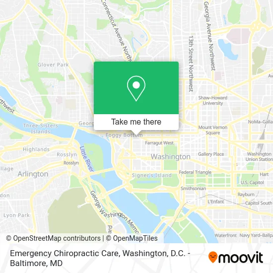
See Emergency Chiropractic Care, Washington, on the map
Public Transit to Emergency Chiropractic Care in Washington
Wondering how to get to Emergency Chiropractic Care in Washington? Moovit helps you find the best way to get to Emergency Chiropractic Care with step-by-step directions from the nearest public transit station.
Moovit provides free maps and live directions to help you navigate through your city. View schedules, routes, timetables, and find out how long does it take to get to Emergency Chiropractic Care in real time.
Looking for the nearest stop or station to Emergency Chiropractic Care? Check out this list of stops closest to your destination: K St & 20th St NW Eb; Pennsylvania Av Nw+22 St NW; K St & 21st St NW Eb; Dupont Circle Metro Station; Pennsylvania Av Nw+24 St NW; L St & 21st St NW Eb; 23 St Nw+I St NW; Foggy Bottom Gwu Kennedy Center Metro Station.
Bus: A58, D10, D80, 220, 240, 260, 620, 640, D20, 725, D82, C85.Train: MARC, NORTHEAST REGIONAL.Metro: BLUE, ORANGE, SILVER, RED.
Want to see if there’s another route that gets you there at an earlier time? Moovit helps you find alternative routes or times. Get directions from and directions to Emergency Chiropractic Care easily from the Moovit App or Website.
We make riding to Emergency Chiropractic Care easy, which is why over 1.5 million users, including users in Washington, trust Moovit as the best app for public transit. You don’t need to download an individual bus app or train app, Moovit is your all-in-one transit app that helps you find the best bus time or train time available.
For information on prices of bus, metro and train, costs and ride fares to Emergency Chiropractic Care, please check the Moovit app.
Use the app to navigate to popular places including to the airport, hospital, stadium, grocery store, mall, coffee shop, school, college, and university.
Emergency Chiropractic Care Address: 2140 Pennsylvania Ave NW Washington, DC 20037 street in Washington
- Dr Morgan D Delaney MD,
- Gary L. Simon,
- Samuel Kallus, MD,
- David A Schessel MD,
- Dr Monica Mukherjee, MD,
- GW Health Network,
- GW Medical Faculty Associates (G W U Medical Faculty Associates),
- Libertyx Bitcoin ATM,
- Dr Patrick Lee, MD,
- Dr Andrew S Holmes, MD,
- Katz Richard J MD,
- 2150 Pennsylvania Ave NW,
- PWR,
- North Italia,
- Coumadin Clinic,
- N-Methylpyrrolidone Producers Group, Inc.,
- Harlow David S,
- BCCM Services,
- Gpi,
- Mtafrica Invest
Places Near Emergency Chiropractic Care (Washington)
- PG Mall, Prince George's County,
- Washington National Cathedral, Washington,
- M&T Bank Stadium, Baltimore,
- Amazon Hq2, Arlington County,
- Sibley Memorial Hospital, Washington,
- Basilica of the National Shrine, Washington,
- Westfield Montgomery Mall, Montgomery County,
- National Museum of African American History and Culture, Washington,
- Washington DC VA Medical Center, Washington,
- Capital One Arena, Washington,
- National Zoo, Washington,
- Pennsylvania Ave NW (3rd st and pennsylvania), Washington,
- Museum Of The Bible, Washington,
- Camden Yards, Baltimore,
- Warner Theatre, Washington,
- Georgetown, Washington,
- Rock Creek Tennis Center, Washington,
- The Anthem, Washington,
- National Theatre, Washington,
- Marriott Marquis Washington, DC, Washington
How to get to popular places in Washington, D.C. - Baltimore, MD with public transit
Get around Washington by public transit!
Traveling around Washington has never been so easy. See step by step directions as you travel to any attraction, street or major public transit station. View bus and train schedules, arrival times, service alerts and detailed routes on a map, so you know exactly how to get to anywhere in Washington.
When traveling to any destination around Washington use Moovit's Live Directions with Get Off Notifications to know exactly where and how far to walk, how long to wait for your line, and how many stops are left. Moovit will alert you when it's time to get off — no need to constantly re-check whether yours is the next stop.
Wondering how to use public transit in Washington or how to pay for public transit in Washington? Moovit public transit app can help you navigate your way with public transit easily, and at minimum cost. It includes public transit fees, ticket prices, and costs. Looking for a map of Washington public transit lines? Moovit public transit app shows all public transit maps in Washington with all Bus, Train, Metro, Light Rail and Ferry routes and stops on an interactive map.
Washington, D.C. - Baltimore, MD has 5 transit type(s), including: Bus, Train, Metro, Light Rail and Ferry, operated by several transit agencies, including WMATA, Montgomery County Ride On, Fairfax Connector, TheBus, PRTC, DASH - Alexandria, Arlington Transit (ART), RTA of Central Maryland, MDOT MTA, MDOT MTA Light RailLink, MDOT MTA Commuter Bus, MDOT MTA Local Bus, FXBGO!, Virginia Railway Express (VRE) and MARC