Directions to Emergency Services & Civil Def (James City County) with public transportation
The following transit lines have routes that pass near Emergency Services & Civil Def
 Bus: 6, 5.
- Train: NORTHEAST REGIONAL.
How to get to Emergency Services & Civil Def by bus?
Click on the bus route to see step by step directions with maps, line arrival times and updated time schedules.
Bus stops near Emergency Services & Civil Def in James City County
Train station near Emergency Services & Civil Def in James City County
- Williamsburg Amtrak Station, 51 min walk,VIEW
Bus lines to Emergency Services & Civil Def in James City County
What are the closest stations to Emergency Services & Civil Def?
The closest stations to Emergency Services & Civil Def are:
- Strawberry Plains at Tranquility is 954 yards away, 12 min walk.
- Pilot Way at Taco Bell is 1027 yards away, 13 min walk.
- Williamsburg Amtrak Station is 4300 yards away, 51 min walk.
Which bus line stops near Emergency Services & Civil Def?
6 (6 Jamestown)
What’s the nearest bus station to Emergency Services & Civil Def in James City County?
The nearest bus station to Emergency Services & Civil Def in James City County is Strawberry Plains at Tranquility. It’s a 12 min walk away.
What time is the first train to Emergency Services & Civil Def in James City County?
The NORTHEAST REGIONAL is the first train that goes to Emergency Services & Civil Def in James City County. It stops nearby at 4:24 AM.
What time is the last train to Emergency Services & Civil Def in James City County?
The NORTHEAST REGIONAL is the last train that goes to Emergency Services & Civil Def in James City County. It stops nearby at 7:44 PM.
What time is the first bus to Emergency Services & Civil Def in James City County?
The 6 is the first bus that goes to Emergency Services & Civil Def in James City County. It stops nearby at 6:08 AM.
What time is the last bus to Emergency Services & Civil Def in James City County?
The 6 is the last bus that goes to Emergency Services & Civil Def in James City County. It stops nearby at 8:45 PM.
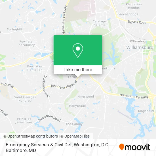
See Emergency Services & Civil Def, James City County, on the map
Public Transit to Emergency Services & Civil Def in James City County
Wondering how to get to Emergency Services & Civil Def in James City County? Moovit helps you find the best way to get to Emergency Services & Civil Def with step-by-step directions from the nearest public transit station.
Moovit provides free maps and live directions to help you navigate through your city. View schedules, routes, timetables, and find out how long does it take to get to Emergency Services & Civil Def in real time.
Looking for the nearest stop or station to Emergency Services & Civil Def? Check out this list of stops closest to your destination: Strawberry Plains at Tranquility; Pilot Way at Taco Bell; Williamsburg Amtrak Station.
Bus: 6, 5.Train: NORTHEAST REGIONAL.
Want to see if there’s another route that gets you there at an earlier time? Moovit helps you find alternative routes or times. Get directions from and directions to Emergency Services & Civil Def easily from the Moovit App or Website.
We make riding to Emergency Services & Civil Def easy, which is why over 1.5 million users, including users in James City County, trust Moovit as the best app for public transit. You don’t need to download an individual bus app or train app, Moovit is your all-in-one transit app that helps you find the best bus time or train time available.
For information on prices of bus and train, costs and ride fares to Emergency Services & Civil Def, please check the Moovit app.
Use the app to navigate to popular places including to the airport, hospital, stadium, grocery store, mall, coffee shop, school, college, and university.
Emergency Services & Civil Def Address: 5077 John Tyler Hwy Williamsburg, VA 23185 street in James City County
- James City County Fire Department Station 3,
- James City County Police Department,
- James City County Fire Station 3,
- Paws & Claws Pet Sitting Service,
- Ardent Builders,
- Hands of Fidelity Care,
- La Fontaine,
- Alis Sofija DDS,
- Waters Edge Church,
- Cross Walk Church,
- Mega Auto Spa-Williamsburg,
- David Sulouff Plumbing,
- Williamsburg Guitar Lessons,
- Williamsburg Community Hospital,
- Union Bank And Trust,
- Reneau Med Center for Age MGT Aesthtc,
- Ross Younger MD,
- Sleep Disorders Center at Williamsburg Neurology,
- Evans Peter S,
- Richard S Ackart MD
Places Near Emergency Services & Civil Def (James City County)
- Pennsylvania Ave NW (3rd st and pennsylvania), Washington,
- Amazon Hq2, Arlington County,
- National Museum of African American History and Culture, Washington,
- Westfield Montgomery Mall, Montgomery County,
- Georgetown, Washington,
- Rock Creek Tennis Center, Washington,
- The Anthem, Washington,
- Sibley Memorial Hospital, Washington,
- National Mall, Washington,
- Camden Yards, Baltimore,
- Marriott Marquis Washington, DC, Washington,
- PG Mall, Prince George's County,
- Capital One Arena, Washington,
- Warner Theatre, Washington,
- M&T Bank Stadium, Baltimore,
- Washington DC VA Medical Center, Washington,
- Washington National Cathedral, Washington,
- Museum Of The Bible, Washington,
- National Zoo, Washington,
- Basilica of the National Shrine, Washington
How to get to popular places in Washington, D.C. - Baltimore, MD with public transit
Get around James City County by public transit!
Traveling around James City County has never been so easy. See step by step directions as you travel to any attraction, street or major public transit station. View bus and train schedules, arrival times, service alerts and detailed routes on a map, so you know exactly how to get to anywhere in James City County.
When traveling to any destination around James City County use Moovit's Live Directions with Get Off Notifications to know exactly where and how far to walk, how long to wait for your line, and how many stops are left. Moovit will alert you when it's time to get off — no need to constantly re-check whether yours is the next stop.
Wondering how to use public transit in James City County or how to pay for public transit in James City County? Moovit public transit app can help you navigate your way with public transit easily, and at minimum cost. It includes public transit fees, ticket prices, and costs. Looking for a map of James City County public transit lines? Moovit public transit app shows all public transit maps in James City County with all Bus, Train, Metro, Light Rail and Ferry routes and stops on an interactive map.
Washington, D.C. - Baltimore, MD has 5 transit type(s), including: Bus, Train, Metro, Light Rail and Ferry, operated by several transit agencies, including WMATA, Montgomery County Ride On, Fairfax Connector, TheBus, PRTC, DASH - Alexandria, Arlington Transit (ART), RTA of Central Maryland, MDOT MTA, MDOT MTA Light RailLink, MDOT MTA Commuter Bus, MDOT MTA Local Bus, FXBGO!, Virginia Railway Express (VRE) and MARC