How to get to Emstar Marzena Charys by train?
Click on the train route to see step by step directions with maps, line arrival times and updated time schedules.
Bus stops near Emstar Marzena Charys in Warsaw
Train station near Emstar Marzena Charys in Warsaw
- Wrocław Stadion, 8 min walk,VIEW
Light Rail stations near Emstar Marzena Charys in Warsaw
- Glinianki, 8 min walk,VIEW
Bus lines to Emstar Marzena Charys in Warsaw
What are the closest stations to Emstar Marzena Charys?
The closest stations to Emstar Marzena Charys are:
- Pilczyce is 170 meters away, 3 min walk.
- Tarczyński Arena (Lotnicza) is 402 meters away, 6 min walk.
- Wrocław Stadion is 550 meters away, 8 min walk.
- Glinianki is 563 meters away, 8 min walk.
- Tarczyński Arena (Aleja Śląska) is 617 meters away, 8 min walk.
Which train lines stop near Emstar Marzena Charys?
These train lines stop near Emstar Marzena Charys: D2, D20.
Which light rail lines stop near Emstar Marzena Charys?
These light rail lines stop near Emstar Marzena Charys: 10, 20.
What’s the nearest light rail station to Emstar Marzena Charys in Warsaw?
The nearest light rail station to Emstar Marzena Charys in Warsaw is Glinianki. It’s a 8 min walk away.
What’s the nearest train station to Emstar Marzena Charys in Warsaw?
The nearest train station to Emstar Marzena Charys in Warsaw is Wrocław Stadion. It’s a 8 min walk away.
What’s the nearest bus station to Emstar Marzena Charys in Warsaw?
The nearest bus station to Emstar Marzena Charys in Warsaw is Pilczyce. It’s a 3 min walk away.
What time is the first light rail to Emstar Marzena Charys in Warsaw?
The 10 is the first light rail that goes to Emstar Marzena Charys in Warsaw. It stops nearby at 4:12 AM.
What time is the last light rail to Emstar Marzena Charys in Warsaw?
The 10 is the last light rail that goes to Emstar Marzena Charys in Warsaw. It stops nearby at 11:56 PM.
What time is the first train to Emstar Marzena Charys in Warsaw?
The D2 is the first train that goes to Emstar Marzena Charys in Warsaw. It stops nearby at 4:49 AM.
What time is the last train to Emstar Marzena Charys in Warsaw?
The D2 is the last train that goes to Emstar Marzena Charys in Warsaw. It stops nearby at 11:02 PM.
What time is the first bus to Emstar Marzena Charys in Warsaw?
The 243 is the first bus that goes to Emstar Marzena Charys in Warsaw. It stops nearby at 3:06 AM.
What time is the last bus to Emstar Marzena Charys in Warsaw?
The 253 is the last bus that goes to Emstar Marzena Charys in Warsaw. It stops nearby at 3:33 AM.
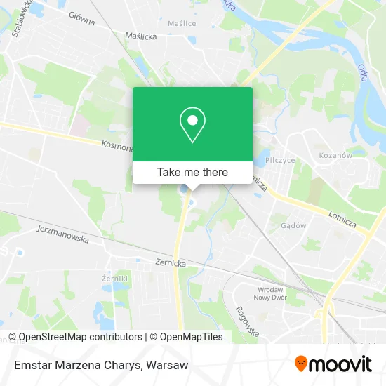
See Emstar Marzena Charys, Warsaw, on the map
Public Transit to Emstar Marzena Charys in Warsaw
Wondering how to get to Emstar Marzena Charys in Warsaw? Moovit helps you find the best way to get to Emstar Marzena Charys with step-by-step directions from the nearest public transit station.
Moovit provides free maps and live directions to help you navigate through your city. View schedules, routes, timetables, and find out how long does it take to get to Emstar Marzena Charys in real time.
Looking for the nearest stop or station to Emstar Marzena Charys? Check out this list of stops closest to your destination: Pilczyce; Tarczyński Arena (Lotnicza); Wrocław Stadion; Glinianki; Tarczyński Arena (Aleja Śląska).
Bus: 243, 253, 152.Train: D2, D20.Light Rail: 10, 20.
Want to see if there’s another route that gets you there at an earlier time? Moovit helps you find alternative routes or times. Get directions from and directions to Emstar Marzena Charys easily from the Moovit App or Website.
We make riding to Emstar Marzena Charys easy, which is why over 1.5 million users, including users in Warsaw, trust Moovit as the best app for public transit. You don’t need to download an individual bus app or train app, Moovit is your all-in-one transit app that helps you find the best bus time or train time available.
For information on prices of train, light rail and bus, costs and ride fares to Emstar Marzena Charys, please check the Moovit app.
Use the app to navigate to popular places including to the airport, hospital, stadium, grocery store, mall, coffee shop, school, college, and university.
Emstar Marzena Charys Address: ulica Szczecińska 9, 54-517 Wrocław street in Warsaw
- Centrum Nurkowe Add Wrocław,
- Emstar - Stylowe Cegły,
- Preś Robert Centrum Wentylacji i Klimatyzacji Ventus,
- Aronia. Pracowniczy Ogród Działkowy,
- Joint Venture Hermann Kirchner Bauunternehmung Gmbh Max Bógl Bauunternehmung Gmbh & Co Kg Berger Ba,
- Amdsp Oddzial Wroclaw,
- Arkusxps. Cięcie Materiałów Spienionych,
- Eltix-Complex sp. z o.o.,
- Postbud. sp. z o.o. Ekologiczne Betony Bezpopiołowe,
- Airnet s.c.,
- 'Menke Logistics' sp. Z.O.O.,
- Print s.c. Makowski J., Węgrzyn W.,
- Kwiaciarnia Czerwona Róża,
- Radexpol Przedsiębiorstwo Techniczno-Usługowe,
- Eko Sylwia,
- Mundus sp. z o.o.,
- Dowgiert Halina. Budownictwo,
- Młynarek Ewa. Przedsiębiorstwo Handlowo - Usługowe,
- Ferum s.c. Buczek Władysław Siłanow Waldemar,
- Alba Atol sp. z o.o.
Places Near Emstar Marzena Charys (Warsaw)
- Domaniewska, Warsaw,
- Wołoska-Szpital 01, Warsaw,
- Szaserów - Szpital, Warsaw,
- CH Arkadia, Warsaw,
- Postępu, Warsaw,
- Cmentarz Bródnowski, Warsaw,
- Centralny Szpital Kliniczny MSWiA ul. Wołoska, Warsaw,
- Wołoska, Warsaw,
- Banacha - Szpital Kliniczny, Warsaw,
- Galeria Mokotów, Warsaw,
- Stare Miasto, Warsaw,
- Szpital Spartanska, Warsaw,
- Torwar, Warsaw,
- Szpital Orłowskiego, Warsaw,
- Szpital Czerniakowski, Warsaw,
- Galeria Północna, Warsaw,
- Sejm Rp, Warsaw,
- Instytut Kardiologii w Aninie, Warsaw,
- Szpital Bielański, Warsaw,
- PGE Narodowy, Warsaw
How to get to popular places in Warsaw with public transit
Get around Warsaw by public transit!
Traveling around Warsaw has never been so easy. See step by step directions as you travel to any attraction, street or major public transit station. View bus and train schedules, arrival times, service alerts and detailed routes on a map, so you know exactly how to get to anywhere in Warsaw.
When traveling to any destination around Warsaw use Moovit's Live Directions with Get Off Notifications to know exactly where and how far to walk, how long to wait for your line, and how many stops are left. Moovit will alert you when it's time to get off — no need to constantly re-check whether yours is the next stop.
Wondering how to use public transit in Warsaw or how to pay for public transit in Warsaw? Moovit public transit app can help you navigate your way with public transit easily, and at minimum cost. It includes public transit fees, ticket prices, and costs. Looking for a map of Warsaw public transit lines? Moovit public transit app shows all public transit maps in Warsaw with all Bus, Train, Metro, Light Rail, Ferry and Cable Car routes and stops on an interactive map.
Warsaw has 6 transit type(s), including: Bus, Train, Metro, Light Rail, Ferry and Cable Car, operated by several transit agencies, including Warszawski Transport Publiczny, Warszawska Kolej Dojazdowa, Koleje Mazowieckie, ZTP Kraków, Miasto Piastów, Miasto Ząbki, Koleje Małopolskie, Komunikacja Miejska Łomianki, Gmina Pruszków, MPK Wrocław, MZDiK Radom, UM w Grodzisku Mazowieckim, UM w Nowym Dworze Mazowieckim, UM Płońsk and Koleje Dolnośląskie