How to get to EnBW by bus?
Click on the bus route to see step by step directions with maps, line arrival times and updated time schedules.
From Neuenheimer Feld, Neuenheim
80 minFrom Thoraxklinik Heidelberg, Neuenheim
79 minFrom Friedhof Käfertal, Käfertal
118 minFrom Möbel Höffner, Schwetzingen
69 minFrom Luxor Filmpalast, Bahnstadt
73 minFrom Agaplesion Bethanien Krankenhaus Heidelberg, Südstadt
81 minFrom Universitätsklinikum Heidelberg-Notaufnahme, Neuenheim
78 minFrom MVV Energie Ladestation, Käfertal
116 minFrom FH 1863, Neckarstadt-Ost/Wohlgelegen
89 min
Light Rail stations near EnBW in Schriesheim
Bus stop near EnBW in Schriesheim
- Schriesheim, Ladenburger Str., 4 min walk,VIEW
Bus lines to EnBW in Schriesheim
- 628, Schriesheim, Bahnhof,VIEW
What are the closest stations to EnBW?
The closest stations to EnBW are:
- Schriesheim Bahnhof is 236 meters away, 4 min walk.
- Schriesheim, Ladenburger Str. is 284 meters away, 4 min walk.
- Schriesheim, Zentgrafenstraße is 2056 meters away, 27 min walk.
Which light rail lines stop near EnBW?
These light rail lines stop near EnBW: 21, RNV 5.
Which bus line stops near EnBW?
628 (Schriesheim, Bahnhof)
What’s the nearest light rail station to EnBW in Schriesheim?
The nearest light rail station to EnBW in Schriesheim is Schriesheim Bahnhof. It’s a 4 min walk away.
What’s the nearest bus station to EnBW in Schriesheim?
The nearest bus station to EnBW in Schriesheim is Schriesheim, Ladenburger Str.. It’s a 4 min walk away.
What time is the first light rail to EnBW in Schriesheim?
The 5 is the first light rail that goes to EnBW in Schriesheim. It stops nearby at 4:56 AM.
What time is the last light rail to EnBW in Schriesheim?
The RNV 5 is the last light rail that goes to EnBW in Schriesheim. It stops nearby at 1:01 AM.
What time is the first bus to EnBW in Schriesheim?
The 628 is the first bus that goes to EnBW in Schriesheim. It stops nearby at 5:08 AM.
What time is the last bus to EnBW in Schriesheim?
The 628 is the last bus that goes to EnBW in Schriesheim. It stops nearby at 1:02 AM.
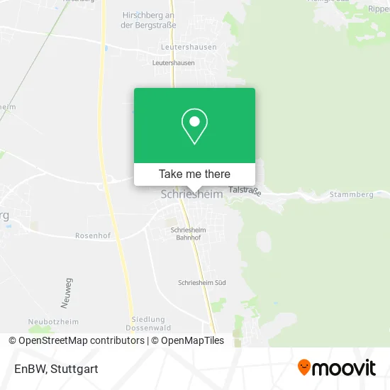
See EnBW, Schriesheim, on the map
Public Transit to EnBW in Schriesheim
Wondering how to get to EnBW in Schriesheim? Moovit helps you find the best way to get to EnBW with step-by-step directions from the nearest public transit station.
Moovit provides free maps and live directions to help you navigate through your city. View schedules, routes, timetables, and find out how long does it take to get to EnBW in real time.
Looking for the nearest stop or station to EnBW? Check out this list of stops closest to your destination: Schriesheim Bahnhof; Schriesheim, Ladenburger Str.; Schriesheim, Zentgrafenstraße.
Light Rail: 21, RNV 5.Bus: 628.
Want to see if there’s another route that gets you there at an earlier time? Moovit helps you find alternative routes or times. Get directions from and directions to EnBW easily from the Moovit App or Website.
We make riding to EnBW easy, which is why over 1.5 million users, including users in Schriesheim, trust Moovit as the best app for public transit. You don’t need to download an individual bus app or train app, Moovit is your all-in-one transit app that helps you find the best bus time or train time available.
For information on prices of bus and light rail, costs and ride fares to EnBW, please check the Moovit app.
Use the app to navigate to popular places including to the airport, hospital, stadium, grocery store, mall, coffee shop, school, college, and university.
EnBW Address: Bismarckstraße 39 69198 Schriesheim street in Schriesheim
- Festplatz Schriesheim,
- Weinfass,
- Weingärtner Erdbeeren & Spargel,
- Stadtplan,
- Ladestation für Elektrofahrzeuge,
- Owk-Platz,
- Wanderkarte,
- Ralf Habenicht,
- Linde Konditorei Cafe,
- Schmid,
- Rötger Unternehmensberatung,
- Elvira Rest Ergo Victoria,
- Schmid Gmbh,
- Baan Thaimassage,
- Kosmetikinstitut Birgit,
- Naturheilpraxis Birgit Hübner,
- Haus Der Feuerwehr,
- Freiwillige Feuerwehr Schriesheim,
- Konditorei & Café Linde,
- Mathaisemarkt
Places Near EnBW (Schriesheim)
- Hauptbahnhof Stuttgart, Stuttgart-Mitte,
- Im Wizemann (Halle), Bad Cannstatt,
- Mercedes-Benz Museum, Bad Cannstatt,
- Porsche Museum, Zuffenhausen,
- Gasometer Pforzheim, Pforzheim,
- Porsche-Arena, Bad Cannstatt,
- Mercedes-Benz Museum (Mercedes Museum Stuttgart), Bad Cannstatt,
- Marmorsaal Im Weissenburgpark, Stuttgart-Süd,
- FlixBus Haltestelle, Stuttgart,
- Mettingen Eros-Center Puff Laufhaus, Esslingen Am Neckar,
- Hanns-Martin-Schleyer-Halle (Stuttgart Hans-Martin-Schleyerhalle), Bad Cannstatt,
- Gleis 101/102 (tief), Stuttgart-Mitte,
- Schleyerhalle, Bad Cannstatt,
- Waldfriedhof, Degerloch,
- Pariser Platz Stuttgart, Stuttgart-Mitte,
- SI-Centrum, Möhringen,
- Hanns-Martin-Schleyer-Halle, Bad Cannstatt,
- Klinikum Stuttgart - Katharinenhospital, Stuttgart-Mitte,
- Wilhelma (U-Bahn Wilhelma), Bad Cannstatt,
- Geilhaus Haus 33a, Reutlingen-Betzingen
How to get to popular places in Stuttgart with public transit
Get around Schriesheim by public transit!
Traveling around Schriesheim has never been so easy. See step by step directions as you travel to any attraction, street or major public transit station. View bus and train schedules, arrival times, service alerts and detailed routes on a map, so you know exactly how to get to anywhere in Schriesheim.
When traveling to any destination around Schriesheim use Moovit's Live Directions with Get Off Notifications to know exactly where and how far to walk, how long to wait for your line, and how many stops are left. Moovit will alert you when it's time to get off — no need to constantly re-check whether yours is the next stop.
Wondering how to use public transit in Schriesheim or how to pay for public transit in Schriesheim? Moovit public transit app can help you navigate your way with public transit easily, and at minimum cost. It includes public transit fees, ticket prices, and costs. Looking for a map of Schriesheim public transit lines? Moovit public transit app shows all public transit maps in Schriesheim with all Bus, Train, Subway, Light Rail, Ferry, S-Bahn and Funicular routes and stops on an interactive map.
Stuttgart has 7 transit type(s), including: Bus, Train, Subway, Light Rail, Ferry, S-Bahn and Funicular, operated by several transit agencies, including SSB - Stadtbahn, SSB, SSB - Seilbahn / Zacke, S-Bahn Stuttgart, Rhein-Neckar-Verkehr GmbH (rnv), Karlsruher Verkehrsverbund, DB AG, DB Regiobus BW, Arverio Baden-Württemberg GmbH, DB RegioNetz Verkehrs GmbH Westfrankenbahn, DB Regio AG Baden-Württemberg, Südwestdeutsche Verkehrs-AG, DB Regio AG Mitte Region Hessen, DB and Bodensee-Oberschwaben-Bahn