How to get to Ent Petit by bus?
Click on the bus route to see step by step directions with maps, line arrival times and updated time schedules.
From Camp militaire de Frileuse, Beynes
53 minFrom IKEA, Plaisir
40 minFrom Chambourcy, Chambourcy
106 minFrom Bois D'Arcy, Versailles
50 minFrom Parly 2, Le Chesnay
82 minFrom Hôpital de Poissy, Poissy
69 minFrom Orgeval, Orgeval
73 minFrom Guyancourt, Guyancourt
77 minFrom Centre Commercial Grand Plaisir, Plaisir
36 minFrom Technocentre Renault, Guyancourt
66 min
How to get to Ent Petit by train?
Click on the train route to see step by step directions with maps, line arrival times and updated time schedules.
Bus stops near Ent Petit in Villiers-Saint-Frederic
Train station near Ent Petit in Villiers-Saint-Frederic
- Villiers - Neauphle - Pontchartrain, 20 min walk,VIEW
Bus lines to Ent Petit in Villiers-Saint-Frederic
- 5206, La Mare,VIEW
- 5214, Mairie,VIEW
- 5219, Mauldrette,VIEW
- 5324, Place de la Gare / Villiers - Neauphle - Pontchartrain,VIEW
- 5201, Place de la Gare / Villiers - Neauphle - Pontchartrain,VIEW
- 5289, Notre Dame du Bel-Air,VIEW
- 5327, Gare de Plaisir Grignon - Quai 2,VIEW
- 7818, Gare Routière de Mantes-La-Ville - Quai 26,VIEW
- 5367, Zac la Prévôté,VIEW
- 5213, Collège Maurice Ravel,VIEW
- 5355, Place de la Gare / Villiers - Neauphle - Pontchartrain,VIEW
- N, Gare Montparnasse,VIEW
- 5240, Puits Perdu - Rue Des Champs,VIEW
What are the closest stations to Ent Petit?
The closest stations to Ent Petit are:
- Châtaigneraie is 459 meters away, 6 min walk.
- Trois Communes is 711 meters away, 10 min walk.
- Lycée - Gare Rd11 is 1011 meters away, 14 min walk.
- Le Pontel (Route de Beynes) is 1015 meters away, 14 min walk.
- Place de la Gare / Villiers - Neauphle - Pontchartrain is 1522 meters away, 20 min walk.
- Villiers - Neauphle - Pontchartrain is 1522 meters away, 20 min walk.
- Collège Saint-Simon is 1780 meters away, 23 min walk.
Which bus lines stop near Ent Petit?
These bus lines stop near Ent Petit: 5214, 5219, 5289, 5327, 5367, 7818.
Which train line stops near Ent Petit?
N (Paris-Montparnasse)
What’s the nearest train station to Ent Petit in Villiers-Saint-Frederic?
The nearest train station to Ent Petit in Villiers-Saint-Frederic is Villiers - Neauphle - Pontchartrain. It’s a 20 min walk away.
What’s the nearest bus station to Ent Petit in Villiers-Saint-Frederic?
The nearest bus station to Ent Petit in Villiers-Saint-Frederic is Châtaigneraie. It’s a 6 min walk away.
What time is the first train to Ent Petit in Villiers-Saint-Frederic?
The N is the first train that goes to Ent Petit in Villiers-Saint-Frederic. It stops nearby at 5:59 AM.
What time is the last train to Ent Petit in Villiers-Saint-Frederic?
The N is the last train that goes to Ent Petit in Villiers-Saint-Frederic. It stops nearby at 10:32 PM.
What time is the first bus to Ent Petit in Villiers-Saint-Frederic?
The 7818 is the first bus that goes to Ent Petit in Villiers-Saint-Frederic. It stops nearby at 5:28 AM.
What time is the last bus to Ent Petit in Villiers-Saint-Frederic?
The N is the last bus that goes to Ent Petit in Villiers-Saint-Frederic. It stops nearby at 1:18 AM.
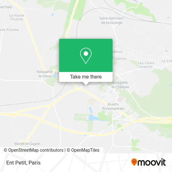
See Ent Petit, Villiers-Saint-Frederic, on the map
Public Transit to Ent Petit in Villiers-Saint-Frederic
Wondering how to get to Ent Petit in Villiers-Saint-Frederic? Moovit helps you find the best way to get to Ent Petit with step-by-step directions from the nearest public transit station.
Moovit provides free maps and live directions to help you navigate through your city. View schedules, routes, timetables, and find out how long does it take to get to Ent Petit in real time.
Looking for the nearest stop or station to Ent Petit? Check out this list of stops closest to your destination: Châtaigneraie; Trois Communes; Lycée - Gare Rd11; Le Pontel (Route de Beynes); Place de la Gare / Villiers - Neauphle - Pontchartrain; Villiers - Neauphle - Pontchartrain; Collège Saint-Simon.
Bus: 5214, 5219, 5289, 5327, 5367, 7818, 5206, 5324, 5201, 5213.Train: N.
Want to see if there’s another route that gets you there at an earlier time? Moovit helps you find alternative routes or times. Get directions from and directions to Ent Petit easily from the Moovit App or Website.
We make riding to Ent Petit easy, which is why over 1.5 million users, including users in Villiers-Saint-Frederic, trust Moovit as the best app for public transit. You don’t need to download an individual bus app or train app, Moovit is your all-in-one transit app that helps you find the best bus time or train time available.
For information on prices of bus and train, costs and ride fares to Ent Petit, please check the Moovit app.
Use the app to navigate to popular places including to the airport, hospital, stadium, grocery store, mall, coffee shop, school, college, and university.
Ent Petit Address: 27 Route de Saint-Germain 78640 Villiers-Saint-Frédéric street in Villiers-Saint-Frederic
- Bernard Michel,
- William Ternus,
- Ayly Beauty,
- Marine - Esthéticienne à Domicile - Wecasa Beauté,
- Villiers-Saint-Frédéric,
- Kpmd Consulting,
- Perspectives Maisons Individuelles,
- Reynier Pierre,
- Le Sentier de,
- Dépannage Informatique PC Okay Cartrink,
- Luet Yann,
- Salle de Sports au Sol,
- Parking Relais Château de Versailles Villiers - Neauphle - Pontchartrain P2,
- Gare SNCF de Villiers–Neauphle–Pontchartrain,
- SEY ma borne,
- Trois Communes,
- Pontchartrain,
- Ceda,
- Seine Aval,
- European Security Trading
Places Near Ent Petit (Villiers-Saint-Frederic)
- Fondation Louis Vuitton, Paris,
- Marché Saint-Pierre, Paris,
- Hôpital Henri Mondor, Creteil,
- Créteil Soleil, Creteil,
- Gare Routière Flixbus, Paris,
- Atelier Des Lumieres, Paris,
- Hopital Foch, Suresnes,
- Hôpital Saint-Joseph, Paris,
- 29 Rue Manin, Paris,
- Centre Hospitalier des 15/20, Paris,
- Institut Curie, Paris,
- Hôpital Cochin, Paris,
- Hopital Lariboisière, Paris,
- Galeries Lafayette, Paris,
- Hôpital Necker, Paris,
- Galeries Lafayette Haussmann, Paris,
- Théâtre Mogador, Paris,
- Hôpital Beaujon, Clichy,
- Hôpital de la Pitié-Salpêtrière, Paris,
- Hôpital Pitié Salpêtrière, Paris
How to get to popular places in Paris with public transit
Get around Villiers-Saint-Frederic by public transit!
Traveling around Villiers-Saint-Frederic has never been so easy. See step by step directions as you travel to any attraction, street or major public transit station. View bus and train schedules, arrival times, service alerts and detailed routes on a map, so you know exactly how to get to anywhere in Villiers-Saint-Frederic.
When traveling to any destination around Villiers-Saint-Frederic use Moovit's Live Directions with Get Off Notifications to know exactly where and how far to walk, how long to wait for your line, and how many stops are left. Moovit will alert you when it's time to get off — no need to constantly re-check whether yours is the next stop.
Wondering how to use public transit in Villiers-Saint-Frederic or how to pay for public transit in Villiers-Saint-Frederic? Moovit public transit app can help you navigate your way with public transit easily, and at minimum cost. It includes public transit fees, ticket prices, and costs. Looking for a map of Villiers-Saint-Frederic public transit lines? Moovit public transit app shows all public transit maps in Villiers-Saint-Frederic with all Bus, Train, Metro, Light Rail, RER, Funicular and Gondola routes and stops on an interactive map.
Paris has 7 transit type(s), including: Bus, Train, Metro, Light Rail, RER, Funicular and Gondola, operated by several transit agencies, including RATP, RER, RER Bus de remplacement, Train, Train Bus de remplacement, Tramway Bus de remplacement, TER, ADP, Magical Shuttle, Argenteuil - Boucles de Seine, Autocars Dominique, Bièvre, Brie et 2 Morin, Le Bus - C.C. du Clermontois and Cœur d’Essonne