Directions to Escuela Lomas de Chapultepec (Puebla) with public transportation
The following transit lines have routes that pass near Escuela Lomas de Chapultepec
 Bus: RUTA 1, RUTA 37, RUTA APANGO, RUTA AZTECA A, RUTA 23.
How to get to Escuela Lomas de Chapultepec by bus?
Click on the bus route to see step by step directions with maps, line arrival times and updated time schedules.
From Boulevard San Felipe 2600, San Pedro Cholula
46 minFrom Guadalupe Caleras, San Pedro Cholula
58 minFrom Plaza Solé Zavaleta, San Gregorio Atzompa
51 minFrom Col. Ignacio Romero Vargas, San Pedro Cholula
48 minFrom 5 de Mayo, Puebla
31 minFrom Calzada Zavaleta y cruce con Recta Cholula, San Gregorio Atzompa
50 minFrom San Cosme Mazatecoxco, San Pedro Cholula
43 minFrom Santa Cruz los Ángeles, San Andrés Cholula
38 minFrom Compartamos Banco, San Pedro Cholula
48 minFrom Salon Social Zavaleta IMSS SNTSS, San Andrés Cholula
40 min
Bus stops near Escuela Lomas de Chapultepec in Puebla
Bus lines to Escuela Lomas de Chapultepec in Puebla
What are the closest stations to Escuela Lomas de Chapultepec?
The closest stations to Escuela Lomas de Chapultepec are:
- Calle Granada 3 is 184 meters away, 3 min walk.
- Avenida De Los Mártires, Bd is 308 meters away, 4 min walk.
- Avenida De Los Mártires, 56 is 335 meters away, 5 min walk.
Which bus lines stop near Escuela Lomas de Chapultepec?
These bus lines stop near Escuela Lomas de Chapultepec: RUTA 1, RUTA 37, RUTA APANGO, RUTA AZTECA A.
What’s the nearest bus station to Escuela Lomas de Chapultepec in Puebla?
The nearest bus station to Escuela Lomas de Chapultepec in Puebla is Calle Granada 3. It’s a 3 min walk away.
What time is the first bus to Escuela Lomas de Chapultepec in Puebla?
The RUTA AZTECA A is the first bus that goes to Escuela Lomas de Chapultepec in Puebla. It stops nearby at 6:06 AM.
What time is the last bus to Escuela Lomas de Chapultepec in Puebla?
The RUTA 37 is the last bus that goes to Escuela Lomas de Chapultepec in Puebla. It stops nearby at 10:53 PM.
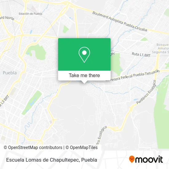
See Escuela Lomas de Chapultepec, Puebla, on the map
Public Transit to Escuela Lomas de Chapultepec in Puebla
Wondering how to get to Escuela Lomas de Chapultepec in Puebla? Moovit helps you find the best way to get to Escuela Lomas de Chapultepec with step-by-step directions from the nearest public transit station.
Moovit provides free maps and live directions to help you navigate through your city. View schedules, routes, timetables, and find out how long does it take to get to Escuela Lomas de Chapultepec in real time.
Looking for the nearest stop or station to Escuela Lomas de Chapultepec? Check out this list of stops closest to your destination: Calle Granada 3; Avenida De Los Mártires; Avenida De Los Mártires.
Bus: RUTA 1, RUTA 37, RUTA APANGO, RUTA AZTECA A, RUTA 23, RUTA 23A, RUTA AZTECA B.
Want to see if there’s another route that gets you there at an earlier time? Moovit helps you find alternative routes or times. Get directions from and directions to Escuela Lomas de Chapultepec easily from the Moovit App or Website.
We make riding to Escuela Lomas de Chapultepec easy, which is why over 1.5 million users, including users in Puebla, trust Moovit as the best app for public transit. You don’t need to download an individual bus app or train app, Moovit is your all-in-one transit app that helps you find the best bus time or train time available.
For information on prices of bus, costs and ride fares to Escuela Lomas de Chapultepec, please check the Moovit app.
Use the app to navigate to popular places including to the airport, hospital, stadium, grocery store, mall, coffee shop, school, college, and university.
Escuela Lomas de Chapultepec Address: Escuela Lomas de Chapultepec, Calle Granada, Lomas de Chapultepec, 72350 Puebla, Puebla street in Puebla
- Santa Cecilia,
- Templo Santa Cecilia,
- Abarrotes San Cristobal de Puebla,
- Lomas de Chapultepec,
- Sorteo Upaep,
- Miscelanea Dulce Maria,
- Unión Textil Ch, S.A. de C.V.,
- Escuela Secundaria Técnica 38 Puebla,
- Atlixco Balneario Las Fajanas,
- Ampliación Vista Hermosa,
- La Taberna de Lola,
- Capilla Virgen de Guadalupe,
- Neon Party,
- Papeleria y Merceria Nuevadeli,
- Carretera Valsequillo Kilometro 7,
- Es. Secundaria Tec. 38,
- Carburadores,
- Agrícola Resurgimiento,
- Vista Hermosa Álamos,
- crediconfia plaza satelite
Places Near Escuela Lomas de Chapultepec (Puebla)
- Ciudad Universitaria, Puebla,
- Centro Comercial Angelópolis, San Andrés Cholula,
- Galerías Serdán, San Pedro Cholula,
- Centro Integral de Servicios CIS, San Andrés Cholula,
- 25 Zona Militar, Puebla,
- Zona de los Fuertes, Puebla,
- Plaza Las Animas, Puebla,
- Parque Ecologico, Pue., San Andrés Cholula,
- Hospital Imss La Margarita, Puebla,
- Complejo Cultural Universitario, Ocoyucan,
- Tres Cruces, Puebla,
- Estadio Cuauhtémoc, Puebla,
- Parque Puebla, Puebla,
- Ciudad Judicial del Estado de Puebla, San Andrés Cholula,
- Secretaria de Finanzas, Puebla,
- Hospital Traumatología y Ortopedia de Puebla, San Pedro Cholula,
- Centro de Desarrollo Comunitario Tres Cruces, Puebla,
- Hospital General Regional 36 IMSS San Alejandro, San Andrés Cholula,
- SAT, San Andrés Cholula,
- Plaza Dorada Centro Comercial, Puebla
How to get to popular places in Puebla with public transit
Get around Puebla by public transit!
Traveling around Puebla has never been so easy. See step by step directions as you travel to any attraction, street or major public transit station. View bus and train schedules, arrival times, service alerts and detailed routes on a map, so you know exactly how to get to anywhere in Puebla.
When traveling to any destination around Puebla use Moovit's Live Directions with Get Off Notifications to know exactly where and how far to walk, how long to wait for your line, and how many stops are left. Moovit will alert you when it's time to get off — no need to constantly re-check whether yours is the next stop.
Wondering how to use public transit in Puebla or how to pay for public transit in Puebla? Moovit public transit app can help you navigate your way with public transit easily, and at minimum cost. It includes public transit fees, ticket prices, and costs. Looking for a map of Puebla public transit lines? Moovit public transit app shows all public transit maps in Puebla with all bus routes and stops on an interactive map.
Puebla has 1 transit type(s), including: bus, operated by several transit agencies, including RUTA, RUTA Alimentadoras, Rutas Convencionales and Líneas temporales