How to get to Escuela de Conductores Jorge Chavez by bus?
Click on the bus route to see step by step directions with maps, line arrival times and updated time schedules.
From Universidad Peruana Cayetano Heredia, La Molina
62 minFrom Av. Argentina, Lima
42 minFrom ISIL, La Molina
51 minFrom Av. Faucett, San Miguel
45 minFrom Local Fuerza Popular, Lima
23 minFrom Óvalo Santa Anita, Ate
45 minFrom Av Arequipa, Lima
25 minFrom Centro Comercial El Polo, Santiago D
35 minFrom ESTADIO NACIONAL LIMA, Lima
20 min
Bus stops near Escuela de Conductores Jorge Chavez in Miraflores
Metro station near Escuela de Conductores Jorge Chavez in Miraflores
- Jorge Chavez, 43 min walk,VIEW
Bus lines to Escuela de Conductores Jorge Chavez in Miraflores
- 1043, La Molina - S.J.L.,VIEW
- 1090, Los Horizontes (Chorrillos) - Óvalo Gutiérrez (Miraflores) ,VIEW
- 1097, Av. Santa Rosa (San Juan De Lurigancho) - Las Palmas (Pachacamac) ,VIEW
- 1110, Miraflores - VMT,VIEW
- 1118, Av. El Triunfo (Villa María Del Triunfo) - Av. Ejercito (Miraflores),VIEW
- 1291, Ventanilla - Chorrillos,VIEW
- 1315, Jose Galvez (Pachacamac) - Óvalo Centenario (Callao),VIEW
- 1491, Puente Benavides (Surco) - Pacasmayo (Callao),VIEW
- IM18, Upc (Santiago De Surco) - Chuquitanta (San Martín De Porres),VIEW
- IO30B, San Gabriel (V.M.T.) - Parque Kennedy (Miraflores),VIEW
- OM19, Chepen (Villa El Salvador),VIEW
- 1087, Alameda Sur (Chorrillos) - 28 De Julio (Jesús María),VIEW
- 1111, Universitaria (Lima) - San Gabriel (Villa María Del Triunfo),VIEW
- 1113, El Triunfo (Villa María Del Triunfo) - Plaza Centro América (Miraflores),VIEW
- 1180, Pamplona Alta (San Juan De Miraflores) - Torre Blanca (Carabayllo),VIEW
- 1182, San Juan de Miraflores - Carabayllo,VIEW
- 1183, Carabayllo - Surco - Carabayllo,VIEW
- 1482, Chorrillos - S.M.P.,VIEW
- C, Terminal Matellini (Chorrillos) - Estación Ramón Castilla (Centro De Lima),VIEW
- EX3, Est. Benavides (Miraflores) - Terminal Naranjal (Independencia),VIEW
What are the closest stations to Escuela de Conductores Jorge Chavez?
The closest stations to Escuela de Conductores Jorge Chavez are:
- La Paz is 129 meters away, 2 min walk.
- Vía Expresa is 157 meters away, 3 min walk.
- Diez Canseco is 245 meters away, 4 min walk.
- Estación Benavides is 249 meters away, 4 min walk.
- Benavides is 329 meters away, 5 min walk.
- Schell is 459 meters away, 6 min walk.
- Jorge Chavez is 3324 meters away, 43 min walk.
Which bus lines stop near Escuela de Conductores Jorge Chavez?
These bus lines stop near Escuela de Conductores Jorge Chavez: 1043, 1111, 1180, 1491, C, EX12, EX9.
What’s the nearest bus station to Escuela de Conductores Jorge Chavez in Miraflores?
The nearest bus station to Escuela de Conductores Jorge Chavez in Miraflores is La Paz. It’s a 2 min walk away.
What time is the first metro to Escuela de Conductores Jorge Chavez in Miraflores?
The LINEA 1 is the first metro that goes to Escuela de Conductores Jorge Chavez in Miraflores. It stops nearby at 5:15 AM.
What time is the last metro to Escuela de Conductores Jorge Chavez in Miraflores?
The LINEA 1 is the last metro that goes to Escuela de Conductores Jorge Chavez in Miraflores. It stops nearby at 10:33 PM.
What time is the first bus to Escuela de Conductores Jorge Chavez in Miraflores?
The 1180 is the first bus that goes to Escuela de Conductores Jorge Chavez in Miraflores. It stops nearby at 3:54 AM.
What time is the last bus to Escuela de Conductores Jorge Chavez in Miraflores?
The 1315 is the last bus that goes to Escuela de Conductores Jorge Chavez in Miraflores. It stops nearby at 12:44 AM.
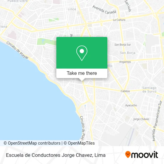
See Escuela de Conductores Jorge Chavez, Miraflores, on the map
Public Transit to Escuela de Conductores Jorge Chavez in Miraflores
Wondering how to get to Escuela de Conductores Jorge Chavez in Miraflores? Moovit helps you find the best way to get to Escuela de Conductores Jorge Chavez with step-by-step directions from the nearest public transit station.
Moovit provides free maps and live directions to help you navigate through your city. View schedules, routes, timetables, and find out how long does it take to get to Escuela de Conductores Jorge Chavez in real time.
Looking for the nearest stop or station to Escuela de Conductores Jorge Chavez? Check out this list of stops closest to your destination: La Paz; Vía Expresa; Diez Canseco; Estación Benavides; Benavides; Schell; Jorge Chavez.
Bus: 1043, 1111, 1180, 1491, C, EX12, EX9, 1090, 1097, 1110, 1118, 1087, 1113, EX3, SX, 1182, 1183, 1482, 1123.Metro: LINEA 1.
Want to see if there’s another route that gets you there at an earlier time? Moovit helps you find alternative routes or times. Get directions from and directions to Escuela de Conductores Jorge Chavez easily from the Moovit App or Website.
We make riding to Escuela de Conductores Jorge Chavez easy, which is why over 1.5 million users, including users in Miraflores, trust Moovit as the best app for public transit. You don’t need to download an individual bus app or train app, Moovit is your all-in-one transit app that helps you find the best bus time or train time available.
For information on prices of bus, costs and ride fares to Escuela de Conductores Jorge Chavez, please check the Moovit app.
Use the app to navigate to popular places including to the airport, hospital, stadium, grocery store, mall, coffee shop, school, college, and university.
Location: Miraflores, Lima
- av 28 de julio 445,
- Calle schell 644,
- Calle Shell entre Paseo de la República y calle Grimaldo del Solar,
- SHELL 644,
- Calle Schell Cuadra 6,
- Chifa Da Ji,
- calle shell,
- GRIMALDO DEL SOLAR 231,
- Av Paseo de la República cuadra 57,
- PASEO DE LA REPUBLICA CUADRA 63,
- GRIMALDO DEL SOLAR CUADRA 1 MIRAFLORES,
- Calle Grimaldo del Solar & Calle Schell,
- SCHELL 597,
- AV PASEO LA REPÚBLICA 5767,
- Ingeniero-Samaniego Alcantara Maria Virginia,
- Av Paseo de la Republica Miraflores,
- CALLE GRIMALDO DEL SOLAR CUADRA 4,
- calle grimaldo del solar 162,
- Elektra surquillo,
- av grimaldo del solar
Places Near Escuela de Conductores Jorge Chavez (Miraflores)
- Aeropuerto Internacional Jorge Chávez, Ventanilla,
- Jockey Plaza, Santiago D,
- Pontificia Universidad Católica del Perú - PUCP, San Miguel,
- av arequipa, Lima,
- Barranco, Barranco,
- Gamarra,
- Parque de las Leyendas, San Miguel,
- Centro Comercial Plaza Norte, Independen,
- Av. Abancay, Lima,
- Paradero Av.Brasil,
- Av. La Marina, San Miguel,
- Real Plaza Puruchuco, Ate,
- Miraflores, Miraflores,
- Larcomar, Miraflores,
- Parque Kennedy, Miraflores,
- Av. Salaverry, Jesus Mari,
- Mall Del Sur,
- Circuito Mágico Del Agua, Lima,
- Plaza San Miguel, San Miguel,
- Hospital Edgardo Rebagliati Martins, Jesus Mari
How to get to popular places in Lima with public transit
Get around Miraflores by public transit!
Traveling around Miraflores has never been so easy. See step by step directions as you travel to any attraction, street or major public transit station. View bus and train schedules, arrival times, service alerts and detailed routes on a map, so you know exactly how to get to anywhere in Miraflores.
When traveling to any destination around Miraflores use Moovit's Live Directions with Get Off Notifications to know exactly where and how far to walk, how long to wait for your line, and how many stops are left. Moovit will alert you when it's time to get off — no need to constantly re-check whether yours is the next stop.
Wondering how to use public transit in Miraflores or how to pay for public transit in Miraflores? Moovit public transit app can help you navigate your way with public transit easily, and at minimum cost. It includes public transit fees, ticket prices, and costs. Looking for a map of Miraflores public transit lines? Moovit public transit app shows all public transit maps in Miraflores with all Bus, Metro and Ferry routes and stops on an interactive map.
Lima has 3 transit type(s), including: Bus, Metro and Ferry, operated by several transit agencies, including Metro de Lima Línea 2 , Metro de Lima, Corredor Rojo, Metropolitano, Metropolitano - Alimentadores, Corredor Morado, Corredor Azul, Rutas Tradicionales, Transportes y Servicios La Esperanza S.A., Las Flores S.A., Virgen de la Asunción S.A., Consorcio HAM, Transportes y Service Canadá S.A., ETUL4SA and ETUCHISA